The following is the second part of the interview done to the team in charge of the INTOGENER activity.
This initiative is aimed to give users and companies the opportunity to bring their thoughts and insides from a non-ESA perspective. It will be used by IAP as an additional feedback to find ways of improving towards future projects.
To see the first part of the interview please click here.

Q4. IAP: Your activities are really wide, but it is hard to imagine at first glance a utility using space technology. How will this be done?
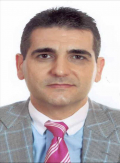
Dr. José M. Pardos-Gotor, Head of Technology Projects, ENDESA Corporation
As part of ENDESA.s strategy there has always been an interest in using new technologies to meet operational needs. A practical case reflecting this is the attempt to improve the efficiency and effectiveness of water-flow prediction.
In this context, as earlier mentioned, ENDESA launched the Novare Awards, which are part of ENDESA.s Global Strategy for Sustainability, led by the scientific community and SMEs with the ambition to promote technological innovation; one of these awards led to the HYDRO project, during which, ENDESA had the opportunity to assess the potential of using space technologies for hydropower management.
ENDESA believes that it is necessary to promote the innovative spirit in all matters related to the value chain of the energy industry to successfully address the environmental challenges that are expected in the future economic world development. ENDESA Novare Awards promote the development of R&D&I projects in SMEs and in relevant areas to ENDESA innovation strategy, contributing to serve in a more sustainable way the society energy requirements.
Q5. IAP: What makes you believe that space-based services is what you need in order to solve your issues, and therefore to co-fund this development?
Soledad Zenteno, Technical Support and Technology Management, ENDESA Chile
ENDESA has always had a strong interest in keeping close to the latest technological developments available that can benefit our field of activity, and space-based solutions are part of this. Moreover, the fact that some of our facilities are located in remote areas of difficult access, exploring the use of Earth Observation (EO) technologies seems a natural decision, in complex areas where the use of in-situ sensors is not always possible, remote monitoring solutions could provide a significant advantage.
ENDESA has supported the use of EO data in water-flow predictions, as shown with the support and funds to HYDRO project carried out by Starlab. We expect that HYDRO results will feed into the launch of INTOGENER service and at the same time incorporate new elements and added value for ENDESA. Therefore, both projects are complementary, HYDRO being the R&D foundation project and INTOGENER serving the transition to an operational service. ENDESA once again will support Starlab, providing manpower and logistical support during the INTOGENER execution.

As already mentioned, ENDESA has its own R&D&I programme, funding initiatives coming from companies on several topics related to energy. Starlab achieved one of these contracts in the past, so we have taken the opportunity to ask them how different it is to work for ENDESA or ESA. Laia Romero, INTOGENER Project Manager answers us these questions.
Q6. IAP: Can you explain to us how it is to work with two so different customers such as ENDESA and ESA?
Laia Romero, INTOGENER Project Manager, Starlab
Although both customer relationships are based on a well defined proposal in terms of tasks, timing and outputs, the management approach differs. While ESA tends to be very demanding at technical level and in the reporting of project results to understand how things are done, a company like ENDESA is less worried about the .how. and more focused on the operational results, including what benefits the technology can offer. From our experience, the level of detail on deliverables is much more demanding in ESA projects and requires meticulous documentation. On the contrary, ENDESA appreciates concise reporting and specially values demonstration results.
 Another difference is that work with ENDESA usually requires the interaction with more than one department at managerial level, sometimes located in different geographical regions. This makes the relationship more fruitful but more complex as well. In the case of ESA, a unique project officer manages the interaction with the provider through a clear reporting line of communication.
In addition, we have to consider that a client like ENDESA is, at the same time, the final user of the service and technology proposed. This means that some flexibility in the project implementation is required since the operational requirements might vary according to the project progress and final results.
We feel very comfortable working for both kinds of customers. The important thing is to understand well the motivation behind each one and to boost common interest within the project results.
Q7. IAP:How did you hear about IAP? What made you apply to this programme and not to other ESA programmes?
Laia Romero, INTOGENER Project Manager, Starlab
We heard about IAP through our National Delegation . CDTI (Centro para el Desarrollo Tecnológico Industrial). CDTI organised an information day where we had the opportunity to hold a short meeting with an IAP representative, to whom we presented a summary of the idea and obtained more information about the IAP application process.
We saw the IAP programme as a great opportunity to fill the gap between the service idea and the commercialisation phase. In our market it is not always easy to launch a new service since this requires major investment, not only for technical development, but also for essential matters such as user federation and promotion. This investment is especially difficult for an SME like Starlab. The IAP co-financing supports the bridge between a mature technology idea and its market commercialisation.
IAP.s long term vision facilitates the link between the service provider and the user, making them work together for a significant period, including further stages such as the demonstration and pre-operational phases. In our opinion, this makes it easier to establish a solid relationship with the user and assess properly the service definition, architecture and validation, aiming to boost the operational phase with minimum risk. Issues such as market prospects and business case are deeply analysed. At the same time, IAP requests the involvement of the user in the service concept definition, making them express their requirements from the beginning and participate directly in the service evolution.
In addition, the IAP programme offers other added value, such as technical advice and a good promotional platform by disseminating the project results within a number of workshops attended by stakeholders and users.
We would encourage other companies to participate in the IAP programme if they have service ideas with an identified target user and with a clear willingness to commercialise the service once operational. The co-financing mode is for sure a good support to companies to achieve results and market success.


 An operational pilot system connecting some isolated areas in both Western and Eastern countries of the Sub-Saharan Africa will be defined and implemented together with medical centres of excellence. The final goal will be to pave the way for a comprehensive eHealth system including clinical services and eLearning as a contribution to a future pan-African network for telemedicine, in line with the TTF objectives.
 SAHEL intends to place users at the forefront of the activity. Correspondingly the project will start with an extensive survey lasting six months to retrieve the user needs and service requirements in the domain of health care services in the relevant sub-Saharan Africa countries. For this purpose, a specific questionnaire has been created and will be broadcasted in the following weeks to all key African stakeholders, organisations, health workers and potential users which can provide information about healthcare facilities. SAHEL key for success is to accurately meet the user needs. Consequently it will need to collect a comprehensive set of user driven demands in order to build a suitable telemedicine platform capable of answering satisfactorily to the needs of African citizens.
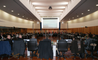
 Close to 50 representatives from EU Member States, ESA, the European Maritime Safety Agency (EMSA) and ESA JCB delegates attended the second joint EMSA/ESA SAT-AIS initiative information meeting in Lisbon on 26 January. This meeting reviewed the achievements and work in progress since the first information meeting held one year ago.