Objectives of the service
WaterSIM is a global solution to continuously survey the blue water to better address basin risks (water cycle) and operational risks (water supply), and a Proof Of Concept project at this stage, to demonstrate how it fills in the common needs and gaps of the public and private water operators:
-
For short term operations: To leverage the barriers of having real time and near real time information on water resources from rivers and lakes, reservoirs, canals, irrigation tanks, rainfall, and soil moisture (wherever, and whenever, and inflow projection), to enhance command area development and management for floods and dams
WaterSIM solution integrates the latest satellite-based technologies to build an authoritative system for all water resources related information. With WaterSIM, operators and decision-makers can precisely monitor the water cycle, and have a clear picture of water state, water stress, water use, water failures and risk exposures. The homogenous access to the information combined with the visibility into risk impact or water demand support effective planning and risk-based management of water resources for states/regions/water users.
Users and their needs
The targeted users are the following stakeholders acting on water resilience:
-
Fire & Rescue Services
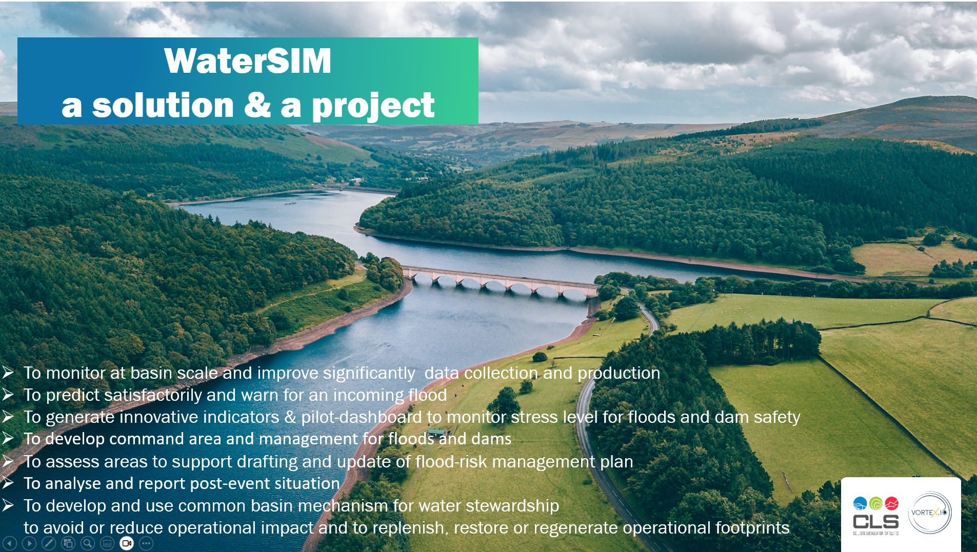
to predict satisfactorily and warn for an incoming flood from rivers and to assess areas to support drafting and update of flood-risk management plan and analysis , reporting of post-event situation;
-
National or cross-border Integrated Watershed Management Organisations
to monitor a full basin to significantly improve data collection and production and generate innovative indicators & pilot-dashboard to monitor stress level for floods and dam safety;
-
Advocacy groups, Sciences, consultancies, and NGOs
to develop and use common basin mechanism to avoid or reduce operational impact and to replenish, restore or regenerate operational footprints.
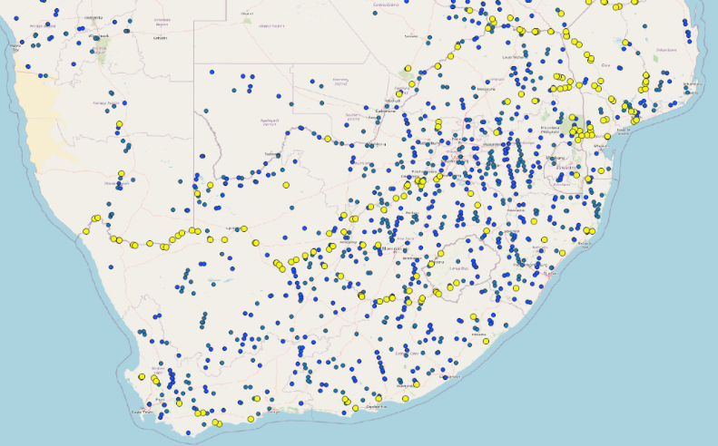
As part of this study, we have first focused on South Africa and France to capture the needs of the users who have expressed an interest for the service WaterSIM, the needs for precise up-to date data and business indicators on water rivers and reservoirs adapted to their region and duties and worked out the solution along their fitness for use.
Another constraint is the delivery model which considers their priority use cases, their economic issues, and their technical capabilities to overcome current water management constraints and to improve the performance of current systems. The selected use cases drive the development and demonstration phase.
Service/ system concept
The service portfolio proposes various monitoring solutions, together with a service bus to capitalize on water data anywhere on Earth and at local scale, and generate automatically added-value downstream information adapted to different needs, budget and infrastructure capacity (small, medium, high).
All services developed are accessible via a unique user-friendly web platform or potentially via API:
-
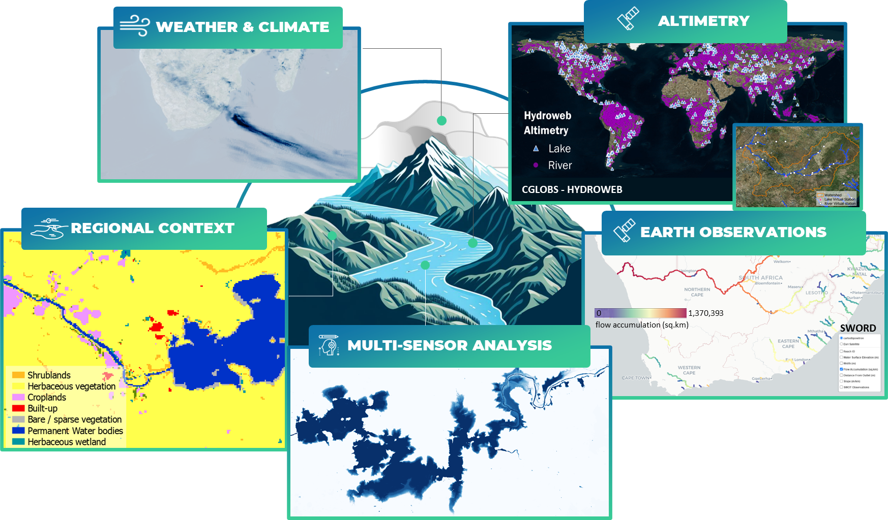
Universal and homogeneous access to data everywhere on Earth
(e.g., near-real-time acquisition of available river levels, flows and surface of water bodies derived from space-based earth observations, weather data and information on the spatial dynamics of the territory)
-
Precise monitoring & control
(e.g., use of all available data, space-based and in situ networks to monitor and control the volume and volume variations of reservoirs, lakes and rivers, the water flow for water abstraction and use, flood hazards)
-
Historical data & indicators adapted to each job
(e.g., prevention for drought, flood and derived pollution risks, risk-based management of water quantity / water stress from reservoirs and anticipation of failures, and more)
-
Expertise to get more of the solution
(e.g. for performance of hydrological and/or water hydraulic systems)
Space Added Value
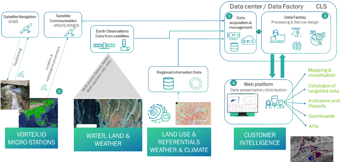
Our solution focuses on the use of space-based technologies (satellite observations and an in-situ constellation of hydrological micro-stations), data fusion and turnkey services all accessible through our webcasting tool to act on water resilience. Our main strength is our ability to process and use all types of data and sensors to collect data in a timely manner and produce insightful and derive water indicator:
-
Satellite communication and navigation
-
ARGOS/Kinéis connectivity
-
To collect data from the micro-stations network (IoT baseline communication protocol)
-
-
Iridium connectivity
-
Second technology used if large volume of data
-
-
Global Navigation Satellite System
-
To get continuous and referenced timing and positioning of stations, as well as rain data
-
-
-
Earth observation satellites
-
Radar Altimetry (open data)
-
For monitoring of the water level and storage change of observed lakes and reservoirs
-
-
Optical Imagery (open data)
-
For monitoring of water extent (flood included), storage change and land use/land cover
-
-
Synthetic Aperture Radar (open data)
-
For monitoring of water extent and flood mapping (even when cloudy)
-
-
Other optical/SAR imagery (cost-effective)
-
Used for production of Digital Elevation Model and ground movement monitoring
-
-
Current Status
The design and implementation of the solution follows a stepwise approach in concertation with the user community:
-
Analyse gaps and prioritise needs and issues;
-
Select priority use case(s) from the large spectrum of needs expressed by the stakeholders for next demonstration phase, co-design the service and expected outputs with the participating stakeholders;
-
Validate critical aspects in a Proof of Concept before launching the next phase for implementing a solution (e.g. for flood-risk management, fitness for use of virtual station monitored from space, use of water level and rain data to monitor the flood generation potential, monitoring of water extent variation and production of new generation indicators, mock-up design of pilot dashboard adapted to stakeholders).
If this activity resonates for you and you are willing to participate now to the Proof Of Concept and be the next beta-tester for the demonstration and qualification phase, please contact us.
Prime Contractor(s)