
All Themes
Based on user needs and industry skills, the evolution of customized solutions and the establishment of innovative services is accomplished through project activities. Focusing on various thematic areas, relevant information on the project activities is provided below.

TSMF_10CM DP: WaldCursor
Status date: 17 April 2024
TSMF_10CM DP is Tama Group’s core project to develop, test and test market the WaldCursor product. The project covers development, test and field test of a cloud & app based remote sensing analytics information platform for forestry and environmental applications.
ABLE ACTIVE
Status date: 17 April 2024
ABLE ACTIVE promotes accessible trails and amenities to people with disabilities, uniquely by disability. Feedback captured from users helps to inform and inspire, making it easier for others to find opportunities suitable for their specific needs, and helping amenity operators to better understand and support their user community.

SCAF
Status date: 16 April 2024
Mitigrate, an InsureTech startup, pioneers flood risk management with its SaaS platform. Utilizing advanced technologies and earth observation data, it offers nature-based solutions, reducing flood risks and CO2 emissions. Targeting insurance companies, Mitigrate's tool fills a crucial gap, providing pre- and post-flood disaster guidance. Beyond risk reduction, it aligns with global sustainability goals, positively impacting insurance performance metrics. An investment in Mitigrate is an investment in resilience, sustainability, and the future of flood risk management.

SA4D
Status date: 16 April 2024
What short and long-term actions can be implemented to foster opportunities for the space sector in aiding the green transition and decarbonisation of the economy, with a particular focus on the Buildings and Energy & Utilities sectors?
PASTA
Status date: 08 April 2024
The world health organization has reported that 7.6% of patients in high-income countries acquire a healthcare-associated infection (HCAI). Recent studies show that more than 650,000 patients a year in England acquire HCAIs, which cost the NHS over £1 billion annually. Airborne transport is responsible for up to 10% of all HCAIs. The PASTA solution aims to improve indoor air quality and to minimise the risk of airborne pathogen infection in future hospital environments using low-temperature plasma technology that is oriented from in-situ resource unitisation in long-duration space missions and space propulsion (Pulsed plasma thruster). This new technology is designed to provide better infection control for airborne pathogens. It can also reduce the carbon footprint of hospitals by improving the energy efficiency of a traditional HVAC system.

CORISCLIM
Status date: 08 April 2024
A global assessment tool of future coastal flood vulnerabilities to build coastal resilience.
Colibri
Status date: 04 April 2024
Colibri is an operational telemedicine solution relying on satellite broadband communication to efficiently support healthcare services in white areas, combining fix telemedicine stations installed in villages, a vehicle equipped with medical devices called “Consultobus” and home appliances for isolated people.
Insiders
Status date: 03 April 2024
🚀 Get Ready to Elevate Your Sports Experience with Infinity: The Ultimate GPS Accuracy Solution! 🌟
Our innovative RTK based device doesn't just capture data; it enriches the entire sports experience by share real-time insights seamlessly across TV broadcasts, second-screen apps, live tracking platforms, ensuring that fans are immersed in the excitement from start to finish.
Remote Ecological Surveys
Status date: 02 April 2024
To restore and protect biodiversity, we need detailed data. A breakthrough is needed in the current labour intensive methods to carry an ecological survey to provide data for biodiversity monitoring and reporting. Gentian provides a solution which harnesses innovative AI technology and highest resolution Remote Sensing imagery to provide a fully remote, cost efficient ecological survey without compromising on accuracy.

Methane Watch
Status date: 02 April 2024
Methane Watch is the world’s first monitoring system to measure the methane footprint of the energy sector. It combines Earth Observation data from the Copernicus constellation, NASA, NOAA and commercial satellites with advanced analytics to monitor emissions from oil, gas and coal with unprecedented accuracy, and provides unique insights to decarbonise the energy industry on a global scale.
Project Eclipse
Status date: 02 April 2024
Following a successful feasibility study for a multipurpose shared electric fleet solution for NHS Hospitals, Project Eclipse covers the development and pilot of a new and highly innovative transport technology for Newcastle Hospitals NHS Foundation Trust. The project sets out to reduce transport related challenges for employees and patients by providing a sustainable, optimised, fully electric fleet solution that improves access, reduces cost and helps the NHS meet ambitious Net Zero targets.
DINAMO
Status date: 26 March 2024
DINAMO is a multi-sensor multi-temporal platform representing an operational tool designed for the early-warning and detection of possible structural failures designed with the purpose to provide a solution to the growing need of reliable and durable operational tools for bridges and viaducts continuous
Orbio Earth Platform
Status date: 25 March 2024
The OE Platform uses satellites to track methane emissions from the oil & gas industry. This enables management of methane and associated energy transition risks using global, asset-level, highly frequent emissions data embedded into a deep regulatory, supply chain, portfolio exposure and operations analytics.
DECISIONX:NETZERO
Status date: 13 March 2024
SATAVIA is reducing the climate impact of flying by mitigating the warming effect from the clouds aircraft make and enabling airlines to claim carbon credits as an incentive. Globally, aircraft contrails trap heat in the atmosphere and increase aviation’s climate impact by over 30%, contributing to global warming. From 2025 the European Union Emission Trading Scheme (EU ETS) will require airlines to report this impact.
SATAVIA’s technology provides atmospheric intelligence to change flight plans to avoid contrail-forming conditions. The mitigated climate impact is verified by SATAVIA and converted into tradable units by a patented method with the backing of Gold Standard, a major carbon accreditation platform.
EO4CSR
Status date: 12 March 2024
The EO4CSR project aimed to assess the potential of Earth observation (EO) derived information to enable companies and financial institutions to facilitate due diligence and reporting requirements deriving from the European CSR Directive (Corporate Social Responsibility - CSRD) and European Deforestation Regulation (EUDR).
THERMALEEGO
Status date: 07 March 2024
Revolutionize energy asset inspection with ThermAleego: AI-powered software using thermal imaging and space assets for precise anomaly detection, optimal maintenance, and cost savings.
DECOM
Status date: 07 March 2024
HIRES-CURRENT-PERF
Status date: 06 March 2024
This feasibility study quantifies the performance of short-term optimal routing mode using a new generation of surface currents data obtained by AI fusion of high-resolution satellite observations.
EO Diagnostics
Status date: 04 March 2024
In this transformative project AI-driven diagnostics, and Earth Observation (EO) data are bridged to
revolutionize patient care and early disease prediction. AI, fueled by satellite data, enables early disease
prediction by analyzing environmental factors such as UV exposure and dust concentrations. This approach
extends beyond traditional healthcare, addressing global health and environmental challenges.
AROBS AlertBox
Status date: 04 March 2024
AROBS AlertBox aims to offer access to E-alert messages and 112 emergency service, in environments that lack reliable GSM (Global System for Mobile Communication). This product is an emergency alert box that connects, via the Iridium global satellite constellation system, , to the national emergency response systems in critical situations when communication channels are compromised.
HeManEO
Status date: 01 March 2024
The activity aims to transform Earth Observation (EO) data into a reliable product for various business clients, including large corporations and the financial sector. It addresses compliance with auditing, legal standards, and emerging ESG regulations, offering End-to-end validation ensuring data security, compliance, immutability, and nonrepudiation.
ORCAS
Status date: 01 March 2024
Trade in Space creates NFTs on a blockchain, using SatEO analysis. But these aren’t works of art – they're tied to physical commodity crops still growing in the field and this new approach enables us to move into a new age of transactional insight®. In this project Trade in Space will show the value this new approach has in streamlining global coffee and cacao supply-chains.

MEB
Status date: 23 February 2024
Unlock the potential of satellite remote sensing and advanced modelling for accurate and cost-effective biomass measurements in your RegenAg and Carbon programme. Gain precise insights into crop and cover crop biomass, as well as CO2 fluxes with our innovative solution.

MASAI
Status date: 22 February 2024
MASAI is a web platform designed to support national and international organisations that intervene in emergency situations (humanitarian crises due to war and natural disasters). This web platform uses automated Artificial Intelligence algorithms applied to VHR and SAR images to identify damage to buildings and infrastructures, estimating the extent of economic damage and affected population; Ukraine is the use case.
Energy SCOUT
Status date: 22 February 2024
Energy SCOUTTM is a modular set of services which transform daily and weekly feeds of raw satellite sensor and spatial data into a series of value-added information products, targeting different activities along the oil & gas supply chain.

Space4LevelCrossing
Status date: 22 February 2024
Space4LevelCrossing is a feasibility study of technical and commercial viability of innovative solutions based on use of satellite data in combination with the train on-board environment perception system for improving safety of Level Crossings.

DITCH
Status date: 20 February 2024
The newly developed DITCH - Digital Twin Catchment service consists of an online accessible digital representation of basins providing static and dynamic variables like topography, land use and cover, hydrological and ecological conditions (water level, discharge, sediment concentrations, algal blooms) of water bodies, and soil characteristics provided through earth observation (EO) including potential dynamics next to past and present situations.
This physical twin is then also combined with socio-economic information to provide relevant decision support tools for resilient basin management of water-related stakeholders.
CDPP
Status date: 20 February 2024
Patient wandering off is a major concern in long term care facilities. The CDPP project responds to that concern by adding geo-fencing and Search & Rescue (SAR) capability using Galileo GNSS. This prevents dementia patients from getting lost and wandering off facilities.
Data4Water
Status date: 20 February 2024
Data4Water addresses the intricate water challenges in India's Godavari River basin, a priority basin for the Water Resilience Coalition. The project aims to enhance water management by providing accurate river discharge forecasts through BWI’s services for various sectors. Targeting farmers, agribusinesses, and local authorities, the project seeks transformative solutions for the basin's diverse water-related issues, offering a holistic approach to address uncertainties, fluctuations, and climate impacts.
BST HIKES
Status date: 14 February 2024
BST.COACH, a Czech digital youth sports platform has developed a reward-based outdoor exercise application using GNSS-stamped locations.

5G Drone Safety Module
Status date: 14 February 2024
Currently drones are not electronically visible, and it is not possible to determine accountability of a drone without searching and hoping you can find the operator. The proposed activity for the ESA Kick-Start project is to solve the issue of electronically identifying and tracking of drones.
Samplifly
Status date: 14 February 2024
SAMPLIFLY is a fast, integrated, and sustainable drone-based express transportation service design to carry different types of samples for industrial companies. SAMPLIFLY is able to operate in highly industrialised areas such as large harbours.

AFNOL
Status date: 14 February 2024
The project aims to improve the data analytics software used by insurance companies to confirm an accident has happened, who is at fault and the probability of injury.
SPACE4LIFE
Status date: 08 February 2024
This study is meant primarily for increasing road user safety when crossing a level crossing and thus, the decrease of fatal accidents at rail-road crossings representing the second cause of railways fatalities in EU. In this project the achievement of higher safety standards for level crossing accident prevention is thought through the design of a low-cost system based on space assets and cutting-edge informatic technologies. The proposed system could be strengthened in terms of data accuracy through the integration of ground technologies (i.e., optical cameras and interactive signs) where needed.

GAINS CCN1
Status date: 05 February 2024
GAINS provides historic and near-real-time insights on the production and activity levels at hundreds of sites involved in the global iron and steel supply chain. It offers an “alternative data” source for the Financial Services industry by providing near-real-time leading indicators such as stockpiles of raw materials and levels of activity and production, based primarily on satellite observations.
PeaSat
Status date: 05 February 2024
The PeaSat project will develop a yield prediction package which uses satellite imagery to forecast vining pea harvest volumes around two weeks before harvest.
ABG
Status date: 30 January 2024
A data product harnessing wildfire impact data for carbon credit verification, estimation, and above-ground biomass change analysis in the growing carbon market.
3E Solar Data Services
Status date: 28 January 2024
3E Project Development solution provides accurate and bankable satellite-based solar irradiation data for solar power modelling: 3E Solar Irradiation Data. It is your go-to application to assess the long-term yield of future solar assets, improve the return on investment and evaluate operational plant performance.

SENO
Status date: 28 January 2024
The SENO demonstration project aims to rapidly and efficiently deploy a high throughput and low latency satellite communications service to serve as a reliable and independent communication channel for the needs of humanitarian organizations in Dori (Burkina Faso). In this way, humanitarian actors would be able to offer IP-based services to Internally Displaced Persons (IDPs) and to the local community, while also improving the working conditions of their staff. Based on the success of the pilot and the market demand, the service could be scaled-up to other locations in and outside Burkina Faso.

DAPV
Status date: 27 January 2024
An advanced data-driven AI enabled, earth observation and ground data based, software solution for forecasting of energy production, crop growth/yield, O&M as well as design and economics in Agri-PV.

PeaceEye
Status date: 27 January 2024
Monitoring and understanding of armed conflicts, Humanitarian-Development-Peace nexus.

SeaScope
Status date: 23 January 2024
CGG’s SeaScope service increases knowledge on the presence, characteristics and behaviour of oil pollution in marine and coastal environments by combining deep interpretative understanding with the unique spatial, spectral and textural information contained within historical and frequently acquired contemporary satellite images.
ForEOSt
Status date: 22 January 2024
Discover how ForEOSt supports sustainable forest management with dynamic monitoring services based on Earth observation data. Get frequent updates on the forest vitality status and establish reliable tree count, density, and species to enhance your management practices. Whether in urban, agricultural, or rural settings, ForEOSt supports national and regional authorities, industries, and private owners in the face of climate change and biodiversity loss.
Let SPACEBEL help you monitor your forest and trees in the most efficient manner.
WARM
Status date: 22 January 2024
WARM uses Machine Learning to identify water stress based on satellite and remote sensing data. The result is a water resilience map that covers entire basins and also shows water availability, water accessibility, and water quality in detailed areas.
GSM (Golden Soils Monitoring)
Status date: 16 January 2024
Seqana is a Berlin-based startup developing a digital Monitoring, Reporting and Verification (MRV) service for soil organic carbon offset and inset projects, using Machine Learning (ML) and Earth Observation technologies. This Kick-Start project aimed to enable Seqana to acquire new ground truth datasets and to calibrate its ML models in Cambodia, Germany, and Kenya/Tanzania in collaboration with its local partners, respectively SmartAgro, CO2-Land, and Justdiggit. The relative improvement in accuracy metrics that Seqana achieved for each of the three calibrated regional models were an average increase in the final point-level test R^2 of 160% and an average reduction in point-level test Root Mean Square Error of at least 20%.
O-BOY
Status date: 10 January 2024
O-BOY is the first wrist-wearable that contains a satellite transmitter - therefore operates outside the range of mobile phones - and will offer a total package of services that can be lifesaving for athletes and adventurers in remote areas.
EOSports
Status date: 10 January 2024
The service aims at assessing the environmental impact of large sporting events.
The environmental impact is composed of the short-term impacts on Air (pollution), vegetation (trampling), and waste - all three part of the proposed feasibility study - as well as the medium-term impact regarding urban heat contribution.
AirTracks
Status date: 08 January 2024
AirTracks is a flexible and cost-efficient Air Navigation Information Service for enhanced aircraft safety during approach and departure at small and medium aerodromes which do not have any aeronautical surveillance system (e.g. Radars). Airtracks combines various aircraft surveillance information (ADS-B, Mode-S, etc) in the vicinity of an airfield. The information can be visualized on a web-based display, showing the relevant/customized ancillary information layers in a user-friendly way e.g. flight plan, aeronautical charts, meteorological information as well as safety related notifications to aircraft pilots (NOTAMS).

Maritime port container activity zones
Status date: 26 December 2023
This geo fencing data base provides the shipping industry with container door opening event qualification, operational deficiencies tracking, container mishandling events locations and CO2 shipment emission data tracking.

Space-to-Tree S-2-3
Status date: 26 December 2023
S-2-3 a multi-scale/parametric system aimed at monitoring the health status of trees within parks of historical-cultural or naturalistic interest. Objectives: defend the beauty of the tree, archaeological and monumental heritage; monitor the environment; manage risks to people or property. The data is enjoyed through webGIS platform with dual functionality: cataloguing trees; Monitoring the dynamics of trees with respect to wind.
Forests from Space
Status date: 26 December 2023
Treedom is the first non-productive, privately financed online planting platform that allows consumers and businesses to plant trees remotely and follow their storylines. Satellite images and their elaboration will provide engagement and transparency tools to our customers and users.

ABSeaD
Status date: 26 December 2023
ABSeaD focuses on environmental conservation. It utilizes advanced machine learning models to analyse Earth Observation data for the strategic management of Posidonia Oceanica seagrass beds, crucial for carbon sequestration.
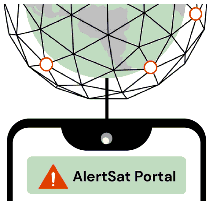
AlertSat Portal
Status date: 26 December 2023
The AlertSat satellite constellation is to deliver Alerts directly to its users, through AlertSat Portal - when critical information has been detected and there is still time to act upon it.

SatPDT-Demo
Status date: 26 December 2023
The SatPDT project aims to develop an innovative satellite-based digital product, called SmartPDT, that enables a safe and effective daylight therapy (daylight photodynamic therapy or dPDT) of skin pre-cancer and cancer, e.g. Actinic Keratosis (AK).

SP4GO
Status date: 26 December 2023
SP4GO is a solution to support the maintenance of electric power distribution infrastructures. SP4GO uses cost-effective and high-resolution satellite data to reduce inefficiencies and maintenance costs of high voltage power lines by detecting potentially dangerous situations related to the overgrowth of vegetation, the construction of new buildings that come too close to infrastructure and detecting land terrain change.
SP4GO is targeted to electric power Transmission System Operators (TSO) and electric power Distribution System Operators (DSO).

OPT4SOL.AI
Status date: 26 December 2023
A smarter way to identify the location for your next solar project. OPT4SOL uses satellite images, GIS, and AI to support site selection for new utility scale PV projects. All the data in one place. The system considers every aspect, from exclusion zones and regulatory limits to distances from power lines and areas of high cunsomption supported by AI powered analysis and scoring of potential locations.
OSCAR
Status date: 26 December 2023
Space-data surveillance service for effective vessel management, enabling greater efficiencies in the planning of construction and the maintenance of offshore wind farms.
It will not appear on the project web page itself but is used in project lists e.g.

SGAM
Status date: 19 December 2023
SGAM is designed for hazard and risk assessment, focusing on the interaction between infrastructures and natural environment. It combines Earth Observation data, ground-based monitoring data, geohazard databases, and AI algorithms to identify critical issues and cost-effective maintenance investments. It features techniques such as A-DInSAR and PhotomonitoringTM for precise monitoring of surface changes, allowing for historical analysis and change detection.

5SEnSES
Status date: 19 December 2023
The project entails developing a software platform for real-time measurement and quantitative monitoring of gas and/or oil extraction sites. This integrates data from seismic, satellite (SAR), GPS, IoT networks and correlating the Earth's surface movements, seismic activity and pore pressure through an AI engine. The results can be employed for industrial monitoring and predictive simulations.

WHIS
Status date: 14 December 2023
The Water Health Indicator Service (WHIS) provides a continuous data stream of environmental health indicators for inland water bodies. This service is an API with monitoring and reporting capabilities that allows you to track a set of specialised and highly descriptive Water Health Indicators.

uSmart Revenue
Status date: 14 December 2023
The uSmart REVENUE project uses Artificial Intelligence and Machine Learning to process satellite imagery and link this with Non-Domestic Rates registers to determine whether building usage might have changed. This enables fraud detection and identification of potentially missing revenues to local authorities.
Soil health space-based evaluation
Status date: 12 December 2023
The Soil health space-based evaluation project leverages SatEO to generate time series capturing historical land use and farming practices on plots. These time series are then correlated to soil measurements in order to explain the impact of farming practices on the health of cultivated soils and identify improvement levers.
WaSat
Status date: 12 December 2023
The Norwegian company Ocean Oasis is developing a wave powered desalination technology to increase access to safe and affordable water in water scarce coastal regions. The capacity to efficiently evaluate the wave resource in specific locations allows for production forecasting and pricing. Earth Observation data has been used to improve the accuracy of the analysis tool.
VADUS
Status date: 11 December 2023
The project VADUS provides to tourists the opportunity to enjoy cultural heritage that is not easily accessible to improve the enhancement of archaeological and museum sites. VADUS,realizes a metaphorical safe “way” of a virtual nature that overcomes physical and cultural barriers related to difficult access, reduced comprehensibility for the lack of some significant parts, presence of hidden or difficult to interpret cultural aspects.
AGRO-BIOMES
Status date: 11 December 2023
The AGRO-BIOMES Kickstart activity aims at understanding the biodiversity market level readiness in four major agricultural markets segments, proposing a few architectures scenario based on the <geosys/> platform capabilities, testing biodiversity-related analytics with ground truth and Copernicus data and finally evaluating economical, technical, and scientific risks and mitigations plan to be considered prior to a go-to-market decision.
UVFDR
Status date: 05 December 2023
The universal virtual flight data recorder (UVFDR) is a vendor-agnostic, non-exclusive data repository, providing flight data including Global Aeronautic Distress and Safety System (GADSS) functions from day-to-day aviation operations to users in near real time.
KARL Scheduler
Status date: 05 December 2023
KARL Scheduler provides farmers with satellite-based irrigation recommendations, ensuring they have a clear view of the irrigation needs of their entire farm. Calibrated with soil sensor data, KARL Scheduler ensures the highest quality satellite-based soil moisture estimates, creating a virtual soil moisture sensor for every 20m of a field, ensuring water resources can be used optimally.
HARVIC Essential
Status date: 05 December 2023
The potato industry has been continuously increasing through the introduction of improved varieties, extensive mechanization and improved cultivation techniques and farm management. In order for the sector to maintain a sustainable growth and act in the dynamic market, the sector is actively looking to become more data driven, making decisions based on technological information and relying less on human expertise.

The Digital Worksite
Status date: 04 December 2023
The Digital Worksite project develops a satellite-enabled solution to improve safety and efficiency for railway maintenance teams by tracking people, vehicles and equipment in real-time during worksites.
Origin Orbit™
Status date: 04 December 2023
Origin Orbit™ is an advanced cloud based B2B software platform, revolutionizing gas and water pipeline management through satellite remote sensing, machine learning, and our integrity management expertise. The platform aims to offer faster, more cost-efficient, and environmentally conscious solutions in line with relevant regulatory and legislative requirements, vastly surpassing traditional survey and assessment methods.

GreenerCotton
Status date: 02 December 2023
GreenerCotton services support the implementation, certification, and transparency of sustainable cotton standards with satellite enabled technology. GreenerCotton is targeting two main use cases: 1. Supporting standardisation companies in implementation and certification 2. Supporting extension services (field advisory) to implement standards and improve production.
C.O.R.E.
Status date: 02 December 2023
The CORE “Carbon Organic Resilient Ethereal” project aims to create an index (SCENARIO Index - Soil Carbon ProtEctioN And RestoratIOn) to map and classify soils according to their capacity to store ethereal and resilient carbon to facilitate carbon farming initiatives and investments.

Visu8
Status date: 28 November 2023
Satellite enabled smart autonomous micro-particulate analysis for real-time and remote water quality monitoring.
SES5G
Status date: 27 November 2023
SES5G prevents, detects and manages wildfires and illegal actions in forestall areas.
The solution relies on satellite observation, autonomous drones, advanced firefighting sensors, security gates with plate readers, mobile control rooms that, with Artificial intelligent algorithms that feed with geolocalized data stakeholders control rooms (Civil protections, Environment department, Public protection, … ).
CROP
Status date: 27 November 2023
The CROP project is aiming to provide a steering tool for agricultural crop rotation. The principle is to offer dashboards to cooperatives and traders to take better decisions thanks to an AI model, satellite data, data projection and the implementation of a data space to characterize the situation at different levels (climate, soil, soil cover in intercropping, cultural practices, irrigation…).

VunaNexus
Status date: 27 November 2023
VunaNexus uses a patented technology to transform human and livestock urine into two valuable products: a fertiliser free of all dangerous pollutants and water that can be reused, this while drastically reducing ammonia emissions and water pollution.

SiriusInsight®
Status date: 27 November 2023
90% of world trade goes by sea making it of great importance economically, strategically and environmentally but the maritime domain is vast and remote making persistent surveillance challenging. SiriusInsight® uses cutting edge artificial intelligence to analyse maritime data from multiple remote and autonomous sources in order to create actionable information for users about otherwise unobserved marine activity.

ProvGRASS_DP
Status date: 27 November 2023
ProvGrass will generate multi-temporal maps of the grass platform or area of interest including sward quantity and quality to enable customers to provide products for end-users (e.g., farmers or advisers) grass management. The initial development is aimed at organisations in dairy, beef & food processing sectors who are looking to address requirements around Scope 3 emissions, as well as improving productivity for their farmers.

ARcade
Status date: 27 November 2023
INFORMATION AND ENTERTAINMENT AT THE RIGHT TIME, IN THE RIGHT PLACE.
Ecosystems – CPV
Status date: 27 November 2023
Ecosystems – CPV provides data and modelling capabilities for utilizing coastal ecosystems as vital green infrastructure for protecting critical assets, business activities and people along coastal zones. The solution provides quantitative data and flexible modelling approaches to the insurance and infrastructure sectors, facilitating the effective and sustainable use of coastal ecosystems for disaster risk reduction and climate adaptation.

STARS
Status date: 27 November 2023
The STARS project aims to deliver a product consisting of the automation of real-time workout parameter registration during swimming workouts. Currently, there is no system available in open water swimming that allows for the real-time registration of both biomechanical and physiological parameters in a wearable and comfortable way.
RT5.0
Status date: 27 November 2023
Rural Tourism 5.0 (RT5.0) is a next generation travel planning ‘eco-algorithm’, designed to improve the visitor experience, impact on the environment, and the economic output of rural tourist destinations.
APPS
Status date: 24 November 2023
Water quality forecasting to enable business & government to optimise usage & risk. We help multiple stakeholders collectively measure, monitor & forecast real time water quality to become resilient and adaptive to climate change
TRACTIONS
Status date: 24 November 2023
TRACTIONS addresses the need for water transparency information by the dredging market and primary production information by the aquaculture sector. TRACTIONS services include continuous local calibration and validation with proprietary optical sensors from the WISPstation network, and very high resolution imagery that is available multiple times and day. This project will study the feasibility of the TRACTIONS service.
EO4CarbonFarming
Status date: 24 November 2023
The project aims to develop a service for monitoring, reporting and verification (MRV) of agricultural measures to bind CO2 in the soil as a part of “Carbon Farming”. The tool will be able to monitor catch crops, report on farming practices for higher carbon sequestration and verify organic carbon build-up in the soil.
SA4D
Status date: 24 November 2023
The goal of the project “Space Acting for Decarbonisation (SA4D)” is to perform a feasibility study that will demonstrate the technical and economic viability of suitable satellite-based services for suggesting decarbonisation actions targeting agriculture, food production and building construction economic sectors.
STREAMO
Status date: 24 November 2023
STREAMO provides advanced Earth Observation services from the Stratosphere, by using swarms of small and reusable High-Altitude-Pseudo-Satellite called CubeHAPS, developed by Stratobotic. The solution improves regionally the Earth Observation services. The products offered are super-resolution, 3D models in real-time and SAR imagery at higher temporal and spatial resolution and lower costs, as almost no infrastructures are needed to use CubeHAPS®.
ReSeNO Service
Status date: 01 November 2023
The ReSeNO kickstart project introduces a trustworthy service to manage, optimise and reduce the use of fertilisers in agriculture. Precise nitrogen estimation will strengthen agricultural sustainable practices to preserve earth’s natural resources, maintain soil quality, reduce chemical use, and save energy. It will also increase the economic profitability of agriculture and secure healthier land, helping on the food demand.

N-Base
Status date: 30 October 2023
N-base solution combines expertise in horticulture with advanced remote sensing technology and provides field maps for monitoring and optimization of nitrogen applications in apple orchards. This is how farmers gain actionable insights to facilitate precise and targeted nitrogen application.

SPOTLITE
Status date: 30 October 2023
Spotlite is an infrastructure monitoring system based on satellite imagery. It uses InSAR (Interferometric Synthetic Aperture Radar) data to assess structural stability and ground subsidence over transportation networks (road and rail infrastructure), including pavement and adjacent slopes.
OGOR Yield
Status date: 19 October 2023
Yield forecast report for 3 major crops (maize, winter wheat, and rapeseed) starting from 2 months before harvest. The forecast is available at the field & farm level and updated every two weeks.

SoilEO
Status date: 15 October 2023
SoilEO – Remote Soil Analysis. Generate fertility maps of your fields with a remote soil analysis.
The demonstration project is to validate and demonstrate the technology on real-life fields in real-life conditions in different countries. By using Remote Sensing and Hyperspectral spaceborne images processing one gets a visual and digital map of macronutrients: Mg, P2O5, K2O, Ca, Soil Organic Carbon and pH.
NGMP
Status date: 15 October 2023
To achieve better efficiency and reliability in monitoring the operation of an agricultural farm, we decided to utilize the potential of combining benefits of IoT sensors together with data from Earth observation. We propose collecting reliable basic data like soil moisture, temperature, humidity and nutrient levels using sensor inputs as well as Earth observation indexes. Our platform handles collection of data, combining them and It’s processing in cloud environment also, all with mobile access and management. We focus on providing effective and reliable monitoring, reporting and alarming, incl. growth status and environmental factors for mandatory public disclosure.

Sat4Insur
Status date: 30 September 2023
The Sat4Insur project aims at delivering a new monitoring service for crop insurance companies. It offers a complete decision tool to the Head of Agriculture of the insurance company and to adjusters to better evaluate crop yield and the financial impact of adverse weather events (i.e., extreme and recurring) such as drought, excess water and storm.

GEMS
Status date: 30 September 2023
The GEMS service uses space-based technology to detect and monitor air pollutants, including hotspots, using Copernicus EO data and algorithms. The service, designed for commercialization, aims to automate data processing, making emission control cost-effective and bridging the digital data access gap, a groundbreaking in emission monitoring.

EDGE-AI
Status date: 30 September 2023
Revolutionizing critical infrastructure protection and biomass monitoring with AI-powered drones. Leveraging cutting-edge technology to redefine security and efficiency in the energy sector. Welcome to the future of real-time surveillance and monitoring solutions.

FWM
Status date: 27 September 2023
Currently, surveys of floating weeds are carried out from boats or helicopters. The service supplies weekly maps and metrics of free-floating weeds using a combination of radar and optical images from ESA Sentinel satellites. Floating Weed Manager is a web service that offers customers across the globe a range of products supporting enhanced weed management programmes.
CRUISE
Status date: 19 September 2023
CRUISE intents is to design, develop and validate a CyberSec Test Range for UAS/RPAS. This technological framework combining ICT, EO and SATCOM, will be located in the Grottaglie Airport (Italy), a facility that experiments RPAS and studies the integration of UAS in non-segregated airspace. It will offer the overall assessment of vulnerability and resilience of UAS with respect to cyber-attacks.
GIP4 Smart Airports
Status date: 19 September 2023
Fourteen million flights are expected in 2035 in Europe. To increase airport capacity and efficiency, optimisation at every step must be carried on. GIP4SmartAirports projects aims at minimizing rotation time and smoothing real-time operations. Space technologies can be a valuable asset to support surveillance and safety, and help airport manager to maintain high quality and complete knowledge of their assets.

EFFORS
Status date: 18 September 2023
A real-time flood forecasting system has been developed and is operated at the computational centre of the Austrian national weather service GeoSphere Austria.
EFFORS brings together experts in the field of meteorology, hydrology, hydrodynamics and satellite communication. Within a coherent modelling chain, the EFFORS system couples the individual numerical models and provides relevant data about flood evolution on short time scales.
VASP
Status date: 18 September 2023
In this project, Space Norway, together with the Norwegian Coastal Administration (NCA), the European Maritime Safety Agency (EMSA) and Kongsberg Seatex (KSX), have enabled a platform for Maritime VHF communications services using VDE-SAT, targeting the services the International Maritime Organization (IMO) has defined in the Maritime Service Portfolio (MSP). The following three services were demonstrated:
-
Ice chart distribution
-
SAR coordination
-
Mandatory Reporting System (MRS) information exchange

PowerEdge
Status date: 15 September 2023
The project is developing a new standard for physical snowpack measurements for the hydropower industry by use of L-band radar measurements in combination with InSAR processing techniques. The added values are higher resolution of snow estimations in time and space as well as less need for physical presence (equipment & humans) in the mountains to do snow estimations.
INST
Status date: 13 September 2023
Instantly Networked Smart Triage (INST) is a novel service enabled by satellite communications that provides real-time data to emergency services to save lives in mass casualty incidents. INST is enabled by a low-cost lightweight device that can be associated with a casualty to indicate where they are, how urgently they require medical attention, and to report the number of casualties.
SMARTGRIDS-DEMO
Status date: 13 September 2023
The project develops technically and financially feasible services that can assist stakeholders of the energy network sector in their work practices. Earth Observation data and Artificial Intelligence techniques are the key assets for developing services that can help improve performance, reduce costs and mitigate problems, which arise from the management, maintenance and operation of the energy network infrastructures.
MWS-A
Status date: 11 September 2023
MWS-A is a new weather nowcasting service for airports with high spatial and temporal resolution. The service combines real-time positions and predicted trajectory data of aircraft, and high resolution nowcasts of the motion and evolution of observed severe weather phenomena. Using these data the MWS-A service engine derives predictions of upcoming encounters of the weather phenomena and aircraft within up to 40 minutes time window in the future.

SeaWire DeepSea 5G LEO
Status date: 16 August 2023
Unleashing the power of 5G connectivity at sea, the SeaWire DeepSea 5G LEO solution transforms maritime communication. This innovative solution combines terrestrial and non-terrestrial networks for unmatched speed, seamless transitions, and lower costs. Beyond solving current maritime challenges, it anticipates future needs, promising an improved quality of life at sea, smarter transportation, and a revolution in the maritime industry.
MTrader
Status date: 16 August 2023
Awake.AI’s marine Marketplace with the power of AI for trading port services and products.

PORT SENTINEL
Status date: 10 August 2023
The main objective of PORT SENTINEL is to estimate the technical and economic feasibility of new relative services to the "Port of the Future" that can take advantage of “space-based” data. The Consortium is proposed to serve the market with instrument for the monitoring of seabed, and in particular harbour, integrating data of satellite navigation and surveys of the state of the seabed.
APPIDE
Status date: 07 August 2023
APPIDE is an AI-powered tool designed to increase the efficiency of thermographic inspections of photovoltaic plants. Using radiometric, RGB, and GPS data acquired from drones, APPIDE generates detailed reports in a matter of hours, identifying exactly where and what the performance problems are on solar sites. Our AI-based solution drastically reduces the inspection times by human inspection and increases the reliability of reports. Overall, APPIDE allows you to make more inspections with fewer human resources, maximising the return on investment of your drones and your business.

CroSSMaps
Status date: 07 August 2023
Development of a solution for scalable, crowd-sourced seafloor mapping to support the fishing industry with better nautical charts.

IPAS
Status date: 07 August 2023
IPAS (Interruption Prevention Alert Service) is a platform-based insight risk service, utilising satellite technology and asset geo-data to identify third party interference within close proximity to critical utility assets. This results in invaluable insights for water and gas utility companies, consequently improving asset management processes in terms of resilience, safety and operational performance to keep essential energy and water utility services running.
Eyes on Plastic
Status date: 04 August 2023
Eyes on Plastic provides a service solution, which combines multiple sensor components into a joint mapping and monitoring solution for plastic in the aquatic environment. By flying high and diving deep, plastic litter can be monitored at all angles and scales. On top, the service invites everybody to actively keep the eyes open on plastic spanning local info to a global reach.

SNA
Status date: 04 August 2023
The Smart Nurse Assistant project introduces an innovative solution to automate repetitive tasks in
healthcare. It will provide an unmanned medical equipment delivery robot service to effectively lower the
pressure on the nurses and other healthcare personnel by taking over some of the time-consuming tasks of
delivering items and equipment between hospital departments, nursing homes and similar healthcare
institutions.

CUES
Status date: 04 August 2023
The Real Estate value chain is currently unable to tap into and utilize the efficiency potentials inherent in the urban built environment. Many office buildings are underutilized – void periods are often long and costly. CUES provides stakeholders in real estate with a surface to visualize and understand and improve asset utilization.

IBISA Phase 2
Status date: 04 August 2023
IBISA is a pioneering global climate insur-tech that shields businesses and communities against the impacts of climate change. Using satellite data, we measure weather conditions to design and operate cost-efficient, scalable insurance solutions.
Through partnerships with local, global insurers and distribution channels, IBISA creates tailored insurance products that are easy to understand, transparent, affordable and provide rapid payouts. Our innovative use of satellite imagery and actuarial tools results in robust insurance products that cater to real-world needs.
Space for UAM
Status date: 04 August 2023
The main objectives of the Space for UAM Feasibility Study is to carry out an in-depth analysis on the technical feasibility and economic viability of space-based services and solutions in support of the development and/or operations of UAM for use cases of interest to the user communities, and/or its integration into the air traffic.
Intelligent Roadworks-Smart Infrastructure Planning
Status date: 31 July 2023
This study investigated the feasibility of using Synthetic Aperture Radar (SAR) images to assess the roughness, as a proxy of quality, of roads in the Flanders region (Belgium). Road authorities could benefit from this solution as follows: (i) The need for (expensive) manual inspection decreases, and (ii), this provides a high-level objectivized overview of road quality in their operating area.

Hand for U
Status date: 31 July 2023
“Hand for U” is an application that allows People in Need and Volunteers to easily contact each other and respectively, express their needs and offer their help on behalf of the Volunteering Organisations. “Hand for U” aims to create a safe space for People in Need and Volunteers to self-organise and create an empathetic community.
RESIST
Status date: 25 July 2023
RESIST provides worldwide coverage for detecting GNSS Spoofers and Jammers anywhere over the Earth’s surface. The system relies on the CMCU, Central Machine learning Computation Unit and ground and space recorded data.
OWASIS WDS
Status date: 23 July 2023
The service provides forecasts of essential water availability and water demand information for water managers. It contributes in creating an essential window of opportunity for end users to timely anticipate, take the right measures and minimise the impact of future events, either droughts or floods.
VARESAS
Status date: 20 July 2023
VARESAS is a solution to support rescue teams during crises. With the usage of data integration from many sources and the integrated Augmented Reality, Artificial Intelligence and Machine Learning functionalities, teams are able to manage and organize rescue operations more effectively.
FARMEX
Status date: 17 July 2023
FARMEX” is the adapted version of the original Farmstar service, developed and operated in France by Airbus since 2005. As the leading Precision Agriculture service based on EO in France, Farmstar helps farmers in optimizing the nitrogen inputs in their fields, not only to comply with regulations but also to steamline their operating costs.
DigiFarm
Status date: 17 July 2023
DigiFarm develops deep neural network models for automatically detecting the highest accurate field boundaries and seeded acres worldwide, through our model for deeply resolving Sentinel-2 from 10m to 1m resolution. This reduces both the cost and time of current manual digitisation by over 95%.

INVENTA
Status date: 10 July 2023
The INVENTA Demo Project implements innovative services able to increase the fruition, accessibility and sustainability of historical/cultural sites through the integration of Virtual & Augmented Reality with Satellite Navigation and Earth Observation. The service will be based on an innovative mobile App leveraging SatCom technologies and the 5G network.
PROFEO
Status date: 10 July 2023
The consortium provides a web-based platform that allows users to get actionable property level flood hazard insights at “the push of a button” combining existing flood data, meteorological data and archived as well as current satellite images. The service is accessible to non-experts, providing flood hazard maps and alerts tailored to the needs of the clients in the real estate domain, and can be scaled to wide geographical areas.

SkyWake
Status date: 10 July 2023
For the detections of water leaks, Earth-Observation can play a fundamental role. By boarding on General Aviation Aircrafts Thermographic, Optical and Synthetic Aperture Radars sensor, and crossing their high-resolution outcomes with satellite interferometric data analyses, sub-surface phenomena may be investigated, understanding how water distributes across the networks of urban environments allowing to potentially address water losses location.

GridEyeS
Status date: 10 July 2023
GridEyeS supports electricity transmission and distribution by providing situational awareness regarding vegetation near power lines faster, cheaper, and with less CO2 footprint through Space-level Artificial Intelligence. It leads to safer and more reliable operation of the electric grid.
Track & Trust
Status date: 10 July 2023
Track & Trust is a cost-effective tracking solution utilizing satellite communication, IoT mesh networks and blockchain technology. The system offers a scalable tracking and communication platform which solves a broad range of supply chain challenges, such as the intricate recording and tracking of goods for remote last-mile delivery. Track & Trust is predestined for logistics and related services for the humanitarian sector.
SMART TT CARE
Status date: 30 June 2023
SmartTTCare aim to provide personalized AI-driven training programs for cancer patients in remission, inspired by table tennis sport and enabling the support of their community. Utilizing 5G connection we will enable real time training scenarios in real life and complemented with virtual environment trainings in the Metaverse where a community will provide support to their love ones. The program will have a global reach anytime and anywhere. A reward system will motivate patients to keep training, while their technology analytics platform monitors their progress in real-time, offering accurate data to patients, healthcare professionals, and families. Virtual reality will allow us to support patients several times a week, and this therapy can be complemented by table tennis practice with a local association.
SC
Status date: 28 June 2023
SmartCane helps sugarcane estates and farmers in Mozambique boost productivity and crop yields through remote sensing derived crop and management advice sent via SMS messages and phone-friendly pdf maps. These messages address actionable advice and support in decision-making and resource management, promoting sustainable practices and problem-solving within cooperatives. Estates and farmers can now make informed decisions based on real-time data for maximum impact.
EARTH SCAN
Status date: 27 June 2023
EARTHSCAN is a Real-Time Healthcare System (RTHS) for detecting and diagnosing polyps during colonoscopy using cloud computing accessed via satellites.
Remote Planet
Status date: 27 June 2023
Secure Innovation’s Remote Planet provides protection of staff and cargo for the high-value transportation industry by harnessing the power of dual-directional communications through an “always-on” SaaS model.
Utilising Low Earth Orbit technology in tandem with global telecommunications the Remote Planet product gives businesses the power to directly affect the outcome of an unexpected event during transportation with its Active Control capability.
ICUTrain
Status date: 26 June 2023
ICUTRAIN is an innovative hospital-train equipped with ambulatory and intensive care units and using space technologies to enable remote medical analyses and consultations that require data exchange and high communication security standards. ICUTRAIN can offer some advantages compared to other solutions because it travels ready for operation, thus requiring limited set-up time once the target destination has been reached.
PSVE
Status date: 22 June 2023
PSVE (Port Stockpile Volume Estimation) is a product DBX is developing within the ESA BASS programme; the PSVE module aims to collect and harmonise global, highly fragmented, dry-bulk commodities data in near real-time, by applying state of the art machine learning classification algorithms and establishing a strong correlation between market trends and the localization of dry bulk stockpiles.

UpGreen
Status date: 19 June 2023
UpGreen helps cities to realize more effective urban green policies. It is based on actionable insights on the actual and future state of urban green as well as on the greenery vision model proposition, enabling strategic decision-making, and identification of the most effective urban green projects and policies.

BeSpatial.AI Demonstration
Status date: 19 June 2023
How do you target advertising to maximize customer reach and minimize costs? Where do target customers stay, live and work? What locations should be the focus of digital and physical advertisement campaigns?
BeSpatial.AI helps businesses in financial services and other industries to boost their ads performance with customer trained machine learning model (HolistiCRM).
Training is done based on internal datasets, EO (ESA) and GIS data (GeoX). In our first use-case machine learning model accuracy reached 91%.
Machine Learning supported targeting ROI 1127% thanks to lower CPC and higher conversion rates targeting the right (potential customer dense) locations.

CoCuRA
Status date: 05 June 2023
CoCuRA uses machine learning to automatically detect cotton fields on satellite imagery and remotely classify these fields based on their environmental impact.
MUSE/ ISP
Status date: 05 June 2023
Autonomous driving requires precise and reliable position information. ANavS develops in the project MUSE an Integrated Sensor Platform (ISP) which includes 3 GNSS receivers, an IMU, two cameras, a Lidar and a powerful sensor fusion for precise positioning.

SmartMetRoadMap
Status date: 05 June 2023
SmartMetRoadMap is focused on updating a platform dedicated to the provision of tailored services for the operational management of meteorological risks on roads.
The updated platform is based on an AI-driven fusion of high-resolution NWP output and heterogeneous measurements captured in real-time, possibly also via 5G, and is specifically designed to make the most of satellite weather monitoring data.

MALIBU
Status date: 05 June 2023
AI-enabled services for private companies responsible for roads surveillance and monitoring, for Municipalities responsible for safety and comfort aspects towards the roads’ users but, at the same time, also needing to safeguard the municipality cash balance.
MALIBU leverages on the most up to date technologies (from satellites to AI) to provide users with agile, flexible, effective and economically advantageous solutions for road defects detection, both through an own web platform, or to be integrated in already available user’s systems (e.g., GIS).
The MALIBU on-board unit, thought and designed for the monitoring of asphalt’ s defects, can be installed on cars, vans or, for the mapping of a large part of the urban road fabric, on local buses fleet; that means an adaptive and functional solution that can provide an overall view and always updated status information of roads travelled daily by equipped vehicles.
All the information can be easily consulted on a web platform intended both as content management, for the management of statistical data and reports, and for data visualization for consulting the information directly on the map
In addition to the defects’ detection service, also a set of other sub-services is provided.

MOWGLI
Status date: 31 May 2023
From planning to monitoring: the exploitation of satellite technologies in urban and rural microgrid life cycle.

AQUAFARM 2.0
Status date: 31 May 2023
Aquafarm brings together satellite data and Soil-Plant-Air models to provide operational services to Farmers service providers as well as national institutions related with crop development and forecast.

Ad Astra
Status date: 30 May 2023
Ad Astra is a project by Astrosat is to assess the technical and commercial feasibility of space services being provided to user organisations without a pay-wall, funded by advertising revenue, specifically global brand Corporate Social Responsibility (CSR) budgets.
VLS
Status date: 30 May 2023
VerifEye enables producers, processors and retailers deliver the proof required by consumers in relation to provenance and other claims.

GALILEARN
Status date: 30 May 2023
GALILEARN Project foresees the acquisition, development and consolidation of skills and knowledge, both technical and scientific, with particular reference to Space and Earth Observation, using tools and methods that combine education and entertainment.
Autocali
Status date: 30 May 2023
Autocali aims to automate the recalibration of irrigation models without user interference or additional hardware. By analyzing satellite images for soil moisture signals, the system detects deviations from existing irrigation models and readjusts them accordingly.
OPAT
Status date: 30 May 2023
The aim of the project is to detect and Track the Plastic litter at sea.
SarSentry demonstration project in Para
Status date: 29 May 2023
The SarSentry project in Para demonstrates the complementary value of the SarSentry deforestation and forest degradation system to the existing forest monitoring system of the Secretariat for Environment and Sustainability of the State Pará in Brazil (SEMAS). Demonstrations have been provided for 3 pilot themes/trials: Nature conservation, Forest plantations and selective logging, and Agricultural areas.
The project has been conducted by SarVision and Wageningen University and Research.
PREMIA
Status date: 29 May 2023
PREMIA project aims to fill the gap currently existing between satellite Earth Observation and the agro insurance market by providing an innovative and integrated end-to-end platform.

FLARE
Status date: 16 May 2023
FLARE is an easy-to-use software analytics platform that provides earth observation data and analyses derived from it in a geospatial context. It offers governmental data and data intelligence that are directly accessible, making it possible to conduct feasibility studies, plan renewable energy opportunities faster, and assess suitability by looking beyond the solar and wind resources. FLARE is valuable for those looking to find and share renewable energy land opportunities with energy developers.
Proteus
Status date: 16 May 2023
Proteus builds on the success of the SEDDCR project and introduces a significantly increased operating area by leveraging novel space technology such as Iridium NEXT. Integrating with the NHS Highlands, Skyports is delivering to six medical facilities where drone deliveries facilitated by space technology has the potential to significantly enhance patient care.

ENTEL
Status date: 16 May 2023
ENTEL combines EO satellite imagery and geospatial data to improve the effectiveness and resilience of large energy infrastructure operators, supporting their activities during the whole network life-cycle: planning - construction - operation.
Anywhere Care
Status date: 12 May 2023
The Anywhere Care Mobile Alarm Service using GNSS assets will enable vulnerable people to be continuously monitored wherever they may be, creating both automatic and user generated alerts for action by Social Care and family carers. This will facilitate a step change in the deployment of social care teams and improve outcomes for recipients.
Economic Intelligence Factory
Status date: 12 May 2023
The objective of this demonstration project was the analysis of satellite data to create standardized indicators of economic activity, from the study of key sectors of the economy.
GAINS
Status date: 12 May 2023
GAINS is an “alternative data” platform for the Financial Services industry providing near-real time activity and leading-indicator production indices for a range of industrial supply chains such as iron ore and steel, and in future other metals, minerals and materials.
GAINS provides historic and near-real-time insights on the activity and production levels at hundreds of industrial sites worldwide on a daily or weekly basis, at a scale not previously possible, by harnessing AI-enabled remote sensing data fusion.
BIGMIG-DEMO CCN
Status date: 08 May 2023
The project aims to establish a service leveraging Earth Observation data and Machine Learning techniques to support the news industry with measurable, testable, and independent satellite-derived information.
PLATIN
Status date: 30 April 2023
The aim of PLATIN is to develop a satcom-enabled platform to support flight operations in real-time (aircraft manufacturers’ flight tests, science flights, UAV surveillance flights). This service is a major evolution of the already existing PLANET service. Innovations in PLATIN are focusing on the integration of a new generation of Satcom (Iridium Certus) allowing new applicative services such as video/high-resolution images transmission or bulk telemetry thanks to higher throughputs.
GISSMoR
Status date: 28 April 2023
We want to utilize mobile robots for performing two distinct services simultaneously: 1) Creating or refining the precision of GNSS-based GIS maps of sidewalks using our mobile robots for data collection via adequate sensors/cameras. 2) Collect data on the quality of the sidewalks using accelerometers already in the robot, coupled with an AI camera for visual confirmation.
Monitoring and verification of carbon credits from forestry CO2 sequestration projects
Status date: 28 April 2023
The project involved developing a pilot system for using satellite imagery from the EU Copernicus programme to monitor forests in the Halo Verde Project (Timor-Leste) to assess the carbon sequestration potential through biomass growth. The output of the system was used to document, assess and verify whether monitored forest plots grew as described in the carbon credit project model specification.

simBa
Status date: 26 April 2023
Say goodbye to traditional physiotherapy and hello to a revolutionary new way of recovery with KINFINITY's simBa! This digital physiotherapy assistant takes the hassle out of rehabilitation and makes every step of the journey enjoyable. With simBa, you'll have a virtual physiotherapist by your side wherever you go, making it easy to stay on top of your exercises and get back to your best self. So why wait? Put on simBa, work through your exercises, and feel the difference today!
DeGAS
Status date: 24 April 2023
DELPHI IMM is developing a service to estimate GHG removal from afforestation projects using remote sensing. The service is aimed to provide insights on carbon storage in vegetation for all entities along the carbon offsetting value chain and present the results in an appealing user-interface including maps, time-series, and reports.

CACHE Net Zero
Status date: 24 April 2023
CACHE Net Zero is focused on the development and commercial deployment of a subscription-based service, aimed at Maritime Port Authorities, Port Operators and Shipping Operators. The service informs and contributes to port and shipping operation environmental sustainability and energy efficiency, leveraging access to satellite data sources, while also responding to the linked concerns about air pollution and progression towards net zero emissions in maritime ports and harbours. CACHE Net Zero data intelligence inform Port de-carbonisation and pathway towards Net Zero.

SatMRV
Status date: 24 April 2023
Soil is critical in combating climate change. It can capture carbon from the atmosphere and store it in the soil while growing food. Carbon farming requires continuous measurement of Soil Organic Carbon (SOC) and rewarding farmers for positive change. Now, how to measure SOC on a regular basis at cost and scale? Because “if we can't Measure it, we can't Manage it”.
THIRSTY
Status date: 20 April 2023
With Project THIRSTY, Hydrosat is deploying two commercial products to enhance food security: 1) we provide accurate yield forecasts that help agribusinesses manage supply chains more efficiently, and 2) we implement a farm management system that helps growers increase crop production while conserving water.

SBWS
Status date: 15 April 2023
In the era of access to huge data resources, advanced analysis and data-to-information processing are essential in the decision-making process. SBWS in the form of friendly web portal, provides advanced analytical tools and a structured data repository, designed to support environmental monitoring using remote sensing data.

Netcarbon Intelligence
Status date: 15 April 2023
NetCarbon revolutionises global carbon sequestration measurement through our Carbon Intelligence Platform, which utilises satellite data to help Cities measure their carbon storage, plan improvements, and manage implementation. Our technology meets the dual challenge of contributing to carbon neutrality while respecting regulatory constraints to fight climate change, together.
Steadycast
Status date: 14 April 2023
Steadycast is an advanced solar forecasting platform for optimizing solar energy integration into power systems and electricity markets. Based on Physics-AI Hybrid modeling and fusion of heterogeneous geospatial data like Earth Observation (EO), it provides worldwide top quality real time and historical forecast data via API. Tailored web visualization tools are also available to better support decision making from planning to operations.
IMMAGINA
Status date: 14 April 2023
IMMAGINA is a digital platform including software modules, surveillance devices, satellite systems and 5G components that combine detection and monitoring functions with the most modern tools for Control Room and Operation Centres. It offers the most complete range of imaging and image-based analysis services to government and private law enforcement agencies.
TransDIm
Status date: 11 April 2023
Adaptix are Transforming Diagnostic Imaging by bringing low-cost, low-dose mobile 3D imaging to patients. Today, common conditions such as fractures, cancer and lung disease are initially assessed by 2D X-ray which gives a fundamentally limited view of our 3D bodies. The products being developed in this project will deliver fast, accurate 3D imaging to these patients.
DHDE
Status date: 05 April 2023
This Business Applications Feasibility Study aims at assessing the technical feasibility and economic viability of space-based services and solutions in the area of digital health, for instance storing and managing health data on people’s existing computers or mobile phones. supporting health infrastructure in developing economies, with focus in Africa and India.
RANGLO
Status date: 04 April 2023
Data integration and predictive analytics service for rail freight in the UK. The Ovinto unique, complementary software platform will help and feed the existing software infrastructure for different users and customers, connecting any relevant internal & external data source to make software modules/silos extremely flexible through collaboration, data exchange and integration.
https://business.esa.int/projects and search results.
EM
Status date: 04 April 2023
This project followed a successful Feasibility Study in improving the GEOSATIS EM system/service, based on a next-generation GNSS bracelet, satellite communication/imagery; to enhance the current electronic monitoring system to a level where Geosatis has an edge over its competitors in terms of; communication, proximity, detail, signal broadcasting, bandwidth, and device use in a larger geographical area with limited. communication signals.
.
FOCUS
Status date: 03 April 2023
Project FOCUS seeks to prove the viability of funding the application of a new regenerative farming standard in African smallholder coffee farming through the voluntary carbon markets. The sequestration of atmospheric carbon will generate a new source of income from carbon credits, remotely monitored and verified through the application of satellite imagery and advanced data analytics.
Alizeti
Status date: 03 April 2023
The “Alizeti” project was designed to help smallholder farmers growing high-value crops in Kenya to produce better harvests and to sell them more efficiently to the organisations who further process and sell them. Four pilot clients in the project were provided with custom-built dashboards on the agriBORA platform based on in-situ and remotely sensed data.
Telecense
Status date: 31 March 2023
Telecense allows Companies, Authorities, International Organizations and Labs to assess and anticipate population growth and migration in emerging countries.
Diginove has developed earth observation algorithms and demographic models in order to build Telecense, a service that provides geo-localized population estimation where censuses are unavailable or outdated.
SEIA
Status date: 27 March 2023
With ESA’s support, DryGro has launched a pilot high-protein crop system in Kenya. By applying earth observation and terrestrial data to the growth system, DryGro’s technology mitigates many of the factors which are currently limiting agricultural productivity. We have partnered with RHEATECH, Hyper Collective, and BuildX to delivery this breakthrough in sustainable agriculture.

FlexCurb CurbX
Status date: 27 March 2023
FlexCurb CurbX evaluates the technical and commercial feasibility of an app for cities to digitize curb assets and regulations more easily in cities. By using augmented reality and postprocessing with Earth Observation the app enables highly accurate and standardized curb data generation.
GeoStorage
Status date: 27 March 2023
Energy sustainability on Earth and on the Moon? Yes! GeoStorage is investigating the use of energy storage in different geologic formations, such as caverns, depleted oil and gas reservoirs, and abandoned mines for strategic and large-scale applications in national energy grids. The project is aiming to secure renewable energy base load and improve their interoperability with other energy sources.

Astrobone
Status date: 27 March 2023
Objective of the project is to study and validate b.Bone scaffold in osteoporotic environment to improve human bone surgery. b.Bone is a synthetic bone substitute, CE marked and indicated for clinical applications in orthopaedic and traumatology surgeries. The scaffold is seeded in vitro with human bone cells in simulated microgravity and then in space (after the current activity), to simulate an osteoporotic accelerated model, and their response is analysed.
3E Solar Data Services
Status date: 27 March 2023
3E Project Development solution provides accurate and bankable satellite-based solar irradiation data for solar power modelling: 3E Solar Irradiation Data. It is your go-to application to assess the long-term yield of future solar assets, improve the return on investment and evaluate operational plant performance.
GreenUP
Status date: 27 March 2023
One of our cities' challenges is to design integrated urban environments that balance between growth ambitions, an increasing population and climate emergency, and at the same time introducing new standards for green growth, biodiversity, inclusion and quality of life. The GreenUP project aims to shed light on how satellite technology can be transformed into flexible and user-relevant tools to support local authorities and other stakeholders involved in the development of sustainable urban environments.
oneTcall
Status date: 20 March 2023
No GSM coverage? You are on a plane or ship and you need to receive an important call or to make an important call? No problem: with oneTcall you can continue to use your mobile phone and your telephone number without changing your user experience and without any limitation.
Thanks to Satellite you can have IP coverage everywhere in the World and also in Mobility. With OneTCall + IP via Satellite you can have also your Mobile Phone working and keep using your telephone number.
Easy for the customer. No additional infrastructure required for the Operator.
OneTCall is perfect to provide seamless voice coverage also on board of Airplanes and Ships.
OneTcall is a patented service.
TrackSat
Status date: 15 March 2023
Development of a standalone drone tracking service capable of transmitting its position over 4G network during normal flight, addressing drone flight regulations. In case of a crash, the drone will use satellite IoT connectivity to send its latest known position.
TruewaveGPR
Status date: 15 March 2023
The fusion of positioning, inertial and subsurface data sets at a singular point.
A consortium of Europe’s leading ground penetrating radar and electronic developers have teamed up with the UKs most high-profile horizontal drilling operations to create the world’s leading terrain compensating subsurface inspection system capable of creating 3D data sets for analysing buried assets below challenging terrain.
GIADA
Status date: 15 March 2023
GIADA exploits gravity field observations, mainly derived from GOCE mission, with others in situ data to build a 3D model of the Earth crust at regional scale. The service results help oil & gas and mining companies in the preliminary exploration activities to identify regions with high potential in terms of natural resources exploitation.
Other industries which can take benefit from the service results are mining companies, or more in general companies requiring a good knowledge of the geological setting at regional scale for resource exploitation purposes.
DOCS-2
Status date: 15 March 2023
Using civil aircraft to create constellations for providing high spatial & temporal Earth observation data and telecommunication services; a most ecological constellation re-using the most reliable platform.
SequOIA-CAM
Status date: 14 March 2023
SequOIA-CAM offers an end-to-end biological carbon accounting, vegetation monitoring and carbon stocks sequestration rate simulation service for sustainable cities, regions, forest owners, and forest-related companies. SequOIA-CAM leverages the unique capabilities of Satellite-based Earth Observation (EO) that provides the necessary high spatial and temporal resolution and cost-effective monitoring capacity to ensure that nature-based solutions are implemented correctly and to ensure accurate quantification of carbon stocks in forests.
OWASIS-NL CCN
Status date: 13 March 2023
OWASIS Water Auditing demonstration project made suitable for implementation in South Africa, Colombia and the Netherlands based on data availability and user needs.
DroSecMa
Status date: 13 March 2023
“The fence no longer defines the perimeter.” Exponential increase in capability and reduction in cost has made drones a truly disruptive technology. Their capabilities may be leveraged for significantly improved surveillance and data collection but that also
represent a significant and evolving threat. DroSecMa leverages the capabilities of drones while providing real-time threat mitigation.
SoilSignal
Status date: 13 March 2023
SoilSignal provides an accurate, scalable and reliable decision support tool for farmers, for soil health management including irrigation management and fertiliser management. Using Earth Observation data and Machine Learning/AI, SoilSignal, powered by Deep Planet’s AI platform, predicts soil health properties at 90% accuracy.
EOLO
Status date: 13 March 2023
EOLO aims to provide the corn growers with an agritech cloud-based platform which allows to save water and energy by predicting the optimal water needs, monitoring the crop health through the use of vegetational indexes and controlling the irrigation system remotely. These features are implemented by leveraging both EO and on-ground sensors data and by fusing them with machine learning algorithms.

MoSCI-ECOSPACE
Status date: 06 March 2023
MoSCI-ECOSPACE is a service tool to assess the condition of ecosystems – like beaches, dunes or controlled flood plains – and man-made structures – like seawalls or dikes – in coastal territories and inform decision-making in case of ill-condition, damage or destruction, based on products derived from earth- and airborne- observing systems.
SyriUS
Status date: 03 March 2023
SyriUS develops innovative data services for bathymetric mapping and seafloor characterization. Currently, these data are often outdated or unavailable for very shallow waters. SyriUS combines proven earth observation (EO) technology [EOMAP] with uncrewed maritime systems (UMS) [Maritime Robotics]. The created data products provide time- and cost-effective large area coverage with calibration and validation of EO data by UMS data.
S4UG
Status date: 28 February 2023
CertiPro
Status date: 28 February 2023
In this truly European project, an innovative railway track worker protection system will be evaluated for its reliability and its ability to enhance the safety of railway track workers. The goal is to demonstrate the safety capabilities of the track worker protection system in a real environment, integrated into the challenging infrastructure of a railway operator in Italy.

UnitGate Satellite Broker
Status date: 18 February 2023
Satellite Broker - Easy Access to Any Satellite Service.

BOREAL ISR +
Status date: 15 February 2023
With this project BOREAL aims to demonstrate that using a SATCOM link for real time images transmission can enhance the range of surveillance operations of the drone BOREAL ISR beyond the current 60km due to classical radio link constraints. Thanks to the endurance of the BOREAL drone system, a range of up to 300km is envisaged.
MaSSha
Status date: 15 February 2023
Development of VDES satellite network roaming, VDES-based maritime IoT services, and maritime DSC distress alert detection for effective search and rescue.
NHSpace
Status date: 15 February 2023
Astrosat are combining EO and ground-based data to create newly-derived satellite data products, as well as enhancing and adapting innovative datasets from earlier projects such as Isolation+ (Social Isolation Index) and ThermCERT (Fuel Poverty), to generate new insights and inform health-inequality root-cause analysis.
MEO-CS
Status date: 15 February 2023
MOE-CS is a service dedicated to monitoring carbon stocks and fluxes related to land use and cover changes, based on both local annual estimates and land cover dynamics. The service also offers a focus on favourable agricultural practices, additional carbon potential and related co-benefits.
InYouSeq
Status date: 15 February 2023
Fauna Smart Technologies is developing a whole new process in farming to deliver a cornerstone tool called “Increase Your Sequestration”: InYouSeq. It is based on satellite data measurements in order to help farmers monitor and improve CO2 sequestration capacity in horticulture i.e. orchards and vineyards.
CostCutting4Sugarcane
Status date: 14 February 2023
Optimizing mill revenue by improving harvest logistics and fertilizer management.
Human Switch CCN
Status date: 14 February 2023
Automotive electrification will change the way energy is produced and consumed across the globe due to the resulting increase in local capacity of mobile battery storage.
The Human Switch enables increased update and utilisation of EV technology along with improved load balancing to support increased utilisation of renewables, helping to improve air pollution and CO2 issues.
The transition from fossil fuel to Electric Vehicles (EVs) will have a seismic impact in the utility, automotive and oil and gas markets as petroleum supply and infrastructure is replaced with power supply and storage.
Recent research has modelled the scale of these potential revenues, combining both the need for storage and V2G capabilities, where many EV owners can be aggregated into one, and their energy loads traded on the power exchanges.
Human Switch will offer two services; Human Switch Transition and Live Service:
EV8 Switch – EV8 Switch helps consumers and fleet managers make the right decisions about going electric, simplifying the process by analysing actual driving behaviour and needs. We know that range anxiety, cost savings, carbon footprint and operational compromise are common concerns, EV8 Switch uses real world data to help consumers decide if owning an electric vehicle will suit their needs.
EV8 Live – Ev8 Live will harness the potential for electric vehicles to become a central component in the energy system, helping customers make and save money through vehicle charging.
PinPoint: The Future of Tracking
Status date: 14 February 2023
The World’s First Intelligent Tracking- & IoT-solution – Through 2-way direct satellite communication. No more manual tracking and logistics - our systems handles automated tracking & logistics, via direct 2-way satellite communication - anywhere on the planet!
U-space2
Status date: 14 February 2023
The U-space2 study aims to identify and analyse the technical and economic feasibility of an Advanced and Specialized Traffic Information Service (A/S-TIS) exploiting space services such as SATNAV, SATEO, SATCOM, METEOSAT and ground services (5G) in support of UAM. The expected result is a A/S-TIS preliminary mock-up of the, its service and system architecture design, its development and business plan.
AERIUS-EO
Status date: 14 February 2023
Urban green spaces (UGS) such as parks, gardens, playgrounds and vegetation play a viable role in supporting the well-being, health and social cohesion of residents by offering space for recreation and relaxation. The AERIUS-EO project aims at supporting city authorities in sustainably maintaining UGS functionalities and should derive planning measures to ensure their resilience against the challenges of a changing climate.
HeReMo
Status date: 14 February 2023
HeReMo supports the healthcare community to deal with the coronavirus outbreak, with special attention to the growing number of citizens affected by chronic conditions and comorbidities. It reshapes the management of patients, with a personalised healthcare delivery, whose chronic conditions could overload healthcare system during pandemic crisis without overlooking patients’ needs and frailties, even more in areas where terrestrial communications are insufficient. The solution has also benefits for other clinical applications.
Space Augmented UAM
Status date: 14 February 2023
Space Augmented UAM aims to determine the feasibility of a “Space Augmented” service enabling cities and regions to conduct U-Space integration assessment utilizing economic, technical and environmental simulations for predictive assessment considering the individuality of each city to generate a self-sustainable Urban Air Mobility ecosystem.
MEMT
Status date: 10 February 2023
MEMT is an intelligent digital tool that provides near real time operational information from the mining site to the mine management, to support fast and objective decision-making, with the purpose of enhancing operational efficiency.

FATE
Status date: 10 February 2023
FATE develops a digital ecosystem to preserve and disseminate cultural heritage sites, realizing an open, participatory and interactive marketplace platform, using best of breed innovative technologies and smart interconnections between service providers, merchants, customers, users and stakeholders, realized on a cloud-based AI supported virtual platform that store, share, manage and maintain historical sites digital twins and related metadata.
SMARTFISHING
Status date: 08 February 2023
SMARTFISHING is a digital twin solution, consisting in a hardware-software platform enabling the remote monitoring of the status (and position) of fishing vessels, the optimisation of fishing activities, the reduction of fuel consumption and the predictive maintenance of critical vessels components.
Space for Children
Status date: 02 February 2023
“Space For Children” is an innovative medical edutainment experience, based on Interactive Reality solution and playable by smartphones and tablets with iOS and Android operating systems, that give doctors and professionals the opportunity to analyze the emotional needs and the psychological support to be offered to children and the family community.
Sustainable Tourism Indicators
Status date: 31 January 2023
Have you ever had environmental considerations while on vacations? Most travellers are keen on preserving the area they are visiting but very few have reliable information on the actual environmental situation. Within this project the use of Earth Observation data is assessed to quantify the environmental situation and deliver this information in a simple way to all tourism stakeholders.
Earth Rover Concentrated Light Autonomous Weeding and Scouting
Status date: 31 January 2023
Earth Rover is developing an autonomous crop scouting and concentrated light weeding farm rover with an integrated Farm Intelligence System to allow for the gathering and analysis of real-time data.
Our company is targeting the high-value vegetable market and it is currently developing innovative technologies to provide prototypes of the farm rover to commercial organic farmers.
Earth Rover’s key benefit is to help growers increase their yields while reducing their costs.

SATWORK
Status date: 31 January 2023
SATWORK is a tool able to monitor the health status of workers and to mitigate health risks but, as well as to help companies to define a new internal “welfare”. In the context of COVID-19, the solution is compliant with a reasonable social distancing and with the privacy needs of workers.
Urban Green Quality Tracker
Status date: 25 January 2023
Enabling the Smart Green Cities of the future by providing a dashboard of the health, extent and impact of the cities urban green.
COSPARIN
Status date: 25 January 2023
The objectives of this project are firstly the improvement in developing vulnerability analysis using spatial data along with the development of a world-wide rainfall assessment in real-time. This is done via several al-gorithms that correlate infrared satellite images to obtain an operational flood risk management base. The data can be used by competent or-ganizations to ensure real-time crisis management.
Space For Buildings
Status date: 23 January 2023
In the Space for Buildings study, ACS will investigate the usefulness of satellite pollution data in combination with a 5g connection, for reducing pollution in buildings. In particular particulate matter(<2.5um). The Tropomi and CAMS projects will be used in combination with a local sensor, to supply the already existing Climatics building management platform of data. Which can then adapt its control loops to the local pollution outside air.
SEEDS
Status date: 23 January 2023
Streamlining tree vegetation management with accurate insights using geospatial analytics.

SEED
Status date: 23 January 2023
Self-learning and AI-powered Atmosphere and Energy Forecasting System using Earth Observation Data, Machine Learning technology, and High-Performance Computing. SEED is tailored to the needs of Indian renewable operators in terms of optimizing solar farm’s operations and maintenance scheduling based on weather and predictive insights generated by the SEED system. It can be adapted to other regions as well.

BIGMIG-DEMO
Status date: 19 January 2023
The project aims to establish a service leveraging on big data from satellite and ground data to support migration management and prevention.

ForestMind
Status date: 19 January 2023
Enacted at the request of members of the UK food supply chain, ForestMind is a two year project with 10 partners who are focused on enabling commodity sourcing organisations to understand and act on deforestation risks in supply chains globally.

SENTINEL HIVE-TECH
Status date: 19 January 2023
Using satellite images, 3Bee’s HIVE-TECH reports real-time information on the flowering status of the crop fields and manages the positioning of hives during pollination. This ensures optimal placement of the hive and enhanced productivity. HIVE-TECH Pollinator Platform connects beekeepers and farmers and optimizes the pollination services on the base of satellite images of crops and colony health data.
SatNetMonitor
Status date: 02 January 2023
SatNetMonitor is a vegetation management and infrastructure risk detection service for electricity network companies. Disaster management service module is offered to Distribution Service Operators (DSO).
SenTAct
Status date: 22 December 2022
SenTAct from Epic Blue gives you all the tools you need to keep your people safe and your operations efficient. SenTAct is a field team tactical awareness which ensures that teams in the field have the information they need for the local context. The embedded Artificial Intelligence engine locates your staff and assets, alerts on hazardous events, and generates mission intelligence.
LifeLoS
Status date: 22 December 2022
LifeLoS is a new patient management and monitoring solution that can be used by any hospital or home care service to track and trace ‘free-to-move’ patients and other relevant people in indoor and outdoor spaces, reacting quickly to possible incidents or lost patients, and to dynamically plan new safe paths in case adverse events happen both indoor and outdoor.

WS
Status date: 22 December 2022
WaterSentinel aims at providing satellite-powered water quality monitoring tools relevant for Environmental, Social and Governance (ESG) assessments as well as broader environmental monitoring applications.
Its falls within a broader goal of promoting the use of space data for sustainable finance decisions.
EPOS
Status date: 22 December 2022
Europe requires clean, independent energy sources now more than ever. EPOS is a software-as-a-service solution that provides energy planning in buildings and cities. It combines state-of-the-art energy modelling with Earth Observation data, enabling engineers and decision makers to ideate, analyse the current situation, and create diverse supply concepts. All necessary data is provided in one place, and AI decision support algorithms are included to make the energy transformation process more efficient.
StreamSonde
Status date: 22 December 2022
The world’s lightest weather sonde, the StreamSonde, is launched from balloon, airplane, drone or UAV and carried around by natural winds. It records winds at higher accuracy and in greater detail than ever before by using GNSS technology and IMU sensors. It also records a large number of weather parameters with multiple sensors. In this project, its benefits for storm and routine weather measurements was demonstrated, along with user benefits of obtaining better weather forecasts.
S-EDGE
Status date: 21 December 2022
S-EDGE is a demonstration project aims to contribute with innovative services to manage public security (Law Enforcement) through a solution, based on the use of Drones, which integrates new 5G broadband connectivity together with satellite technologies.
The service is conceived to support law enforcement operations for preventing and detecting crime and/or dangerous situations for the citizens, thanks to the provision of a Drone-based surveillance solution.
PALETTE
Status date: 21 December 2022
PALETTE is a technology and platform that uses satellite data to produce synthetic cloud-free images and deliver unique value to the earth observation industry and other industries. By combining satellite constellations, PALETTE can provide users with access to continuous, up-to-date imagery and simplify the data acquisition process.
P-STEP
Status date: 21 December 2022
Personalised Space Technology Exercise Platform (P-STEP) is an innovative solution that will deliver and monitor personalised exercise advice to patients living with long-term health conditions (LTC). The platform in the form of a smartphone application will facilitate physical activity behaviours change by combining personalised disease-specific exercise advice and self-monitoring with real-time environmental data.
RESUCI DEMO
Status date: 21 December 2022
RESUCI – DEMO is focused on the implementation of pre-operational services that aim at improving recurrent daily operations of critical infrastructures’ managers, including energy operators and forest managers.
For this, two services have been implemented using Earth Observation (EO) imagery:
-
Service 1: Right of way monitoring for obstacles and activity detection – standing as an alternative to traditional methods of characterizing and monitoring the rights-of-ways of linear networks, this EO based service provides faster updated characterization of the land use, when compared to traditional methods
-
Service 2: Field maintenance operations management and control - this service fills a gap and stands a high value management tool that prevents the need for common monitoring approaches, typically by deployment of field teams. Also, this service is designed to be provided continuously, providing users with up-to-date information on the status of the maintenance tasks

MiLoW-RRS-DP-2
Status date: 21 December 2022
Following customer requests for expanding the initial service offering of the Micro Local Weather Route Recommendation Service’s high-resolution weather forecasts, new services for snow depth information, weather warnings, a short-term precipitation radar map, and high resolution climatologies were developed to provide better assistance and reduce weather-related risks for planning and undertaking safe outdoor activities.
eOdyn SeaWaze Offshore Demo Project
Status date: 16 December 2022
eOdyn SeaWaze Offshore Demo Project sought to develop a service called SeaOps by eOdyn. It is a new decision support tool to boost marine operations efficiency while supporting risk mitigation and cost reduction. This tool has been developed within the SeaWaze Offshore Demo Project. The pledge is to avoid unnecessary ocean currents and sea-state related weather down times, from bidding phase to execution.

SNOWtoWATER
Status date: 16 December 2022
SNOWtoWATER service provides high resolution and accurate snow water equivalent and snow cover data. SNOWtoWATER makes use of innovative A.I. algorithms fed by remote sensing data and quantitative sitespecific analysis, providing results through a digital platform.
SMS
Status date: 16 December 2022
The project comprises two activity streams:
-
Weather over AIS, which aims to extract weather information from vessels that use AIS to improve weather forecasting in areas where this information is scarce.
-
AIS and Synthetic Aperture Radar (SAR) data fusion, which enables the creation of a service for detecting “dark” vessels, creating a wide-area situational awareness solution for public entities.
AIS+
Status date: 16 December 2022
The availability of qualitative data is crucial for the automation of ports. The automation process is often hampered by data streams that are incorrect, have insufficient resolution or are incomplete. This service will provide verified and improved AIS data based on space assets.
SOILRISK
Status date: 16 December 2022
SOILRISK is a high-resolution Predictive Model Application for Landslides that gathers atmospheric and environmental data and converts it into valuable intelligence in order to forecast landslide occurrence and provide a warning system for prevention.
SOILRISK is based on an innovative Machine Learning approach and a proprietary early-warning algorithm, using more than 20 conditioning factors dynamically.

ITS EQUANT
Status date: 16 December 2022
By leveraging satellite communications and geo-positioning, the ITS (Intelligent Transportation System) Equant consortium aims to make Valerann’s technology more scalable and capable in roads where there is limited cellular connectivity. In doing so, the consortium will make the benefits of active traffic management available to all roads.
GIP 4 Smart Airports
Status date: 05 December 2022
The GIP 4 Smart Airports solution provides all actors of airport ground operations (e.g. airlines, airport, handlers) with better, accurate, real-time information about ongoing turnaround operations. GIP 4 Smart Airports offers a non-intrusive, bird-eye view of airport activities, without intruding and disrupting current working practices of airport teams, while making real-time information available to everyone.
DeFROST for Hydro
Status date: 05 December 2022
Extraction of Snow Water Equivalent through satellite data for hydropower energy production and trading optimization.
SEOS
Status date: 05 December 2022
SEOS is an initiative led by Ecometrica to advance applications of Earth Observation in Scotland aiming to increase the consistency, continuity, extent and usefulness of geospatial content through the provision of services that address environment and land management challenges faced by a number of Scottish public and private organisations. Global Surface Intelligence is a project partner, providing advanced satellite data processing.
WatAspace
Status date: 05 December 2022
How much water is flowing in the river? What is the water level in the reservoir?
The answer to these questions is not always easy to find, especially on ungauged rivers and on reservoirs managed by third parties. WatAspace answers these questions by using satellite data, without the need of in-situ sensors
SCD
Status date: 28 November 2022
Unibap demonstrated the SpaceCloud-as-a-Service (SCaaS) business model and SpaceCloud ecosystem which brings edge, cloud, and storage capabilities with flexible analytics to satellites. SpaceCloud enables low latency, high value actionable information, better optimized and managed downlink bandwidth, and increased satellite utility. This benefits many different business verticals such as precision agriculture, crisis and disaster management, civil and defence security and environment preservation.

AutoTrust
Status date: 28 November 2022
A cloud-based solution for the transport and logistics industry that provides 5G and Satellite Communication integrated connectivity enabling continuous vehicle telemetry monitoring with data assurance and analytics.
AMOR
Status date: 28 November 2022
AMOR provides Public Institutions and Visitors with specific services for Cultural Heritage Safeguard and Fruition.
The Safeguard services (derived by satellite EO, UAV systems and GPR technologies)provide information and actionable data about the conservation status of historical monuments. The Fruition services (supported by 5G connectivity) offer to the CH Visitors an Augmented/Mixed Reality experiences via the dedicated mobile-App which is directly accessible through their mobile devices.

SODOR
Status date: 28 November 2022
This Satellites for Digitalisation of Railways (SODOR) project will deliver pilot demonstrations of improved network connectivity for train monitoring and passenger broadband. The project aims to demonstrate how new constellations of communication satellites can seamlessly fill gaps in terrestrial coverage and provide additional capacity to improve safety and provide travellers with better connectivity.
TerraRisk
Status date: 21 November 2022
CyStellar TerraRisk RE is a data analytics platform, designed to deliver real-time geospatial insights and intelligence into risk and underwriting, reserving and rate making, insurance portfolio optimization and claim assessment processes.

YieldOptimizer
Status date: 21 November 2022
YieldOptimizer is a new service which is able to predict high, medium, or low potential yield areas and areas subject to high, medium or low water stress, based on the use of satellite data.
This new feature opens the doors toward efficient monitoring and better crop management for all those farmers who want to be part of a new Agritech world and optimize their benefits with a better understanding of the fields.
Climate-proofing of buildings
Status date: 21 November 2022
To make existing buildings more environmentally and socially sustainable, we need to know how efficiently they work with energy. Energy auditing is used for this purpose. It determines a building’s energy performance and identifies energy-saving opportunities.
The key component to energy auditing is climate data.
Outdoor temperatures are used to assess the energy performance of heating systems.
Solar radiation is used to assess the energy performance of photovoltaic systems.
The availability and accuracy of these data are crucial.
Using MeteoInsight, there is no need to use data from distant weather stations and waste time manually processing the data.

HOPE
Status date: 21 November 2022
Human safety is a critical factor that defines the iGRC (intristic Ground Risk Class) of the Unmanned Aircraft Systems operations. The HOPE project aims to integrate various source data, including satellite data (SatEO), to forecast human mobility over time, with the help of artificial intelligence and provide the derived information to operators&authorities.
FiELD
Status date: 21 November 2022
Finding Intelligent Environment-led Data (FiELD) initiative delivers a cooperative framework in rural hubs to facilitate implementation of space data by end users through the “citizen science” concept. The range of services is built around the principles of consolidation, facilitation, education and innovation of appropriate earth observation (EO) data, to enhance local authority and citizen decision-making.
LOOP
Status date: 17 November 2022
LOOP solution provides a worldwide observatory of air quality, weather conditions, and environmental/regional insights for supporting implementation of air quality policies and decision making for land spatial management, to reach low environmental impact.
BirdsEyeView
Status date: 14 November 2022
BirdsEyeView is a B2B InsurTech. Specifically, BirdsEyeView operates as a Managing General Agent (MGA), using meteorological data from satellites to structure and sell innovative parametric weather insurance products.
Specifically, BirdsEyeView sells a parametric weather insurance product to businesses to protect them against the financial damages caused by excess rainfall events. This product is delivered on BirdsEyeView’s proprietary online algorithmic underwriting engine called RAPTOR™.
GeoAI_Watloss
Status date: 12 November 2022
GeoAI_Watloss - Location of leaks in water supply networks using artificial intelligence algorithms based on satellite and aerial imagery and GNSS positioning. The aim of the project is to build a product supporting the process of locating water leaks in water supply networks by improving the procedure of their detection.
INSURE
Status date: 04 November 2022
INSURE aims to provide an extensive set of services to any company involved in the decommissioning of their oil and gas operation, as well as photovoltaic, wind and green energies offshore and onshore platforms. INSURE service implements a set of functional blocks for the monitoring of the environment, the platform status and support the management of the platforms off-shore during all the phases of activity through an advanced telecommunication system.
Roof Solar Panel Calculator
Status date: 04 November 2022
An easy-to-use service for detecting roofs suitable for solar panel installation. The service provides information about roof measurements, pitch, orientation, and potential solar energy production.
SWESAT
Status date: 04 November 2022
Remote measurements of snow storage with acceptable accuracy is a long awaited solution by the hydropower industry due to its potential in providing high number of data points and high spatial coverage. We demonstrate a novel approach to derive snow storage (SWE) by use of L-band radar measurements in combination with the interferometry technique.
Profumo
Status date: 04 November 2022
Profumo proposes novel weather-based services for the Mediterranean navigation with the aim of granting fuel saving, pollution reduction and improving safety for passengers, crew, goods and ships’ instruments.
The idea is to establish a cooperative schema (between commercial vessels) where meteo-marine data is collected from standard and non-standard on-board instrumentation.
Acquired data is used in the Profumo service center to produce reliable high resolution meteo-marine forecasts and nearly real time information, allowing the provision of helpful route optimization and navigation services also in a complex and constrained basin as the Mediterranean one.
To satisfy the demand of commercial customers, Profumo has conceived innovative services expressly for the middle short routes.
Dynamic Routing at Mediterranean scale.
The service provides pre-voyage route planning and updated information for optimal re-routing for vessels. This is possible due to the Profumo’s integrated approach involving weather observations, forecasts and optimal route computation through the modeling of ship’s characteristics, for predicting the vessel’s specific response to weather phenomena, in terms of seakeeping and fuel consumption.
Moreover, the system provides frequently refreshed meteo information allowing in-route corrections, therefore optimizing speed and course.
Navigation assistance
By using the navigation assistance service, the crew is fully supported in the route decision and planning. Profumo, integrating real time meteo-marine conditions, increases the safety and the navigation comfort through the application of the most recent guidelines for avoiding dangerous situations in adverse weather and sea conditions.
High definition weather products
Thanks to the cooperative meteo data injected in high resolution, local-scale forecasts, Profumo provides detailed predictions with a native (not rescaled) resolution of few kilometers.
BeSpatial.AI
Status date: 02 November 2022
How do you target advertising to maximize customer reach and minimize costs? Where do target customers stay, live and work? What locations should be the focus of digital and physical advertisement campaigns?
BeSpatial.AI helps businesses in financial services and other industries to boost their ads performance with customer trained machine learning model (HolistiCRM).
Training is done based on internal datasets, EO (ESA) and GIS data (GeoX). In our first use-case machine learning model accuracy reached 91%.
Machine Learning supported targeting ROI 1127% thanks to lower CPC and higher conversion rates targeting the right (potential customer dense) locations.
RAMar
Status date: 31 October 2022
RAMar is assessing the introduction of space-based RF-data into the existing KSAT vessel detection service. The existing service based on SAR and AIS/LRIT data is expanded to utilise RF-data as an additional source of information on vessels at sea. The aim is to enhance the detection and characterisation of dark vessels.
POMERIUM
Status date: 27 October 2022
The POMERIUM project aims to realise a complex monitoring system for Cultural Heritage (CH) management in order to support managers in the daily and extraordinary activities and expert decisions. The system will be based on the added value given by the integration of different technologies: satellites, Remotely Piloted Aircraft Systems (RPAS), in-situ Internet of Things (IoT) monitoring, image recognition, advanced modelling, and 5G.
ZOE
Status date: 24 October 2022
The ZOE project focuses on the development of a self-powered water grid management system that enables continuous remote monitoring and leakage detection of water pipelines through decisions based on both terrestrial and satellite data. We aim to identify water leaks both in urban areas and the countryside.

Project Lunar
Status date: 21 October 2022
Phase 1 of Project LUNAR has determined the feasibility of a multi purpose shared electric fleet solution for NHS Hospitals. We wanted to reduce transport related challenges for employees and patients by providing a sustainable, optimised solution that improves access and reduces cost.
Cert-EO
Status date: 21 October 2022
The aim of Cert-EO („Certified with Earth Observation”) is to apply Earth Observation solutions to support certification procedures of organic farming. The feasibility study project focuses on a service that can complement the personal on-the-spot checks with serving gap-filling data about a selected area, parcel or crop by automated analysis and evaluation of remote sensing (satellite) images.
AdRefAS
Status date: 21 October 2022
Build-up of a geo-referenced agricultural database by using satellite-based monitoring and cloud information technologies for collecting reliable and timely statistical data on agricultural parcel level in Latin America, complemented by a web-based platform providing continuously up-to-date georeferenced agricultural data for users and stakeholders.
UNDERSEE
Status date: 21 October 2022
In the same way we check the weather forecast and take preventive measures, so we will do for the water.
SnowPower
Status date: 21 October 2022
The amount of water stored in snow is a crucial information for hydropower managers, yet hard to retrieve with current methods. SnowPower was able to generate large-scale snow information for mountainous regions at unprecedented accuracy and resolution from active radar satellites, combined with established data and a snow model to complement traditional methods.
Digital Engineer
Status date: 20 October 2022
The Digital Engineer is an AI-powered Digital Assistant allowing engineering learners, students and professionals, to acquire industry knowhow and expertise alongside a group of peers, through hands-on projects, anywhere in the world, to solve big problems on planet Earth, and providing the tools for engineering instructors to focus on teaching. The platform is the foundation of the future of engineering education thanks to powerful digitalization and automation of workflows.

NUA
Status date: 20 October 2022
The increasing frequency and severity of extreme weather events has drawn the attention of the insurance industry on climate change risks. For insurance to act as a climate change adaptation tool to increase the resilience of our society, new data and services are necessary. NUA is a highly innovative SaaS for the climate risk management and forecast at local scale.
EMT
Status date: 20 October 2022
The aim of the Estate Market Trends (EMT) project is to provide a financial service that introduces a digital transformation of access to real estate market data. The main objective of the proposed solution is to create investment reports based on a selected location (coordinates). The system assumes the use and mutual integration of different sources of real estate data.
MESPAC
Status date: 13 October 2022
MESPAC is a service suite that delivers to the offshore wind industry highly accurate, continuous and certified wind, wave and other metocean information for offshore wind farm sites. Based on Earth Observation Satellites, the quality of the data provided is suitable for bankability and advanced design activities for new marine energy projects.
PickyRobot
Status date: 13 October 2022
We want to manufacture a harvesting tractor for strawberries. No one should do physically hard field work anymore. The Time has come to make a change. European companies should also be on the verge of this new technologies. We make use of high accuracy SatNav GNSS-technologies (GALILEO) to secure the robot operations.
MEANDAIR
Status date: 11 October 2022
Meandair provides pilots with relevant weather data. Before flight, a plan can be registered in the application and the necessary weather information will be downloaded. By pushing the flight button, just before take-off, the Meandair weather information travels along with pilots. Updates of the latest weather can be also downloaded during flight using the SATCOM communication devices. The weather data are also available to 3rd party application developers, behind easy to use programming interface.
DECISIONX
Status date: 27 September 2022
SATAVIA is an AI software and data company simplifying decision-making in aircraft flight operations and maintenance to make aviation smarter and greener.
DECISIONX is a cloud-based analytics platform combining global flight data with atmospheric data to perform environmental exposure assessments for aircraft and buildings. This enables better decision-making in condition monitoring, predictive maintenance and aircraft performance.
Sports Event Live Photography
Status date: 22 September 2022
Success for Live Event Photography!
With support from ESA, UK software company AWOL has successfully piloted and launched their ground-breaking Live Photography service. Participants and supporters at marathon, swim and triathlon events received high quality photos within seconds of them being taken, establishing Live as the de-facto standard for Event Photography worldwide
SAT-IS(F)Action
Status date: 22 September 2022
Existing space technologies (SatNAV, SatCOM, SatEO) can be blended with the most innovative data intelligence and certification technologies (Edge AI, IoT and DLT) to offer next generation Remote Container Monitoring services (Container-as-a-Service, CaaS), hence increasing overall food supply chain safety and reliability, in the pursuit of the highest possible final customer “satisfaction”.
LUCI
Status date: 22 September 2022
Project LUCI aims to assess land use around railway infrastructure and detect changes that could be hazardous to the safe running of the railway. The project aims to give trackside managers crucial information to enhance the decision making process and ultimately make the railways a safer place to work and travel.
STEMBOT
Status date: 21 September 2022
In addition to a shortage of manual labour, tree nurseries, orchards and vineyards are facing challenges regarding their use of chemicals, which shall decrease to comply with EU regulations and decrease environmental impact. In this context, Exobotic Techologies aims to offer an agricultural robot and a web application using satellite images to help these actors to better monitor and treat their plants.
H2Orb
Status date: 20 September 2022
H2Orb tested the feasibility of developing a monitoring and alerting tool that harnesses satellite data to complement ground sensors in supporting the aquaculture sector. It used real-time data insights and early alerts to enable intervention measures for environmental and water quality to be applied to safeguard aquaculture stock whilst allowing farmers to monitor the results of their interventions.
TT-GSAT
Status date: 20 September 2022
TT-GSat offers a test and trial environment for emergency personnel and industry where it is possible to touch, try out and play with real building blocks to creatively find and implement new solutions. These building blocks can be individually combined with each other to try out and test the interaction of different equipment in different deployment scenarios.
Organic Plausibility Checker
Status date: 19 September 2022
Organic markets are growing all over the world. The frequency of organic food fraud is increasing as well. To counter this fraud, satellite-based new technology can play an important role. Our satellite-based organic Plausibility Checker will act as a third eye for ensuring the extra surveillance in the organic sector combined with a supply chain mass balance system that combines certification and product transaction data.
DRONEAI
Status date: 19 September 2022
The DRONEAI project aims at providing an integrated approach to provide a close to real time assessment solutions for disaster relief and humanitarian interventions. It consists of a complete and state-of-the-art solution relying on Artificial Intelligence including a set of tools to enable its application in a time of tension and with high level of flexibility. DRONEAI is combined as an edge processing solution in HITEC’s Nomadic Satellite Communication (NoSaCo) terminal, it creates a unique solution to support the on-site analytics.
COMO
Status date: 02 September 2022
COMO is a service based on wearable technologies and a software platform solution enabling to measure vital sign parameters of patients to be monitored remotely by physicians. It aims to lighten the burden of the healthcare infrastructure and support caretakers and patients during pandemic situations such as COVID-19.
SAGRESSMART
Status date: 01 September 2022
Powered by artificial intelligence and earth observation, SAGRESSMART provides solutions to improve efficiencies and success in seafloor mineral exploration and investment. As a way to increase knowledge, reduce risk and uncertainty, and assess mineral potential, SAGRESSMART is design to simplify and reduce the time spent compiling, managing and interpreting data and concentrate efforts on the evaluation and raking of high-value targets.

YouShip
Status date: 16 August 2022
YouShip is an on demand delivery platform that connects any business with local couriers or autonomous delivery robots to provide the best delivery experience at the best price. The platform in real-time matches the couriers according to the packages type, delivery windows, and locations. Its AI-powered algorithms find and notify the right courier to the right location at the right schedule time.
First RESPonse
Status date: 11 August 2022
First RESPonse aims to help health professionals (ambulance dispatchers, first responders, hospitals) to deal with pandemic outbreak via acceleration of the entire pre-medical resource chain by up-to 20%, increase the first responders’ safety and improvement of situation awareness for public.
B-SURE
Status date: 11 August 2022
B-SURE can significantly reduce disaster management response time
The main B-SURE service is rapid collection and bandwidth-efficient secure communication of operationally relevant field information. The baseline field platform is a smartphone, while remote information managers access data and interact with the field users via Web browsers online on secure servers. The field users cover professionals, civil population and small UAV operators. A novel element is the specific focus on and support for remote disaster management support.

IE4Education
Status date: 11 August 2022
Creation, production and installation of exhibitions based on satellite images to promote space applications or to highlight a territory or a specific topic.
DRAMA (AMMO CCN#2)
Status date: 11 August 2022
DRAMA enables airports to address the drone challenge in a systematic, fact-based manner. All decisions concerning the management of drones and procurement of detection solutions are driven by risk assessment and ongoing risk monitoring. DRAMA provides airports with an easily adaptable solution that enables mitigation strategies and drone sensor selection.

SATET
Status date: 11 August 2022
The SATET project will assess how the space asset data can be used to forecast revenues, and costs and quantify operational risks associated with the planning, operation and management of wave and wind energy platforms.
DIBAS
Status date: 02 August 2022
DDK Positioning Ltd. (DDK) provide GNSS hardware and Precise Point Positioning (PPP) services that improve GNSS positions from 10m to an accuracy of <5cm. DDK delivers its positioning service exclusively via the Iridium satellite communications constellation using Iridium’s 66 military grade LEO satellites to the maritime and agricultural sectors globally, from pole-to-pole.

GeoInsure
Status date: 02 August 2022
GeoInsure is an operational solution based on Global Navigation Satellite System and Earth Observation, specially designed for the (re)insurance industry. GeoInsure provides two main geospatial gateways: (1) it enables the seamless integration of multiple geospatial data sources, providing a comprehensive environmental context and (2), through GeoInsure service activation, insurers can benefit from extensive Earth Observation data based pre / post-event analysis.

CoCuRA
Status date: 27 July 2022
CoCuRA uses machine learning to automatically detect cotton fields on satellite imagery and remotely classify these fields based on their environmental impact.
ONE CLASS!
Status date: 26 July 2022
ONE CLASS! is a “ONE STOP SHOP SATCOM-BASED SOLUTION” conceived to foster the use of distance learning in isolated schools/areas, to assist children hospitalized for medium to long-term stay, to support the multiclasses needs and facilitate social integration actions for Foreign Unaccompanied Minors (FUM) needing access to education and social inclusion programmes. Via a project extension (CCN3) a new service is added, providing a rapidly deployable packaged solution for education in emergencies, provisioned with telecommunication systems (“Portable Learning Space (PLS)”. The idea is to conceive, develop and operating a “one stop shop solution” offering to emergency context the opportunity to have a “classroom in place” completely equipped with Information and Communication Technology (ICT) devices and provisioned with an integrated telecommunication system (satellite, mobile, 5G) to start the process of social and cultural integration thanks to the access to digital educational and civil/cultural-oriented contents.

DreamCoder TM 2.0
Status date: 26 July 2022
DreamCoder 2.0 is your first ticket to Space. It is a commercially driven application to digitally access the International Space Station. The service is powered by Nanoracks Europe in partnership with Rina Consulting.
Eyes on Plastic
Status date: 26 July 2022
Eyes on Plastic provides a service solution, which combines multiple technical components into a joint mapping and monitoring solution for plastic in the aquatic environment. By flying high with satellites and diving deep with Remotely Operated Underwater Vehicles, plastic litter can be monitored at all angles and scales.
EO4CS
Status date: 15 July 2022
After decades of interventions in the cocoa sector and implementation of voluntary sustainability standards, the environmental impacts of cocoa production are still present. Supposedly sustainably produced cocoa is mislabelled and not produced according to sustainability standards. The EO4CS project aims at preventing food fraud of cacao by supporting the certification process for labels of sustainability with objective satellite-based earth observation information.
BePI
Status date: 15 July 2022
BePI is a health and security service born to help public and private entities to address COVID-19 emergency. The synergic use of UAVs and UGVs (aerial and ground robots) assisted by AI, makes it possible to contactless measure people’s body temperature, blood oxygen saturation and heart rate and to detect specific alerts (presence of people’s gatherings and use of protective face mask). The service provides geo-referenced and aggregated data for each covered area.
Virtual Post-It
Status date: 13 July 2022
The Virtual Post-Its project seeks to develop a solution that allows construction foremen and technical building inspectors to create location-anchored, interpersonal digital rework messages or “virtual post-its” during the review of construction work. These digital rework messages or “virtual post-its” are thus linked to the location of rework in real 3D space using alphanumeric content and semantic signs based on a set of rework typology.
SmartSatCare
Status date: 13 July 2022
SmartSatCare’s goal was to promote the use of TV-based remote assistance services for medical monitoring with specific relevance during the COVID-19 pandemic. It aimed at integrating the whole system with satellite technologies, and test it on a real territory. The goal was to enhance the teleassistance in different geographical areas, including those rather remote.

LeA: Learning Achievements
Status date: 13 July 2022
LeA Project boosts the acquisition, development and consolidation of skills and knowledge, both technical and scientific, with particular reference to Space, using tools and methods that combine education and entertainment.

AIBROINFRA
Status date: 13 July 2022
Quicklink proposes to develop Artificial Intelligence (AI) that will both optimise the quality of remote video contribution and dramatically reduce costs for the production customer. The solution will be tested on the OneWeb network to enable high quality news interviews to be transmitted to and from remote locations.
ECO4CO
Status date: 11 July 2022
ECO4CO is an intelligent and autonomous end-to-end system. It combines data from satellites, Internet, traffic movements and medical information. The system provides end-users (authorities, civil protection) with notifications, warnings and timely/geolocalised information. ECO4CO aims at providing crucial advice to effectively prevent new outbreaks, to react in advance, and to predict critical situation regarding facilities, medical storage, or mass movements.

AlmEO
Status date: 05 July 2022
AlmEO is an innovative integrated service dedicated to the management of almond orchards using in situ Earth Observation and meteorological data. TerraNIS has developed two tools for the purpose of the AlmEO service provision 1) Vegetation Growth Monitoring and 2) Daily Water Status. Both tools have been developed in collaboration with end-users in order to monitor and compare the vegetative growth of almond plots and to provide irrigation recommendations.

SWAIR
Status date: 30 June 2022
The aviation industry is becoming increasingly dependent on the GNSS-based technologies, at the same time being aware of its vulnerabilities, including those originating from Space Weather. SWAIR responds to that reality with a system providing GNSS and Space Weather monitoring and performance assessment products, compliant with international regulations and recommendations.

City DT4DT
Status date: 29 June 2022
City DT4DT is an advanced package of services developed for the urban utilities and municipalities. The package includes a 3D environment, complemented by three space-based monitoring modules, for predictive analyses.
CHC
Status date: 29 June 2022
The CHC Project delivers satellite connectivity to health care sites within Cornwall & Scottish Highlands where terrestrial connectivity may be poor. The project team is validating with technology within the health care sector by evaluating the functionality of e-health software platforms on the satellite provided network, and assess benefits of satellite enabled healthcare to staff and patients.
SAT-DEFO
Status date: 29 June 2022
SAT-DEFO application delivers information about mining-induced ground deformations to customers: citizens of the areas which are exposed to such changes, local authorities from mining regions as well as law offices. The service is based on satellite imagery from Sentinel-1 mission to generate subsidence maps and then deliver the information in form of a reports or alerts to the customers.
OTAM+
Status date: 16 June 2022
The OTAM (Oil Trading Analytics Monitor) is a comprehensive solution for the oil trading analytics market, created by seamlessly combining Earth Observation data with oil analytics data. This new combination of datasets provides actionable insights on the status of the oil market.
SatADAPT
Status date: 16 June 2022
SatADAPT is a Predictive Maintenance system based on vibration monitoring and AI. The system consists of wireless vibration sensors which send data to an AI engine in the cloud which is also replicated onto Edge devices. The AI looks for anomalies in the frequency spectrum and warns of potential failures, classifies the expected defects, and estimates the time to failure.
Inference
Status date: 02 June 2022
Using new approaches to map sugar worldwide, focusing on the more complex regions, including Thailand and India.
EnviNavigator
Status date: 01 June 2022
In the project, self-learning AI engine and services for providing up-to-date information on the current state of forests, their risks, and changes in them have been produced for the needs of forest professionals and forest owners by combining satellite data with other data sets relating to forestlands.
AgriPoints
Status date: 27 May 2022
AgriPoints solution is designed to leverage the potential of crop fields, through utilising globally available satellite imagery and Artificial Intelligence techniques. AgriPoints analyses crop fields and forecasts their progression based on areas with similar conditions and identifies unexpected anomalies on crops, caused by weather, pest outbreaks, drought or soil nutrient deficiency. The solution targets individual farmers, consulting companies and investors.
DHI Global Seas
Status date: 19 May 2022
Global Seas (focussing on the shipping industry) allows you to reduce fuel consumption and to improve your vessel performance.
Global Seas Offshore Wind Energy CCN (focussing on the offshore wind industry) allows you to reduce downtime during installation and O&M of offshore wind farms as well as optimizing allocation of expensive operational assets
M4PM
Status date: 19 May 2022
M4PM ("Tumours, Organoids and Spheroids in Space - Microgravity for Personalized Medicine (M4PM)") is a feasibility study around an end-to-end service growing high-quality spherical 3D tumours, organoids and spheroids in Space. These Space-grown TOS are used for personalized medicine, disease modelling, drug research and (high-throughput) drug screening as well as toxicity testing.
WISE 5G
Status date: 17 May 2022
The enhanced performance of a 5G oriented connectivity on-board of Ferry Vessels based on the use of Ka HTS and Ku satellite bandwidth, as supplementary backhauling, can introduce on-board new families of services for the passengers, the crew and the Ferry itself.
Local Hub
Status date: 17 May 2022
The community calendar model will underpin healthier ageing, help address deprivation and inequalities through improved access to transport to activities, improving overall health and wellbeing, mental health and prevention of long-term conditions.
SenZitall
Status date: 17 May 2022
The SenZitall integrated solution is envisaged as a one-stop-shop for integrated pest management. The unique selling points of the provided system and service are: a flexible and reliable data transfer solution (terrestrial or satellite without the need for user intervention) ensuring that no data is lost, high modularity in sensor type and node topology with easy deployment of extra nodes at any point in the product life-cycle, and a low-cost energy harvesting solution supporting a fully independent system. The data received from the sensor network combined with the earth observation data provides the users with a sophisticated solution for improving their pest management practices (SDSS).
ECOP
Status date: 17 May 2022
ECOPlayer (ECOP) - ecological, virtual educational platform for children and young people. The activity is based on the use of synergy resulting from the integration of modern satellite solutions aimed at creating an educational platform based on three methods of content presentation: Virtual Reality, Augmented Reality and a combination of features of both solutions in the form of Mixed Reality.
The proposed product is based on two key space programmes carried out by ESA: Earth Observation as part of the Sentinel mission and GNSS global positioning systems. The proposed solution envisages exploiting the synergy of the Sentinel project's products with the Galileo and EGNOS satellite navigation systems to provide integrated geo-information to the users.
Orbital Assets
Status date: 02 May 2022
Earth Observation (EO) technology holds significant potential to map and monitor building assets and material stocks in urban environments, at scale - thus providing key information to improve resource efficiency and circularity within the building and construction sector. Orbital Assets will pilot and prototype new EO solutions to systematically map and monitor building objects, elements, and types in urban areas.
Safeblock
Status date: 02 May 2022
Safeblock improves Compliance Reporting by establishing physical frames of reference for IoT Data that can be assessed by both building owners and regulators. GNSS parent nodes anchor a reporting network of heterogeneous IoT sensors whose relationship to the parent nodes is established by data analysis of their ‘observed environment’. Data from compliance devices is stored immutably and data claims analysed before acceptance. Safeblock creates a record of safety data from source to approval which is transparent and auditable.
inSAR4insurance
Status date: 28 April 2022
Stability Monitor is web application delivering information regarding ground movement of client’s area of interest, assessing not only the risk of the territory to move or fail, but the long-term trend of such movement and related statistical information. The potential clients of the solution are insurance and development companies (spatial/urban planning, architectural and engineering offices), taking care of real estates.
Stability Monitor is to be a web-based solution (web application) delivering information regarding ground movement on specific areas.
CONTACTLESS
Status date: 28 April 2022
Contactless Car Rental, transforms the car rental experience from being counter-centric to app-centric. It ensures a car rental company can offer a service where the rental customer can get the right car in the right location at the right time, providing much greater convenience while removing the need for user/staff contact.
Purlieu
Status date: 28 April 2022
The Farmeye Purlieu system delivers an innovative means to survey and monitor hedgerows. The system combines traditional well-established methodologies for surveying hedgerows with state-of-the-art precision GPS/GNSS, photogrammetric techniques and low-cost terrestrial lidar scanning (TLS).
FLAMES
Status date: 28 April 2022
With the FLAMES project, the consortium of Unisphere, Matternet and Nordic Unmanned demonstrated how simulation technologies can be used to increase the automation of drone flights in an urban and maritime environment.
For the first time, high-resolution weather data, the Copernicus digital elevation model, aircraft performance models and trajectory simulations were combined to create a digital twin of drone flights. This forms the basis for automated flight planning, which is offered as a SaaS service. Moreover, the validated simulation technology is the basis for autonomous flight operations in the future and enables a reliable transfer of pilot knowledge into software. As a result, a broader customer base will be able to use drone technology.
HERMES
Status date: 28 April 2022
To provide end users, i.e. Hospital Organizations, Medical Screening and First Aid Units, with an efficient services ecosystem for the monitoring, management and prevention of Medical Emergency from pandemic such as COVID-19.
AstroLEO
Status date: 13 April 2022
Awareness of the Earth's vulnerability and the digitization of education are important issues for current and future generations of students. AstroLEO serves these areas in an Augmented Reality (AR) based mobile learning application by presenting curriculum-compliant content against the backdrop of Earth observation.
MEDICO AMICO
Status date: 13 April 2022
MEDICOAMICO is a new App allowing medical staff, wherever they are, to monitor their patients at home, to make teleconsultations and to deliver telerehabilitation sessions.
The patient simply needs to download MEDICAL AMICO on his/her smartphone, tablet or PC.
Rehabilitation sessions can be carried out both in real time interactively with the Therapist, or independently by the Patient, but always monitored at any time by the Therapist.
Smart-GAM
Status date: 13 April 2022
Smart GAM aims at offering an innovative and semi-automatic decision-making supporting system for asset management and predictive maintenance purposes to improve the financial resilience of assets, taking advantages of innovative data-fusion algorithms, satellite Earth Observation technologies and their integration with ground-based monitoring/database segment. SGAM focuses on the risks related to structures and infrastructures, analysing their interaction with the local geological and environmental context, by automatically evaluating the direct or potential future interferences with geohazards such as landslides, floods, sinkholes, fires etc. The service aims to support Decision Makers in defining and prioritizing the maintenance operations based on the asset vulnerability and loss scenarios, with a philosophy that may be summarized as “FROM HAZARDS TO MANAGEMENT SOLUTIONS”.
REACT2
Status date: 13 April 2022
React 2 provides satellite and emergency communications to deliver national and regional health bodies, to hospitals and first responders on the ground, a truly innovative pandemic response system. A fully integrated software suite which supports pandemic responses as well as major emergencies. React 2 provides a ‘Virtual Command and Control’ system for emergency management and a ‘Back-office’ system for Case Report Form and Contact Tracing Forms analytics.
LudoTrek
Status date: 13 April 2022
LudoTrek is a GNSS-based learning game platform with an easy-to-use interface for creating customisable routes which can designed for educational and entertainment purposes.
Space studies
Status date: 12 April 2022
Our project develops four workshops with high interactivity between participants and instructor and among participants, in order to provide the participants an experience as similar as possible to the on-site workshop. The workshops offer training in handling of astronomical databases within the virtual observatory scheme; of Earth observations for disaster management and environmental studies; and Life science and “OMICS” technics.
Unmanned maritime data acquisition and intelligence for decommissioning
Status date: 24 March 2022
The project consortium led by Sulmara are developing an unmanned subsea data acquisition and delivery system for decommissioning of offshore energy assets. The service is based on use of an uncrewed surface vehicle (USV), combined with a remote operated towed vehicle (ROTV) to acquire subsea survey data required by offshore energy operators. The main services offered are pipeline, area, and asset integrity surveys, including environmental surveys.
EBX4EDU
Status date: 24 March 2022
For individuals and educational institutions, Earth Blox makes access to satellite data easy by removing the barriers to access and understanding. Earth Blox quickly empowers students to go from sensing to sense-making, whether they are in a lab or at home.
EMLM
Status date: 22 March 2022
EMLM investigated the technical feasibility and commercial viability of Earth observation satellites to detect, monitor and model the movement of large accumulations of floating marine plastic litter as it travels from the source, along rivers and estuaries, and into the Oceans.
TREVAR
Status date: 21 March 2022
TREVAR is a platform designed for the realisation of tactical training in team games. The solution is based on GNSS satellite positioning technology and Virtual and Augmented Reality (VR/AR) aspects. The recipients of the system are coaches and players. The main functionality of the system is based on ability to visualise selected tactics and conventional training.
PlastEcoTrack
Status date: 21 March 2022
This project assesses the technical and commercial feasibility of space-related services to support the reduction of marine litter. A multi-technology approach is studied to detect and track marine litter in the coastal area. An integrated economic channel from the collect to the revalorization is evaluated, including the tracking solution and involving local fishing communities to boost efficiency.
MEO-Certif
Status date: 17 March 2022
MEO-Certif is a web mapping tool dedicated to organic farming players. Thanks to a panel of cartographic indicators, professionals can use the service during their decision-making process.
DANPREIT
Status date: 17 March 2022
DANPREIT digital twin is a Prop-tech that prevents, mitigates, and manages Real Estate Investment Trusts (REITs) disputes. Our digital platform uses satellite and non-satellite data to create simulations that can predict exposure to litigious or arbitration procedures.
Decom
Status date: 16 March 2022
BMT and 4EI investigated the feasibility of developing a unique service to support the decommissioning of energy assets using commercially available space-based data. The study focussed on how Earth Observation (EO) data might be used to improve the existing Environmental Impact Assessment processes.
Golf Data Intellect
Status date: 14 March 2022
Technology that automatically records every round, every hole and every shot. Then delivers actionable insights into over 100 statistics that relate directly to your own golf game. The technology works in the background to identify the exact position of every shot. The data is then used to generate statistics, analytics and insights through an array of engaging features that improve a golfer’s game.
EO4Belmap
Status date: 14 March 2022
Enhancing Belmap, GIMs’ geo digital twin of the built-up environment, through Artificial Intelligence techniques applied on earth observation data. Resulting in four new Belmap data modules: Greenfields, Building Age, Roofs and Gardens.
KSAT DECOM
Status date: 28 February 2022
KSAT DECOM aims to help operators and regulators to monitor offshore decommissioning activities by combining oil spill detection, vessel monitoring, multi-mission SAR and EO data, weather condition and greenhouse emissions to reduce costs, increase efficiency of operations, develop safer methods for execution and reduce environmental impacts during decommissioning.
PLESS
Status date: 28 February 2022
Marine pollution in the form of plastics is a devastating problem that not only affects the whole planet ecosystem, but also represents a great socio-economic impact on human activities
It is considering this ever increasing problem that there is an urge for new conceptual and technological solutions that can help to detect, monitor and mitigate the consequences of marine plastics pollution and, ultimately, contribute for the establishment of adequate policies that can contribute for its mitigation.
CLASS@CROSS
Status date: 23 February 2022
The Class@cross project has developed a Satcom based solution aiming at offering an Education Outreach platform accessible from any ICT device in order to enrich the educational opportunities with special regard to the social factors and cultural and scientific contents.
XplorIT for Recovery
Status date: 21 February 2022
Due to the pandemic, Data Duopoly have pivoted to utilise their existing technology to help the recovery post-Covid. They can help aid social distancing on site by utilising satellite data and location data and this demonstration project will allow them to utilise this technology in 2-3 high profile venues and optimise this market opportunity before scaling to more venues.
DRIPIN
Status date: 17 February 2022
Ground movements are an important driver for water pipe failure. This project aims to integrate radar satellite based InSAR data into water utility strategic modelling and operational workflows to improve decision-making and reduce pipe failure and associated costs.
MELODY JUNIOR
Status date: 15 February 2022
MELODY is a robotic telemedicine tool, which allows a medical expert to remotely perform an ultrasound exam on a distant patient. It offers access to diagnostic capabilities for remote populations requiring ultrasonography. While it has proven to be effective on adults already, MELODY is however not approved yet for paediatric use. This activity aims therefore to develop and validate a solution allowing children to also benefit from remote ultrasound scan. This is of high interest during the COVID-19 crisis, as it will avoid travel to the rare paediatric centres while protecting medical experts from a direct exposure to the virus.
SMOCGEO
Status date: 15 February 2022
SMOCGEO is enabling a transparent assessment of the sustainability of global commodities supply chains, using geospatial analytics. The project fuses satellite data, geospatial data and machine learning techniques to transform complex climate data into meaningful outcomes for enterprise corporates and financial institutions.
SpaceSense SOC
Status date: 14 February 2022
This Kick-Start Activity creates several satellite-based models that could be used to track Recommended Farming Practices (RFP) for carbon sequestration at a sub-field level (10m, based on Sentinel 1 & 2 data), and provide these information to companies creating Soil Organic Carbon (SOC) stock models. They will be focused on the three following detectors:
Cover Crop Flag: Is the field using cover crops between main crops?
Crop Rotation Diversity Indicator: How do the crops rotate in the field?
Tilling Flag: Is the field being tilled or not between crops?
SatNav E@syCare
Status date: 14 February 2022
SatNav E@syCare is an advanced service, with mobile Apps and a cloud-based application, for the remote monitoring of vital parameters and well-being information of chronic patients and people at risk by general practitioners, specialist doctors and nursing operators on the field. The service is operated according to personalized healthcare plan. SatNav E@syCare exploits GNSS technology to provide enhanced functionalities and location-based data analysis results.
atPACE
Status date: 14 February 2022
A project-centric, situational awareness portal aiding construction and decommissioning of offshore installations. Rich insights are engineered from Earth Observations, AIS, weather, sea state and various GIS data repositories and combined with in-situ surveys and sensor data. All information is dynamically shared amongst project stakeholders creating common understanding, transparency, and improved efficiency.
MOOD Decom
Status date: 14 February 2022
Feasibility study of digital services supporting decommissioning activities at sea through the provision of Earth Observation (EO)-enriched modelled MetOcean parameters relevant for operation planning and environmental impact monitoring.
DragonFly
Status date: 03 February 2022
Today, speed and effectiveness have become essential characteristics of the logistics sector and the transportation of goods more and more requires a continuous monitoring of various parameters (e.g. position, temperature, shocks) during the different steps of the goods journey (i.e. collection, transport, storage, delivery). Indeed, the loss and/or the deterioration of shipped goods have enormous financial impacts for companies, in particular for items with a very high value (e.g. pharmaceuticals products, rare items). DragonFly is a comprehensive solution able to provide an effective continuous real-time monitoring solution which has been designed to monitor globally the end-to-end journey of the most critical goods (such as pharmaceutical products) in a cost-effective way.
SAQM
Status date: 03 February 2022
Man-made air pollution leads to 5.5-8.5 million deaths each year and causes countless chronic respiratory conditions. Traffic is the most important source of this pollution. Using satellite data, Satellite Air Quality Models (SAQM) are the most detailed air pollution maps for cities around the globe. Our portal allows users instant access to the air pollution data, benefiting everyone.
SISMA2
Status date: 03 February 2022
The objective of the SISMA2 demonstration project was to implement cost-effective space-based tools and demonstrate the value of our smart-herding solution to monitor herd activities (large terrestrial animals raised outdoors, domestic, and wild) and their vulnerability factors, to modernize the herding industry and increase the plasticity of adaptation of reindeer husbandry to climatic changes in the environment and to the evolution of regional contexts.

DeMoFloRa
Status date: 31 January 2022
KickStart activity exploring end-to-end earth observation monitoring solutions for the insurance and the mining industry.
WIS
Status date: 28 January 2022
WIS is creating an easy to deploy solution combining sophisticated global models, downscaled to regional areas, and fed by local IoT weather stations and earth observation satellite data, using machine learning techniques.
This innovative solution intends to offer high resolution and accurate predictive indicators tailored to the customers in the countries currently underserved on climate services.
EPICO19
Status date: 28 January 2022
EPICO19 is a web-app designed to support public health technicians and decision-makers managing epidemic control. The tool is a GIS-based (Geographic Information System) DSS (Decision Support System), driven by an epidemiological machine learning engine that provides forecasts of the outbreak spread. EPICO19 exploits Artificial Intelligence applied to Very-High Resolution (VHR) satellite imagery and SatEO to evaluate population’s vulnerability due to pollutants exposure.
VIDA
Status date: 20 January 2022
VIDA is an earth observation and AI-powered custom software that enables data-driven investment, business and policy decisions in rural villages in Africa and Asia. → www.villagedata.io
OPTIMAL CITIES
Status date: 17 January 2022
Companion enabling the development of Healthy, Wealthy and Wise cities.
S.T.E.L.L.E.
Status date: 17 January 2022
S.T.E.L.L.E. will give rise to SCUOLAB – SDA (Satellite Data Augmented), an educational platform with interactive and experiential contents produced from satellite Earth Observation data and based on issues of global importance such as climate change, melting glaciers, rising sea temperatures in order to give the teachers support with innovative resources to conduct both in-person and remote education experiences.
DOSHP
Status date: 17 January 2022
We optimise harvest planning for farmers. We use Earth observation to map the terrain, altitude, NDVI and soil data, and satellite navigation (GNSS) to validate and to direct the machinery. We combine this with weather data, machine learning and dynamic resource allocation to produce a digital twin of the environment the farmers operate in, that allows them to make data-driven operational decisions on a day-to-day.
‘feed from the field’
Status date: 17 January 2022
At the moment, the ‘feed from the field’ is an emerging technology that takes live content from entertainment and sports sources and publishes it worldwide to mobile phones. The technology ensures the availability of the content to the user with minimum delay from the time the content is available to it being on the user’s smart device. This process is manual and requires operator intervention.
A.I.Perion
Status date: 13 January 2022
AIperion is a SaaS that supports the crop insurance claim management process through the use of A.I., Earth Observation and Meteorological data.
Sat4Safety
Status date: 07 January 2022
This study has as its main objective to identify the real-life pragmatic needs of the public safety stakeholders within the Public Protection and Disaster Relief (PPDR) entities – on the specific topics of using (secure) satellite communication and satellite observation, to better address their own services offered to the public.
These PPDR stakeholders are identified and included as co-participants in the study – in order to make sure they represent a relevant set of end-users and that their indicated needs and requirements can be used to design and implement future satellite service that will benefit all/most of the (EU/world) PPDR entities.
iVOICE - WOMBATT
Status date: 03 January 2022
IVOICE is a ground breaking technology that can change the way dangerous levels of fatigue are prevented in the mining industry. iVOICE is a non-invasive method to help operators prevent accidents in safety-critical working environments. iVOICE is a key part of fatigue management systems being applied within the mining industry by Wombatt Fatigue Management.
UV-SAN
Status date: 22 December 2021
UV-San is a smart sanitization system which uses ultraviolet radiations to inactivate viruses and bacteria within ambulances. Relying on a patented control system, UV-SAN ensures high level of safety. UV-San can be used many times a day when the patient’s compartment is empty keeping geo-traceability of procedures carried out and reducing the time needed for the sterilization.
EO4CarbonFarming
Status date: 20 December 2021
EO4CarbonFarming offers calibrated maps of the organic carbon content in the soil by analysing Sentinel-2 time series. The service is provided through a digital platform and supports carbon farming certification, reducing the CO2 footprint of agriculture, promoting soil fertility and improving the resilience of farming systems to climate change.
SIM
Status date: 17 December 2021
The objective of SIM is to use satellite imagery in order to provide an innovation to infrastructure monitoring of railways, electricity and pipelines. The product provides a solution which empowers the operators to save operational expenses by observing dangers from vegetation, height changes and third-party interactions along the network.
PoF
Status date: 16 December 2021
A consortium consisting of Arthur D. Little, CLS and Marlink are performing a study on how space-based technologies can be leveraged in the modernization of ports. The study includes a full range of Space-based technologies including satellite communications GNSS, SAT-AIS and Earth Observation and how these technologies could be applied in combination with terrestrial assets.
UrbanAI for Green Buildings
Status date: 14 December 2021
UrbanAI for green buildings is a data fusion tool to model close to real time green buildings or city states in terms of environment, emissions, energy consumption, traffic, all in one place. UrbanAI can be tailored to any area of interest on the Earth. Software goes beyond data fusion and has embedded analytics functionalities such as time series & reporting possibilities, environmental/energy impact calculator.
ClimField
Status date: 14 December 2021
The main objective of the ClimField service is to provide farmers and growers with the EO-based solution allowing for improved management of the irrigation process in a field crops production: mainly potatoes, cereals and vegetables. The solution is based on estimation of evapotranspiration using satellite data and on calculation of a field-scale water balance.
CARES
Status date: 14 December 2021
CARES is a telemedicine service developed in response to the Covid-19 crisis, which aims to monitor health conditions of quarantined population on a wide area, including remote locations, through worldwide satellite connection. The service provides information about the health of patients through the collection of measurements, their transmission via different communication methods, and their distribution to the medical authorities. The primary objective of the service is to protect doctors from the risk of contagion and limit risks for patients by avoiding their exposure to the hospital environment.
AITO
Status date: 14 December 2021
Service for automation of logistics tasks in industrial and urban environments using a fully autonomous driving transport system.
HERMOSA
Status date: 14 December 2021
HERMOSA is a service platform dedicated to support activities on ecosystem restoration and biodiversity conservation in its larger sense and the positive impact it has on the issue of food security, creating sustainable jobs, mitigating and adapting to climate change and empowering communities in technologies. HERMOSA is built using Open Source Software, accessible through the internet, empowered by web-mapping and Remote Sensing technologies.
EuroSim CBRN
Status date: 14 December 2021
The EuroSIM CBRN Project aims to develop the UrbanAware Incident Modelling Platform to provide lifesaving CBRNe/HazMat situational awareness and decision support.
AGRORADAR
Status date: 14 December 2021
The AgroRadar solution help farmers to be “Farm to Fork” compliant boosting agronomic processes optimizations.
Robotiphy Severus
Status date: 14 December 2021
Program virtual robots in-browser in realistic immersive environments with space asset integration.
AIDA-SHM
Status date: 14 December 2021
AIDA-SHM (Artificial Intelligence Data Analyser – Structural Health Monitoring) is an IoT artificial intelligence software solution for monitoring and predicting the health of reinforced concrete structures.
CropAI
Status date: 29 November 2021
CropAI uses Artificial Intelligence (AI) and Earth Observation (EO) satellite data to detect crop types throughout the European Continent. The service offers to commodity traders insights on crops, while it provides them assistance in making better trading decisions.
mylo
Status date: 29 November 2021
mylo is end-to-end project management software for the construction industry. It connects every human resource (regardless of role) via a centralised system of work that focuses on the harvesting and measurement of granular project data. The data informs big-picture decision making to reduce risk and consequent cost.

WAMcam
Status date: 29 November 2021
WAMCam™ is an innovative solution integrating satellite communication and machine learning technologies to radically improve wildlife research and conservation. Researchers and conservationists in remote regions can deploy AI-enabled cameras to fight poaching, monitor animal traps, and study wildlife. Receiving prompt notifications by the cameras revolutionizes the effectiveness of these groups of users.
Fusion Platform®
Status date: 22 November 2021
The Fusion Platform® by Digital Content Analysis Technology Ltd, D-CAT, delivers a range of flexible, affordable B2B software services as APIs to: remotely detect and classify weeds; detect frost damage; provide remote predictions of yield months prior to harvest; estimate pasture biomass on demand. The price/performance service selections arise from both the algorithm/AI marketplace and the imagery Reverse Auction, where suppliers, end users and developers monetise and market their offerings globally.
SIITAg
Status date: 22 November 2021
Sub-optimal fertilization decisions are causing yield losses, environmental damage, contributing to climate change, and making agriculture unsustainable in the long run. Our farmers and crop advisors need smart technology to be able to make better and faster fertilization decisions. Agricultural fertilization decision making process is complex. Existing technologies are either too expensive or too much time intensive. As a result, majority of the farmers rely on their experience for fertilization decision, which is not data-driven thus involves lots of guess work. Spacenus wants to change that.
Space Enhanced Decision-Making in Recruitment
Status date: 22 November 2021
Aims to leverage deep technology to help corporate organisations with the ability to hire top diverse talent, personalised to the company’s culture, without algorithmic and neurological bias. This can save businesses, globally, millions of pounds from bad hiring decisions, and bridge the acquisition to retention gap, via the incorporation of neuroscience, data, natural language progressing and space assets.
Mining air data for healthier, smarter decisions
Status date: 31 October 2021
Air quality and pollen allergies impact our health and quality of life. We are developing analytical services to mitigate the impact of air pollution and pollen on people’s health. The core of our products is the combination of satellite data with measurements from our particle sensor, creating a unique service for local pollen forecasting. Our customers are airminers - they mine their own air.
CO.DE-19
Status date: 31 October 2021
CO.DE-19 is a system for contactless delivery services based on an autonomous driving drone which allows the pick-up, transport and delivery of small packages with zero emission impact on the environment and without any human involvement needed.
CO.DE-19 is able to move indoor and outdoor in full autonomy, to recognize and avoid obstacles thanks to satellite navigation, cameras and up-to-date sensors.
HARVIC
Status date: 31 October 2021
HARVIC aims to provide forecast and advisory services to potato value chain actors in the Benelux through Earth observations in combination with innovative in-situ data, enabling potato companies to better manage their raw material productivity and optimize business processes and operations.
HyperSOC
Status date: 22 October 2021
HyperSOC (Hyperspectral measurement of Soil Organic Carbon) is aiming to develop analytical solutions to serve carbon farming projects worldwide throughout their long carbon sequestration journey.
Gridfinder
Status date: 22 October 2021
Gridfinder is a mapping service using machine learning to analyse satellite imagery to provide development funders, national governments, and private foundations with bespoke information on potential project off-grid energy locations, training on how to integrate this information in their planning systems, and the offer of a subscription service to benefit from this information on an ongoing basis.
SSD
Status date: 13 October 2021
In this project, a data privacy-compliant social distancing tool for monitoring compliance with social distancing regulations was developed. In times of COVID-19, it is important to track and monitor the number of people being present in a specific area. The tool can also document the captured visitor numbers in a web-based backend and can trigger warnings so that organizations can prove compliance to regulations.
TERRA
Status date: 13 October 2021
Climate-related economic losses in agriculture have now reached €73bn/year. We need to build a climate-resilient agriculture now, by preparing for the evolving climate risk. TERRA is a SaaS risk-assessment and monitoring tool seamlessly integrating satellite data, reanalyses and seasonal forecasts, targeting insurance companies providing agricultural coverage.
ProvGRASS
Status date: 13 October 2021
ProvGrass provides white labelled, multi-temporal maps of sward quantity and quality to enable customers to provide branded products for end-users (in this case farmers) related to grassland management. The initial development is aimed at dairy farmers, but the principle also applies to other livestock, biorefinery feedstock and conservation applications as well.

CoffEO
Status date: 08 October 2021
Building a data intelligence & risk management platform for the coffee industry powered by AI, SatEO & cutting-edge agrometeorology to scale sustainable coffee production.
TELEMACHUS
Status date: 27 September 2021
Telemachus is an integrated hardware/software medical system for the remote treatment and monitoring of users’ health conditions and positioning, thanks to a smart bracelet and a web platform leveraging on AI. Devised as a telemedicine tool answering the need to contain the spread of COVID-19 virus, Telemachus digitalise the interaction between Patients, Doctors and Health Authorities, and allows the monitoring of the health conditions of healthcare workers within hospitals.
OGOR YIELD
Status date: 21 September 2021
OGOR YIELD estimates the maize yield at different levels: field, farm, county, region, country, for all agricultural seasons, starting with 2017.Knowing the yield at field level allows to decrease input costs, to optimize logistic and storage costs and ultimately to increase farmers profit.
ForestAI
Status date: 21 September 2021
The ForestAI project uses Artificial Intelligence (AI) and Earth Observation (EO) to provide an advanced forest monitoring solution globally. The service offers customers in the forestry domain with new tools to more efficiently manage their forests through up-to-date maps, deforestation alerts, and risk assessments.
GSOT
Status date: 16 September 2021
The main goal of this project is to create an augmented reality system for the 50ha Grunwald battlefield site in Poland. Visitors will be able to download the application to their smartphones and learn more about the history of the battle while visualising the deployment of all forces on site.
Saturnalia
Status date: 15 September 2021
Saturnalia offers unique, hard-to-find insights on fine wines all in one place. The mission is to create a living atlas of fine wines, completed with quantitative data. Such a reliable and transparent tool helps all wine lovers and professionals obtain strategic information and unique predictions not typically accessible within the wine sector.
A-QKD-S
Status date: 13 September 2021
This project defines an ‘Augmented Quantum Key Distribution (AQKD)’ Satellite Service that uses nanosatellites to deliver cryptographic keys for fractions of the cost of traditional satellite constellations. This service, rather than compete with large service providers, aims to augment these larger networks and could be used for on a wide range of end applications with multiple market verticals.
Tandem
Status date: 10 September 2021
Tandem is building the future of mobility for towns and small cities by turning existing local taxis, minibuses and coaches into smart, shared shuttles
AGROMS
Status date: 08 September 2021
AGROMS aims to identify crop types among major ones, at the very beginning seed season, then to provide a forecast of the harvest size, by the mid-season, far before the actual harvest, with the best accuracy. All by using Artificial Intelligence.
SNAPPED
Status date: 25 August 2021
This project is a technical, economic and commercial feasibility assessment into an adaptive Load Reduction Device (LRD) for Floating Offshore Wind (FLOW) mooring systems that can significantly reduce Levelized Cost of Energy (LCOE).
Green Buildings Services - Biodiversity Net Gain
Status date: 23 August 2021
The Biodiversity Net Gain service aims to develop a rapid, accurate and efficient approach to the mapping of biodiversity baselines and biodiversity change for Biodiversity Net Gain, facilitated by remote sensing technology.
Green Buildings Services - Optimising Vacant Land
Status date: 23 August 2021
The growing urban population and the impacts of climate change are putting increasing pressure on cities.
Vacant, underutilised and brownfield land provide an opportunity to create transformative interventions that contribute to addressing urban challenges and enhance the resilience of cities.
FAST
Status date: 13 August 2021
The FAST study has the objective to identify and preliminary define new or enhanced applications, leveraging satellite communications capabilities, for the public safety sector with a focus on the three main verticals: Law Enforcement, Fire Brigades and Emergency Services.
EXTENSION
Status date: 02 August 2021
The project aims at the creation of services for the safeguard, conservation, promotion and enjoyment of the cultural heritage by using Space assets, AR and 5G network. The initiative has as its principal user the Municipality of L’Aquila, whose heritage is willing to be prevented and enhanced thanks to the development of the app, major outcome of the project Extension.
GWSS
Status date: 30 July 2021
With rapidly growing wildfire disasters in Europe and worldwide, we see an increasing need for new technologies and applications to better monitor these fires. OroraTech is developing an innovative all-in-one global wildfire detection, alerting and monitoring service from space.
SmartCane
Status date: 28 July 2021
SmartCane provides agronomic and management information derived from remote sensing to commercial sugarcane producing companies and affiliated farmer organisations– “outgrowers”. The objective of the service is to provide timely information via SMS, with which farmers and commercial sugarcane producing companies can make better decisions, which result in increased production and income per hectare and reduced use of resources.
CMM
Status date: 28 July 2021
Crop Mycotoxin Management (CMM) offers a service for an efficient management of mycotoxin contamination in wheat production. Satellite-based earth-observation data are derived to crop information and combined with terrestrial data sources to assess the infield disease risk during vegetative growth and the risk of mycotoxin accumulation at harvest. Such information support farmers in site-specific scouting activities, variable-rate applications of fungicides and selective harvesting to exclude mycotoxin contaminated grains. Furthermore, the service provides information on the regional yield in terms of quality level of wheat.
Beeline
Status date: 27 July 2021
The Beeline Cycle Routing project involves creating a routing engine and underlying mapping data to mimic human intelligence in route selection for cyclists. Traditional routing engines simply optimize for shortest distance or time. Beeline’s solution is intended to allow for optimization for safety, pleasantness, quietness of route and other parameters important to cyclists.
SMRC
Status date: 21 July 2021
SMRC intends to create a school map in rural communities with the help of satellite data, applying computer vision to earth observation data.
Foresense SEIA
Status date: 21 July 2021
SEIA is a solution supporting distribution network operators to perform faster, safer, more accurate and ecologically friendly asset monitoring and assessments. Our algorithm leverages state-of-the-art technological advances in machine learning to automate the monotonous and repetitive aspects of condition estimation of energy transmission network towers. This allows cost-effective funding decisions based on automated analysis of assets’ condition in aerial photography.
PREMUSOS
Status date: 20 July 2021
PREMUSOS uses GNSS and EO imagery in order to identify the best locations in which to place environmental sensors that detect phenomena such as flooding, to accurately place those sensors as they are installed; and to use current EO data to enhance maintenance procedures.
Pre-Loc
Status date: 13 July 2021
Loss of water through damaged pipes is one of the biggest problems in the global distribution of drinking water. To make leak detection easier, we sell our customers a T.O.M.-System for use by own specialist staff or offer a qualified service for leak detection through Turn-off metering. Necessary information about the pipe network is documented in an online portal.
FB Eye
Status date: 13 July 2021
FB Eye – acronym of Fire-Bombing Eye – is a commercial initiative to improve the firefighting operations using innovative space-based and ground-based technologies.
FB Eye is an innovative platform-as-a-service commercial provision of integrated satellite/airborne Comms/Nav support to the precision water bombing of large wildfires.
FB Eye will provide to waterbomber’s pilot a near real time information map with precise geographical location of most radiating fire hotspots, being the most effective release target to extinguish rapidly the fire.
GEO
Status date: 11 July 2021
The MIS Global Events Observer (GEO) applies accurate, real time intelligence of space-based and ground sensor data to teams working across the insurance cycle. GEO offers unique opportunities for businesses to make informed decisions when selecting, pricing, monitoring, mitigating and assessing risks, and seeks to drive technology into traditional workflows to enhance policyholder service and deliver cost savings and time efficiencies.
Gentian
Status date: 21 June 2021
Using satellite earth observation to measure the biodiversity contribution of green infrastructure, mitigate stormwater risks, and identify sites for retrofitting green roofs.
AVISAR
Status date: 11 June 2021
AVISAR is a pre-operational demonstration project enabling primarily Mexican and other Energy stakeholders to understand and adopt Earth Observation to solve their oil & gas challenges onshore and offshore.
Linda Forest
Status date: 05 June 2021
CollectiveCrunch is an AI leader in the forestry industry. Our product is called Linda Forest and is delivered via a SaaS platform. Using Linda Forest our customers make better buying and selling decisions, use wood-based raw material more efficiently, and overall reduce their costs. Linda Forest can be adopted to new opportunities such as prediction of risks from climate change.
TeleAssist
Status date: 04 June 2021
TeleAssist is an Augmented Reality (AR) platform that consists of AR glasses and a specialized communication platform integrating satellite-based communication capabilities. For mobile healthcare professionals it improves the delivery and improvement of remote care in rural, poverty, and conflict areas, along with global assistance to mobile emergency care.
ARIES
Status date: 04 June 2021
A project for an efficient system for prevention, monitoring and response against wildfires and landslides emergencies with focus on satellite assets, terrestrial 5G networks, drones and next generation IoT sensors.
Plastic Less Society
Status date: 28 May 2021
This project assesses the technical and commercial feasibility of space-related services to support the reduction of marine litter. A multi-technology approach is studied to detect and track marine litter in the coastal area. An integrated economic channel from the collect to the revalorization is evaluated, including the tracking solution and involving local fishing communities.
Oresome
Status date: 16 May 2021
Increasing mining productivity through acquisition and analysis of operational data over a converged satellite/terrestrial communications architecture.
Xylene EO
Status date: 16 May 2021
Xylene is a SaaS providing European importers of raw materials, a smart supply chain with transparency and control to comply with regulations and consumer demands and protect companies' brand reputation. This innovative approach combines supply chain data gathering and analytics with satellite technology (SatNav and EO) and blockchain to create supply chain transparency.
FEST
Status date: 16 May 2021
Vake is making the oceans safer and more transparent by detecting and exposing IUU fishing activity. They deliver Deep Maritime Insights through automated data fusion of vessel trackers and satellite imagery. During the project, the work included activities towards NGOs and Government Agencies working on analyzing IUU fishing activities and other illegal or unreported activities.

FATMAP Live
Status date: 30 April 2021
FATMAP’s app and 3D mapping technology helps people discover and navigate outdoor adventures all over the world. FATMAP ‘Live’ adds real-time data layers to the map including live satellite views, weather, webcams, local risks and conditions to make enjoying the outdoors easier and safer.
AI4Sendai
Status date: 30 April 2021
From portfolio or project analysis down to single asset, Ai4Sendai helps key industries such as Energy, Oil And Gas, Insurance and banking, Real estate, Agriculture as well as Public authorities and NGO making the best informed decision by providing a timely and accurate planetary intelligence for precisely locate their assets, identify their vulnerabilities to climate change and rate risks to specific natural hazard.
SAT SHV
Status date: 29 April 2021
The Satellite Navigation supported Shipment Visibility Platform (SAT SHV) for the Global Supply Chain Industry targets a platform to provide shipment visibility to players of International Supply Chains, in particular to larger Importers and Exporters as well as to Logistics Service Providers. Integration of Satellite Data AIS data of vessels as well as aircrafts is a key component of the designed solution. In addition, PLS embraces a holistic approach to cover multiple modes (sea, air, land) and is covering supply chains door to door.
BioScope
Status date: 27 April 2021
Farm managers need efficient and objective means to plan and monitor their crops, to evaluate the outcome of field operations and plan new ones for example how much and where to apply fertiliser, water and crop protection agents or how to optimise the soil. For monitoring crop status, farmers can use high resolution images.
4S Safety of Future Transport
Status date: 13 April 2021
4S Safety of Future Transport is a study undertaken within the frame of the 4S Strategic Programme Line that aims at identifying a list of applications that will use highly innovative and secure Satellite Communication systems to support safety critical services within the transportation industry (Aviation, Maritime and Railway).
AlertSat
Status date: 13 April 2021
AlertSat is an earth observation change detection satellite constellation developed by the PandionAI corporation. The concept with on-orbit and autonomous image change detection, together with the instant delivery of information, gives end-users a tool to act efficiently in critical situations. AlertSat is designed with today’s challenges of rapid global changes in all areas, environment as well as business, in mind.
SmartGrids
Status date: 13 April 2021
The SmartGrids feasibility study delivers the benefits of space based assets to energy network stakeholders. Technologies such as cloud computation and deep learning are coupled with multispectral satellite imagery, SAR, GNSS, and satellite communications to develop strongly scaling, novel, bespoke cost efficient services capable of supporting and enhancing existing operations.
SAFES
Status date: 13 April 2021
The SAFES feasibility study has the objective to identify and define applications that use highly innovative Satellite Communication technologies to support essential services in the Energy & Utilities and Media & Entertainment sectors
Isolation Plus
Status date: 13 April 2021
Due to the Covid-19 pandemic, there is a new normal termed “Isolation Plus”. This project identifies the hidden vulnerable in communities and empowers local organisations to help those individuals who may have remained uncovered during the crisis. The solution offers new and unexpected insights into where the most vulnerable in local communities reside.
Sustainable Tourism Indicators FS
Status date: 07 April 2021
Have you ever had environmental considerations while on vacations? Most travellers are keen on preserving the area they are visiting but very few have reliable information on the actual environmental situation. Within this project the use of Earth Observation data is assessed to quantify the environmental situation and deliver this information in a simple way to all tourism stakeholders.
INVENTA
Status date: 07 April 2021
The INVENTA project intends to carry out the feasibility study of an innovative service able to increase the fruition, accessibility and sustainability of historical/cultural sites through the integration of Virtual & Augmented Reality with Satellite Navigation and Earth Observation. The service will be based on an innovative mobile App using 5G network.
AgeSpot
Status date: 07 April 2021
AGESPOT is a completely new technological development based on satellite earth observation data offering services that allow access to precise data on WHERE and HOW MANY people, under consideration of their ages and socio-economic attributes, currently live and will likely live in the FUTURE.
SunSafe
Status date: 07 April 2021
SunSafe aims to help people with sensitive skin better protect themselves using a sunlight tracker wearable.
airUTM
Status date: 30 March 2021
airUTM is an Unmanned Traffic Management system that allows for equitable use of airspace for both manned and unmanned aircraft in Africa. We enable large numbers of drones to safely and securely conduct operations in compliance with aviation regulations.
HGR
Status date: 30 March 2021
The project designed a hybrid GNSS receiver (HGR). The HGR provides innovative time and position certification services for smart transportation applications. HGR has the ability to detect spoofing and meaconing attacks, therefore validating the authenticity of the location-related data. The HGR combines GALILEO OSNMA service, ADS-B data from aircrafts and Network timing information
3DE
Status date: 29 March 2021
3DE is a Platform-as-a-Service (PaaS) solution targeted at the energy sector that facilitates the management of geospatial data for Right of Way Management and Asset Inspection. Using remote sensing technologies (satellite, aircraft, and drones) combined with machine learning techniques, 3DE improves predictive maintenance work practices, increases the safety of operational personnel, and reduces Operations and Maintenance (O&M) costs.
Ag|knowledge 4.0
Status date: 26 March 2021
Ag|knowledge 4.0 improves the agricultural risk management for the stakeholders of the agri-supply chain in emerging economies. The services provided exploit various EO-technologies from remote sensing, weather satellites to GNNS to close a big information gap on operational crop monitoring in support of smallholders. The focus of the pilot-demonstration service is on India.
ASTROCAST
Status date: 25 March 2021
Astrocast is developing an advanced Nanosatellite network for the Internet of things (IoT).
FreeBreath
Status date: 24 March 2021
FreeBreath is a technical and economic feasibility study of a service improving the real-time understanding of air quality status and forecast in areas not covered by terrestrial sensors thanks to satellite EO, GNSS data and predictive analysis.
ChAI Price Predictions
Status date: 23 March 2021
ChAI is using satellite imagery to help the nickel supply chain, a crucial ingredient in the batteries that power electric vehicles, laptops and phones. With mines located in inhospitable or remote locations where traditional sources of information have been hard to come by, buyers and sellers of nickel can now use ChAI to help reduce their risk.
HRIDE
Status date: 19 March 2021
HRIDE has demonstrated the use of ionospheric products collected by Spire’s LEO satellites. These satellites measure the total electron content by monitoring signals from GNSS. Spire has developed an ionospheric data assimilation model and a space weather API that permits users to extract data. The project has demonstrated the use of the ionospheric model to provide corrections for positioning algorithms.
HoloCap pilotage application
Status date: 19 March 2021
A remote pilotage telepresence project, utilizing 3D game engine, volumetric video and Augmented Reality to bring maritime pilots virtually onboard a ship`s bridge from a remote location.
SAIUDMA
Status date: 11 March 2021
A new ground-to-space air quality (AQ) analytics platform for city and traffic planning departments with the purpose of positioning data insights at the heart of managing resilient urban environments. Our analytics products form the decision making basis for investing in initiatives that help reduce harmful pollution and push for the design of new infrastructure sensitive to local residential communities and vulnerable population cohorts whilst allowing for sustainable economic development.

Orbital Witness
Status date: 11 March 2021
This project is working to provide archives of high-resolution satellite imagery alongside complementary property and legal datasets to allow real estate lawyers to conduct legal due diligence on property assets in a faster and more pain-free fashion.
ESA FGC
Status date: 10 March 2021
We applied space imagery to automate the identification of football fields with artificial turf material to an extent and frequency not possible with land-based tools. Pooling information enables the generation of information about football fields. Other information may be added for a tailored value proposition to field owners, field manufacturers and for field maintenance.
DAPPO
Status date: 09 March 2021
An AI & EO-based service that improves management of tuber supply to potato processing industry and potato storage facilities.
SatCare
Status date: 04 March 2021
SatCare aimed to demonstrate two service concepts of remote diagnostics using a broadband managed communication system to include satcom. SatCare allows for video rich data to transmit scans to an hospital from a vehicle on the scene of the emergency and en-route to the hospital. Enabling a robust clinical decision support system for prehospital patients has an impact on the health outcomes for patients and can improve the productivity and efficiency of the ambulance service. Through the addition of Satcom we can broaden the coverage of this service to include areas where terrestrial broadband communication (LTE) is unavailable or over-subscribed.
DeFROST for Hydropower
Status date: 01 March 2021
Based on satellite data, DeFROST delivers the ultimate snow monitoring solution for Energy (hydropower) industry. With DeFROST, such actors can improve current water inflow seasonal forecast by ingesting snow data, as well as, diagnosing early snow melt events for hydropower energy generation optimization
CubeHAPS
Status date: 25 February 2021
A constellation of mini HAPS that provides a low-latency and low-cost telecommunication service over areas not covered by terrestrial infrastructures.
Liveland CCN
Status date: 25 February 2021
The scope of the Liveland CCN has been to further develop and refine the GMV NSL STICK service previously developed under the Liveland Demonstration project in order to improve its commercial viability.
This included the overhaul of the STICK architecture to function in stand-alone, the improvement of the service accessibility to the clients and the enhancement of the STICK firmware functionalities making the service further appealing.
Foresight Marine
Status date: 23 February 2021
Foresight Marine digitises the process of machinery inspection; our edge sensors generate certifiable & actionable data accessible to anyone, anytime, anywhere – from the ship mechanic to the board room decision makers.
MEMT
Status date: 23 February 2021
MEMT (Mobile Equipment Monitoring & Maintenance Tool) improves decision making for mine managers and foremen on operational efficiency of their mobile heavy machinery fleet. The easy to deploy system allows to gain visibility on various aspects of the working conditions and working environment. The main target is to increase the fleet performance, preserving the good health condition of their machinery.
ASPEN2
Status date: 19 February 2021
ASPEN is an affordable and reliable measurement tool for pavement condition monitoring. Our smartphone app allows road infrastructure authorities to gather high-quality data for maintenance planning at a fraction of the price spent today.
SEDDCR
Status date: 18 February 2021
In the SEDDCR project, space-enabled delivery drones were used to assist the National Health Service (NHS) in rural Scotland in the fight against COVID-19. The delivery drones carried critical COVID-19 pathology tests and related medicine between hospitals and medical practices, ensuring that the NHS had access to a fast, frequent and reliable medical logistics system.
HeraSpace IUU
Status date: 17 February 2021
HeraSpace IUU helps the identification of illegal unreported and unregulated fishing supporting EU legislation and environmental protection.
HumaNav-Next
Status date: 17 February 2021
HumaNav Next demo project addresses the Aid & Development community’s urgent need to increase the security of humanitarian missions. It will develop a fully integrated and reliable vehicle on-board solution, providing:
• Geo-location, fleet monitoring, management and security
• Telecommunications: voice, messaging and data
The solution will provide seamless world-wide coverage and full service regardless of the lack of any local infrastructure, by using Iridium satcom and GNSS location. It will be adapted to humanitarian vehicles deployed in field missions in underdeveloped regions and conflict areas. All services will be available while driving.
DARTT
Status date: 15 February 2021
DARTT (DemAnd-Responsive rural Transport for Tourism) is a demand-responsive transport solution to improve the viability of public transport in rural areas, focussing on a tourism target audience. It combines a new experience for discovering tourism destinations, with booking bus tickets in rural areas.
SPACE EDU PARK
Status date: 10 February 2021
Digital and gamified learning environment to provide support to Science Teachers and Students in Italian lower secondary schools also through the use of multimedia content enhanced by space assets and AR/VR experiences.
SatADAPT
Status date: 09 February 2021
The SatADAPT solution consists of wireless vibration sensors which transmit vibration data from the equipment being monitored to a Gateway that runs a local Artificial Intelligence engine (edge AI). The Edge AI is in turn synchronized with a centralized AI engine which is part of a cloud based Central Management System or CMS. The edge AI engine analyses the data looking for anomalies in the frequency spectrum and warns of potential failures, along with a classification of the expected defects and estimated time left to occurrence.
VisionV
Status date: 09 February 2021
VisionV integrates a combination of data provided by the end-user (spatial and non-spatial) and data derived from space-borne assets (VHR optical, elevation, structural health) to create new AR/VR visualisation capabilities in the context of:
- Situational awareness for Critical National Infrastructure (CNI) asset management
- Search & Rescue
ZPR
Status date: 08 February 2021
The aim of the project is to give MPAs (Marine Protected Areas), National Research Institutes, NGO and as well as marine operators access to advanced technologies as artificial intelligence (AI), robotics and space technologies, that could help, favourite and accelerate marine conservation.
Specifically, the project will allow the data mining of coastal marine habitats through embedded AI on satNav localized underwater explorer-class drones and surface vessels whose autonomous survey are optimized by cloud AI and Earth Observations (EO), creating web dashboards for MPAs to access all the marine habitats data, trends and alerts, and share them all within their community.
Seco
Status date: 08 February 2021
SECO is a novel system that integrates three EO services and five EO technologies with the sole purpose to prevent and detect water leaks. The services are delivered directly to customers systems via an API and/or a web platform. SECO integrates satellite optical and radar datasets delivering a short to long-term intelligent alert system for water leaks prevention and detection.
ACABAS
Status date: 04 February 2021
Using civil aircraft as a platform to collect AIS data, complementing existing terrestrial and satellite solutions, enhancing AIS data availability.
Aquax
Status date: 03 February 2021
AQUAX is an integrated system of robots, satellites and artificial intelligence, intended for monitoring and identifying anomalous discharges within lakes, rivers and reservoirs.
Earth Rover
Status date: 02 February 2021
Earth Rover is developing integrated crop scouting and laser weeding. We are targeting the high value vegetable market, and are currently testing commercial prototypes of tractor-mounted crop scouting with UK’s largest organic brassica farmer.
SoURCE
Status date: 02 February 2021
SoURCE - the concept of the service is to fulfill growing demand in the real estate market for having information concerning utility infrastructures which are provided in real time, updated and with high accuracy, via a user-friendly mobile application. The service combines different technologies (EGNSS, Earth Observation, Augmented Reality, Computer Vision) to enable simplification of gathering and proper interpretation of dispersed information about utilities in real time at current user location.
Collie AI
Status date: 02 February 2021
Route optimization software is abundantly present in logistics. However, none of the available solutions has a global scope of application, they are limited to a single transport mode: ship, train, truck, or airplane. Though extremely useful, there is an essential missing piece of information: the concatenation between transport modes.
360blue
Status date: 02 February 2021
360blue is an information and software suite to determine water related risks, support optimization of water management, and asses water replenishment activities.
Making green buildings greener
Status date: 29 January 2021
Air quality impacts our health and our quality of life. Most of us spend 90% of their time indoors - but do we know if the air quality in our homes is good?
In this project, Airmine outlines smart home solutions to improve air quality in homes. We develop hyper-local outdoor air quality nowcasts and forecasts using data from our outdoor air quality sensors. By integrating local air quality data with smart home systems, the user can take predictive measures that can improve indoor home health.
OPTIPORT
Status date: 28 January 2021
A significant contributor to the global GHG emission is the “hurry-and-wait” behaviour in tramp shipping. OPTIPORT is a Just-in-Time Arrival service that calculates optimal port arrival times for vessels currently underway by leveraging data from Sat-AIS and geospatial analytics.
This problem is tackled by combining the capabilities of StormGeo (weather forecasting, fleet performance and vessel routing) and Oceanbolt (port congestion, commodity trade flows and AIS data processing).
EDGE
Status date: 27 January 2021
The Nexlys’ advancED farminG intElligence(EDGE) aims to take the interaction between the farmers and their plantation fields to a new level. It will deliver an Artificial Intelligence(AI) based Decision Support System(DSS), enabled by the usage of space assets, which will allow farmers to maximise the benefit of existing operational assets and know how.
OWASIS-NL
Status date: 27 January 2021
The lack of proper information on water availability is one of the most challenging obstacles for water management practices. To fight this challenge, OWASIS-NL uses space assets in two innovative water availability services that support effective water resource management in the Netherlands and South Africa.
POREWIT
Status date: 26 January 2021
POREWIT is satellite-based services aiming to support the monitoring of forestry activities and supply chains, the detection of non-compliant behaviours and the implementation of law enforcement operations (investigation & evidence) in relation to forestry law.
MoMoRib®
Status date: 26 January 2021
Monitoring and alert system for river bank. MoMoRib® uses a calculation programme based on the multi-methodological comparative analyses applied to geodetic, hydrological and soil-properties patterns, then links the information to the AI processed satellite datasets in the river zones prone to failure and/or where plastic and/or toxic waste can be concentrated.
GEWS
Status date: 26 January 2021
Greenhouse owners are in a very competitive market, in which unexpected costs due to damage and decay of the greenhouse assets can cause severe problems. This demonstration project aims at demonstrating how a notification service using space data can help greenhouse owners to prevent or mitigate non-insurable risks threatening their business, and thereby save costs.
Quantified Farm
Status date: 26 January 2021
Quantified Farm uses the latest advancements in satellite image processing, modern ground sensors, 5G sensor networks, and artificial intelligence to deliver quantified farm information on a direct instance. This approach allows to make better and directly operational information products that help farmers in three targeted key applications: precise irrigation, fertilisation, and crop protection.
ENTEL
Status date: 26 January 2021
The ENTEL project enables the development of an innovative service to improve the effectiveness of large infrastructure (electricity and gas pipeline) operators' activities within network life-cycle.
ReMedy DEMO Project
Status date: 22 January 2021
A Thousand miles out at a sea. You are the captain on a large container ship. A crew member is seriously ill. You have been trained for this and it is your call. Remote medical care is complicated due to the distance between parties.
Telemedicine currently focuses on analysis / consultation. MedAssist.online’ s Two- way Augmented Reality service adds the “DO-factor”, by bringing a remote doctor virtually alongside a caretaker, working jointly to deliver the best possible care at lowest cost.
miBeez
Status date: 21 January 2021
Development and demonstration of a Integrated Precision Apiculture System including management, monitoring and decision support modules. Development of monitoring devices for installation in beehives and development of management software platform (desktop and mobile app) for use by beekeepers.
ILDAP
Status date: 18 January 2021
Uncovering illegal logging in the past, present and future.
Rapid response. Anticipate to mitigate.
COLD-ML
Status date: 15 January 2021
The COLD-ML project has implemented one of the first approaches for the development of a fully automated, AI-based application for detecting the retreat of outlet glaciers on a global scale using EO. The project is an important step forward for timely and near-real time data provision on Greenland cryosphere changes, one of the most visible global indicators of climate change.
SatPDT
Status date: 15 January 2021
The pioneering daylight Photodynamic Therapy digital solution for Actinic Keratosis, using satellites for saving lives from skin cancer.
Floodly AI
Status date: 15 January 2021
Detection of subsurface water using satellites and AI, for the purpose locating new sources of drinking water and pipe leaks.
PrepaCoast
Status date: 14 January 2021
An online tool is developed to visualize coastal erosion and accretion in Togo, Senegal and the Maldives. The tool is powered by Google Earth Engine platform and will provide information relevant to coastal zone management, institutions involved in financial planning of infrastructure projects, the tourism industry and entities involved in early warning and resilience.
Cityfier
Status date: 14 January 2021
Cityfier is a digital service to analyse and forecast the value of a city district or a single property. Cityfier combines GIS data, earth observation data and Urban Master Plans in order to evaluate and forecast the value of residential real estates.
ARCAmarine
Status date: 11 January 2021
The goal of the study is to develop an end-to-end solution mitigating cyber risks related to maritime communications via satellites. In particular navigation data are critical to improve the safety of maritime traffic and the reliability of downstream services.
MoSCI-ECOSPACE
Status date: 08 January 2021
The MoSCI - ECOSPACE product is a service for storage, processing, visualisation and analysis of Earth and airborne observation datasets. It aims at delivering meaningful information for overseeing and managing risks to critical infrastructure (CI) in coastal and riverine settlements. The service targets in priority the public water authorities responsible for managing coastal and riverine areas and resources; the utilities, contractors and engineering consultants; and the international financial institutions and insurance brokers.
GREy (former BFPaaS)
Status date: 07 January 2021
The terrain profiles play increasingly critical role in the risk assessment of Unmanned Aerial Vehicles (UAV) operations planning and related risk assessment.
The BFPaaS project is a continuation of the feasibility study on the same topic and will end up in a creation of an automated system providing terrain profile (derived from the Sentinel-1 radar imagery and other data sources) along the pre-defined route.
RiPolMin
Status date: 18 December 2020
RiPolMin is a smart remote monitoring tool aimed at detecting pollution of rivers by mines. It is being developed and tested on abandoned mines in Cornwall, UK, and is designed for land, environmental and liability management. The tool applies novel processing to Sentinel-2 and drone-borne spectral signatures, to identify problem sites and track pollution at a local level.
Space for Sanitation - Woodco
Status date: 18 December 2020
This Feasibility Study explores business opportunities for the utilisation of satellite earth observation data, satellite communication and terrestrial communications to link toilets and sewage treatment facilities to wider sensor networks, to significantly augment sanitation management and the monitoring of public health.
Car-lileo
Status date: 18 December 2020
Car-lileo is a trustful, European platform solution giving car dealerships, detailers, service providers and the mobility sector an overview of their stock and insights at the Point of Sale. Cars, assets and persons interacting with them are located indoor/outdoor seamless, processes are optimized and customer experience enhanced.
MonICATO
Status date: 18 December 2020
MoniCATO proposes a backward compatible solution to secure the use of satellite-derived time in devices used by power grids (like Phasor Measurement Units and Intelligent Electronic Devices), combining authenticated Galileo signals, digital identity and Distributed Public Key Infrastructure (DPKI). Overall, the project proposes a new concept for the secure transmission of timing data among the nodes of the network and offers enhanced services for the monitoring of intentional interfering and cyber-attacks against GNSS signals and network devices.
VinoSAT
Status date: 17 December 2020
VinoSAT transforms EO Sentinel-2 imagery into readily available information that will change decision making in vineyards.
VinoSAT services are tailored to address the main vineyard monitoring needs and become a powerful tool in the hands of grape growers and winemakers.
heatwAIve
Status date: 17 December 2020
Extreme heat has a negative effect on human health. Due to climate change more intense and frequent heatwaves are expected to occur. The aim of the heatwAIve project was to develop an AI-based voice assistant to inform people about the risk of heatwaves and to provide them with behavioural recommendations. The related information is derived from Copernicus Earth observation (EO) and weather data.
AIDOPS
Status date: 16 December 2020
AIDOPS provides monitoring services based on artificial intelligence for automatic detection of objects and patterns in satellite images. AIDOPS concentrates on the fields of agriculture and forestry. The long-term goal is to provide new automated ways of assessment for inventories and monitoring to detect damage caused by bugs or climate in crops and forests at an early stage.
CarbonSpace
Status date: 15 December 2020
CarbonSpace is an AI and satellite-powered B2B SaaS platform for remote carbon footprint tracking that provides organizations with actionable insights to tackle climate change.
CROP
Status date: 15 December 2020
The CROP project is aiming to provide a steering tool for agricultural crop rotation. The principle is to offer an exhaustive vision of past rotations but also to make a projection of the rotations in the one or two next years thanks to an AI model, satellite data and other data to characterize the situation (climate, soil, cultural practices, irrigation…).
CliniTouch Vie II
Status date: 14 December 2020
CliniTouch Vie is a satellite air quality enabled, digitally connected health care platform that provides remote monitoring, tailored clinical interventions and education to patients with chronic conditions to significantly improve health outcomes.
OAPM
Status date: 14 December 2020
Developed by CGG’s Satellite Mapping business unit, with support from ESA, OAPM provides regular, cost effective, satellite-derived information over offshore assets to establish a baseline, and a programme of routine pollution monitoring. The emphasis of the OAPM service is regular delivery of high-quality slick interpretation to enhance situational awareness.
GrassSignal
Status date: 14 December 2020
GrassSignal provides an accurate, scalable and reliable decision support tool for sustainable rangeland, grassland and pasture monitoring. Using Earth Observation data and Machine Learning/AI, GrassSignal, powered by Deep Planet’s AI platform, predicts grassland properties at 90% accuracy.
SPACEWHALE II
Status date: 11 December 2020
SPACEWHALE is an innovative, semi-automated approach based on deep-learning techniques to detect large whales (~ 10 – 30 m) from VHR satellite images. It forms the bridge between space asset providers and stakeholders in need of population assessments of large whales and enables surveying areas out of reach for traditional methods such as ship and aerial surveys.
ES-LR
Status date: 11 December 2020
ES-LR™ is an IoT dedicated to the equestrian community. Its aim is to improve the security and safety of search & rescue (S&R) operations and eventually save more lives.
OPTIMAL4
Status date: 11 December 2020
Discover the most profitable crops and markets for you, just by drawing your site.
ECDPIF
Status date: 10 December 2020
MONITORED AI is a space-based application aimed at Detection & Prevention of Illegal, Unregulated and Unreported (IUU) fishing for different stakeholders involved in the monitoring of Environmental Crimes in Europe and Beyond. The AI powered solution integrates Synthetic Aperture Radar (SAR) imagery and Automatic Identification System (AIS) to autonomously detect dark vessels (no AIS transmission) and spot suspicious behaviour.

VIRTUAL CLINIC DIRECT
Status date: 09 December 2020
Trauma to the tibia or other bones leave patients needing extensive rehabilitation over many months. However, a combination of too few hospital beds and the patient’s preference to recover at home means that monthly trips to the hospital predominate the rehabilitation pathway. The frequency of the visit is suboptimal from a care perspective with the risk of complication and readmission a constant issue. The journey is likely to be inconvenient and expensive for the patient. The need for a service that provides daily, remote measurement of rehabilitation variables is needed for the benefit of all stakeholders.
Hospitals, Insurance companies, employers, communities, patients and their families want more effective and efficient rehabilitation which is available to everyone, no matter where they live.
Virtual Clinic Direct leverages the integration of Satellite Assets (Satcom and GNSS) with an intelligent medical device architecture (sensors, microprocessors, smart phones, machine learning, Bluetooth Low energy, 3G & 4G etc.) to create a ubiquitous service that measures and tracks:
- Healing rate of fractured bone
- Level of behavioral compliance
- Patient progress against benchmark
Risk of complication and readmission
Virtual Clinic Direct leverages the integration of Satellite Assets (Satcom and GNSS) with an intelligent medical device architecture (sensors, microprocessors, smart phones, machine learning, Bluetooth Low energy, 3G&4G etc.) to create a ubiquitous service that measures and tracks:
- Healing rate of fractured bone
- Level of behavioral compliance
- Patient progress against benchmark
- Risk of complication and readmission
4D Urban Insights
Status date: 09 December 2020
4D Urban Insights creates maps of fast growing areas and makes urban dynamics visible and actionable. By applying Machine Learning, changes in horizontal and vertical spread can be detected automatically and early warnings can be shown to users.
CoDRIVE
Status date: 09 December 2020
Better travel experience for the public by providing reliable and efficient real-time situational awareness and traffic information for optimal decision making;
Providing car manufacturers with highly integrated low-cost geospatial information platform, which could be integrated with ADAS or CAVs;
Enabling smart network management for local authorities, promoting efficient traffic control, safer route planning, thereby reducing congestion and the carbon footprint.

AMMO
Status date: 04 December 2020
Ascend offers two distinct disruptive services that cover all types and sizes of airports, from the smallest to the largest ones. These services offer analysis of Earth Observation data for safety monitoring of the airport surroundings, and combine it with a cloud and browser based management system. Thereby the AMMO services are supporting the airport operators who are asked by the European Aviation Safety Agency (EASA) to comply with the regulation EU 139/2014 on aerodrome safety.
MiLoW-RRS-DP
Status date: 04 December 2020
To enable the growing community of outdoor enthusiasts to better plan and prepare safe and enjoyable activities, MetGIS, DLR/DFD and Outdooractive developed a fully integrated one-stop-shop solution for weather-based trip planning and decision support on tour. The recommendation features, warning services, high resolution weather forecasts and snow cover maps are powered by space technologies and space derived data.
Safeblock
Status date: 27 November 2020
Building safety is opaque and insufficient with constant reports of those responsible for safety failing in their duties. In light of recent tragedies like the Grenfell fire, improving trust in building safety for all stakeholders is key to enabling a strong and continuous safety culture in the housing sector.
Floating Weed Manager
Status date: 24 November 2020
Floating Weed Manager is a surveillance and monitoring service for freshwaters where aquatic weeds cause social and economic disruption to communities living and working around impacted lakes and reservoirs. It combines radar and optical satellite EO data to provide weekly data and maps of weed coverage to support weed management programmes.
NIVCS
Status date: 23 November 2020
NIVCS is a project that leverages Oceanbolt’s ability to process and analyze AIS signals, leveraging the latest big data processing analytics frameworks and the extensive Global Navigation Satellite Systems. The aim of the project is to help combat illegal, unreported and unregulated fishing, while providing transparency into fishery emissions.
Virtual Watchkeeper
Status date: 18 November 2020
Shipping Companies invest in safely transporting goods and/or passengers. Maintaining a quality portfolio of vessels, along with leading marine safety standards and capability, have taken on a greater importance than ever. Besides mere compliance, they want to verify the safe practices on board and assess the competencies of crew members. Our comprehensive solution increases the situational awareness on board and verifies safe practices at any moment and/or review actions when needed.
STAY
Status date: 10 November 2020
STAY: is a mobile interactive experience that rewards young people for acting positively during COVID-19 or a similar public health crisis.
The platform incorporates live data feeds, Augmented Reality and geo-location into unique learning experiences that give young people the opportunity to earn pieces of digital merchandise in return for their efforts.

InsureApp Service
Status date: 10 November 2020
The objective of this project is to demonstrate a web-based Water Control Room which improves the efficiency of insurance claim management and water management before, during and after weather-related hazards. The key service offered is the Flood and Rain Report Generator which automatically generates reports for specific flood or rainfall events based on information from satellites, radars, gauges and crowdsourcing
PV Forecast Service
Status date: 09 November 2020
The global deployment of solar PV electricity generation is hampered by the unpredictability of the power generated. Better PV forecasts would allow electricity system operators to schedule alternative electricity generation earlier, hence reducing system costs and carbon intensity. Addressing climate change as effectively as possible is at the core of Open Climate Fix’s mission.
Careview
Status date: 05 November 2020
Careview is a web-app that uses GNSS positioning to improve the accuracy of outreach and door-knocking to identify socially isolated residents in a city, helping councils save money. This satellite technology is vital to improve the statistical chances of finding socially isolated residents. Careview was the only non-clinical solution to win an NHS Innovation Award in 2017. As a result of the ESA co-funded Demonstration Project, Careview has now been deployed in Leeds and Bury in Greater Manchester.
AGRONOBOTS
Status date: 31 October 2020
Agronobots integrates computer vision, robotics, ML & AI and combines them with air and ground based robotic systems to develop a state-of-the-art fully automated solution for non-destructive, accurate, and rapid phenotyping of potato, broadacre and vegetable crops under field trials conditions, which will provide a step change over manually collected data by qualified technicians.
The SeaUrchin
Status date: 19 October 2020
The SeaUrchin is an affordable state-of-the-art wearable surf tracker, being developed by Kittiwake Labs Ltd in Cornwall, UK. The SeaUrchin tracker takes advantage of GNSS for tracking surfer sessions and applies novel data analysis for session characterisation and to monitor progress.
GridEyeS
Status date: 19 October 2020
GridEyeS AI service contextualizes satellite, weather, drone and other operational data at scale, enabling fast and frequent monitoring of power lines at a fraction of the cost.
RASOR
Status date: 14 October 2020
A streaming service for live and replay space imagery - bringing together amazing videos and visualisations from across space into one easily accessible platform.
MSaaS
Status date: 14 October 2020
Developments on Unmanned Maritime Systems (UMS) are flourishing. In MSaaS, economically and technically sustainable UMS based services are identified, defined and assessed creating business opportunities for manufacturers and suppliers of ship technology.
SatSource
Status date: 08 October 2020
SatSource uses space technology to strengthen impact investment screening, monitoring and evaluation, and corporate and financial reporting on the traceability and sustainability performance of agricultural commodity supply chains.
ConnieAI
Status date: 08 October 2020
ConnieAI is an AI based platform to guide tourists in touristic venues like zoos. Through a common smartphone app and a web-based backend, the solution allows to easily create digital guides and provide visitors with multimedia content and orientation services.

ONE CLASS! Open Network for Education
Status date: 05 October 2020
The ONE CLASS! project proposes an efficient satcom based solution integrated with eLearning services, aiming at supporting two main activities:
- Basilicata Multi-classes: ONE CLASS! supports rural schools located in the Basilicata Region (IT), which need to face the problem of the so-called “multi-classes” with the additional constraint represented by the geographical isolation.
- Social Integration Services for Foreign Unaccompanied Minors (FUM): ONE CLASS! supports social operator entities and reception centres of immigrants and all other NGOs active in the field, which need to offer to foreign unaccompanied minors (FUM) educational and social inclusion services, being often located in very remote areas.
REACT 2
Status date: 25 September 2020
React 2 relies on satellite and emergency communications to deliver national and regional health bodies, to hospitals and first responders on the ground, a truly innovative pandemic response system.
mAPP’ing
Status date: 22 September 2020
SHA
Status date: 21 September 2020
The sustainability and tech company Sobolt proposes Natura.ai: A smart tool intended to assist nature mapping and management planning. Sentinels for Habitat is the further development and subsequent assessment of these functionalities. By combining artificial intelligence (AI) with earth observation data from Sentinel-2, we improve Natura.ai’s existing algorithm; ultimately helping bring better nature monitoring practices.
MONITORED AI
Status date: 10 September 2020
Climate change poses a number of challenges for farmers worldwide. OPT/NET B.V developed an AI-driven platform that generates timely and valuable insights about farmland conditions to individual farmers & large agri producers in predominantly cloud covered high latitude coastal areas facing challenging weather patterns. The solution is expected to lead to up-to-10% increase of respective yields and more than 10% reduction of the associated costs and wastage.
FAMOS
Status date: 10 September 2020
The principal objective of the FAMOS project is to develop a comprehensive forest status monitoring system tailored to the requirements of commercial clients from the commodity sector, especially within the context of cocoa, palm oil, and rubber. Combining earth observation, IT technology and GNSS, the service supports target users by improving the efficiency of existing business processes.
Human Switch
Status date: 10 September 2020
Automotive electrification will change the way energy is produced and consumed across
the globe due to the resulting increase in local capacity of mobile battery storage.
The Human Switch enablesincreased update and utilisation of EV technologyalong with improved load balancing to support increased utilisation of renewables, helping to improve air pollution and CO2 issues.
The transition from fossil fuel to Electric Vehicles (EVs) will have a seismic impact in the utility, automotive and oil and gas markets as petroleum supply and infrastructure is replaced with power supply and storage.
Recent research has modelled the scale of these potentialrevenues, combining both the need for storage and V2G capabilities, where many EV owners can be aggregated into one, and their energy loads traded on the power exchanges.
Human Switch will offer twoservices; Human Switch Transitionand Live Service:
Human Switch Transition Service (Switch)–Switch helps consumers and fleet managers to make the right decisions about going electric, based on their actual driving behaviour and needs. We know that range anxiety, cost savings, carbon footprint and operational compromise are common concerns, Switch uses real world data to take the guessing out of transitioning.
Human Switch Live Service - The service allows EV owners to participate in lucrative V2G market mechanisms whilst preserving the minimum level of transport utility from their vehicle. Live helps customers make and save money through vehicle charging, by embedding EV's into the energy system.
P4D
Status date: 04 September 2020
Diabetes Management is a 24/7 job without any day off. Patients have to make countless decisions every day on nutrition, activity, and medication. Mistakes are heavily punished and can result in events of hypoglycemia and secondary diseases. Our app helps patients to make the right decisions for their diabetes management and to increase their time in healthy blood sugar target range.
B-LiFE - TEN
Status date: 24 August 2020
The B-LiFE Telecommunication Emergency Node is a new field communication and control system, integrating space assets and new tools for crisis and logistics management.

ADVISER
Status date: 24 August 2020
ADVISER (AugmenteD VIrtual reality SErvice for Renewable energy) aims to empower Decision Support satellite and UAVs based i-EM SAT services combined with mixed reality capabilities to provide support for the Planning & Construction and the Operation & Maintenance of renewable energy power plants: VR-AR technologies, coupled with the utilization of space assets, could empower O&M activities, in terms of cost savings, effectiveness of the interventions and safety.
SEED
Status date: 24 August 2020
An advanced AI enabled satellite-based data powered software solution for renewable energy production forecasting including solar and wind energy
ICT4Forest
Status date: 24 August 2020
ICT4Forest is an integrated dynamic forest monitoring and management service allowing a frequent, reliable and harmonized update of diversified forest and Earth observation data on a dedicated IT platform developed by Wuudis Solutions Oy (Finland). SPACEBEL (Belgium) will perform satellite image interpretation monitoring activities to be integrated into the Wuudis platform using Artificial Intelligence (AI), free Sentinel and other satellite data, as well as available open data. The innovative system facilitates the day-to-day business for silvicultural operations and forest resource monitoring, helping forest sector stakeholders to increase their income while reducing operational costs.
SENECA
Status date: 24 August 2020
SENECA (Space Enabling blockchaiN for Emobility appliCAtions) aims to provide blockchain-enabled services to manage the energy flow between e-vehicles and the grid using space-assets. The goal of the services derived from this kick-start, is to allow in the future users to perform energy-transactions in a secure and agile blockchain environment, where smart contracts will enable the utilization of e-vehicles battery in relationship with renewable energy availability, facilitate e-vehicles fleet management needs, and finally support the electrical grid necessities.
Map2Fish
Status date: 21 August 2020
Map2Fish is a service that consists of a WMS service and a web mobile application that provides to the corresponding customers and end-users near real time and forecast of pelagic fish concentration probabilities and parameters like sea surface temperature, dissolved oxygen, chlorophyll-a concentration, water transparency, currents and waves.

STARS
Status date: 19 August 2020
The STARS project aims to deliver a service consisting of the automation of real-time workout parameter registration during swimming workouts. Currently, there is no system available in open water swimming that allows for the real-time registration of both biomechanical and physiological parameters in a wearable and comfortable way.
Landmrk Context Expansion
Status date: 14 July 2020
The Landmrk Context Expansion project sees Landmrk’s location based experiences platform supercharged with hyper-local weather data, space data and earth observation data. The resulting platform enables the creation of a variety of compelling experiences for mobile phone users based on their context.
SatNetMonitor
Status date: 13 July 2020
Electricity is the lifeblood of modern society and security of electricity supply is extremely important. Energy transmission and distribution networks are vulnerable. Information collected by satellites can be used to make the maintenance of the networks more efficient, to reduce risks due to the changing environment, and to mitigate the risk of interruptions.
Buildspot
Status date: 13 July 2020
Thanks to Copernicus data, The Buildspot service
- Optimize the construction sites surveillance
- Be aware of all existing construction sites
- Quantify the urbanization status of specific area
- Watch for the geographic development of the construction market
Kinetikos4DBS
Status date: 07 July 2020
Kinetikos is transforming the standard of care for movement disorders by eradicating the subjective observational analysis and the discontinuity in delivered healthcare, allowing healthcare providers to reach more patients, more often and support their decision-making on objective measurements to improve patients' outcomes.
Satlab
Status date: 07 July 2020
Floating-Lab: AI-powered field deployable bio-sensor technology for remote bio-imaging of water samples at microscopic scale for the automatic real-time detection of pathogens.
AquaEye
Status date: 26 June 2020
The AquaEYE system verifies the physical location of certified aquaculture facilities and water quality data.
IBISA
Status date: 24 June 2020
IBISA enables agriculture index-based insurance for agricultural entrepreneurs, everywhere and in an easy manner, by leveraging Earth Observation data and blockchain technology

WAMMO (AMMO CCN#1)
Status date: 24 June 2020
The WAMMO project, a continuation of Ascend XYZ’s AMMO project, aims to expand the service with ground radar data. Airports will be able to visualize bird activity and identify the associated areas of interest. Radar data and correlated EO data from multiple airports will be used to produce statistical models for airports not equipped with a radar and with similar habitats.
PaaS
Status date: 15 June 2020
The SatADSL value proposition is to offer to Teleports a unique Platform As A Service (PaaS) service that they can use for improving service offering to their own customers while at the same time monetizing their unused satellite capacity with a new customer, SatADSL, and its network of ISPs and Teleport’s partners.
Soft-Alpha
Status date: 08 June 2020
Soft commodities, such as soy and sugar, and their related financial derivatives, are widely traded on exchanges worldwide. At present, production data is only made available at fixed points through the year (usually after the growing season). The Soft Alpha project, co-funded by the European Space Agency under its Business Applications programme, provides predictive analysis on soft commodity crop performance based on EO derived data, in a sector that is currently dependent on historical data.
TeleAssist
Status date: 27 May 2020
TeleAssist is an Augmented Reality (AR) platform that consists of AR glasses and a specialized communication platform integrating satellite-based communication capabilities. For mobile healthcare professionals it improves the delivery and improvement of remote care in rural, poverty, and conflict areas, along with global assistance to mobile emergency care.
MERSAI
Status date: 26 May 2020
Satellite Earth observation data and artificial intelligence tools are used to monitor effluence and untreated sewage flow into rivers, lakes and reservoirs. As water becomes increasingly scarce, it has become important to manage this resource. The problem of accessing safe drinking water is a major concern, there is a need to reuse treated wastewater and prevent pollution of water sources.
ProDiRec
Status date: 22 May 2020
Within the retail landscape, the distribution of products in stores is in constant change. Producers and distributors take great efforts to stay informed about the current distribution of their products. The ProDiRec AI service provides the possibility to recognize product distribution in retail stores by analysing crowdsourced retail shelf photos and detecting products on these photos automatically.
Blue Discovery
Status date: 22 May 2020
BLUE DISCOVERY is an innovative and powerful technology platform designed to provide an efficient and low-cost Access Control and Visitor Information System to Marine Protected Areas (MPAs), allowing them to offer a comprehensive set of added-value services to their visitors.
DIGITAL MINE
Status date: 19 May 2020
Hypervine creates a digital twin of the quarry enabling companies to understand the physical site and their operations better. The digital twin is created through the use of a number of technologies including Space assets as well as distributed ledger technologies that bring high levels of transparency, trust and security to the digital twin.
VARESAS
Status date: 13 May 2020
VARESAS is a remote support and situational awareness solution that uses newest innovative technologies such as Augmented or Virtual Reality and the direct integration of Earth Observation data.
JACKSON (AMAZON CCN#1)
Status date: 11 May 2020
This project is based on several ESA-backed projects, which resulted in the successful development of a set of telemedicine systems for civilian, military and commercial aviation applications. Since they were launched onto the market, the Tempus IC and Tempus Pro patient monitoring systems have been commercially successful in a range of pre-hospital care applications in Europe and North America.
This new project targets the development a range of products to allow wider implementation of telemedicine and patient data sharing through easy to install technology. This will enable access to larger market segments through cardiac electro-therapy solutions and data sharing capabilities.
STAP-ULD
Status date: 04 May 2020
STAP ULD-Watcher provides a new and patented solution for monitoring and tracking airfreight container (ULD) in all airports of the world. Supported by IATA regulations the ULD-Watcher will help to avoid delays, lost baggage or goods and will reduce insurance cost dramatically and increase general profit for the customers of STAP.
NetVR
Status date: 30 April 2020
NetVR is an easy to use and intuitive virtual reality application that can visualise underground assets of one or more utilities. It receives data from a cloud database and shows the data in 3D extended reality, with high accuracy, on a mobile device. Positioning is based on standard GPS in a standard device (e.g. tablet) and corrected using a calibration algorithm and reference points.
ERMS
Status date: 30 April 2020
KVS Technologies automates drones, enabling them to deliver emergency response services for power grid operators in case of power outages or problems on the grid. To further strengthen this offering, KVS Technologies explored the use of satellite communication and Earth observation, to allow it to operate even in emergency situations where the cellular network is down.
ATMM
Status date: 30 April 2020
The driving force of SBI is to invent and develop innovative solutions. As a new service, the Automated Transportation Mining Monitoring is designed to provide transparency on global coal flows. It monitors volumetric changes of coal stock piles at harbor sites, activities of vessels and harbor infrastructure. The services will be available via different channels according to the customers’ needs.

EOMST
Status date: 22 April 2020
The 21Net system enables Internet services on board high-speed trains. The system uses several communication technologies to access the internet: cellular, Wi-Fi and satellite. A Mobile Access Router manages the links switching from one to the other depending on their availabilities. The goal of the project is to improve Users’ experience of the current system by optimizing the bandwidth usage. In a final phase, 21Net will improve the overall system performance with the development of a new generation of its Mobile Access Router: MAR4
3TIMS
Status date: 17 April 2020
The project “3TIMS” focuses on the on-board monitoring of the completeness of freight trains, because the lack of electrical power supply at its wagons prevented a safe solution so far. 3TIMS involves rail stakeholders and investigates fusion of three technologies (GNSS, IMU, Brake Pipe monitoring), plus M2M radio link, to establish the design and consolidating it by a proof-of-concept analysis.
Hawking
Status date: 17 April 2020
Hawking is a machine learning based solution for commercial growers analysing satellite imagery for better management of their crops.
DeFROST
Status date: 16 April 2020
Based on satellite data, DeFROST delivers the ultimate snow monitoring solution for Outdoors Tourism digital businesses and Touristic Destinations. With DeFROST, such actors can help their users stay safe while planning and enjoying their next outdoor activity – while staying ahead of competition and helping them grow in off-peak seasons.

aircheckr
Status date: 15 April 2020
aircheckr provides detailed outside air quality information and tools needed to effectively reduce your exposure to air pollution. It empowers people to actively or passively make better decisions and take actions in order to breathe better air. People are no longer defenceless. Improving the air at home/office or car, or reducing your exposure during biking or exercising is now possible. Together with its partners, aircheckr is working hard to integrate air quality information into a wide range of services, applications or devices.
Diagnostic ECG garment
Status date: 07 April 2020
KYMIRA is developing smart wearable garments that interact with the human body to change, improve and one day save the wearers’ lives. This project built on a previously developed cardiac monitoring prototype garment, investigating its ability to identify developing cardiovascular conditions and detect the onset of acute cardiac events through machine learning software.
Shrub Mapping
Status date: 07 April 2020
The Shrub Mapping service is intended to detect shrub management needs in young boreal forest areas. Based on Terramonitor’s Earth observation and multi-source data, the cloud service maps large forest areas, analyses and monitors the shrub situation in conifer forests and generates insights about the need for forest management duties anywhere in the world.
ASMSpotter
Status date: 06 April 2020
With ASMSpotter, local authorities get regular, automatic updates of artisanal mining activity in their area of interest. The service is powered by Machine Learning so that large areas can be monitored at no extra effort.
SyriUS Feasibility Study
Status date: 04 April 2020
SyriUS is developing innovative data services for bathymetric mapping, benthic mapping, seafloor characterization, habitat mapping, and environmental monitoring. Current end users experience a lack of such data availability. For example, bathymetric maps are often outdated and not available for very shallow waters. SyriUS proposes three innovative data services that combine proven earth observation (EO) technology from EOMAP GmbH & Co. KG with unmanned maritime systems (UMS) solutions from Maritime Robotics AS. Data products created via the SyriUS services provide larger area coverage than can be obtained using only UMS, and with greater accuracy than can be obtained using only EO solutions.
Space Science as a Service
Status date: 31 March 2020
The “Space science as a Service” feasibility study aims to validate the viability of a new model to deliver space science satellites through a commercial delivery and implementation plan.
EnviNavigator
Status date: 31 March 2020
EnviNavigator is a customer-tailored EO-based analysis services supported by mobile applications targeted for forestry and insurance businesses. The services offer easy access to most up-to-date forest data by utilizing EO-based change detection with machine learning methods for assessment of storm damages, climate-change-driven risks and predicting carbon balance development.
RECIPE
Status date: 30 March 2020
RECIPE provides low cost 3D models of cultural assets through a COTS tool.
Input data shall be EO satellite images and photos taken by tourists, via mobile phone cameras.
SaMoLoop
Status date: 26 March 2020
A service platform and data services solution, fully focusing on supply chain optimization through integrated software services. The ultimate aim of this solution is to optimize logistics and increase efficiency in the complete rail and intermodal freight supply chain, for multiple stakeholders at the same time.
LymeApp
Status date: 24 March 2020
Lyme Borreliosis (LB) is a rapidly growing health problem in the Highlands of Scotland. Prevention is difficult because of the paucity of information about “hot spots”. LymeApp integrates georeferenced disease data into spatial models using Earth Observation data alongside data from GP surgeries, and the Scottish National Lyme Borreliosis Testing Lab to produce an interactive risk map.
ERP
Status date: 23 March 2020
The ERP kick starts aims at delivering solution blueprints for forecasting
- the utilization of public fast-charging sites for Electric Vehicles (EV) and cover methods for the provision of EV navigation to the next suitable charging site
- on suitable geographical areas for new fast-charging infrastructure
- on EV public fast-charging energy demand (incl. peaks/lows)
SkyLiberty CCN#1
Status date: 20 March 2020
Through the SkyLiberty project, ESNAH has created a service associated to a set of different products to support pilots and other aviation stakeholders in the performance of safe and effective flights.
Originally designed for aviation, the SkyLiberty service has proven to be useful in several other domains (e.g. boats or trucks tracking).
The service is composed of several modules named SkyUser (mobile application and web for pilots), SkyOperator (web application for operators, i.e. persons or entities owning and renting one or more aircrafts to pilots) and SkyLink (tracking device and satellite modem), which have different functionalities tailored to the needs of various stakeholders.

ARGOS > INSIDE
Status date: 12 March 2020
In parallel to the CLS initiative to design a satellite constellation dedicated to Space IoT called Kinéis, this study aimed to analyse the market opportunity of a recently developed hybrid Argos chipset with terrestrial communication capabilities to fill coverage gaps . A largely increased satellite data collection capacity and low cost and small size terminals will permit to significantly multiply the number of devices. Three application areas have been targeted in the feasibility study: container shipping, artisanal fishing, equipment operation control especially for humanitarian aids.
RESUCI
Status date: 04 March 2020
RESUCI is an undergoing project developed to prove the technical and commercial viability of using spate assets and technology in support of resilient and sustainable right of way corridors for powerlines and pipelines, while simultaneous contributing to mitigate the infrastructure related negative impacts to the surrounding environment.
EO Claim Ledger
Status date: 04 March 2020
The insurance industry is facing several challenges today: an increasing number of natural disasters and related losses strain their budgets. The EO-Claim Ledger aims to support the insurance industry by providing a fully automated claim management system making use of Earth observation imagery. Blockchain technology allows the provision of a secured system. It reduces administrative costs and prevents fraud.

MARVELOWS
Status date: 04 March 2020
The project objective is to identify and specify new services using VDES (VHF Data Exchange System), so leveraging robust ship-to-ship, ship-to-shore and shore-to-ship communications that this technology makes available. Starting from e-navigation Maritime Service Portfolio (MSP) as defined by IMO e-navigation strategic implementation plan, two services have been identified that mostly match the Contractor business opportunities: dematerialisation and towage.
GroWise
Status date: 27 February 2020
GroWise will give credit providers through the use of growth models for a variety of common African crops an accurate view of the crops in the ground. It will also allow them to deliver agronomic advice, via a new app, to farmers – something which is currently lacking with small/subsistence farmers.
C-HCN
Status date: 20 February 2020
SatADSL project with the objective to commercially offer a highly competitive High Capacity Networking (HCN) service with enhanced functionalities, latency and monitoring capabilities. The value proposition is based on the use of the SatADSL multi-satellites, multi-technologies, multi-frequencies Cloud-based Service Delivery Platform or C-SDP
SP4GO
Status date: 14 February 2020
SP4GO feasibility study addresses the needs of Distribution System Operators (DSO) and Transmission System Operators (TSO) using innovative solutions.
Demand/Response and e-Mobility needs will be addressed in the context of Smart-grid area, while for the infrastructure operation and maintenance (O&M) the services considered are vegetation monitoring, electric consumption estimation, impact of weather events such as lightning on energy infrastructure, and satellite backup platforms for data exchange and communication.
Fully Automating Data Pipeline
Status date: 11 February 2020
In 2010, the United Nations explicitly designated that "safe, clean, accessible and affordable drinking water” is not only a necessity, but also a fundamental human right. However, we live in an imperfect world, in which man-made activities and natural disasters create conditions that limit our access to water and expose us to dangerous water events. Organisations around the world have recognised this challenge and shown their commitment to creating, as the World Bank terms it, “a water-secure world for all.”
IMGeospatial is honoured to be part of this movement and has partnered with three clients to address the biggest water-related threats to our livelihood: flooding, water scarcity and water quality. We provide business intelligence that enables them to proactively manage their water systems, build resilience in their communities and ultimately minimise risk and impact. We do so by automating the data pipeline, reducing the time and cost of turning earth-observed data into actionable insights.

SkyLiberty
Status date: 07 February 2020
SkyLiberty is a new service based on a software product, which aims to improve the preparation and the performance of flight navigations. It offers a full set of new concepts and services for student pilots, beginner and advanced pilots, aircraft operators, airline companies and passengers
DASF
Status date: 06 February 2020
Spacenus is a Germany-based Artificial Intelligence (AI) company that develops applications for Agriculture. The key competence of Spacenus is speed, practicality and a creative culture for problem solving. We offer AI solutions that incorporate mobile phone cameras and satellite imagery to digitize agriculture as and provide precise farming information. Our goal is to facilitate enhancing agricultural productivity while protecting the environment.
EMC
Status date: 04 February 2020
The EDU-MAT COPERNICUS is related to the use of VR / AR applications in Education. The proposed IT solution aims to create an educational platform with mathematical tasks using visualization of satellite technology in augmented reality. It can be innovative solution allowing students to get acquainted with mathematical knowledge in an interesting way.
Sceye Services Enabled by HAPS Complemented by Satellite
Status date: 31 January 2020
Sceye investigates the feasibility of using High Altitude Pseudo Satellites (HAPS) for increasing awareness in maritime areas through observation and communications relay.
IntVAR
Status date: 28 January 2020
The proposed mobile application will be a platform supporting users interested in active spending time by the water. The integration of GNSS and VR/AR technologies combined with satellite imageries will offer new opportunities to improve travel safety and to help avoid dangerous navigation obstacles. The application will also enable communication between active users and participation in virtual regattas.
Poworganic
Status date: 28 January 2020
Poworganic is developing a circular micro-credit model powered by satellite imagery, tackling the energy, sanitation and health crisis in developing countries and further.
CRESS
Status date: 28 January 2020
Bennamann’s end-to-end fugitive biomethane capture, processing, storage and distribution service gives customers the ability to generate revenue from waste, while facilitating local supply of a zero-carbon energy.
OneWave
Status date: 28 January 2020
OneWave, is a complement to the Tsunami Early Warning Systems (TEWS), a system able to detect and monitor the front wave of a Tsunami created from a major geological event, earthquake, landslide or explosive volcano by using accurate satellite radar measurements and precise position of the spacecraft of Copernicus Program.
TIKKA Service
Status date: 27 January 2020
The TIKKA's service is dedicated to support forest users during their operational task inherent to the development of timber logging plans. The service benefits from the integration of LIDAR, SAR and GNSS technologies. The project output (the maps, analysis and reports) will be published and available for all the authorized person via the web geoportal.
IWBSF
Status date: 27 January 2020
The aim of this feasibility study is the development of an end-to-end service that aims at providing access to value-added information for forestry users. The idea of the IWBSF is to promote the efficient and widespread use of EO and GNSS elements through published services including analyses outputs from forestry case studies, information concerning distribution, inventory uploading, resource management and archival functions.
Galileorama
Status date: 27 January 2020
Galileorama is a VR platform to experience touristic and retail venues both at home and on-site. It allows the venue operators to easily create and provide visitors with VR 360° panorama media by building upon a common smartphone app (+ virtual reality glasses like cardboard) and a web-based backend.
Services enabled by HAPS
Status date: 22 January 2020
HAPS platforms are evolving in the stratosphere to conduct earth observation. They provide large-scale images as a support to decision-making processes in domains like meteorology, security, safety, natural resource inventories, climate change or prevention and monitoring of natural disasters. They provide high versatility, near real-time information and high revisit frequency on their targets
MoSCI
Status date: 20 January 2020
MoSCI - ECOSPACE is a suite of web-based subscription services for storage, processing, visualisation and analysis of earth and airborne observation datasets - spanning over a range of spatial and temporal resolutions, with capacity to deliver meaningful information for overseeing and managing risks to critical infrastructure (CI) in coastal and riverine settlements and be an early-warning decision support system.
HAPS4ESA
Status date: 17 January 2020
A roadmap for combining High Altitude Pseudo-Satellites (HAPS) and satellites for ‘persistent surveillance’ monitoring scenarios.
River Nexus
Status date: 16 January 2020
River Nexus is a life changer for millions of people in the river basins in developing countries. River Nexus offers climate-services based on space-technology applications and the productive use of clean renewable energy to improve the local economy. Through a single infrastructure, we cover local essential needs for sustainable development, while targeting also national and international hydro meteorological value chains.
ADS-B Xplore
Status date: 14 January 2020
ADS-B Xplore elaborates innovative service ideas targeting:
- Big data applications based on air traffic surveillance data
- A global communication solution accessible for every aircraft to support safety and flight route optimization
- Safe coexistence of manned and unmanned air traffic
FSARG
Status date: 14 January 2020
FSARG is a mobile application which is dedicated mainly to recreational anglers. It enables the use of integrated depth data of fishing grounds with up-to-date information on species and quantities of fish present in a given water reservoir. Information on the most appropriate fishing times on a given day and location are also available.
ALEEGO
Status date: 13 January 2020
ALEEGO online platform is for demanding companies caring for data safety and integrity wishing to inspect their assets using UAV technology, in a simple way.
S4CI – Support for Critical Infrastructure
Status date: 13 January 2020
A monitoring service that provides Critical National Infrastructure (CNI) asset owners and operators with resilience against problems associated with structural health through the use of Earth Observation data and in-situ devices.
InsSAT
Status date: 13 January 2020
The InsSAT project delivers a fully functional and operational system of automatic processing and analysis of satellite, meteorological and if needed also aerial data, focused on providing tools for assessment and settlement of insurance claims in the agricultural sector. The project is a CCN to the ASAP (“Advanced Sustainable Agriculture Production”) Demonstration Project that was completed in 2018.
GPS Triggered AR System
Status date: 10 January 2020
Imagine you’re walking along Hadrian’s Wall. Your phone vibrates. You pause, hold up your phone and scan the landscape around you. The ghostly figure of a Roman soldier appears on your screen and begins to tell his story...
We have developed a new GPS Triggered AR Module that makes it easier and more cost-effective for organisations to engage audiences.
FertiSat
Status date: 09 January 2020
The aim of FertiSat project is to provide farmers with site-specific application maps for nitrogen fertilization of cereal crops. Since absorption of nitrogen by plants is influenced by weather and moisture conditions, those variables are taken into account when determining precise doses of the fertilizer. The service is based mainly on multispectral, high resolution satellite imagery.
Sun4Health
Status date: 07 January 2020
The Sun4Health demonstration project develops a ready-to-market solution by providing a comprehensive, integrated revolutionary system for the best exploitation of solar radiation benefits avoiding the healthrelated risks, according to any environmental scenario and targeted for any kind of end-user, especially for children.
IFTRAINING
Status date: 07 January 2020
Virtual reality training is revolutionizing the way we train employees by allowing them to learn by doing. They are more engaged, better prepared and develop new skills faster with data-driven insights. In this project we explore how to use satellite communication to enable virtual training anywhere and space weather to adapt the virtual training according with outdoor conditions.

EUROPORT
Status date: 07 January 2020
Ports are fundamental and main part of inter-modal global transport in the world. The growth in freight transport stresses the existing infrastructure to its limits. There are already considerable signs of congestion in the European transport system, e.g. on the roads and in harbors. Congestion will have a negative impact on the costs and time of transportation, which affects the prices and the quality of products.
EUROPORT aims to optimize the synchronization between the several transportation modes reducing the downtime in the logistic chain.

KORE
Status date: 07 January 2020
KORE improves UK and international agronomists’ and farmers’ crop management by exploiting new precision agriculture techniques to target inputs and increase crop yields.
KORE utilises remote sensing and satellite navigation techniques to survey fields easily and cost-effectively.
KORE provides simple interpretations of complex information on crop growth and crop health.
KORE replaces a successful, proven on-line agronomy service, EssentialsMap.
Track & Trust KS
Status date: 20 December 2019
Datarella’s Track & Trust product seeks to boost transparency between stakeholders and offer immutable trusted tracking for stakeholders in humanitarian supply chains. Track & Trust architecture leverages advanced blockchain technology and satellite connected IoT devices to guarantee that goods are continually accounted for even in the most exigent and adversarial conditions.
Accurate Solution for SUrface movements with tRusted E‐signature
Status date: 20 December 2019
The ASSURE project aims to integrate a space-based application device (GNSS and SatCom) with blockchain technology to continuous monitoring of surface displacements. ASSURE is used to monitor area subject to land deformation and on critical infrastructure subject to external forces endangering their stability with a certified device and thus with certified data.
SHOW
Status date: 19 December 2019
SHOW as a mobile service is aimed at making seniors feeling constantly needed by society, as they are enabled to offer help to family members, friends, or in general people who need support. It addresses the challenges of elderly people regarding increasing mobility, maintaining activity, improving safety, reducing stress, growing assurance of behaviour and reducing social exclusion.
AIMEE
Status date: 16 December 2019
In 2010, the United Nations explicitly designated that "safe, clean, accessible and affordable drinking water” is not only a necessity, but also a fundamental human right. However, we live in an imperfect world, in which man-made activities and natural disasters create conditions that limit our access to water and expose us to dangerous water events. Organisations around the world have recognised this challenge and shown their commitment to creating, as the World Bank terms it, “a water-secure world for all.”
IMGeospatial is honoured to be part of this movement and has partnered with three clients to address the biggest water-related threats to our livelihood: flooding, water scarcity and water quality. We provide business intelligence that enables them to proactively manage their water systems, build resilience in their communities and ultimately minimise risk and impact. We do so by automating the data pipeline, reducing the time and cost of turning earth-observed data into actionable insights.
ThermCERT
Status date: 12 December 2019
Fuel poverty is an increasingly large social problem in the Great Britain, as well as in the rest of Europe. Ageing, inefficient building stock and rising fuel prices are pushing more and more households into fuel poverty.
ThermCERT reduces the complexity, cost and time spent identifying households who may qualify for Energy Company Obligation (ECO) support, allowing energy suppliers to deliver their obligation more efficiently.
ThermCERT Feasibility Study
Status date: 11 December 2019
The European Commission established a long-term objective of decreasing the CO2-emission levels for the building sector by 27% by 2030.
Every third building in Europe is in need of deep renovation (older that sixty years). People in these houses are overpaying for the heating many times. That is both economically and environmentally harmful. Buildings account for 40% of the EU's energy consumption, 36% of its CO2 emissions. Current annual building renovation rate in Europe is below 2%.
The actual thermal performance of building stock is the critical element for situation awareness, impacting progress on energy efficiency measure uptake.
Utilising Earth observation, satellite navigation and ground level data, ThermCERT represents a crucial aid in helping to understand the true thermal performance of the city built environment, highlighting the energy efficiency problematic areas and issues.
DG-TRAC Demo Project
Status date: 10 December 2019
The DG-Trac project addresses the tracking and tracing of dangerous goods in the medical sector integrating and using navigational and communication space services together with GSM/UMTS and Internet. DG-Trac introduces a centralised mechanism for the management and distribution of information concerning each dangerous goods transport.
In case of an accident, emergency service will be informed about the involved dangerous goods.
Village Data Analytics
Status date: 02 December 2019
Village Data Analytics (VIDA) is a software-enabled service that automatically identifies remote villages and determines their suitability for a micro-grid installation using earth observation data and machine learning algorithms.
VIDA can be scaled across large user-defined areas to find a portfolio of viable micro-grid sites. This data-driven knowledge de-risks projects, reduces time and planning costs and enables investment at scale.
SpaceChain
Status date: 27 November 2019
The multisignature wallet makes digital currency transactions more secure by requiring two approvals for each transaction, one from the user and one from the satellite. The security of transactions are guaranteed via satellite hardware isolation, a multiple approval model, and secure satellite communication making the transaction resistant to hacking.

SAQM FS
Status date: 27 November 2019
The project aims to test the feasibility of providing accurate and high resolution global air quality modelling services using vehicles extracted from very high-resolution earth observation imagery. Providing detailed air quality modelling for a large number of cities will improve decision making, enable efficient and cost effective urban growth and reduce the air pollution impact on human health.
MULDIARCOS
Status date: 27 November 2019
The MULDIARCOS project has implemented and demonstrated a cohesive end-to-end delivery chain of satellite imagery and met-ocean data. The implemented service has been demonstrated during maritime operations in the Arctic. Arctic maritime operations often have a need of fast and regular earth observation and weather information. In the project, focus has been on streamlined and effective ordering, delivery procedures due to limited and expensive communication channels to the vessels during the operations.
Cerberus
Status date: 26 November 2019
BlackShore’s crowdsourcing platform Cerberus reinforces developing country economies utilizing satellite imagery amplifying sustainable food production while preserving the environment. This is achieved through the power of satellites, socially conscious gaming and the power of the crowd.
IoT4Verticality
Status date: 18 November 2019
IoT4verticality is a decision support solution to improve the current inspection procedures and enable condition-based maintenance of critical infrastructures; it monitors the verticality of structures, which is particularly important in tall structures such as flanged poles and guyed poles/towers.
TreeTops
Status date: 15 November 2019
Treetops use high-resolution images from Satellites, UAVs and Airplanes, to facilitate the use of remote sensing in the forest industry. This online tool analyse forest Canopy Cover and Single Tree Detection. Compared to traditional measurement methods, this new solution enables more reliable analysis for forest monitoring and estimation of the forest assets.
Services enabled by HAPS (Thales Alenia Space)
Status date: 14 November 2019
The need for effective surveillance covering large surface areas around the world is expected to boost the market for HAPS.
The study objectives are:
- to define services where HAPS can play a key role in the short-term, mainly for maritime and border surveillance, support to ISR (Intelligence, Surveillance and Recognition) activities and emergency response applications,
- to technically and economically assess and characterise the previous applications and services complemented by satellites.
NG-RMP
Status date: 14 November 2019
The Next Generation Recognised Maritime Picture (NG-RMP) provides a real time marine solution for the monitoring of vessels, complemented with advanced decision support. The system provides for risk determination from the viewpoint of either navies and the security of countries EEZ or insurance organisation to determine risk exposure of their marine vessel portfolio in real time worldwide.
Smeeth
Status date: 08 November 2019
SMEETH designed to supports health researchers handling a large database on atmospheric composition, meteorological data, and correlated geo-referenced medical records, in a web-based Geographic Information System (GIS) environment. The final goal of SMEETH is to determine the plausibility of providing early warning of outbreaks of respiratory diseases using satellite measurements.
SOLAR3
Status date: 08 November 2019
SOLAR3 leverages core space assets including navigation, earth observation and satellite communication, as well as the recent advances in solar-powered unmanned flight and hyperspectral imaging technologies towards the realisation of large-scale diagnostics of vegetation for precision farming.
AR.fx
Status date: 07 November 2019
AR.fx enables users to create, place and to interact with location-based 3D content in Augmented Reality utilizing smartphones. It incorporates gamification elements such as blueprint (users can connect pre-defined line-dots in AR and create 3D objects) and multi-player capability along with AR Scene-Editor. On a global map users can explore and physically interact with AR content of interest.
AMTRACK2
Status date: 07 November 2019
The AMTRACK service aims at filling the gaps between terrestrial AIS service and SAT-AIS (Satellite AIS) service. Both services provide ship positions but the first is limited because of the limited VHF range of coastal stations, typically 25-30 nautical miles, while the second is limited in areas of high ship densities (Asia, Golf of Mexico, Europe…).
GLAUCUS: Smart Fishing and Route Planning System
Status date: 07 November 2019
GLAUCUS is an end-to-end system to help fisheries to optimise their navigation routes and identify the best fishing grounds, dynamically updated to know where it would be more convenient to fish during the fishing trip. The system allows fishermen to locate the fishing grounds and also provides the optimal route to navigate through the seas, between fishing grounds and/or to the ports.
AT
Status date: 07 November 2019
Activity Time (AT) deals with forms of spending time after school or work. Using mobile phone geolocation users receive notifications about interesting activities and events in the neighbourhood and are able to track children activities and results. The service provide NGOs and private companies with tools to manage their own offer and create opportunities to reach the target audience.
SAVANT
Status date: 06 November 2019
SAVANT is an end-to-end analytics and insights service, generating and delivering bespoke products tailored to specific requirements of customers seeking information on the mining industry, with an initial focus on the copper mining sector.
Stratio.OEMs
Status date: 29 October 2019
Stratio uses Artificial Intelligence to enable automotive manufacturers to automate fault detection, identifying its root causes and estimating component’s state of life and remaining useful life, reducing the need for manual or semi-manual analysis of vehicle data.
DEDALOS SAT
Status date: 28 October 2019
DEDALOS is a low-cost system based on GPS for the static monitoring and early-warning of movements and deformations of critical infrastructures induced by natural (landslides, subsidence, etc.) and/or man- made impacts (excavations, extraction/injection of gases, etc.). DEDALOS SAT project aims to upgrade current system in order to provide:
- full continuity of service by adding satellite data transmission;
- improve reliability through GALILEO data processing.
EPM
Status date: 14 October 2019
Artisanal and Small-scale Mining (ASM), Abandoned Mines and Repositories (AMR), and Large Scale Mining (LSM), whether legal or illegal, are associated with negative environmental and social impacts. Despite regulations, mines are continuously and rapidly expanding, often, out of control.
Broadband Africa
Status date: 26 September 2019
The Broadband Africa service provides Internet in a pay as you go format to customers in Africa, to permit them to flexibly choose the capacity, the connection speed in both transmission and reception, and the duration of the service.
DeFROST
Status date: 26 September 2019
Based on satellite data, DeFROST delivers the ultimate solution for terrain status monitoring for the Outdoor Tourism Industry. Providers of Digital Outdoor Platforms as well as Outdoor Touristic Destinations require the most accurate and up-to-date data of terrain conditions to be able to take decisions like opening, closing or carrying on maintenance works on a trail, plan marketing campaigns and inform tourists, ultimately keeping them safe.
SnowSense DP
Status date: 23 September 2019
Provision of Snow, Run-off and Hydropower Information for Remote Areas: We are using In-Situ Snow Monitoring, Earth Observation and Model Techniques as innovative solution for the assessment of snow cover, the amount of water stored in it, it’s potential for energy production and the related risk of flood events.
Big data for migration study
Status date: 13 September 2019
“Big Data” refers to new computational capabilities, that warehouse huge set of data, technologies and analytics in order to extract added value from “bulky information” in a reasonable amount of time. The increasing possibilities offered by satellite technologies integrated with collateral data can support the complexity of the migration flow monitoring
AutoNautUSV-CommsHub
Status date: 12 September 2019
An unmanned surface vessel to upload data from remote sea-bed assets by underwater acoustic communications. The wave and solar energy powered AutoNaut USV shall remain at sea for many weeks “harvesting” valuable data. For oil and gas, defence and marine science customers it shall significantly reduce safety exposure in the offshore environment and remove the need for costly conventional vessels.
GridWatch
Status date: 09 September 2019
GridWatch offers owners of high voltage power infrastructures a continuous monitoring and alarming system to support the inspection, maintenance and management procedures of power lines, and a management system providing the measurements of the parameters necessary to dynamically operate the power lines, i.e. ambient temperature, wind speed and direction, solar irradiance and conductor temperature.
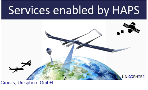
Services Enabled by HAPS (Unisphere)
Status date: 02 September 2019
Within the context of satellites, terrestrial infrastructure and Remotely Piloted Aircraft Systems (RPAS), HAPS are a new platform offering unique advantages, but also complement existing services. Three major HAPS applications have been analyzed within this feasibility study. The concept of “HAPS as a Service” (HaaS) has been introduced and its unique requirements to highly automated flight management were detailed. A follow-up demonstration project with the focus on flight management has emerged from this feasibility study.
COLDSUN
Status date: 21 August 2019
The project has explored a communication service that allows to transmit data between underwater networks and the internet via satellite networks. The overall system renders possible low-cost data transfer using a data relay buoy equipped with interfaces for underwater as well as satellite communication. This offers a cheap and flexible communication solution for companies operating in a maritime environment.
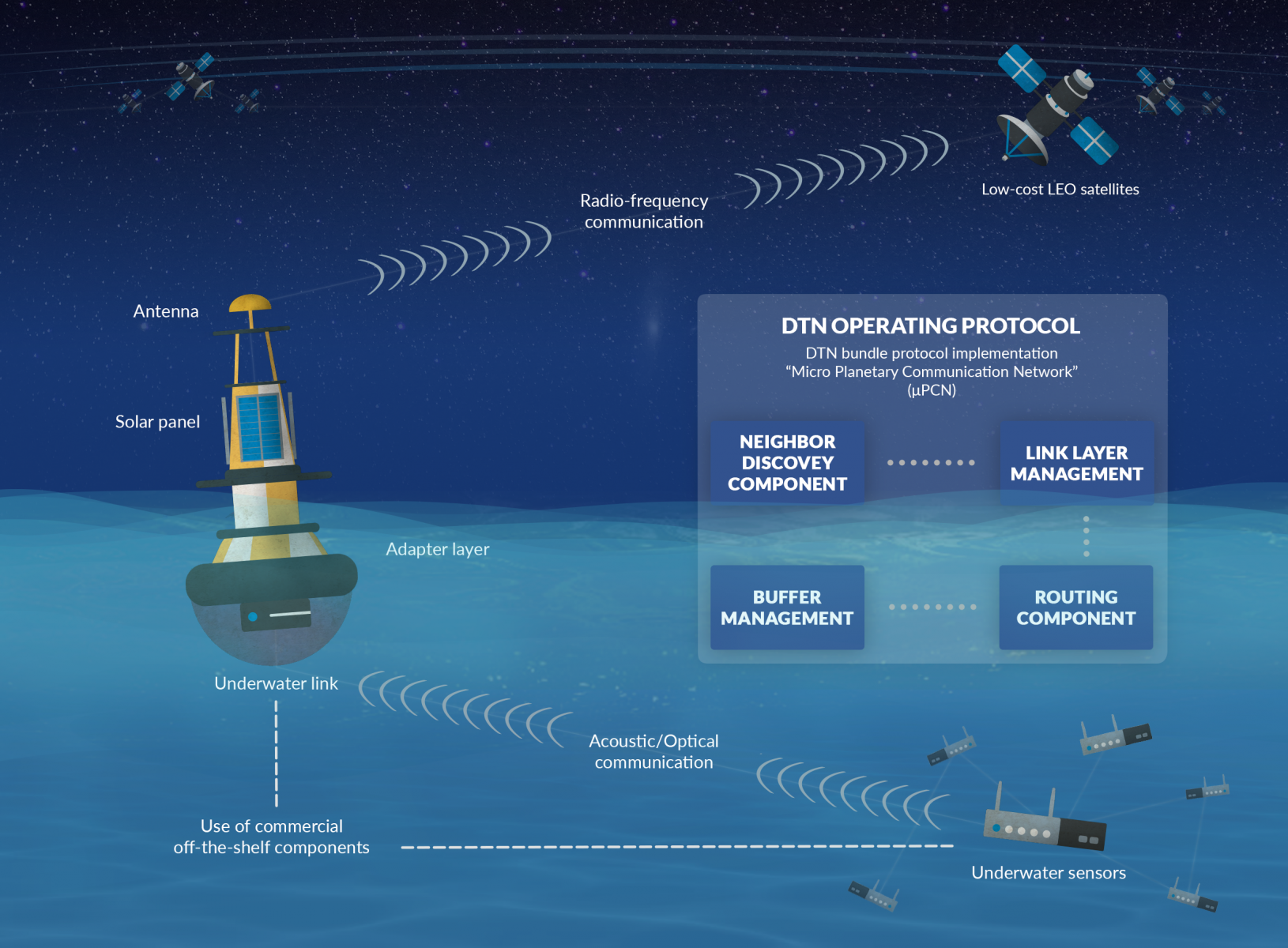
GoWalk
Status date: 12 August 2019
Walk2Health is a smartphone app that encourages older people to take regular exercise. The key problem is that many elderly people lack sufficient motivation to take regular exercise, which leads to health declines. The study investigated the potential of a new smartphone app that provides motivation to older people with reminder messages, charts, and daily targets.
MOWGLI Feasibility Study
Status date: 09 August 2019
MOWGLI is a solution that provides a set of services for optimal microgrid planning, designing and operational and maintenance (O&M) applications in urban and rural areas of developing countries, with particular focus on India user case. The activities have been implemented in cooperation with the India Energy Storage Alliance (IESA) and funded by European Space Agency (ESA) within ARTES IAP programme.
BIGMIG
Status date: 02 August 2019
The study aims at identifying possible applications of space data (imagery, navigation data, satellite communications etc.) and other (“big”) data sources to help and improve the mitigation, readiness and response to the human migration phenomena, and to assess their technical and economic viability.

SAFEDEM
Status date: 01 August 2019
Demining has been relying on traditional techniques in order to perform the critical task of Land release. Space assets, EO products above all, provide a practical and effective support in many phases of the demining activities, helping in surveying the mine affected areas in a more detailed and less expensive way.
UNDERSEE
Status date: 26 July 2019
UNDERSEE is committed to develop a scalable solution to bring knowledge about rivers, lakes and oceans to water dependent stakeholders by providing simple access to water quality data.
SatCBRN
Status date: 12 July 2019
SatCBRN explores the use of satellite services for surveillance and hazard management of incidents involving release of chemical, biological, radiological or nuclear threat agents.
CC RAFCo
Status date: 09 July 2019
The aim of CC RAFCo Kick-start activity is to assess the feasibility of a service which assist food and beverage industries monitor crops performance (their own or from suppliers), and plan for climate-related disruptions in the supply chain. CC RAFCo service offers a one-stop-shop for all climate-related data needs, to help companies integrate climate change impacts into their business planning: from contingency planning for seasonal climate variability to long-term climate change risk management.
DW-TRAC
Status date: 09 July 2019
DW-TRAC (Dangerous Waste Tracking & Tracing) lays the foundation for the implementation of a sustainable service for real-time tracking and tracing of dangerous/hazardous waste in Europe, providing a better service and transparency for customers, carriers and authorities.
SFM
Status date: 04 July 2019
The objective of the SFM project is to formulate an integrated system-service aimed at monitoring and providing real-time information to first responders and decision makers, about the status of the area impacted by a release of agent chemical, bacteriological, and radiological even with explosives (CBRNe).
eOdyn surface currents
Status date: 01 July 2019
eOdyn’s surface currents service enables saving costs and mitigate risks on offshore Oil & Gas marine operations. Simultaneously providing unique information onboard vessels and to onshore support teams, this satellite-based service supports decision making.
PLIMM
Status date: 24 June 2019
‘Helping to find the important needles within the InSAR time series haystack’
The PLIMM services developed within the project provide users with unique information on the performance of their assets. Using a set of proprietary workflows and algorithms on processed InSAR data the system is able to identify critical insights within the millions of individual measurement points. Developed in close collaboration with the user community, the system provides earth observation outputs in a format that is most appropriate for the target sectors.

CSP-FoSyS
Status date: 14 June 2019
Concentrating solar thermal power plants with an electricity production of up to 250 MW have to be integrated into the electricity grid. Both day-ahead and intra-day forecasting of the production and therefore direct solar irradiance forecasting is needed.
During the demonstration project, a forecasting system based on the use of satellite data, cloud cameras, numerical weather prediction models and plant model was developed. The system was installed, tested and demonstrated in La Africana CSP power plant in Spain.
UKSRI
Status date: 14 June 2019
Field-level seasonal weather predictions can empower growers to make better-informed decisions, reducing their food waste and greenhouse emissions. We have demonstrated a working pilot of a new seasonal forecast system that combines EC Copernicus model outputs with daily weather analytics to improve long-term rainfall predictability. Applications include summer planning for irrigation, cultivar selection and decisions about crop mixes to mitigate crops losses from drought, floods or climate-linked pathogens. UKSRI has identified British growers, producers and agronomists who could benefit from these services.
Poolspot
Status date: 14 June 2019
INVITE ALL SWIMMING POOL OWNERS IN YOUR (E-)SHOP
We automatically detect swimming pool owners at wide scale thanks to our identification algorithms using satellite imagery.
Take the opportunity to reach new clients with our direct marketing service.
DROMAS
Status date: 12 June 2019
DROMAS services aim at periodical full country monitoring of agricultural vegetation to serve decision makers on national level
SenTAct
Status date: 12 June 2019
The services is a visual communications service for operational management. The service helps teams in the field assimilate information relevant for the local context. We aim to offer a communications platform which leverages Location Intelligence to provide the right information at the right time, and Augmented Reality to ease access and understanding of the information.
GeoSHM Demo Project
Status date: 10 June 2019
The GeoSHM Demo Project implements a pre-operational installation and demonstration across three of the longest bridges in the world. The primary purpose of the project is the integration of GNSS positioning and Earth Observation techniques to enable the Structural Health Monitoring (SHM) of long-span bridges. This project intends to bring the GeoSHM service to the global market incrementally.

AgroRadar
Status date: 07 June 2019

WAMCam
Status date: 03 June 2019
Developed by Archangel Imaging, WAMCam is an innovative solution integrating satellite communication and machine learning technologies to radically improve wildlife monitoring and population studies. Researchers and conservationists working in remote regions can deploy AI-enabled cameras to remotely monitor animal traps and study areas. Receiving prompt notifications of the wildlife identified by the cameras revolutionizes the effectiveness of conservation studies.
Meandair
Status date: 27 May 2019
Every day, pilots have to take difficult decisions about their flight routes avoiding adverse weather and safeguarding fuel-efficiency of their flights. Meandair helps to quickly determine the safest and most fuel-efficient routes for general aviation flights with respect to the ever-changing weather.
Space Innovation System to Monitor Animals
Status date: 23 May 2019
SISMA2 provides a series of cost-effective space-based tools to facilitate the management of the pastoralism livestock industry, and cope with the future.
OTAM
Status date: 15 May 2019
The OTAM (Oil Trading Analytics Monitor) is a comprehensive solution for the oil trading analytics market, created by seamlessly combining data from the maritime (AIS+) and remote sensing (optical and SAR) sectors with oil analytics data. This new combination of datasets provides actionable insights on the status of the oil market.
Invisible Worlds
Status date: 09 May 2019
Rezatec and the Eden Project will explore how geospatial data analytics could benefit individual growers or forest owners with small areas under management, by providing commercially valuable and actionable decision support tools accessed via a self-service, digital platform. In addition, these analytics could be provided as an operational service to other creative visual installations at museums and institutions around the world.
PASST
Status date: 08 May 2019
Precise Apiculture Supported by Space Technologies (acronym: PASST) is a mobile application that enables the implementation of precise apiaries management based on the latest satellite technologies and geolocation in connection with close cooperation with agricultural producers.
Vialone
Status date: 08 May 2019
Vialone leverages Big Earth Observation Data to support European organic rice farming and trade. Copernicus data and tailored in-situ sensors keep rice paddy fields constantly monitored from both space and ground. Vialone unlocks best practices of organic paddy management and supplies early information on growth trends. Thanks to Vialone, the so-called mature consumer will be able to make healthy and informed choices based on reliable traceability information on top-tier organic rice.
VtDaws
Status date: 07 May 2019
VtDaws is a service developed on a SaaS model. VtDaws includes in its features the access to EO data (especially Sentinel and Copernicus Services data), a change/anomalies detection engine based on machine learning techniques, a warning service transforming data into information to the users and community sourcing features to add in-situ data and share information on smartphones or tablets.
RailSAT
Status date: 07 May 2019
RailSAT intends to enhance the current practices of monitoring railway track geometry and the surrounding environment by using Earth observation satellite data, in particular Interferometric Synthetic Aperture Radar (InSAR), and satellite navigation.
ARCT.esa
Status date: 12 April 2019
The ARCTTM stakeholder mapping tool offers visualization of “Project Health” in the cross-roads between society, environment, business and policy. The unique de-risking tool combines climate change risks with other factors and makes them relevant, simple and visual for owner and decision makers of any infrastructure project.
ARCT has also found a fun and engaging way to score and report on the UN Sustainability Goal Climate Action goal #13. www.arct.tools.
ALBA-TROSS
Status date: 10 April 2019
Alba Orbital is working to develop satellite applications which utilize each aircraft’s unique ‘Automatic Dependent Surveillance-Broadcast’ (ADS-B) signature. ADS-B signals contain data on flight path, and flight weather conditions, and can be used to enhance global weather forecasts, verify aircraft carbon emissions, and aid in Mayday scenarios, especially when fused with other satellite and ground based data-sets.
Tesselo
Status date: 10 April 2019
Our mission is to help organizations manage their natural resources more efficiently and sustainably. To achieve this goal, we augment satellite imagery with Artificial Intelligence and environmental expert knowledge to deliver actionable business insight to our customers.
Planet B is too far away – let’s take care of Planet A.
Greenhouse Early Warning Service
Status date: 09 April 2019
Greenhouse owners are in a very competitive market, in which unexpected costs due to damage and decay of the greenhouse assets can cause severe problems. This feasibility study aims to provide insights into how an early warning service using space data can help greenhouse owners to prevent or mitigate non-insurable risks threatening their business.
ARC-REACH
Status date: 08 April 2019
A number of countries are making preparations to turn the rapidly warming Arctic into a busy global shipping route.
The objective of the ARC-REACH project is to validate the need and feasibility to setup a cost-effective low-power long-range dynamic radio network, tailored for tracking of cargo and maritime activity, complemented with remote sensing of the environment.
MIDAS
Status date: 02 April 2019
Land mines and IEDs are a global problem that impact individuals, nations and the international community.
The MIDAS programme uses space services to improve efficiency, coordination, assurance, traceability, autonomy and safety of clearance operations; reducing casualties and returning land to productive use around the world.
AUDROS
Status date: 02 April 2019
The “Autonomous Drone Services in the CBRNe operations” (AUDROS) Feasibility Study assessed the technical feasibility and commercial viability of space-based services in combination with the emerging RPAS technologies which become a game changer in many service domains to improve the monitoring, early warning, surveillance and reaction on CBRNe events and threats.
SSFIS
Status date: 02 April 2019
Smallholders are underserved by credit providers as lenders are unable to assess their risk. Sensonomic’s system uses predictive and prescriptive simulations to assess system effects of credit deployment and open the market. With its dynamic data consumption, and iterative and reactive simulations, the service provides a continually updated prediction of how robust the credit providers portfolio is.

NG Aviation – Smart Airports
Status date: 28 March 2019
Proposed system serves as a platform for Airside area management based on ICAO and EUROCONTROL legislative as a support for satellite navigation.
AIME Aeronautical Information Management Environment software platform enables to create and share digital aeronautical data including the temporal warning messages (Digital NOTAM) in AIXM 5.1 format.
European Space-based Information Management System for CBRN (EuroSIM CBRN)
Status date: 22 March 2019
The aim of this project is to investigate the feasibility of developing the next generation of CBRN information management system through the provision of a web-based service model which enables a wide user community to have access to the type of advanced CBRN IM technology already available to the military in the UK, the USA and NATO.

CERASAT
Status date: 20 March 2019
CERASAT aims to provide reliable, real-time and global rainfall measurement services. It extracts the rainfall information from the signalling data generated in satellite communication (SatCom) networks by employing advanced machine learning and signal processing techniques. CERASAT can complement existing rainfall measurement solutions e.g. rain gauges and weather radars.
HiVaCroM
Status date: 18 March 2019
HiVaCroM uses a time series of Sentinel-1 SAR observations as the basis for generating field-level canopy cover measurements for high value potato crops on a national scale. The canopy cover measurements are required frequently, throughout the growing season, as input to yield models and to inform crop performance metrics. The yield model and crop performance metrics provided important information that growers and supply chain can use to manage crop-related risk during the growing season.
ISSWIND Demo
Status date: 13 March 2019
ISSWIND provides value-adding services to wind power industry in the areas of planning and operations, with financial and organizational benefits, to a wide range of wind power stakeholders. More accurate wind resource assessments and power production estimations are just two of the range of services available that shall benefit the client’s business.
Project Impactor
Status date: 11 March 2019
Impactor deliver a prototype/credit scoring tool based on locally collected data, weather data and remote sensing data works. With this, we can provide financing to smallholders – and support traders in taking over financing activities to these smallholders – Impactor could in a later stage expand to advice, which after then can be presented to impact investors (via a platform).
HARP
Status date: 08 March 2019
For safe operations, commercial aircraft have to be able to communicate with air traffic control centres at all times. In remote areas such as the polar regions, communication is by HF shortwave radio, which may be severely disrupted by space weather events. The provision of state-of-the-art services for HF communication management is covered by the HARP project.
Ground Instability Risk Profiling (GIRP) now branded as Hi_Ground
Status date: 22 February 2019
DynTrans
Status date: 20 February 2019
The Dynamic Public Transport System (DynTrans) is a concept for dynamic public transport systems based on existing transport networks and satellite positioning. DynTrans assists public transport providers and governmental institutions to increase the attractiveness of their public transport systems. The system provides a taxi-like transportation service for the costs of a bus ticket to passengers.
SCS
Status date: 18 February 2019
Smart Coop Solutions (SCS) is an Internet of Things (IoT) based sensing service enabling the organic farmer to monitor and maintain mobile chicken coops remotely and to guarantee suitable conditions for the animals. Animal welfare under organic standards has strict regulations and requires that coops offer a suitable indoor climate and outdoor environment. Real-time monitoring through the SCS provides farmers with relevant statistics, actionable information and peace of mind through a simple mobile app.
DateGIS Demo
Status date: 12 February 2019
DateGIS Demo is the follow-on demonstration project from the ARTES 20 DateGIS feasibility study completed in 2016.
DateGIS is an integrated Geo-information System (GIS) for Date Palm precision agriculture. Objective of DateGIS is to provide information products and services on date farms and palm trees for:
- Government institutions, specifically for the following needs:
- Date farm and palm registration service;
- Regional / national Red Palm Weevil control management program;
- Date sector (farmers), specifically for the following needs:
- Increase yield, productivity and quality of date farming;
- Reduction of date farm losses due to Red Palm Weevil infestation.
Currently the main threat for the global date sector is the Red Palm Weevil plague, so the first focus of DateGIS is on service items 1.b and 2.b (the most urgent needs), with a clear and sustainable long-term growth model for service items 1.a and 2.a.
The key asset of the DateGIS is information supply chain management (“from big data to farm information”) which includes building a strong network of remote sensing data suppliers, aerial survey service providers, knowledge partners and local network / sales channels.
PRIIMA
Status date: 08 February 2019
PRIIMA serves the need for high-resolution sea-ice forecasts in the Arctic and Antarctic maritime sector. It converts static satellite images into real-time information and even into animations showing the future drift of sea-ice over the next hours and days, while the resolution of the images is being conserved.
NARWHALS
Status date: 05 February 2019
NARWHALS objective is to realise a feasibility study of a service capable to provide high accuracy positioning by monitoring and mitigating the ionospheric impact on GNSS navigation in the Arctic environment. Istituto Superiore Mario Boella (ISMB) and SpacEarth Technology (SET/INGV) propose a possible solution by combining their expertise in low power hardware and managing ionospheric data.

POINTSAT
Status date: 01 February 2019
POINTSAT enables professional remote collaboration services of support, instruction and training in challenging conditions for the maritime, offshore, and energy industry sectors. The project integrates satellite infrastructure and augmented reality technology into a smart and reliable solution for all technical collaboration needs.

ARCtic Sea-ice and CleAN monitoring
Status date: 17 January 2019
The project brings solution for a systematic and automatic detection of sea ice (including the identification of ice and marginal ice zone) and oil slicks in the Arctic from Sentinel-1 images. Based on Machine Learning (Support Vector Machines), it permits to process automatically thousands of images with high accuracy.
NITREOS
Status date: 16 January 2019
NITREOS is a service platform that serves organic farmers, as well as conventional, in carrying out daily activities in a more efficient, profitable and sustainable way, as compared to the practices they used until now.
NITREOS provides the following services to farmers and agricultural consultants: i) Irrigation Scheduling; ii) Variable Rate Fertilization; iii) Crop Growth Monitoring; and iv) Yield Estimation.
Satellite data analytics for (re)insurance
Status date: 16 January 2019
Geospatial data analytics for (re)insurance
Wild boar project
Status date: 14 January 2019
The key product/service is to provide a monitoring of damages to agricultural and environmental areas caused by wild boar (Sus scrofa) using remote sensing data. The technical key idea is to upscale from the investigation of local areas via high resolution aerial images to larger areas via satellite data.

ANHS
Status date: 10 January 2019
The market opportunity identified by DHI GRAS is to provide customers with updated information of navigational hazards including coastlines and submerged reefs in the Arctic.
RGB
Status date: 10 January 2019
Our latest solution for remote graphics allows sports federations and content owners to adapt TV graphical overlays for different geographies without multiplying the number of feeds, thereby reducing costs and maximising the event value for partners and sponsors.

Building Stock Monitor Service
Status date: 09 January 2019
The proposed Building Stock Monitor Service is a service to aid municipalities with monitoring the entire building stock within their geographical borders by using satellite imagery from Sentinels 1 and 2.
The revisit time of these satellites give unprecedented update frequency as opposed to current technology that typically involves fly-bys at high costs.

Space4Microgrids – India
Status date: 03 January 2019
Space4Microgrids – India
The Space4Microgrids – India project focuses on supporting the implementation and operations of microgrids in India. The overall aim is to determine the feasibility of viable and sustainable operational satellite based services that can subsequently be developed and demonstrated. These services will aim at resolving various challenges related to deployment of sustainable microgrids for remote, isolated and emerging areas in India. Our services will assist in planning, design, operational and maintenance stages.
WONDER
Status date: 21 December 2018
The targeted solution is an automated, cloud-based digital service for water quality monitoring which could be utilized globally. The solution builds on earth observation, global positioning, crowd sourcing, internet of things (IoT) and predictive analysis.
AIR-Portal
Status date: 20 December 2018
AIR-Portal provides extremely local (100m resolution) air quality monitoring and forecasting, delivering actionable insight for citizens, governments and industry.
The delivered historical, real-time and expected air quality data is based on a unique down scaling algorithm which integrates satellite data, local sensing, land use data, meteorological models, and dispersion models.

ESA-IoT
Status date: 19 December 2018
The study intends to understand the future of a satellite-based IoT solution and the market for related products in multiple industries that require monitoring and in particular the monitoring of assets in remote areas. Through the study we engaged with major industrial companies providing them with a small demo of the proposed IoT product to validate business opportunities.
SBS RailS Phase 2.1
Status date: 19 December 2018
SBS RailS Phase 2.1 aims to design, build and test the first European Demonstrator of Train Control System based on the ERTMS L2 standard operating with satellite navigation and a satcom multi-bearer telecom service. The demonstrator will be tested on the Pinerolo-Sangone pilot line in collaboration with RFI that in the meantime has activated the certification process with the safety agencies.

Watch Out!
Status date: 19 December 2018
While wearable tracker gadgets become mainstream, they fail to provide a solution for elderly fall prevention. This new algorithm from Gait Up empowers existing wearables with smart fusion of GNSS and IMU for simple and accurate activity metrics related to elderly falls, like gait speed. The algorithm is implemented in a smartwatch application, satisfying requests from national healthcare institutions.
WELLACTIVE
Status date: 14 December 2018
WELLACTIVE is a Silver Fitness & Leisure Platform helping Seniors perform outdoorrecreational activities tailored in real-time to their personal abilities and interests, combining “physical, cerebral and social” undertakings shaped for “impairment and accessibility”.

Star Point
Status date: 14 December 2018
Apply the ESA’s DrMUST LoOP outlier detection model to find anomalies in financial trading data and in time-aggregate sales and trading performance measures. Provide rich real-time alerts to sales people and traders when anomalies are detected.

RWatch
Status date: 14 December 2018
Monitor the number of cars in selected retail outlets, and use car park fill rate as a proxy to monitor and predict the financial performance of retail companies
ConsTrack
Status date: 12 December 2018
ConsTrack serves as a comprehensive construction site information service to the economic and financial sector, through an integrative satellite observation and satellite navigation solution and dedicated IT system.
NaturAgeing
Status date: 12 December 2018
Smart digital solutions for healthy ageing through improvement of outdoor lifestyle of the elderly.
Urban Space Series
Status date: 11 December 2018
The Urban Space Series is a real-time index of urban economic development. The product developed in common with ESA and QuantCube Technology is an IA platform for land characterization, specifically to detect urban city area, based on satellite images. The service monthly provides the shape of selected cities and useful metrics such as area and urban change detection.
SPACEWHALE
Status date: 11 December 2018
SPACEWHALE is an innovative, semi-automated approach based on deep-learning techniques to detect large whales from VHR satellite images. It forms the bridge between space asset providers and stakeholders in need of population assessments of large whales to increase our ability to survey areas out of reach for traditional methods such as ship and aerial surveys.
EMUSER
Status date: 10 December 2018
EMUSER is an innovative obstacle detection system integrated with a satellite Broad Band link for the safety of active level crossings.
EMUSER provides increased resilience in case of natural disasters or damages to the rail infrastructure. It can be installed in areas that are uncovered by conventional communication networks.
Entocycle - Accelerating Insect-Based Protein Production
Status date: 05 December 2018
Entocycle has assessed the viability of space-based services for the production of sustainable protein.
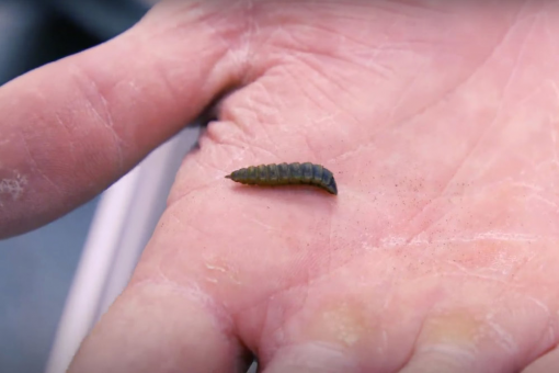
Space Applications using Animal tracking data
Status date: 30 November 2018
The aim of the feasibility study is to evaluate a service for monitoring wildlife and farm animals. The service consists of a hardware part (collars for the animals, buy or lease) and a software to be offered as software as a service. For users these two parts are transparent, and they rent an overall service for animal tracking.
MAPCAM
Status date: 29 November 2018
MAPCAM provides crop identification and crop productivity information through the growing season to support a number of different regulatory, policy, planning and protection functions aimed at ensuring food security and adaptation to above-average climate change impacts.
ClimField
Status date: 29 November 2018
ClimField was a project aimed at assessing feasibility of development a portfolio of EO-based irrigation supporting services addressed to Polish field crops producers. Effects of climate change on the situation of farmers and treatments they undertake were taken into account during the study.

SAT-DEFO FS
Status date: 26 November 2018
SAT-DEFO project purpose is to build an app with data-proven, valid, both historical and current information about ground deformations for the inhabitants of the areas who are exposed to such changes (especially in the localizations threatened by ground subsidence caused by mining activity).
RAPSODY
Status date: 19 November 2018
RAPSODY, a project led by TEKEVER, will demonstrate the use of remotely piloted aerial systems (RPAS) in a wide area maritime context, through the execution of search & rescue and pollution monitoring missions. The missions will be executed in near-real scenarios over the Atlantic Ocean. The Satcom-enabled RPAS will be fully prepared and customized to perform these maritime missions, including the integration of specific payloads and the usage of specially tailored mission-oriented data fusion, data compression and automatic feature recognition and identification algorithms.
AquaFarm
Status date: 16 November 2018
Aquafarm brings together satellite data and Soil-Plant-Air models to provide operational services to Farmers’ service providers as well as national institutions related with crop development and forecast.
Space Applications for Wildlife
Status date: 15 November 2018
The services helps private and public organizations with assessing, monitoring, preventing, managing, and planning strategy for wildlife conservation.
SAMIPS
Status date: 15 November 2018
The main objective of the project is to investigate user needs, technological feasibility and economic sustainability of the implementation of the EO-based solution allowing for detection and monitoring of habitats affected by invasive plant species.

TSMF_10CM
Status date: 06 November 2018
The TSMF_10CM investigates the technical feasibility and commercial viability of information services regarding a) regular generation of forest stress maps and b) detection of bark beetle infestation in support of small and medium size forestry operations in Germany.
IceCast
Status date: 06 November 2018
IceCast demo project aims to develop and demonstrate a service based on IoT based capabilities combined with space assets, to help navigation planning in ice covered water areas. The solution fetches data from different data sources, stores the data, analyses it and provides output via graphical UI. There are three pilot customers who are piloting the solution in Baltic Sea and are giving input for solution development during the creation phase.

IDiSPUTE
Status date: 06 November 2018
IDiSPUTE supports land use planning and identification of hazards for the population through the application of an innovative algorithm based on artificial intelligence applied to images from earth observation satellites.
SFCS
Status date: 06 November 2018
Satellite Fruit Control System (SFCS) based on the use of smartphone, image processing and EGNSS technology combined in developed application will allow to estimate the quantity, physical and qualitative parameters of fruits planned for harvest.

MSW-Service
Status date: 30 October 2018
We study the feasibility of services that combine,
- High resolution now-casts of strong wind shear, turbulence and other severe weather phenomena, and information of large flocks of birds,
and
- Real-time information and forecasts of the global spatial distribution of space weather effects,
with
- accurate real time position information of aircraft,
to make aviation more safe, effective and economic, with less carbon footprint.

TELEKAIROS®
Status date: 29 October 2018
TELEKAIROS® Fintech is a tool for financial and (re)insurance contracts that derive value from an underlying asset such a traditional stock, a bond or stock index. TELEKAIROS is capable to manage different kinds of risks, for example by increasing the efficiency of the underlying market because they lower unforeseen costs of purchasing an asset outright.

Earthcube
Status date: 29 October 2018
Every year, millions of financial contracts whose value is indexed on hard commodities prices are traded on financial markets. Australia and Brazil represent 54% of the global supply, while China and India combined represent more than half of the global demand in hard commodities. It is thus key for investors to be able to forecast outputs and inputs in these countries where opacity remains high. Earthcube leverages satellites to tackle this issue.
TTSat
Status date: 24 October 2018
The successive and recurring epidemiological crisis in developing countries have evidenced the need for more efficient organisation in terms of diseases early detection and warning as well as global emergency response capacity.
There is a clear opportunity to provide an integrated information system delivering real time data collection and alert from/to all sites in a territory where no telecommunication infrastructure is available in remote sites.
Built upon the epiSat business solution by Telemedicine Technologies S.A.S. and leveraging satellite terminals by CLS (Collecte Localisation Satellites), the TTSat service will be deployed in collaboration with UNFPA (United Nations Population Fund) in three countries, Benin, Guinea and Senegal.
TALED
Status date: 24 October 2018
TALED is an innovative integrated SATCOM/EO/GNSS platform to cope in RT/NRT with all kind of Fire incidents in outdoors: Forest fires, Waste fires and Hazmat Fires. The system will guarantee better technical and economical performances of the service. TALED has been integrated in the DSS of Campania Region, operated by SMA, the official service provider and TALED’s team partner.

CountFloors
Status date: 22 October 2018
CountFloors (CF) is a service designed to collect and analyse GNSS-geocoded images of buildings acquired at street level together with Sentinel data. CF automatically retrieves ground-level and satellite images on urban areas of interest, and uses a machine learning approach to extract risk-relevant characteristics of buildings depicted in the images. These features are sought after by risk modellers and insurance companies; yet they are of interest also in the real estate market and to the municipalities for their planning.

SYMPA
Status date: 18 October 2018
Sympa: “All-around solution for the sustainable monitoring and control of Marine protected Areas”.
Vitrociset Belgium, le Centre Spatial de Liège, and LaMMA joined in Consortium, developed a system for the supervision of the touristic and commercial traffic for the benefit of the Marine Protected Area and maritime authorities, by mean of providing added value location based services to tourists and integrating this information with AIS data.
Sympa service offering is completed by the “Vessel Detection” facility that exploits the Sentinel images for target detection; and the “Water quality” monitoring which integrates earth observation into innovative biogeochemical and hydrodynamic models as support the for a sustainable and competitive tourism.
IoTrees
Status date: 18 October 2018
Forests cover 30% of the Earths land area and provide a vital role by converting atmospheric carbon into oxygen as part of the growth process. Forests are essentially the ‘Lungs of the Earth’. Determining the rate of forest growth is an essential indicator of the health of a forest and also a key indicator to estimate future growth performance. Climate Change is a major concern to humanity and many countries around the globe have established national forest inventories to determine forest growth and health. Treemetrics through the Internet of Trees (IoTrees) project has developed a vision and plan to revolutionise the way trees and forests are measured and monitored by utilising latest Satcom and IoT technologies.
Curio Canopy
Status date: 11 October 2018
Combining analysis of satellite imagery with crowdsourced data, this urban tree montioring platform connects communities and urban forestry professionals. It provides an open data service that drives improved understanding of urban trees and access to better information in order to: i) increase tree planting and tree care; ii) improve environmental conservation management and planning; iii) support educational and communication resources for learning and knowledge-sharing.
Assure
Status date: 17 September 2018
Assure is a system designed to alert the care community of someone suffering from social isolation
SIITAg
Status date: 17 September 2018
Agriculture is the most important core industry in the world. With feeding 9.5 billion people globally by 2050, it faces a tremendous challenge. Food production must increase by 75%. To that end, Spacenus develops sustainable operational services which addresses agricultural plant nutrient deficiency (PND) with an Artificial Intelligence (AI) system connected with earth observation, navigation and IoT.
SAMoH
Status date: 17 September 2018
Satellite Earth Observation offers a rich source of information-rich temporal data for those charged with monitoring and managing natural habitats. The SAMoH platform helps to connect these users with imagery and provides analytical and visualization tools that do not require users to be remote sensing experts. Through the use of cloud storage, cloud processing power and open data cube technology, turning imagery into insight for a range of users in the environmental sector is quick, easy and cost-effective.
COHABIT
Status date: 12 September 2018
COHABIT monitors and assesses in real-time the whereabouts of large wild animals and dynamically generates geo-fenced alerts for visitors to avoid dangerous encounters and for farmers to protects their crops and livestock. Wildlife – human cohabitation is made possible through the use of data analytics, image-recognition, animal tracking and space technology.
dYbydX
Status date: 04 September 2018
Routing information to navigate the urban environment in accordance with users’ personal mobility needs.
SmartCARE
Status date: 04 September 2018
SmartCARE is an ICT platform of advanced e-health services where physicians and patients meet and manage daily activities, within a therapeutic process, in a collaborative way enabling an optimization of healthcare rehabilitation at home. SmartCARE IHC (Integrated Home Care) services will assure a constant verification of the therapeutic process without requiring the on-site presence of medical staff.

Blue SIROS
Status date: 04 September 2018
The project investigates the technical feasibility and commercial viability of an operational system for marine route optimisation, which integrates modelling/forecasts of ocean currents based on near-real time satellite altimetry data services. The service supports commercial users in the maritime community with respect to fuel savings, competiveness and port logistics as well as ship safety.
SolumScire (SC)
Status date: 31 August 2018
SolumScire makes soil data more valuable and useful. This service is based on better referenced and new spatial soil data and combines this with plant performance information to get insights on soils and plant management as well as their important interactions. The data aggregation and use improves modelling for precision farming to increase yield and to lower emissions.

Ibisa-ks
Status date: 31 August 2018
Crop protection for smallholder farmers with low fees and fast payments
LUMEN
Status date: 28 August 2018
LUMEN provides a fully integrated end-to-end solution for real time monitoring and critical situation management with medium sized RPAS that can operate beyond line of sight.
The service is demonstrated with two specific use cases representative for the target market: flood extend mapping and maritime coastal monitoring.
TransparentSea
Status date: 22 August 2018
TransparentSea develop an innovative fishery monitoring system.

AMBROSIA
Status date: 14 August 2018
The ESA-Ambrosia food safety and traceability platform combines Blockchain technology, IoT, Satellite Earth Observation (SatEO) and GNSS Satellite Navigation to achieve maximum automation, security, and transparency of the food supply chains.
Blue Desert
Status date: 08 August 2018
Blue-Value (developed in the project ‘Blue Desert’) is an information and software suite to determine water related risks, support optimization of water management, and asses water footprints.
NAPPI
Status date: 03 August 2018
The NAPPI navigation solution aims to provide a tailored navigation service for the ageing population in public infrastructures to enhance their mobility and life quality. The solution is able to achieve centimeter tracking precision in indoor environments as well as to provide smooth routing transition between indoor and outdoor environments by combining satellite, acoustic and inertial sensor technologies.
BioDiv Checker
Status date: 01 August 2018
The BioDiv Checker is a service to acquire and analyze remote sensing images for supply chain integrity within ecological farming.

SIS-SREM
Status date: 26 July 2018
To improve the safety and the information provision for people planning and undertaking outdoor activities in mountain resorts in the Eastern European market, the SIS-SREM project developed an advanced mountain rescue team management (MRTM) solution for organizations to better coordinate teams during search & rescue missions (S&R) and an Infotainment platform that provides 3D outdoor maps and mobile guidance for visitors, enables new forms of digital marketing and communication and integrates RPAS technology based services.

RSFPS Service
Status date: 25 July 2018
The extension of the TIKKA project on the REMOTE SENSING FIRE PROTECTION SYSTEM is results of the positive evaluation of the TIKKA project by the forest users. The new Service will be based on the TIKKA project conception that has been evaluated and implemented during the demonstration phase for the Forest Users. The service will be implemented and provided to the brand-new market which are the National Parks in Poland. The beneficiary of the RSFPS during the demonstration phase of the service will be the Kampinoski National Park, which is the second biggest National Park in Poland (385 km2) and in 2000 year has been listed on UNESCO List.

SPARK ME
Status date: 23 July 2018
SPARK ME develops an acceleration programme to attract, support and validate new application and service ideas using Satcom in association with additional space technologies. The ultimate goal is stimulating the creation and growth of new markets of space/satellite-based services, addressing the real users’ need and triggering cross-fertilization processes by "contaminating" other areas of activity with the use of space technologies.
JERICHO VDE
Status date: 23 July 2018
Feasibility study, performed by a Polish team, providing a comprehensive overview of the VDES technology future maritime applications potential. Analysis regards two of the most interesting services, i.e. MSI (Maritime Safety Information) exchange, with particular emphasis on polar regions, and SAR (Search and Rescue) operation coordination – on-scene search patterns exchange.
MiLoW-RRS
Status date: 23 July 2018
MiLoW-RRS is an innovative weather service based on space technologies and space derived data that provides outdoor enthusiasts a one-stop-shop solution for planning multi-day outdoor trips in complex terrains. The service combines maps, elevation profiles and route descriptions with accurate and reliable weather forecasts for planning and undertaking outdoor activities.
WASTE IAP
Status date: 23 July 2018
The development of a service that uses Earth Observation data to detect and monitor legal waste sites, and GNSS technology to track the destination of high value waste items. The information is used to show evidence of legal operator compliance and illegal disposal or exportation of waste.
DFMS4i
Status date: 18 July 2018
The project investigated how drought and flood prediction and monitoring services derived from in-situ and space-based Earth Observation data - in from the Sentinel satellites - could support the uptake of agriculture insurance in developing countries, with an initial focus on Uganda.
GFaaS
Status date: 17 July 2018
Geospatial Framework as a Service (GFaaS) aims to bridge the gap between the geospatial data providers, service providers and the intermediate/end-users to ensure painless access to processed geospatial data for addressing agricultural productivity concerns.

Pi-Link
Status date: 13 July 2018
Collection and transmission of ocean water column data opens up new data-based revenue streams across a range of industrial sectors and stakeholders. The Pi-Link activity explores the market and technical feasibility around sustainably gathering and supplying such data using a sensor-equipped version of SNTech’s Pisces device, called Pi-Sense.
WaterInfo
Status date: 12 July 2018
Providing continuous updates on hydro reservoir filling levels by means of Earth Observation data & machine learning to improve power price forecasting, production planning and market analysis and energy trading.

SiPeCon
Status date: 12 July 2018
SiPeCon offers information services based on a fully operational sensor information supply chain to support crop protection agents and their clients (farmers) who want to increase crop production yield by reducing yield losses caused by pests and embrace Integrated Pest Management (IPM) innovations to reduce reliance of chemical pesticides, which is a novel business approach for crop protection.
GREENSPIN Agri Planet
Status date: 11 July 2018
GREENSPIN AGRI PLANET: a global service for field-level agricultural insights based on Earth Observation, crowd information and artificial intelligence.

DSE IOT Project
Status date: 11 July 2018
DryGro is commercializing a novel method of agriculture that produces a soy-alternative crop in areas where land is water-scarce, arid, or otherwise non-arable. This project aims to determine the suitability of satellite-enabled IOT, earth observation, and numerical weather prediction technologies for facilitating the application of DryGro’s horticultural approach in such remote, inhospitable climates.
HelloBin
Status date: 11 July 2018
HelloBin services optimizes routing for waste collection for waste collectors and contributes to the ability to manage the waste stream more efficiently.
VECMAP
Status date: 05 July 2018
VECMAP® is an award-winning one-stop-shop for the area-wide mapping of the distribution and abundance of pests that transmit diseases. The software includes tools for (1) geo-located field survey planning, (2) collection, storage & management of geo-referenced data, and (3) spatial analysis and spatial modelling of observed presence and absence data using earth observation data sets as predictor data.
UTRAQ
Status date: 05 July 2018

AirTracks
Status date: 05 July 2018
Situational awareness is key in the aviation industry. Whereas many flight information services for scheduled air services transporting passengers, mail or cargo already exist, solutions for other parts of the aviation industry are scarce good. AirTracks is a dedicated flight information service solution that focusses on customer information needs in the fields of UAV and general aviation.
SmartVEC
Status date: 04 July 2018
SmartVEC® is a spin-off platform from VECMAP® to monitor vector population dynamics and the spread of vector-borne diseases in urban settings in the tropics. It is used by Avia-GIS to support its contract research activities with the pharmaceutical industry in disease hotspots globally.
SmartSenZ
Status date: 04 July 2018
SmartSenZ® is a spin-off service from VECMAP® that aims at delivering eco-friendly integrated pest management services to public and private customers in the tropics. The service was demonstrated and is currently being deployed in the luxury hospitality sector in South Africa.
EO-li
Status date: 28 June 2018
EO-li (Earth Observation based location identifier) is an open source web-based,global platform matching demand and supply of identifying, selecting and reporting in the land restoration context. It has four components, namely the (i) identification of a location area to be restored, the (ii) selection of an area and the actors involved in the restoration activity, the (iii) monitoring and reporting on the progress of the project using earth observation and geospatial data and (iv) a learning component providing guidance and capacity strengthening.
Saturnalia
Status date: 28 June 2018
Saturnalia leverages on Earth Observation Data to predict wine quality before bottling. Copernicus data and tailored in-situ sensors keep vineyards constantly monitored from both space and ground. Saturnalia unlocks best practices of vine management and supplies early information on next season’s fine wine. Tech-savvy wine investors and distributors rely on Saturnalia to access the most promising sales before their competitors.
MYFoodS
Status date: 25 June 2018
EO-based information service based on monitoring Micro Yields for assessing Food Security and Malnutrition (MYFoodS) in rural subsistence farming areas in Burkina Faso
SAGAS
Status date: 20 June 2018
The SAGAS feasibility study successfully completed the investigation of the viability of Multi-Source ADS-B (Automatic Dependent Surveillance - Broadcast) integrated services, bringing the terrestrial ADS-B (ADS-B-TER) and space based ADS-B (ADS-B-SAT) technologies with added-value from relevant ground and space based data-fusion and advance analytics for delivering the “best of truth” aircraft and airspace surveillance capabilities and value-added applications for the target markets and use scenarios.

GEOA
Status date: 20 June 2018
Geoaudio is an ‘Augmented Reality meets Audio’ experience that enhances the tourism offer for outdoor attractions in a non-obtrusive way that does not detract from the natural environment. Users experience an immersive soundscape of voice, music and sound effects triggered by GNSS derived locations as they move through the landscape.
RTICM
Status date: 19 June 2018
LuxSpace (LU), in cooperation with the project partners arviem (CH), OHB teledata (D) and megatel (D), develop an innovative container/cargo monitoring device which offers cargo localisation and condition monitoring capabilities via a wireless sensor network and reporting using satellite communication means and AIS (Automatic Identification System) data.
Apart from the technical development, a comprehensive customer tailored real time cargo monitoring service is offered, including analytics and operational support.
SENSE
Status date: 17 June 2018
The preservation of safety and information distribution in the maritime transport market is currently enabled by systems, which already show signs of overload, such as AIS. SENSE is a feasibility study to analyse and assess the use of space assets, and in particular VDES, for maritime navigation systems. The project aims at developing a viable system services concept closing the information gap between ship and shore. SENSE’s core value is information exchange using worldwide standardized dataflows and thus ensure easy scalability and integration of new vessels.
SenZitall
Status date: 15 June 2018
The SenZitall integrated solution is envisaged as a one-stop-shop for smart IPM and horticulture management. It will operate as a fully independent, low power WSN providing high resolution, near real-time environmental data as input to an integrated Spatial Decision Support System (SDSS). The sensors will run with a multi-constellation GNSS and a dual uplink SATCOM system.
COMBO-SBB
Status date: 06 June 2018
COMBINED CONNECTION SAT and DSL for SMART BALANCING and BACK UP project aims to develop a complete and innovative end to end platform to combine dynamically traffic between a SAT connection and a xDSL connection available in the user premises to guarantee improved overall link capacity and link continuity
Migration Radar 2.0
Status date: 29 May 2018
Migration Radar 2.0 services are aimed at optimizing the prognosis for different stakeholders involved in the field of migration, operating at different roles and capacities. Big datasets stemming from space assets and social media are combined with existing migration datasets to develop information-enriched products, customized to the user needs. Provisioning these products in the form of automated, user-intuitive and flexible services helps the stakeholders in optimizing their decision making processes in a timely and accurate manner.

Big data applications to boost preparedness and response to migration
Status date: 25 May 2018
The study aims at assessing the technical feasibility and economic viability of services enhancing human migration crisis management, through the use of Big Data solutions and RPAS.
agriloc
Status date: 22 May 2018
agriloc targets significant improvements in agriculture through automation supported by satellites. For this purpose, a thorough market analysis and numerous user surveys have been carried out to identify current problems and needs of farmers. Projected agriloc systems and services have been validated through requirements definition, design, and field demonstrations in various user workshops and public forums at agricultural fairs. The solutions are aimed at supporting farming processes through integration of highly accurate Guidance, Navigation, and Control, with reliable connectivity utilising telecommunication satellites, and supported by new test systems and services to support farmers in their purchasing decisions.
AgeSpot Feasibility Study
Status date: 18 May 2018
AgeSpot provides THE starting point for any innovative technological solution addressing ageing populations. It enables efficient targeting of the silver economy and offers precise demographic data on WHERE and HOW MANY age specific classes currently live and will likely live in the FUTURE. With AgeSpot a new Earth Observation (EO) supported business intelligence service is offered.
TeleRetail Delivery Robot
Status date: 17 May 2018
TeleRetail automates regional logistics to save millions of users billions of hours while minimizing the ecological footprint of transportation. Its activities include the development of automated on demand courier robots for same day delivery services in urban and sub-urban areas. The company's technology reduces the space, cost and energy requirements of local logistics by up to 90%.

SeaSearch
Status date: 11 May 2018
Based on mobile phone detectors and data correlation from other sources such as satellite, maritime and radar systems, SeaSearch focuses on the detection of small vessels at sea and generates Maritime Situation Awareness Pictures.
TILQ-AP
Status date: 03 May 2018
TILQ-AP is an integrated application designed to help cities in impact management of climate variables on elderly population life quality. It integrates satellite data (EO and meteorological) with medical and demographic data to monitor and send alerts on upcoming heat waves in cities (including the “Urban Heat Island” effect) that might be dangerous for elderly people.

FULLVIEW-SAT
Status date: 02 May 2018
FULLVIEW-SAT aims at implementing a solution to deliver a live immersive 360 degrees multicasting of sport events for Major and Minor sport leagues. FULLVIEW-SAT makes use of state-of-the-art Satellite News Gathering (SNG) based on of High Throughput Satellite and full IP solutions. The content is then delivered to the users via Internet; a dedicated App and visors will allow users watching at sport events as they were in the different location of the football field, providing an immersive experience.
SAFERDANUBE
Status date: 09 April 2018
The SAFERDANUBE system will provide assistance to river vessels operating on the Romanian sector of the Danube river. This is required in summer and winter, to cope with the appearance of ice/sand banks that difficult and/or prevent the navigation. The project’s pilot will demonstrate a service relying on the integration of Satellite Earth Observation data (SAR), Satellite Mobile Communication and Satellite Navigation Services to this aim.
SaMoLoSa
Status date: 06 April 2018
The Ovinto SaMoLoSa demonstration project addresses the use of satellite technology for the reduction of transport risk, security enhancement and optimisation of logistic operations by the tracking and monitoring of extremely dangerous goods in unpowered, mobile transport units such as rail tank cars and intermodal tank containers.
SatCom W-IFE
Status date: 03 April 2018
Airlines are embracing next generation connectivity in the cabin and cockpit. High capacity satellites are the key to meeting consumer demand for high speed, high quality and low cost connectivity in the air. Through this SatCom W-IFE ESA activity, Viasat’s satellite-based in-flight connectivity with Viasat Ireland’s in cabin applications is to provide an evolving range of services to the airborne market.
DOCS
Status date: 20 March 2018
Re-using civil aircraft to create constellations for providing high spatial & temporal Earth observation data and telecommunication services; a most ecological constellation re-using the most reliable platform.
SatCorpAfrica
Status date: 15 March 2018
SatCorpAfrica (SATellite CORPorate services in AFRICA) is a Satcom Applications project by SatADSL (BE) aimed at developing, integrating and validating a satellite IP connectivity system and associated services allowing SatADSL to offer via local African Telecom Operators a solution targeting the WAN (Wide-Area-Network) market segment with a set of attractive and flexible offers.

SISMA
Status date: 12 March 2018
SISMA is a low-cost solution to monitor domestic and wild herds that includes regional analysis to help dependent populations and state agencies to manage animal safety and welfare and mitigate climate change. It combines IoT and satellite technologies to track the movement, activities and biometrics of the animals. It enables data sharing between herders, veterinaries, local – state authorities, scientists, consultants…
Cycle route planning tool
Status date: 07 March 2018
Imagine yourself dumped in the middle of the Alps with your mountain bike. Now try and find a route that gives you 3 hours ride-time, 1200 meter elevation gain and a gnarly descent with epic scenery. Easy? Thought not. Beinn Bike delivers this capability quickly and efficiently allowing you to spend more time riding and less time planning.
LocalB
Status date: 07 March 2018
LocalB is a novel location based service that links vendors and consumers within a geographical area.
Nostalgeo
Status date: 05 March 2018
Nostalgeo is a location-based platform to preserve & experience the streetview of the past. The interactive tool allows users to explore, compare, upload & fit old streetviews in relation to the streetview of today. A location-based API service allows other users/developers to access historical streetview data over whole Europe and integrate it into their own (touristic) applications.

SENSA
Status date: 05 March 2018
The SENSA project aims at a collaborative platform supporting âsustainable & responsible tourismâ in protected remote areas, such as natural parks, natural reserves and historical sites.
Tourism Impact Monitoring Service
Status date: 05 March 2018
Realise and monitor sustainable tourist destinations using Earth observation satellites.
WJETSS
Status date: 22 February 2018
WJETSS enables transportable, consumable and perishable “Things” or dangerous cargo (IoT) to “tell” their Whole-Journey Experience (WJE) from production to consumption, through sensor data monitoring and collection (“SenSourcing”) from all freight legs.
SatBAMS
Status date: 21 February 2018
The Battery Array Management System automates the storage and distribution of power. Unlike existing battery arrays, the BAMS will maintain better Security of Supply, ensure that the reserve does not loose capacity over time and extends operation of batteries by 50%-100%.
High Precision Navigation System for Trucks
Status date: 20 February 2018
Autonomous driving and reverse parking of truck-trailer combinations are very attractive for the transportation and logistics industry to reduce the transportation costs and to avoid accidents.
LiveLand
Status date: 20 February 2018
Transport operators across the UK face significant challenges in monitoring and detecting landslides and subsidence across their networks. LiveLand supports asset owners and operators to assess and monitor high-risk areas of their transport network providing improved geological hazard information at regional, network and local levels using integrated data from Earth observation satellites and GNSS.
WILDWEGO
Status date: 16 February 2018
WILDWEGO (in the WILDLERNESS WE GO)is an innovative Augmented Reality (AR) ecotourism game fostering biodiversity conservation in wilderness areas by tourists “on the go” in parks and by their family, friends and social networks contacts “remotely”.
GrazingSpace
Status date: 19 January 2018
GrazingSpace is a satellite based information service that supports dairy farmers that want to keep their cows grazing in pastures instead of indoor feeding.
The service supports optimizing the grazing management by delivering timely information to the farmer on where to graze his cows and when to move them to another field. Biomass information determines the estimated size of the strip/field, and the cow movement tracks, translated into grazing behaviour data indicate if cows are still efficiently grazing or have to be moved.
i-FishSAT
Status date: 17 January 2018
Intelligent Integrated Information System for Sustainable Fisheries Management via Satellite (iFishSAT) has developed a range of solutions that exploit space assets (Communication, Earth observation and GNSS satellites) to streamline the fresh seafood value chain by allowing fishermen to sell produce to customers whilst still at sea thus, providing direct linkage to a broader customer base and without geographical limitations as well as reducing waste through discard of produce that is desirable in the local market. This new model for the seafood industry transforms it from a local or regional activity to a Europe-wide open marketplace where profit for fishermen is enhanced whilst also ensuring that retailers and consumers get the best quality produce at prices that are not unduly inflated by agents’ fees.

International Satellite Derived Shallow Water Bathymetry Service
Status date: 15 January 2018
A web-based service to provide immediate, off-the-shelf, online access to shallow water depth data derived from very high resolution satellite imagery.

KosmoMed
Status date: 19 December 2017
KosmoMed realized a solution for an integrated system of e-Health applications and services supporting the Health Institutions in order to have extensive access to healthiness data exchange and create a multidisciplinary platform to provide professional e-Healthcare services.
CapeOutdoors3D
Status date: 19 December 2017
CapeOutdoors3D prototyped a web-based (and conceptualised a mobile) application for tourists planning outdoor activities in Nature Reserves and National Parks in South Africa. The project linked the space technologies Earth Observation and Satellite Navigation with the aim to provide a 3D virtual reality planning tool for tourists. In addition, Earth Observation based fuel condition maps were developed to support protected area authorities in their fire management activities.

SPOTTITT
Status date: 19 December 2017
Spottitt is the new brand name for the SEWISS service delivered by the project consortium. Spottitt has been conceived to support onshore wind developers, turbine manufacturers and energy providers with the complex, expensive and time consuming process of screening and selecting the most suitable greenfield sites for development, without the need for initial travel to sites of interest.

Dively
Status date: 19 December 2017
Dively is the first mobile application that supports a safe experience for underwater sports fans. Thanks to a powerful combination of environmental data and 3D underwater views, planning your next experience will be a breeze. Designed by divers for divers, Dively presents complex earth observation data and bathymetry in a visual, easy and user-friendly way, with the aim of enhancing your experience while boosting your safety.
KATOUM
Status date: 18 December 2017
KATOUM is a project dedicated to the setting up of tailored EO-based services and products for the sustainability of investments in the Mediterranean karst regions. Are targeted the areas affected sinkholes, landslides and subsidence associated with a sharp local base level/water table level drop. The latest will occur more frequently with the increase of heat waves in summer time.
B-LiFE
Status date: 18 December 2017
The ESA IAP-ARTES 20 “Biological Light Fieldable Laboratory for Emergencies” (B-LiFE) Demonstration Project is the follow-on of the B-LiFE Feasibility Study and deals with a new service providing biological analytical capabilities with integrated space assets for emergency response during health crises and epidemics.

BLUE DISCOVERY
Status date: 18 December 2017
BlueDiscovery is an innovative and powerful technology platform designed to provide an efficient and low-cost Access Control and Visitor Information System to Marine Protected Areas (MPAs)and Tourist Ports, and at the same time to provide to them the capability to efficiently offer a rich set of added-value services to visitors.

ConnieAI
Status date: 15 December 2017
ConnieAI is an AI based platform to guide tourists in cities and touristic venues. Through a common smartphone app and a web-based backend, the solution allows to easily create digital guides and provide visitors with touristic content and services.
SWAY4Edu2
Status date: 14 December 2017
Capacity Building activities for rural schools and rural radio stations in Africa based on eLearning platform accessible on-line via the Sat3Play platform.
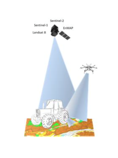
SolumScire
Status date: 14 December 2017
SolumScire makes use of latest satellite- and positioning technologies to better understand soil and soil conditions in crop production. The project collects and combines high resolution satellite and soil analysis data to provide soil spatial information and to create a service for farmers to feed spatial soil information automatically into their farm management system (FMS) to then improve field related precision farming activities.
ASSIST WRM
Status date: 13 December 2017
According to the outcomes of the forerunner feasibility study, there is a potential market landscape for high-end services supporting the winter road maintenance. Intercepting then the real needs of users and stakeholders involved in winter maintenance, the follow-up ASSIST WRM demonstration project intends to address these opportunities by providing a set of advanced space-based services, specifically deploying a multi-sites pilot-demonstration over four different European countries during the 2016-2017 winter season.
DAEDALUS
Status date: 13 December 2017
The DAEDALUS service offered by Satavia aims to assist airlines, air navigation service providers, and aircraft and aeroengine manufacturers to increase operational safety and efficiency, and increase situational awareness of stakeholders on aircraft and the ground. Key objectives include in-flight detection and forecasting of a range of aviation hazards, and analytics to support flight operations.

MAPP-DEMO
Status date: 11 December 2017
Following a pirates' attack, onboard communication equipments are destroyed: the vessel’s track is lost, the research area grows as time passes, making it harder to deploy rescue assets efficiently.
The challenge is to answer to the question: “Where is my ship?”
The ‘Keep in sight’ service combines a hidden tracker installed onboard and EO acquisitions to provide this critical information.
SAR crop index
Status date: 11 December 2017
This demonstration project is a progression of a number of feasibility studies conducted by AgSpace Agriculture and The Satellite Applications Catapult into the application of Synthetic Aperture Radar (SAR) data for agriculture. The project demonstrates the new crop growth index on 20 UK farms throughout the 2016 and 2017 growing seasons.
URGED
Status date: 21 November 2017
URGED addresses an increasing global requirement for the provision of better predictive decision support tools for urban infrastructure managers to enable cities to become more resilient to environmental threats. Through the evolution of Rezatec’s geospatial data analytics and the incorporation of new satellite data sources, e.g. Sentinel 1 and 2, these tools will be accessed through the URGED online platform.

SIMONA
Status date: 17 November 2017
The aim of SIMONA project is to provide an information platform that based on the integration of satellite and terrestrial data can both complement and enhance existing Maritime situation awareness services operated by Italian Coast Guard and Navy over a wide area of the Mediterranean Sea and at the same time provide space-based services bringing functional advantages to private stakeholders like Merchant ships Insurance Companies and leisure boat users.
The technological key is represented by the integration of services from Earth Observation sensors (mainly Cosmo SkyMed Copernicus Landsat and WorldView) Satellite Communications (Orbcom or Iridium) Satellite Navigation (GPS EGNOS Galileo in the future) along with information andor operational services coming from other Institutional (AIS Cadastral Data) andor Private assets (Merchant Ship databases Port Info databases).
DART
Status date: 09 November 2017
The DART service aims to offer affordable medium distance transportation capabilities to Polish professionals as primary target market. DART will be based on the use of light aircraft located all over the country, by exploiting GNSS-based approach procedures and remote AFIS services. It ambitions to be much cheaper and flexible than current air-taxi like services.
SBS-RailS
Status date: 16 October 2017
Space Based Services for Railway Signalling feasibility study shall assess technical feasibility and economic viability of an integrated satellite navigation and satellite communication solution complementing Level 2 European Rail Traffic Management System (ERTMS).
Satellite navigation systems can be integrated with the on-board and wayside signalling systems to guarantee the required level of safety (SIL4) that is today provided by the existing train detection systems, while satellite communication systems can complement or even replace terrestrial communications.
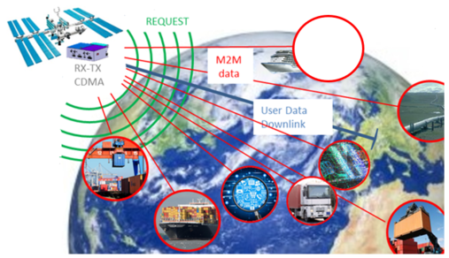
SatApps
Status date: 19 September 2017
Internet of Things/IoT – M2M – industry 4.0 – these headlines are representing large user groups which have an urgent need of a globally available, low-cost, secure data service, dedicated to very small data volumes per sensor and for use also in remote areas. The objective of the study is to perform an in depth requirements analysis on 2 focus pilot user groups: railway transportation and container/waste management.
MarIA
Status date: 15 September 2017
This project has developed a cloud-based system to support more efficient management of sustainability standards in commercial fishing and processing operations. The system developed allows for the inputting of information manually into smartphones/tablets and the capture of information from sensors on-board fishing vessels (including GPS position), whilst at sea, which is sent via satellites to a central database. This database is viewable by prospective customers before the catch is landed.
SUMO
Status date: 05 September 2017
SUMO is a service to assist in the planning and monitoring of marine operations for offshore wind farms. The service integrates diverse information to allow the monitoring and forecasting of metoceanic conditions and track the locations of vessels and personnel involved.
This improves the management and coordination of the construction, operations and maintenance activities and leads to increased efficiency and safety.

SATLAS
Status date: 05 September 2017
SATLAS is an Idea Incubator, developed for and offered to innovators who want to “Start, Integrate and Test” their SatCom related concepts in an easy, light and quick way, taking benefit from the support, mentoring, services and tools made available from the SATLAS consortium (SES Techcom, SatADSL, Newtec).

Uam®
Status date: 27 July 2017
e2E intends to offer more affordable data communication services into niche markets currently underserved from existing infrastructure or where traditional satellite delivery is too expensive. The core of the service concept builds on two key technologies that have been developed with small airborne IDP networks in mind that incudes RPAS, HAPS and small satellites.
KABALIST
Status date: 13 July 2017
The project is focused on the set up of reliable and cost effective distribution of live video feed of non-mainstream sport events into the Internet. The context and the proposed pilot service is tailored to the Serie C Italian football league. The novelty introduced with this pilot project is the adoption of uplink in Ka-band using inexpensive and semi-permanent installations to the stadiums, supported by a set of features to ensure compliance with the targets in terms of availability, quality, accessibility and costs.
DeSIRE II
Status date: 27 June 2017
DeSIRE II, Second Element of the ESA EDA RPAS Demonstration Roadmap, aims at developing and demonstrating a service based on a Remotely Piloted Aircraft (RPA) flying in Beyond Radio Line of Sight (BRLOS) using a dual satcom link supporting Command and Control (C2) and Air Traffic Control (ATC) functions.
The project also aims at demonstrating to the users the potential of RPAS complemented by satellite applications (Satcom, Satnav and Earth Observation) for developing new services for operations.
Project objectives are pursued by means of a real flight campaign using Piaggio Aerospace P.1HH RPAS, and complemented by simulation and emulation activities.
Com4Offshore
Status date: 27 June 2017
The Com4Offshore services enable communication and information exchange between offshore and onshore supporting logistics processes and construction workflow with the aim to significantly reduce the time and costs of the costly offshore construction projects. It offers:
- Satellite based public service supporting the communication needs of the different user groups in offshore wind farm areas.
- Technically and economically optimal solution to the users irrespective of their location by combining wireless, mobile and satellite network technologies.
- Access communications services, sensor devices & software applications for offshore construction activities
CyMonS
Status date: 22 June 2017
CyMonS offers spatial and high-frequency water quality monitoring of inland surface waters, combined with a 1 to 5 days forecast for cyanobacteria scums. The service integrates Sentinel-2 imagery, hand held monitors (EcoSpot & WISP-3) and fixed position monitors (EcoWatch) to monitor cyanobacteria with a high spatial scale. The algae forecasting model allows water authorities to timely issue warnings and take mitigation measures.
ArTeK
Status date: 20 June 2017
ArTeK aims at developing an innovative, effective and sustainable service offered to Properties managers to have a complete and systematically updated view and enhanced awareness of the state of conservation of immovable Cultural Properties and to support their management and fruition. ArTeK integrated service builds on space assets (earth observation, navigation and satellite communication) as well as additional technologies (drones, on site equipment, etc.) in relation to specific user needs.
ASAP DP
Status date: 24 May 2017
The proposed Agricultural Service is designed as a “One-stop-shop” for actors in the Agricultural sector, providing information on crop status and their growing conditions based on EO and ancillary data. The System flexibility and comprehensiveness ensure its applicability for a variety of problems faced by Users in different Agricultural sectors.
DAMMINGS
Status date: 24 May 2017
The project designed, developed and carried out pre-operations of a service platform providing an automated and continuous monitoring service of dam infrastructure and its surroundings by integrating GNSS and InSAR space capabilities.
Amazon
Status date: 12 May 2017
The objective of this project is the development and validation of a tele-assistance service, using multiple space assets, for professional clinical users in remote locations using a compact device for vital-sign monitoring and remote diagnosis. It is based on a previous ESA-backed project, which resulted in the deployment of a telemedicine system for commercial aviation applications (TEMPUS)
STAR-FISH Feasibility Study
Status date: 11 May 2017
STAR-FISH is a management system that will automatically monitor and record fishing activity and fish discarding, in order to verify compliance with discarding regulations. The STAR-FISH service will consist of:
- A Remote Monitoring System (RMS) (hardware and software) installed on board vessels to monitor, record, identify and transmit fish discard data
- On-shore software which monitors fishing and discarding data from vessels and can provide alerts to fishing regulators
- Interfacing with databases/platforms to support fish sustainability and traceability statistics
STEAM
Status date: 04 May 2017
The objective of this study is to investigate the technical feasibility, financial/non-financial viability and sustainability of a future service aiming at measuring the amounts of sulphur oxides components ejected by vessels travelling inside the Emission Control Areas (ECAs) as defined by the International Maritime Organization (IMO).
Urban DRR
Status date: 18 April 2017
Applying space based solutions to save lives and critical infrastructure by reducing the risk and impact of natural disasters in urban areas.
M3i
Status date: 12 April 2017
M3i is an end-to-end, one-stop service that reduces the fieldwork required to gather information on critical Landscapes of Interest. Satellite imagery, analysed in conjunction with a minimal set of ground-based data, significantly reduces the time and money required to perform surveys, and thus greatly improves the potential for all forms of land use to be incorporated into sustainable management schemes.
SMART
Status date: 22 March 2017
SMART is a system that aims to provide a decision support service targeting the “early warning" of a disaster or critical event (specifically hydro-geological events) and to improve the "first response" intervention capability. The system has the advantage of strengthening the procedures used today by the Civil Protection to collect and manage the data "monitored" without interfering with the current practice.
STC
Status date: 15 March 2017
Space-Tech for Cycling investigates the technical feasibility and commercial viability of a bike-benefit model with associated GNSS-data analyses as a means to increase the modal share of cycling in cities. The approach rewards cycling by offering tempting benefits to the cyclists. The cyclists’ GNSS-track-data are further processed to offer a foundation for traffic planning projects, public health measures, and marketing and sales campaigns.
SafeSki
Status date: 27 February 2017
The SafeSki Demonstration Project covers the pilot implementation of Safety and Information Services for Ski Resorts and succeeds the successfully completed SafeSki Feasibility Study. The SafeSki pilot-demonstration stage aims at increasing the safety and security on slopes, increasing customers and thus revenue, saving time regarding data acquisition and documentation and reducing personnel costs through optimization of internal processes.
INSUTRAX
Status date: 19 January 2017
The INSUTRAX feasibility study objective is to investigate the technical feasibility and commercial viability of integrated applications utilizing various satellite data sources (GNSS, EO and Satcom) for cargo tracking in support of IT insurance products focusing on Polish insurance market.

SWAY4Edu
Status date: 18 January 2017
SWAY4Edu aims at developing a satellite ICT (Information Communication Technology) solution to support the three main activities of Rural Radios, Electoral eTraining, and Space4Education.

SAT-AIS DPC
Status date: 18 January 2017
The SAT-AIS Data Processing Centre (DPC) Demonstrator is a development co-funded by EMSA (European Maritime Safety Agency) and ESA. The DPC collects SAT-AIS messages, ancillary information for generating and distributing enhanced data services to the maritime community.
European-wide Mobility, Safety and Efficiency Management for Logistics Enterprises
Status date: 16 January 2017
The objective of this project is to improve the energy efficiency and vehicle tracking capabilities of logistics and transport service providers in Europe. For this purpose, innovative ICT and climate protection technologies have been combined with space technologies, namely earth observation and satellite navigation, to offer a cost-efficient and flexible ‘one-stop-shop’ solution helping lorry drivers to achieve an eco-friendly driving style, while allowing fleet managers to monitor actual fleet fuel consumption and CO2 emission.
Eagle Space
Status date: 11 January 2017
Eagle Space aims at the integration of space based capabilities in crisis management to support the joint combat of natural flooding and wildfire disasters. The proposed concept is based on realising a harmonised awareness of the disaster area and emergency operations between the various emergency entities in different regions with own working cultures.
RPAS Intelligent Parcel Delivery
Status date: 11 January 2017
In the advent of the remotely piloted aircraft system (RPAS), the Unmanned Parcel Delivery (UPD) project seeks to utilise RPAS and satellite technology to establish a fast, safe and secure UPD service to customers in remote and hard-to-reach locations.
TransparentForests
Status date: 07 December 2016
TransparentForests, a web-based Geographic Information System (GIS) for mapping and data management, is designed to increase the credibility and transparency of the FSC certification process. It supports all stakeholders in engaging with, and improving the certification process. It creates opportunities for operational efficiency across the certification service delivery chain. The TransparentForests concept has applications in forest insurance, finance and biomass energy.
aircheckr
Status date: 07 December 2016
Aircheckr creates & opens up the best available air quality data in the EU. Aircheckr translates the air quality data to the specific needs of a broad range of applications like real estate, health or sports. The data is enhanced by the power of the crowd, and it is easily interpretable & include personal recommendations.
LymeMAP
Status date: 02 December 2016
Lyme Borreliosis (LB) is a rapidly growing health problem in the Highlands of Scotland. This disease, carried by ticks, is difficult to prevent because there is little information available about the risk of disease, and how to reduce it. LymeMAP integrates data from the Scottish National Lyme Borreliosis Testing Laboratory and local doctors’ surgeries with environmental data from Earth Observation satellites, to produce interactive risk maps providing information on ticks, LB and disease hot spots. For the first time in the Highlands, visitors and the local population will have access to accurate information enabling them to reduce their risk of tick bites and LB, whilst still enjoying the countryside.
Intelligent sensor and satellite network (ISSN)
Status date: 02 December 2016
The project is a feasibility study in order to establish whether there are sufficient market opportunities, and the technological maturity for developing a flexible and reliable intelligent sensor network where satellites are among the nodes in the network (ISSN). ISSN has a number of potential application areas in connection with Offshore Oil & Gas exploration and production, environmental surveillance in general, safety, search and rescue, transportation etc.
PalmOilVision
Status date: 24 November 2016
PalmOilVision aims at providing the palm oil sector with innovative, reliable and cost efficient services for increasing production sustainability and efficiency, through the integration of Earth observation imagery and Remotely Piloted Aircraft Systems (RPAS).
OWASIS-NL
Status date: 17 November 2016
How can water management authorities, agro food industries and multi-national industries benefit from improved information on water availability?
The OWASIS-NL feasibility study investigated innovative services that help water managers to make more efficient use of the available water and to reduce the risk of flood and drought damage.

AIR-Portal
Status date: 02 November 2016
The economic and technical feasibility of AIR-Portal, an air quality dashboard for European cities, was shown in this study. The consortium developed in a demand driven development the requirements of three major European cities into a working proof of concept. With this proof of concept the technical feasibility was proven, furthermore a business case was developed proving the economic feasibility.
ISSWIND
Status date: 02 November 2016
This project consists on a study to define Supporting Services for the Wind Power Industry, having in mind the possible use of space technology, assets or products and its added value, gaps and possible improvements.
DateGIS -
Status date: 22 October 2016
DateGIS is an integrated Geo-information System (GIS) for Date Palm precision agriculture. Objective of DateGIS is to provide information products and services on date farms and palm trees for:
a) Provide date farm management information to increase date production, quality and yield;
b) Development and management of a national RPW control program;
c) Reduction of farm financial losses caused by RPW infestation;
d) Improve water use efficiency, irrigation and fertilizing management.

XcitID
Status date: 17 October 2016
The Xcit'ID project is dedicated to design, develop and validate a pre-operational integrated service platform aiming at significantly improving the management of the transport supply chain of temperature-sensitive pharmaceutical goods.
Saltwater
Status date: 05 October 2016
Saltwater is a service for aquaculture companies using Earth Observation and hyperspectral in situ instruments for the monitoring of harmful phytoplankton. Monitoring results are provided on a high spatial and temporal resolution. When combined with other environmental data the users can predict the movement of harmful phytoplankton, thereby reducing loss of stock and increasing feeding days.
PROTECT
Status date: 28 September 2016
The PROTECT project aims to exploit existing systems and infrastructure in conjunction with applicable space based assets to provide cost-effective added-value technology centred services that provide improved situational awareness to both on-board and shore based stakeholders, based on real-time innovative integration of piracy and sensor information/data.
I-PORT
Status date: 07 September 2016
The I-PORT demonstration project involves creation and demonstration of IT services for optimisation of inter-modal container transport in Ports. The project is a collaboration between AIMES, Avanti Communications Group plc, ContainerPort, exactEarth and Atlantic Containers Ltd and involves deployment of systems within the UK and also in Germany, in collaboration with The Institute of Shipping Economics and Logistics (ISL) and DBH.

Profumo FS
Status date: 02 September 2016
Profumo proposes novel weather-based services for the Mediterranean navigation with the aim of granting fuel saving, pollution reduction and improving safety for passengers, crew, goods and ships’ instruments. The idea is to establish a cooperative schema (between commercial vessels) where meteo-marine data is collected from standard and non-standard on-board instrumentation and used to produce innovative high resolution meteo-marine products, and to provide route optimization and navigation services.
PIMSIS
Status date: 01 September 2016
To demonstrate the added value of space assets for the monitoring of the integrity and safety of gas & oil transmission pipelines.
agriloc FS
Status date: 24 August 2016
agriloc targets significant improvements in agriculture through automation. For this purpose a thorough user survey was carried out to identify current problems and needs of farmers. Projected agriloc systems and services were then validated in a user workshop. The solutions are aimed at supporting farming processes through integration of highly accurate Guidance, Navigation, and Control, reliable communications utilising communication satellites, weather and satellite data, and automation of farm management and process planning.
CCP
Status date: 22 July 2016
This project aims to develop a new technology that allows non-technical personnel trim, play, deploy, videos for Auto-Feed Content Creator component by category.
TT-GSAT
Status date: 21 July 2016
TT-GSAT facilitates rescue and emergency services as well as industry and service providers to leverage innovations along evaluated needs and requirements, which results in minimized risk for solution development and eases complex deployments in a mission critical environment.
Comprehensive services with scoping services for innovation driven procurement, test and operation support for SatCom and terrestrial communication, navigation, EO based solutions and training/simulation services are offered.

TRISS
Status date: 20 July 2016
Humans spend energy and money to plant and manage trees in their habitat. Tree information is essential to enable rational management: Tree numbers, their position, height, crown size, health, habitat condition and species are relevant to professionals managing both urban and rural environments. This feasibility study focused on satellite based services providing or updating tree information.
Improving the Efficiency of Loss Adjustment and Claims Management in the Insurance Industry
Status date: 13 July 2016
The study analyses the feasibility and viability potential of an earth-observation based service for supporting the claims management process in the forest insurance industry. A main aspect is loss adjustment after large-scale disasters with a focus on storm events and forest fires.
BIOSCOPE FS
Status date: 05 July 2016
BIOSCOPE investigated the technical and economical viability of a vegetation monitoring system based on the integrated use of satellites and Remotely Piloted Aircraft Systems (RPAS).
BIOSCOPE
Status date: 05 July 2016
Agriculture is becoming more and more data driven and farmers are in demand of relevant, fresh information about their crops for location specific treatment. BIOSCOPE sets up a unique service based on satellite imagery when possible and drone imagery as backup when clouds prevent an undisturbed view.
HAMS
Status date: 01 July 2016
Using Satellite applications in conjunction with terrestrial sensors to better monitor and understand heritage assets. The nature of maintaining a large portfolio of heritage assets provides a large opportunity to use remote sensing techniques to deliver a more efficient method for monitoring distributed assets.

FLARE
Status date: 10 June 2016
FLARE is an integrated software package and data service which supports the global forestry insurance industry in asset estimation, risk management and loss adjustment. This feasibility study analysed the operational, technical and economic viability of a FLARE system/ service providing Earth Observation and Global Navigation Satellite System data and mapping products, within a simple software interface.
3INSAT
Status date: 07 June 2016
3InSat demonstration project developed, tested and verified a new satellite-based subsystem, based on the Ansaldo STS ERTMS solution, for allowing the SIL4 train localization function at Signalling System Level by using GNSS. 3InSat also implemented an integrated solution based on the combination of SatCom, 3G/4G systems and TETRA to realize the link between the on board train control system and wayside signalling infrastructure.
WIMS
Status date: 02 June 2016
Using a variety of space applications to improve and streamline the maintenance and monitoring regimes of the water industry within the UK.

Project U
Status date: 20 May 2016
Project U is about a new generation software/hardware platform and services that enable an enhanced User-centered learning experience combining together physical and digital presence, promoting active participation versus passive presence.

SatSoHoAfrica
Status date: 20 May 2016
SatSoHoAfrica is allowing the provision of competitive broadband internet services to Small-office-Home-office (SoHo) users in Sub-Saharan Africa.
Electronic Offender Monitoring
Status date: 27 April 2016
Electronic Monitoring (EM) is used by several judicial government bodies worldwide to track offenders on probation or subjected to other forms of legal liberty constraints. This Feasibility Study analysed the technical feasibility and economic viability of an EM system/service featuring Galileo, the European Global Navigation Satellite System (GNSS) and using enhanced cartography and imagery obtained through Earth Observation (EO).
VGTropics
Status date: 22 April 2016
In many African countries, livestock farming is an important source of revenue that improves the quality of life and strengthens the development of the economy. Animal health not only has an impact on animal production and its economic consequences, but zoonoses may also have an important impact on public health. Real time surveillance and prompt actions are paramount in diminishing the impact of epizootics on livestock. For this reason, early detection and shortening the time between detection, reporting and providing measures to contain an outbreak is crucial.
VGTropics is the result of the “Predict” feasibility study which was successfully concluded in 2012.

ARCTICSAT
Status date: 22 March 2016
The objective of this feasibility study is to assess and validate the requirements for space technologies in support of optimising situational awareness in the Arctic. The major focus is on two application areas – shipping (e-Navigation in the Arctic) and oil & gas (Arctic oil spills).
GridWatch FS
Status date: 22 March 2016
The solution intends to provide owners of High Voltage power infrastructures with useful information for supporting the management of both procedures for inspection and maintenance, and dispatching of electrical energy.
EO Crowd
Status date: 22 February 2016
Over 90% of our seas are unsurveyed. EO Crowd uses crowd sourcing, EO data and open data to fill this data gap.
Com4Offshore
Status date: 17 February 2016
The objective of the feasibility study is the assessment of the technical feasibility and commercial viability of an integrated communication system, enabling a multimodal usage of communication infrastructure and services for offshore wind park construction. The interactive applications of such innovative system include a simplified, reliable and cost effective exchange of voice, video data and positioning information between the contractual partners of offshore construction activities during a complete wind farm project.
GeoNavCon
Status date: 09 February 2016
The objective of the study is the concept preparation for the development of integrated services based on satellite navigation, satellite communication and earth observation technologies to improve availability, accuracy and integrity of position determination, data communication and geo-information for users in remote and constrained environments in the forestry domain.

VeriSpace
Status date: 09 February 2016
VeriSpace was an ESA-funded feasibility study that seeks to identify how space assets, such as Earth Observation (EO), Global Navigation Satellite Systems (GNSS) and communication technology, can be used to enable business benefits to insurance companies and loss adjusters when managing insurance claims. During the study, the VeriSpace Consortium specified two sustainable, user-driven services that utilise these space-based technologies to meet the needs of those businesses involved in claims management.
The VeriSpace feasibility study showed that space assets can contribute to providing services that can help the insurance industry in a number of business processes within the overall insurance claims process, which can ultimately provide efficiency savings to the insurance industry.
SaMoLoSa FS
Status date: 28 January 2016
The Ovinto SaMoLoSa study addresses the use of satellite technology for the reduction of transport risk, security enhancement and optimisation of logistic operations by the tracking and monitoring of extremely dangerous goods in unpowered, mobile transport units such as rail tank cars and intermodal tank containers.
IDRC
Status date: 26 January 2016
Communication and access to information are key requirements for public safety services responding to an emergency. However communication capabilities are often compromised or destroyed. Reliable alternatives must be rapidly deployed.
The IDRC study defines and assesses the technical and business feasibility of an operational service providing a wider access to the benefits of space capabilities in the first 72 hours.

SEA SEARCH
Status date: 26 January 2016
SeaSearch provides detection and identification capabilities of small vessels, agnostic to vessels’ size.
Based on the mobile phone detectors and other sensors such as radars, AIS and SAR, SeaSearch builds Maritime Situational Awareness Pictures.
Sensors are using SeaSearch own developed technology based on Software Defined Radio (SDR).

SASISA
Status date: 25 January 2016
SASISA (Small-Aircraft Service for Instant Situational Awareness) supplies airborne situational awareness support for civil protection operations in the early phases of disaster response. Remote sensing results have often only been accessible after several days. With delivery of georeferenced imagery via satellite broadband during flight and value-added mapping products within a day, SASISA offers transformational change to European emergency management services.

SEWISS
Status date: 14 January 2016
The SEWISS service has been conceived to support onshore wind developers with the complex, expensive and time consuming process of screening and selecting the most suitable greenfield sites for development, without the need for initial travel to sites of interest. The SEWISS system is conceived to be a one-stop online portal, where developers can access recent, relevant, high resolution EO, and non EO data layers, then within the same portal use these layers of data to conduct automated land cover, rooftop recognition, green field, turbine selection and positioning analysis across their areas of interest.

Cerberus: Forest Falcon FS
Status date: 05 January 2016
If you care about the future, you also care about our planet. Greenhouse gas emissions caused by forest degradation and deforestation are one of the largest causes of global warming. Many organizations have a negative impact on the extent and quality of our forests. It is time we change that. We map what matters. Through our crowd — a big, global community of people who care about our planet just as much as we do — we build maps and information products of high quality and reliability. Our forest monitoring services can be adjusted to your specific needs, so you will get exactly the information you need.
New Commons
Status date: 18 December 2015
Combining analysis of satellite imagery with crowdsourced data, this system brings together urban forestry professionals and those living in urban environments in order to improve the levels of understanding and information available on the trees growing in these unique ecosystems.
PLASMA
Status date: 04 December 2015
This project covers the specification, design, implementation and pre-operational demonstration of a ‘Platform for Advanced SAT-AIS Maritime Applications’ (PLASMA) at the UK’s Satellite Applications Catapult facility in Harwell.
CGWay
Status date: 04 December 2015
An initial study into the feasibility of implementing a high throughput satellite gateway in equipment containers including the use of a highly innovative approach to the antenna using multiple smaller antennas.
T4MOD
Status date: 30 November 2015
T4MOD project aims at developing and validating a user-friendly Telemedicine system, through an interoperable IP overlay satellite network associated to an intelligent end-to-end communication service, capable to support different medical specialities. This solution, to be validated in a military environment, could be also extended for future exploitations in civilian field for organisations (for example national health systems) operating in underserved and/or geographically isolated areas, such as in case of natural disasters or humanitarian crises. The system can be instrumental to develop new medical protocols for a cooperative medical work of diagnosis and therapies. T4MOD involves as users the health Department of four Ministries of Defence: France, Germany, Italy and Spain.

EASY
Status date: 26 November 2015
Together with traditional chartering, new business lines like yacht brokering, manufacturing assistance, luxury cruising are emerging asking for the availability of innovative services on board. These new businesses require a higher grade of liability towards their customers, hence forcing the providers to put more emphasis on systems and services in order to increase the safety and availability of information during the cruise.
VICOMESTRA
Status date: 30 October 2015
This project is a critical step to the introduction of HD media streaming services from mobile terminals in 2015. The solution is proposed to demonstrate dynamic video transmissions using the latest HEVC video codec running on a portable encoder combined with the latest Inmarsat BGAN HDR and GX satellite services.
MAPP
Status date: 23 October 2015
The increase in piracy incidents in areas such as the Gulf of Aden and the Gulf of Guinea threatens life at sea and causes substantial cost to the shipping industry and governments as vessels transit through the High Risk Areas.
LMS
Status date: 07 October 2015
In compliance with European and national regulations, the GNSS based livestock transport online monitoring system as well as the related service elements allow the online control of (especially long distance) livestock transports as well as simplify livestock transport documentation. The solution can be integrated with other vehicle subsystems and transport information such as fuel consumption, temperature conditions, water level control, etc.

OWASIS-UK
Status date: 02 October 2015
OWASIS – UK is a Feasibility Study aiming at developing a sustainable service line improving the monitoring of water availability, quality and distribution by integrating satellite images and innovative terrestrial sensors and information technologies.
This study focuses on the UK market and it targets all types of user groups such as industrial users, public water authorities or regulatory organisms.

iVOICE
Status date: 17 September 2015
This study evaluates improvements to existing voice analysis technology. It is coupled with high fidelity communications signal and GNSS data, aiming to detect situations of mental strain and fatigue in operators. With the aim of offering a new technology – iVOICE, integrated VOIce analysis via satellite Communications Embedded in time and safety-critical environment. It also investigates the potential to develop services linked to high-risk and high-stress environments or dislocated domains, including heavy equipment operation, ground and air transportation for private and commercial use, as well as applications for future use in distributed health care for remotely living populations and peace-keeping communication and navigation services.
SAPI&NS
Status date: 16 September 2015
The SAPI&NS study aims to improve the effectiveness of Search And Rescue operations for civil and military operators (so-called dual use). With satellite communication and satellite navigation, the involved personnel and vehicles (esp. helicopters and boats) can be tracked and status information can be collected.
The solution is conceived to be used across different scenarios (air, ground, sea) and will next to tracking services also offer tools for management and coordination of operations.
HV-SATPROTEC
Status date: 16 September 2015
Feasibility study on new electricity infrastructure management services using space assets

WATERLENS
Status date: 04 September 2015
Feasibility study for new water infrastructure management services using space assets.
SharperSat
Status date: 31 August 2015
With the support of ESA, Finnish company Sharper Shape Ltd is developing innovative services for the improvement of maintenance and recovery of high voltage electricity transportation infrastructure using SatEO, GNSS data and Unmanned Aerial Vehicles.

EFFORS-FS
Status date: 25 August 2015
The aim of the present feasibility study is to develop an Enhanced Flood Forecasting System for Critical Infrastructures Protection in medium size Alpine catchments.The service is designed to address infrastructure located either on the river itself (e.g. bridge) or in the flood plan (e.g. a building).

GIRP
Status date: 25 August 2015
Subsidence due to clay shrinkage is the largest ground instability issue affecting residential property in the UK (75% of all valid insurance claims) with rectification costs averaging £250m (295m Euro) p.a. Research by the insurance sector (Swiss RE and Lloyds of London) indicates that the extent of subsidence both in the UK and Europe will worsen in line with climate change forecast. The insurance sector equally recognizes the need for significantly improved profiling and predictive tools to identify and target risk mitigation management.
The Ground Instability Risk Profiler (GIRP) service is planned to enable an accurate and predictive ground stability risk profiling service to the insurance industry in a range of flexible formats through the integration of property data sources and satellite information.
Forsway S2
Status date: 18 August 2015
The objective of this project is to develop a Satellite modem for Internet access in rural areas using DVB-S2 technology. The product is intended to complement existing ADSL terrestrial based solutions. Where it is too expensive and /or too time consuming to get a terrestrial infrastructure for broadband, the Forsway modem offers a cost effective, easy to use solution to access the Internet based on satellite DVBS2 distribution associated with a multi-standard terrestrial return link.
Low Cost Hybrid Terminal Triple Play Solution
Status date: 18 August 2015
The aim of the project is to develop a low cost end-to-end solution for satellite based triple-play services. The platform uses existing infrastructure to enable TV, telephone and IP communication. Satellites are used for downlink communication and different terrestrial media are used for the return traffic.
Mimir 2.0
Status date: 18 August 2015
The project will continue the development of the Mímir server, Forsway’s solution for satellite hubs providing one-way Internet over satellite. The product will be extended to be a usable component in all types of one-way Internet over satellite deployments, covering deployments from small ISPs with a few hundred users to the largest operators with high performance multi-transponder services covering several million users.
TransparentForests (FS)
Status date: 14 August 2015
Forest products such as paper, wood and composite materials are used in everything from construction to news distribution and energy generation, yet they may represent considerable environmental and social impacts. Today, knowing the origin and life cycle of product constituents is important for both retailers and consumers. Major corporations do not like to be associated with poor forest management: it is bad for business and for customer relations.
SatResponse
Status date: 06 August 2015
The frequency and impact of natural and man-made disasters is increasing, resulting in needs for better response efforts.
Satellites provide a secure, resilient, always-on infrastructure for dealing with emergency situations; however cost and availability problems often hamper their effective use.
SatResponse investigated new technical, commercial and operational models for delivering better satellite communications and other space-based application services to Disaster Responders.
SAFETREE
Status date: 05 August 2015
Satellite Support to Forest Fires Airborne Patrol (SAFETREE) aims at improving efficiency of the airborne patrols within the Airborne Fire-fighting Service (AFS) that secure the forest fire prevention in the Czech Republic. SAFETREE service is designed to support AFS in the decision making on airborne patrol dispatch and routing based on integration of Earth Observation and Satellite Navigation technologies.
DROMAS
Status date: 05 August 2015
DROMAS services aim at periodical full country monitoring of agricultural vegetation to serve decision makers on national level and to provide historical and current year crop analysis to support farm management at agricultural parcel level.

PloughStars
Status date: 04 August 2015
Plough Stars is a feasibility study and part ESA’s Integrated Applications Promotion (IAP) Programme. The industrial team led by Berner & Mattner investigates new services and applications for improving winter road maintenance. Existing, mainly terrestrial, systems are enhanced with space-based technologies. Users and stakeholders involved in winter road maintenance benefit from this system through increased performance and a simplified routine.
Salt Water Surface Water Monitoring
Status date: 16 July 2015
BlueLeg Monitor (BLM) from the Netherlands investigates the use of its proprietary remote sensing technology for water quality monitoring in aquaculture. In particular Hazardous Algal Blooms create serious damage to aquaculture by incidentally suffocating fish and the release of toxins. This tendency is expected to increase as a result of global warming and nutrients run off into surface water, as well as by transport of invasive species of algae due to the release of untreated ballast water from ocean ships.
Arctic IAP
Status date: 08 July 2015
Telespazio VEGA UK are developing a range of value-added services using layers of geo-information and commercial data that can be customised to the needs of specific operators. The services include primarily satellite derived imagery VMS (24/7 Vessel Monitoring System) from the Telespazio Group, AIS (Automatic Identification System) provided by Canadian consortium member exactEarth Europe Ltd, and low bandwidth high fidelity image transfer system AnsuR, a Norwegian company.
Maritime expertise and access to the market through Marine South East and additional maritime data layers are provided by Stevenson Astrosat and HR Wallingford.
This solution presents a viable Arctic Integrated Situational Awareness Service building upon existing operational or semi-operational services provided by consortium members, and adding additional features believed to be of value to the user community that will help to differentiate and ensure the success of the service.
Peat Spotter
Status date: 07 July 2015
Peat Spotter was conceived by Rezatec Ltd. as a potential data service to provide cost-effective information for sustainable peatland management. Our intent is that Peat Spotter will reduce the amount of expensive field work required to gather information on peatland location, intactness and carbon content over time.

SATForM 3D
Status date: 06 July 2015
A tremendous opportunity exists for the global forest industry to capture the combined benefits of cutting edge technologies in the areas of satellite remote sensing technology, ground forest measurement, data analytics and cloud computing. The goal of the SATForM 3D project has been to design and develop a web-based application -Forest Mapper- integrating different satellite Earth Observation (EO) and aerial LiDAR with an innovative ground-based Terrestrial Laser Scanning (TLS) forest measurement technique and data analytics, to provide better management and more efficient utilisation of our global forest resources.
The project had the support of the main forest owners and forest managers in Ireland, who have collaborated in defining and validating the Forest Mapper features so that it now provides an innovative solution to their current needs.
ASSIST WRM (FS)
Status date: 06 July 2015
The “Advanced Snow plough and Salt spreader based on Innovative Space Technologies“ (ASSIST) project aims to deliver a comprehensive feasibility study on the technical and economic sustainability of a winter road maintenance system based on space technologies.
ASSIST proposes a concept developed along with the improvement and integration of two main assets: Satellite Navigation (and related augmentation systems) and Earth Observations to get additional digital information about roads and weather forecasts.
SARONTAR
Status date: 19 June 2015
The SARONTAR (Situational Awareness and Command & Control of Rescue Forces in Alpine Regions) project comprises the demonstration and pilot implementation of a satellite-supported operations control system for a more effective and a more coordinated proceeding of the rescue forces in alpine rescue missions.
It is based on GNSS for positioning and navigation. Topographic maps and high resolution orthophotos form the basis for geoinformation. As communication techniques, terrestrial and satellite communication is used to provide a high level of reliability and thus seamless communication between rescue forces, mission controllers and emergency management centres.

SURMON
Status date: 18 June 2015
The SURMON Demonstration Project targets airborne Geophysical Survey (GS) and oil Pipeline Monitoring (PM) services based on the use of a Remotely Piloted Aircraft System (RPAS). Equipped with suitable sensors and making use of satellite communication and navigation, operation of the RPA beyond line-of-sight is enabled.
GeoSHM
Status date: 17 June 2015
GeoSHM (GNSS and Earth Observation for Structural Health Monitoring) is a Structural Health Monitoring (SHM) system that integrates GNSS and Earth Observation technologies to offer an integrated solution for the maintenance of different types of asset.
TIM
Status date: 16 June 2015
Efficient asset management is required to meet increasingly stringent demands on safety and reliable performance of new and ageing infrastructure under varying and sometimes hazardous environments. The Transport Infrastructure Management (TIM) Service is planned as a new generation of asset monitoring services that can be deployed across multinational organizations. The concept is based on the integration of location and mapping capabilities of space assets and ground local point sensor networks - delivering data in the most efficient manner.
INTOGENER
Status date: 12 June 2015
INTOGENER (INTegration of EO data and GNSS-R signals for ENERgy applications) Demo is a project aiming at demonstrating the operational capabilities of a water flow monitoring and prediction system aimed at hydropower production and water management organizations.
DG-TRAC feasibility study
Status date: 11 June 2015
The DG-Trac project addresses the tracking and tracing of dangerous goods in the medical sector integrating and using existing space technologies (navigational services, communication services) with GSM/UMTS and Internet.
ICWM for MED
Status date: 04 June 2015
ICWM for MED solution provides water quality monitoring and surveillance of coastal areas by integrating information from: Earth Observation, Navigation and Communication satellite assets; in situ measurements; crowdsourcing information. It intends to address the current limitations from both Earth Observation based and traditional at sea measurements methods in order to support the duties of environmental agencies and coastguard authorities.

DDM
Status date: 03 June 2015
The Dam and Dike Monitor (DDM) is an innovative tool that aims at providing better information (in near real time) for dam and dike maintenance and flood management. An on-line interface is provided to the users showing the actual risks of dam and dike failures, based on dam and dike monitoring techniques and flood forecasting. As the Dam and Dike Monitor is internet based, there is no need to develop ad-hoc software and hardware infrastructure.
SIS-SREM Feasibility Study
Status date: 03 June 2015
The SIS-SREM (Safety and Information Systems for Ski Resorts in Emerging Markets) feasibility study investigates and assesses the technical feasibility and commercial viability of a sustainable service which will support the management of ski resorts (development, operation, maintenance) in order to reduce the operational cost and services which support safety and enjoyment of their visitors.

IAP-Copernicus
Status date: 08 May 2015
The IAP-Copernicus study addresses the use of space assets, combined with terrestrial « web2mobile » technologies, in the provision of reliable, ad-hoc information to all stakeholders involved in the monitoring of risks and mitigation of hazards impacting people. The study focuses on the development of an economically sustainable « Business Services Platform » for two use cases: public safety in Belgium and food security in Senegal.

B-LiFE
Status date: 29 April 2015
The B-LiFE project is focused on delivering services for field analysis of biological threats and emergencies using a Light Fieldable Laboratory System.
ASAP-FS
Status date: 16 April 2015
The ASAP service aims to deliver in a ‘one-stop-shop’ approach reliable information to actors in the Polish agricultural market to optimize the production, reduce input costs, and increase income. The service aims to deliver information on condition and status of vegetation, soil moisture and surface temperature, data for fertilization and amount of fertilizers, condition of vegetation before and after winter (frozen vegetation).

SELIAT
Status date: 13 April 2015
SELIAT stands for the feasibility study Safe Emergency Landing in Alpine Terrain. It has investigated a service in aviation that shall provide geographic information about suitable landing sites to support off-field landings in alpine areas with difficult terrain. This information will be available to pilots in their cockpit. The information may be required either as part of an operation of a search and rescue mission or in case of a technical failure in the aircraft.

ISIDE 4 Africa
Status date: 30 March 2015
I4A focuses on the provision of educational content and Internet access to African primary and professional high schools and to health and cultural centres. In a nutshell, I4A aims at providing a one-stop-solution for the collection, organization, delivery and use of digital educational contents based on the ISIDE platform/service.

i-enquire
Status date: 26 March 2015
The project, which is part of ESA's Newcomers initiative of the ARTES 3-4 Programme, is aimed at developing, integrating and validating a set of mobile applications onboard of vehicles such as cars, coaches and trucks, using the S-Band delivery platform of Solaris on the Eutelsat W2A satellite.
SatFinAfrica
Status date: 25 March 2015
This is a pilot project to demonstrate the suitability of the Sat3Play platform, originally designed for the consumer and SoHo market, to provide reliable and secured financial services in remote and underserved areas in emerging countries in Africa.

SFEDONA
Status date: 25 March 2015
The SFEDONA project aims to design, develop, validate and demonstrate a complete end-to-end fire detection and alerting application which makes use of state-of-the-art fire detection technologies based on terrestrial optical cameras and sensors, data fusion, satellite and wireless communications as well as modern IT technologies.

SASS@Sea
Status date: 25 March 2015
The objective of the project is the development and validation of a system for the provisioning of an integrated maritime communications service.
CyMonS FS
Status date: 02 February 2015
The consortium, led by surface water quality specialist BlueLeg Monitor (BLM) from Sneek, the Netherlands, has executed a contract with the European Space Agency (ESA) under the Integrated Application Promotion (IAP) program to develop services for the monitoring of blue green algae or cyanobacteria under the project acronym CyMonS: cyanobacteria monitoring services.
eHSA, Study on Sustainability, Liability & Business Aspects
Status date: 29 January 2015
Sub-Saharan Africa, characterized by its extensive rural populations with little or no access to conventional healthcare, renders eHealth a potentially effective solution for the provision of healthcare. The goal of the eHealth for Sub-Saharan Africa (eHSA) programme is the development of pan-African eHealth services, enabled by satellite telecommunications, to expand healthcare access for rural African populations.
SafeRail
Status date: 14 January 2015
The objective of SafeRail is to improve the safety at Rail Level Crossings (RLC). In terms of accident prevention, RLC are demanding spots since two disparate transportation systems are intersecting (road, rail respectively) and neither of them completely controls the situation. In response to this, SafeRail provides a flexible and secure solution at a moderate price, using latest advancements in satellite technology.
PLANET2
Status date: 09 December 2014
PLANET2 aims at providing business and regional aviation with in-flight information updates on weather conditions and hazards, while contributing at the same time to the observation of the atmosphere thanks to in-situ measurements sent from the aircraft to the weather agencies.
AAF
Status date: 03 December 2014
Snow avalanches kill people and damage infrastructure in mountainous regions worldwide. Avalanche warning services base their products mainly on numerical weather prediction outputs, networks of automatic stations and observers in the field. Presently many European networks are not dense enough and observations by people in the field are hindered by bad weather conditions or high avalanche danger.
ISAES
Status date: 01 December 2014
The proposed project is to conduct a feasibility study focused mainly on interoperability aspects derived from to design, implement and operate a pan-African eHealth platform based on a satellite communications system.

SafeSki FS
Status date: 17 November 2014
SafeSki is a feasibility study aimed at creating an innovative concept for user-friendly information services, which support the operators of ski resorts in the management while increasing safety, the portfolio of services offered to skiers, snowboarders, etc., and reducing operational costs.

Mercury
Status date: 21 October 2014
Project Mercury aims to establish and prove the commercial viability of a new satellite based communications service that will end the isolation of Mobile Breast Screening Units deployed across the UK as part of the National Health Services (NHS) breast cancer prevention and detection programme.
FarmingTruth
Status date: 14 October 2014
FarmingTruth is a precision agriculture service that furnishes end users (e.g. farmers, growers, agronomists, agricultural consultants, etc.) with a web-based soil and crop information system to enable the optimisation of land production for increasing yield at reduced input cost.

LeCross
Status date: 10 September 2014

METSAR
Status date: 09 September 2014
The METSAR project will investigate the feasibility of developing and demonstrating a new concept to the Search and Rescue (SAR) community.

Lift Off
Status date: 08 September 2014
Internet penetration growth curve is still on the steeper side: people require more and more affordable and fast connection to the Internet, independently from where they are. The key characteristics of what is expected by an Internet connection are speed, affordability and reliability. In this sense the Lift Off Project tries to bring further the innovation brought by the recent satellites investigating on how DPI (Deep Packet Inspection) can be introduced by a Satellite Service Provider. The scope of this innovative “next step” on top of the KA-SAT is to optimize the existing services and to generate innovative market offers for satellite internet connectivity maximizing the user experience while improving the ratio cost/performances.
SATMODO
Status date: 08 September 2014
The SATMODO project is aimed specifically at the round-wood timber harvesting market, by facilitating ”live” monitoring of harvest processes. To date the SATMODO project addressed current harvesting issues in remote areas by utilizing both cellular and satellite transmission technology as a means of providing data transmission pathways for the live harvest data from the Harvester Machine.
OTMOSERA
Status date: 29 August 2014
The purpose of the fast track feasibility study 'Open Trail Map / Open Solutions for enhanced Situation Awareness and efficient Emergency Response Actions in Mountainous Regions - OTM / OSERA' was to investigate and assess the technical feasibility and commercial viability of sustainable services to support the management and maintenance of hiking paths and trail maps, to support the safety and enjoyment of their visitors, to reduce the operational cost, and to prepare the follow-on steps for the implementation of such services.
NAVITOUR
Status date: 21 July 2014
N@VITour project, by integrating Telecommunications, Earth Observation and Navigation satellite assets, aims to set-up a service that allows:
- managing the resources of natural parks;
- supporting tourists during tours in natural parks.
SnowSense
Status date: 08 July 2014
SnowSense aims at the qualitative, spatial and temporal improvement of available snow information (snow covered area, snow parameters). It integrates space and ground-based assets to achieve this target. The project has won the 2013 ESA IAP IntegSpace Award.
SHM Telecom Towers
Status date: 02 July 2014
The project “SHM for Telecom Towers” aims at developing a remote monitoring service to support the assessment of the structural integrity of assets, as the towers for Radio-TV Broadcasting or other metal infrastructures, in order to increase safety and optimize the maintenance procedures and promote the transition from a time-based maintenance to a condition-based one.
ISABELIA
Status date: 27 June 2014
The ISABELIA Feasibility Study specified and validated the sustainability of services and that would provide users at sea with near real time information on dangerous ice situations, indicators of collision risk and on risk of grounding, thereby improving the safety of vessels in the Baltic Sea.

Earth Rider
Status date: 12 June 2014
The Earth Rider concept, conceived and developed by Space Synapse Systems Ltd, attempts to educate, enlighten, and engage end users with environmental and space awareness issues by:
- Sharing the personal experiences of space travel by astronauts;
- Producing high-quality planetarium shows;
- Creating an effective immersive experience that allows end users to “experience “the awe of spaceflight; and
- Disseminating downstream Earth Observation satellite applications.
WIAP
Status date: 26 May 2014
This study aims to identify and realise the benefits that can be brought to the wind power service industry by integrating new and/or improved space capabilities. The study focusses on the users/stakeholders of the wind industry to understand their needs, with the aim to identify a potential gap in the infrastructure.

TalkingFields
Status date: 09 May 2014
TalkingFields aims to increase the efficiency of agricultural production via precision farming by means of geo-information services. It integrates space and ground-based assets to achieve this target. The TalkingFields Demonstration Study is the result of a feasibility study which was successfully concluded in 2009.

CAESAR
Status date: 02 May 2014
The CAESAR feasibility study, finished in March 2014, focused on a service able to provide detailed and timely information on the weather and marine conditions to the maritime Search and Rescue (SAR) coordination centres, with the aim of reducing the risks and improving the efficiency of SAR operations.
REACT
Status date: 14 April 2014
The REACT project involves the project consortium working with the Irish Dublin Fire Brigade to develop a system that will ensure constant and reliable communication for exchange of real-time information between deployed emergency response personnel and its relevant command centre during a crisis or disaster situation.
PREDICT
Status date: 10 April 2014
The objective of the PREDICT (Prevent and Respond to Epidemics and Demonstrate Information and Communication Technologies) feasibility study was to define sustainable new services for animal health surveillance and early warning. The combination of Earth Observation and state-of-the-art Information and Communication Technology enables to improve early reporting and rapid response and contributes to limit the spread of epidemics.

MATIST
Status date: 09 April 2014
The MATIST services provide ground motion information to operators of alpine transportation infrastructures such as railway companies, institutes representing the national roads and companies from the energy sector.

SAMBA
Status date: 07 April 2014
The objective of SAMBA is to establish feasibility of space-based services for maritime emission monitoring. SAMBA will achieve its objective by combining AIS/GPS-based maritime emissions with remote sensing-based atmospheric pollution monitoring into maritime emission compliance monitoring and information provision service.
InsureApp Service
Status date: 01 April 2014
This feasibility study carries out an analysis of the most critical elements with respect to technical feasibility and viability (economic as well as non-economic) of a web application aimed at improving the efficiency of the management of insurance claims with a focus on weather-related hazards

BALMON
Status date: 26 March 2014
The BALMON project aims to provide an extensive, well-justified assessment of technologies, services and development needs that will support and enhance the efficiency of water quality monitoring and coastal surveillance activities in the Baltic Sea region.
FlySafe
Status date: 18 March 2014
Bird strikes on aircraft pose a real safety threat for both military and civil aviation. Depending on specific circumstances such as the speed of the aircraft, the point of impact, the mass of the bird, the number of birds and the type of aircraft, bird strikes can result in devastating accidents.

LUMEN
Status date: 07 March 2014
LUMEN (Light UAS in non-segregated airspace for Maritime and Environmental surveillance) is a demonstration project aiming at promoting the operational use of a light RPAS (Remote Piloted Aircraft Systems) for Maritime surveillance and Environmental (Flood) monitoring delivering real-time information to the end-users. For this, the LUMEN system combines different space technologies: GNSS (Global Navigation Satellite Signals) for navigation of the RPAS and geo-correction of the acquired data and real-time satellite communication to transfer the acquired data from the Ground Control Station to the service provider.
iFish North Sea
Status date: 03 March 2014
I-fish North Sea aims to provide an integrated information and communications system that will utilise a combination of satellite communications and satellite navigation to enable unified timely and accurate collection, management, and use of marine fisheries data to provide value added services to fisheries stakeholders for improved sustainability of our fast depleting fisheries resources.
Live Land
Status date: 29 November 2013
The objective of Live Land is to provide users with a suite of services that enables the management of hazards and the exposure of national transport infrastructure assets to landslide and subsidence events. During the feasibility stage, the Live Land consortium assessed the viability of developing a suite of services driven by the needs and requirements of end user organisations. Live Land proposed a ‘catalogue’ concept, to incorporate a suite of enabling technologies (including Space-borne, in-situ and geological datasets) that could improve the forecasting, monitoring and alerting of landslides and subsidence.
FISHSAT
Status date: 27 September 2013
FISHSAT is conceived as a system of systems employing space assets (Earth Observation, Satellite Navigation and Satellite Communication) to improve collaboration between markets, fisheries and enforcement authorities. The intended benefit of FISHSAT is to increase the efficiency of fishing activities, match better the market demand, improve catch traceability and strengthen enforcement.
I-Port FS
Status date: 20 August 2013
This study addressed the feasibility and viability of an integrated solution consisting of space and terrestrial assets in support the optimisation of freight transport through European ports.
SASISA FS
Status date: 13 June 2013
SASISA assesses and validates a new service that enables emergency and disaster relief organisations to exploit overhead remote sensing during the most critical initial response phase for improved situational awareness.
DeSIRE
Status date: 30 May 2013
The DeSIRE (Demonstration of Satellites enabling the Insertion of RPAS in Europe) demonstration project is a joint ESA-EDA initiative aimed at demonstrating the safe insertion of Remotely Piloted Aircraft Systems (RPAS) in non-segregated airspace using satellites capabilities for RPAS command and control, ATC communications and Mission data transfer to ground, in order to satisfy the needs of potential user communities. The demonstration will be carried out in Spain through several flights using a RPAS (Heron 1) providing airborne maritime surveillance services to the Spanish Users involved in the project.

TWIM
Status date: 29 May 2013
Two Way Information Management (TWIM) is a Feasibility Study to assess the added value of receiving information regarding incidents, public safety issues, criminal behaviour etc. from the general public via their smartphones or other mobile devices, in support of operations of Civil Protection Services (Police, Fire Brigade, Ambulance Service etc).
SEMAFORS
Status date: 22 April 2013
SEMAFORS, the Ship Efficiency Monitoring, weAther Forecasting and Optimised Routing Service is a user focused project in support of the shipping industry.
SEMAFORS will investigate, establish and demonstrate through sea trials a concept to improve ship fuel efficiency by providing the means to better planning, avoiding of adverse weather and by making better use of ocean currents.
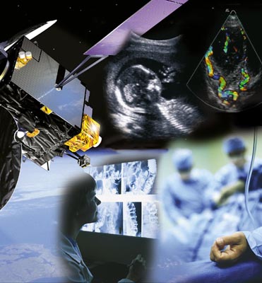
ASSIST
Status date: 26 March 2013
Healthcare is facing increasing quality and resource challenges, which telemedicine services hope to solve. But will this make healthcare more efficient or safe? Can satellite communications add value to such services? A newly launched study - ASSIST - will aim to answer these and other questions.
FAAPS
Status date: 19 March 2013
Floods affect more people and cause more property damage than many other natural hazards. FAAPS (Fully Automatic Aqua Processing Service) proposes to support emergency management professionals with the provision of flood extent maps even in rain conditions and over large areas.

eHSA Regulatory
Status date: 20 February 2013
Partnering with Africa to help strengthen health service delivery is a key driver of this project. The goal of the eHSA programme is to develop pan-African eHealth services enabled by satellite to benefit the sub-Saharan Africa (SSA) region. These services focus on providing various types of eHealth services to benefit citizens and health workers.

EASY Feasibility Study
Status date: 12 December 2012
The objective of the EASY feasibility study has been to carry out an analysis of the technical feasibility and commercial viability of "one-stop-shop" services to the high value leisure yachting market mainly but not limited to the Mediterranean Sea, integrating various space assets (Satellite Communications, Satellite Navigation, Earth Observation). The integrated system and associated services shall provide enhanced services in order to render yachting more reliable, safe and "easy", thereby attracting a wider spectrum of potential users.
Blue Belt
Status date: 01 November 2012
Embedded into the SAT-AIS context, this IAP Demonstration Project aims to support the EMSA Blue Belt project. Providing space-based AIS data, it seeks to complement the terrestrial AIS data and provide an added-value source of information for Customs Authorities interested in maritime situational awarenees for vessels and geographical focus areas.
UASatCom
Status date: 04 October 2012
The UASatCom project targets airborne geophysical survey and oil and gas pipeline monitoring services based on an Unmanned Aircraft System (UAS). Equipped with suitable sensors and making use of satellite communication and navigation, operation of the UAS beyond line-of-sight is enabled.

Integrating Space Assets for UK Civil Resilience
Status date: 24 September 2012
The project is aimed at integrating space assets in a manner that will better serve the UK resilience community during crisis response. The goal is to provide a service that enhances the responder and decision maker tool-kits through the integration of existing space capabilities.

SAFEDEM Feasibility Study
Status date: 27 August 2012
Nowadays landmines and Explosive Remnants of War (ERW) still represent a danger for civilians, even long after conflicts. In addition, both dramatically hinder the recovery of economies impacted by a conflict, because resources located within areas such as arable land, infrastructure and water suspected of mine contamination cannot be exploited. In the SAFEDEM project, innovative methodologies based on well suited space assets will be exploited for an integrated end-to-end demining assistance service.
FruitLook
Status date: 17 August 2012
Water is a critical resource in South Africa, which challenges the agricultural sector to reduce irrigation water consumption while keeping production sustainable. Adequate information on the crop water, growth and nutrient status is crucial to improve water management.The FruitLook pre-operational service demonstrates to Western Cape grape and deciduous fruit farmers the benefits of integrated satellite technologies in their daily water and farm management.
SAVEWATER
Status date: 07 August 2012
The Savewater Project conducts a feasibility study for integrated Satellite - AUV (autonomous underwater vehicle) applications in the field of water management. The proposed application integrates satellite services (earth observation and navigation) and mobile platform services (in situ measurements and visualization of water characteristics).
VECMAP Feasibility Study
Status date: 30 July 2012
Hitchhiking on international trade and travel, foreign species that act as vectors of disease (e.g. mosquitoes, ticks) may establish themselves in new environments world-wide if conditions are favourable. VECMAP aims at assessing the feasibility of developing a tool and associated service for automated mosquito mapping and forecasting.
Gulliver
Status date: 03 July 2012
The GULLIVER feasibility study aims at assessing the added value of space assets in securing the delivery of pharmaceutical goods. For that purpose, Novacom Services has fostered the creation of a wide community of experienced users covering the end-to-end distribution chain.
SADA
Status date: 22 June 2012
The SADA projects aim to improve the socio-economic impact of land release activities in Mine Action. Three parallel feasibility studies have been evaluating the use of space assets to assist the Mine Action community, with a broad scope, covering activities such as risk and impact analysis, planning, resource management, field operations and reporting.
INSA
Status date: 15 June 2012
The project utilizes satellite images, in situ data and historical data dericing technical conclusions helping decision makers in their tasks of land prioritizing and allocating the use of mine action resources to improve socio-economic impact as well as avoiding unnecessary deployments of clearance activities in non-contaminated areas. Navigation and satellite communications help to streamline field activities, logging and shared database access, as well as to support collection and georeferencing of airborne data.
IRISS
Status date: 14 June 2012
The IRISS feasibility project has identified the applications and requirements for an integrated information, communication and navigation gateway within the rail transport sector, designed and developed a solution and performed a proof of concept activity.
EuroPORT
Status date: 11 June 2012
The objectives of this feasibility study are to assess the technical feasibility and commercial viability of an integrated solution and associated services which support the optimization of freight transport through ports (e.g. routing and scheduling), based on a better understanding of users and stakeholders needs and transport conditions, and better information exchange.
Pims
Status date: 11 June 2012
Pipeline integrity management is a key concept in the gas and pipeline industry. This concept involves the definition of a Pipeline Integrity Management System (PIMS), which describes all activities to ensure that the pipeline system is safe and operational 24/7.
eHSA Governance
Status date: 25 May 2012
The governance study is the first in a series of four horizontal studies performed in the eHSA programme. The goal of the overall eHSA programme is to develop pan-African eHealth services, enabled by satellite, to benefit the sub-Saharan Africa region. The governance study will examine the basic conditions for implementing eHealth and telemedicine services in sub-Saharan Africa, whether imposed by the governments or by private parties.
iTRAQ
Status date: 25 May 2012
iTRAQ is a project to develop a dynamic traffic management system for optimising use of the road network whilst meeting growing demands to sustain high standards of air quality in urban environments.
Infoterra
Status date: 21 May 2012
This study was designed to determine the feasibility of the use of space assets such as satellite communications, positioning, and Earth Observation to support the humanitarian mine action community.
S2BAS
Status date: 23 April 2012
The S²BAS project aims to develop, deploy and demonstrate (via proper test flights campaign) a platform for the provision of an integrated set of satellite-based low-cost services targeted to small and regional airports. The concept consists in supporting aspects related to the whole life-cycle of a flight, from its development and planning to its execution and control; with the aim of improve access, operations at the airport and increase safety at a low cost.
TESHEALTH
Status date: 31 March 2012
The TESHEALTH project is dedicated to developing, implementing, qualifying and validating a telemedicine system promoting the use of satellite communications aimed at reducing the impacts of chronic diseases, improving life styles and empowering citizens to adopt a healthier behaviour.
CSS-SpaceMon
Status date: 21 March 2012
CCS SpaceMon aims at the integration of spaceborne Earth observation, navigation and communication to support the monitoring of future CO2 storage sites as part of Carbon Capture and Storage (CCS) technology. The monitoring plays an important role and is mandatory during operation but also after abandonment of such sites.
Land Border Control
Status date: 12 January 2012
The surveillance of borders is an essential function of a state, and is a topic that has gained increased concern in recent years. This study focuses on land border surveillance - a multifaceted and complex topic touching on some of the most critical security challenges of the moment.

SSMART
Status date: 30 November 2011
The SSMART project will provide solutions for monitoring and managing multimodal (road, rail, waterways) transports of dangerous goods. Integrating and using available space technologies (satellite navigation, satellite communications, earth observation) with terrestrial systems SSMART will improve safety, coordination, information exchange, and communication for both routine transport operations as well as for emergency situations.
INTOGENER Feasibility Study
Status date: 08 November 2011
INTOGENER is a feasibility study for the implementation of a water flow monitoring and prediction system aimed at hydropower production and water management organizations. The study is supported by ENDESA, a Spanish utility with a leadership position in South America.

ISIDE
Status date: 27 September 2011
GrapeLook
Status date: 17 August 2011
This project focuses on the operational monitoring of crop water and nitrogen use of vineyards in the Western Cape province of South Africa. Based on the daily management of irrigation water resources and on-farm nitrogen by means of satellite remote sensing technologies, satellite communications and satellite positioning the project aims to assist various end-users.
CSP-FoSyS-FS
Status date: 15 June 2011
Concentrating solar thermal power plants with an electricity production of up to 250 MW have to be integrated into the electricity grid. Both day-ahead and intra-day forecasting of the production and therefore direct solar irradiance forecasting is needed. The feasibility study investigates a production forecasting service using numerical weather prediction and satellite-based nowcasting. It will prepare the setup of a demonstration solar production forecast system for the Andasol-3 power plant in Spain.
sahel
Status date: 06 May 2011
The SAHEL initiative is a demonstration project for telemedicine service in Sub-Saharan Africa. The project will define and implement an operational pilot system connecting some isolated areas in both Western and Eastern countries of the Sub-Saharan region with medical centres of excellence for clinical services and eLearning. It is the first building block of a large pan-African network for telemedicine, in line with the TTF (Telemedecine Task Force) objectives.
SPACEGRID
Status date: 10 November 2010
The aim of the study is to promote the integration of state-of-the-art satellite telecommunication and Earth observation technologies with power grid management systems. The activity is carried out by Carlo Gavazzi Space SpA in close collaboration with TERNA SpA , the primary owner of the Italian National High Voltage Electricity Transmission Grid (NTG), with nearly 60 thousand km of lines throughout the national territory.
SINUE
Status date: 15 September 2010
The SINUE study will investigate the technical feasibility and economic / regulatory viability of integrating space based systems with UAS (Unmanned Aerial Systems) in order to enable their integration into non-segregated airspace and to relay payload data for new institutional and commercial services in near real-time.
Birdstrike
Status date: 20 May 2010
The present activity is concerned with reducing the risk to civil aviation of an accident in the airport airspace environment as a result of bird strike.

SECCOH
Status date: 10 October 2009
"Management Centre for the Transport of Hazardous Goods in the Alpine Region" is an activity dedicated to the identification of users and requirements for the definition of services regarding the transport of Hazardous goods in the Alpine region.
TalkingFields Feasibility Study
Status date: 21 May 2009
TalkingFields is an initiative trying to increase the efficiency of agricultural production via precision farming by means of geo-information services integrating space and ground-based assets in an integrative way.