Objectives of the service
ORCAS is about demonstrating an approach that can solve big global challenges:
Trade in Space exist to reduce friction in food supply chains. They need to reduce the cost and complexity of global trade. They need to lower the barriers of market access for everyone, wherever they may be. And they need to do it all sustainably.
New digital technologies – ubiquitous earth observations, and smart contracting software systems – when fused together, enable us to meet these challenges.
Within this project Trade in Space have used the power of orbital assets to measure compliance to import legislations, and created transparency required for importers to evidence that they know the sustainable origins of their products.
ORCAS’ main objective is in working with different parts of the supply chain to demonstrate an end-to-end test of Trade in Space’s approach; and then to showcase this to new prospective users and collaborators as they begin building new ways to trade more equitably, and sustainably in the digital age.
Users and their needs
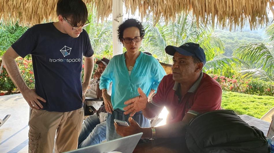
Users of ORCAS range from growers, buyers, traders and supply-chain companies. Trade in Space can add value to operations at every stage of the supply chain, and their super-users are therefore supply chain-operators.
-
Need to find a new source of supply? Trade in Space will run a risk analysis search to check prospective areas for the likelihood of adverse EUDR results.
-
Maybe you need to verify that your supply is sustainable? Trade in Space wrapped sustainability assessment data into smart contracts that follow produce from farm to super-market shelves.
-
Maybe you’re a small producer wanting to ensure you still have access to the largest single market, and to increase the value of your crop by proving compliance and sustainable organization? Using Trade in Space’s low-cost offline tools you can collect the data you need.
-
Are you in need of some additional finance to buy inputs for next years production? Trade in Space reports have been used to secure up to $1b USD in sustainable green finance.
Service/ system concept
The ORCAS Concept is simple; users log into the service platform to perform key supply chain management tasks.
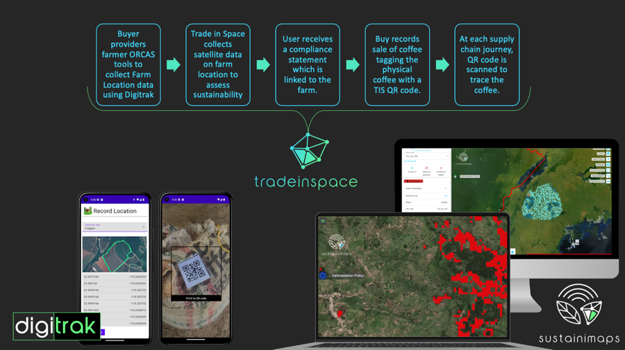
ORCAS pulls data from a range of sources, including SatEO systems and the users themselves, to create more valuable information for users.
Users can use this new information to complete a new range of applications, that are enabled by distributed ledgers. This means trust-worthy, and immutable tasks can be completed at the touch of a button – like striking a trade contract, filing a carbon sequestration report to gain credit for sustainable production, or analytically proving compliance to international deforestation standards.
This information, and supporting data can then be wrapped into a smart-contract which is attributed to produce as it moves through the supply chain. New data and information such as shipping dates, import/export control data, e-bill of lading data, etc, can then also be added to the ledger for each supply chain operation.
Space Added Value
Trade in Space is revolutionising agricultural trading by leveraging satellite Earth observation. This advanced approach underpins our model for generating 'non-fungible tokens' (NFTs) specifically for agricultural assets, marking a significant innovation at the very beginning of their lifecycle.
Central to this innovation is the invaluable data derived from space. By extracting detailed agricultural information from satellite sources, Trade in Space gain reliable, globally scaled insights essential for initiating the NFT generation process. This method disrupts traditional agricultural trade practices with its precision and scope.
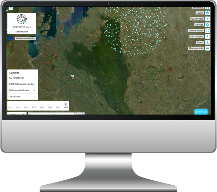
Their product relies fundamentally on satellite services. Trade in Space utilize Global Navigation Satellite System (GNSS) data to accurately pinpoint farm locations within the supply chain. Furthermore, their in-depth on-farm analysis is driven by satellite imagery. This enables them not only to verify crop existence but also to assess critical factors like forest loss, relative humidity, and temperature. These indicators are crucial for predicting risks such as pest infestations and disease outbreaks, thereby enhancing agricultural efficiency and security.
Through this integration of space technology, Trade in Space not only create a new paradigm in agricultural asset management but also showcase the immense value that space-derived data adds to modern agricultural practices and digital asset trading.
Current Status
Trade in Space has successfully completed it’s pilot study with a key pilot user in Colombia, using their requirements and working with other potential customers they have developed two key products which bring visibility, transparency and sustainability to agricultural supply chains.
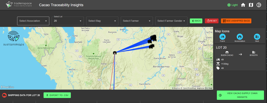
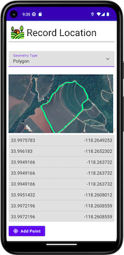
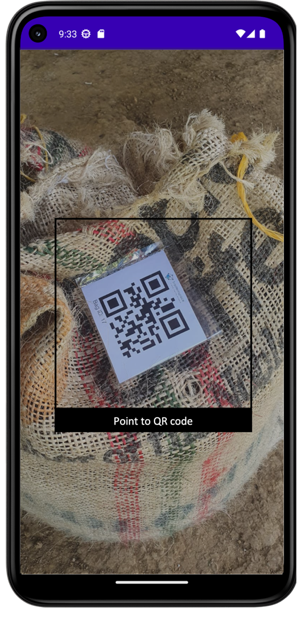
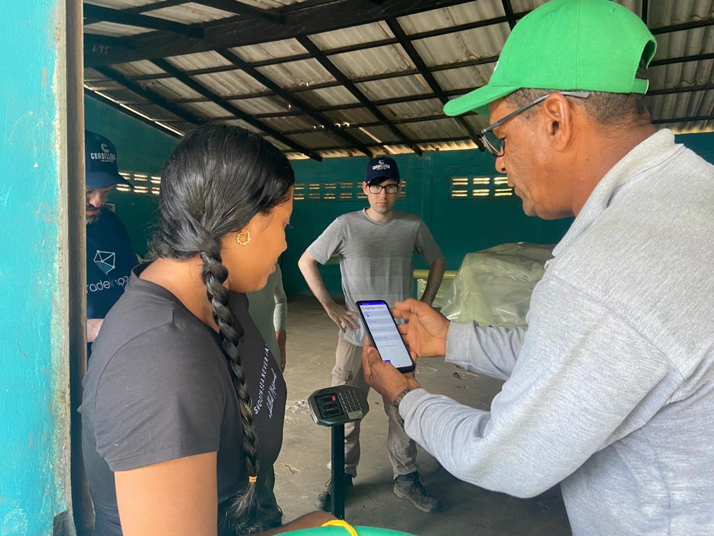
Firstly, utilising android technology and satellite positioning, farm data is collected on our mobile app, Digitrak – users input farm location, yield information, sale information and more, recording the origin of the crop. From there it is pushed to Sustainimaps, where satellite data is retrieved and the farm is assessed from compliance to legislative standards like EUDR. Sustainimaps is where Trade in Space users view and report on their supply chain, using the QR code scanning method, their produce is collected, tracked and verified throughout the supply chain.