Objectives of the service
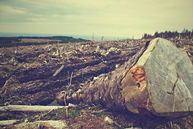
The EUDR requires that eight raw materials and derived products may only be placed on the EU market or exported from the EU, if they are free from deforestation and forest degradation. This means that they must not have been produced on land on which deforestation or forest degradation has taken place since 31 December 2020. Each product must be traceable along the entire supply chain to the field where it was produced.
EO4CSR provides a comprehensive solution to address the challenges faced by companies in complying with the EU deforestation regulation. The platform that makes use of Earth observation and complementing geospatial data offers a holistic approach to compliance monitoring and empowers companies to effectively track and verify the deforestation risk associated with their supply chains.
Users and their needs
Users in the context of compliance with the European Union Deforestation Regulation (EUDR) require a comprehensive system to collect and analyze data on commodity origins, assess deforestation risks, and develop related mitigation strategies. A digital solution needs to enable monitoring compliance using Earth observation ensuring traceability from farm to consumer. In an optimal case, the wanted end-to-end solution is integrated with existing ERP and warehousing systems.
Service/ system concept
With each delivery, the commodity importer or value adder receives freight documents which have to include information about the location of the land, where the crops were grown. This geospatial information is imported into the EO4CSR geo-engine where a ‘geo-logic’ is implemented. To assess if the commodities were sourced from deforestation-free areas, Copernicus imagery (or complementing satellite data) will be used to produce a landcover map for the area under investigation for the reference time 31.12.2020. No real-time image processing is needed. If the analysis reveals that the area was not forested in 2020, the next due diligence steps are performed. It follows a decision tree and leads to a final positive or negative outcome.
Besides the geospatial analysis, supplier information is managed in the EU4CSR platform. It can ingest information from the European Forest Observatory and include additional business logic. As a result, the due diligence and risk reports are produced which can be delivered to the EC Information System.
Space Added Value
The EU4CSR platform requires to work with geospatial information. Especially the EUDR requires the precise location of the land plots where commodities were grown. Earth observation is the optimal tool to evaluate the deforestation status. Copernicus imagery is a consistent source to assess the land cover for the reference date in December 2020. A combined approach using Sentinel-1 and Sentinel-2 enables also reliable forest mapping in tropical regions where many of the commodities of concern are grown.
Current Status
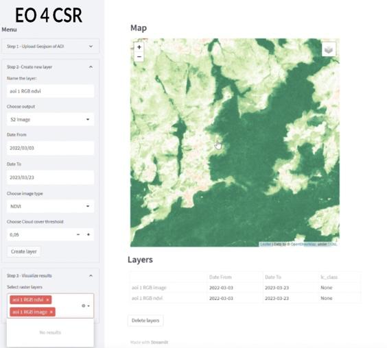
The project investigated the use of EO for CSR reporting. Despite the CSR Directive, affected companies are still struggling due to lacking domain specific reporting standards. Thus, a focus was put on the EUDR requiring deforestation-free supply chains. A prototype was developed to assess the deforestation using Sentinel-1 and Sentinel-2 imagery. The development of an end-to-end supply chain management solution is currently under evaluation.