
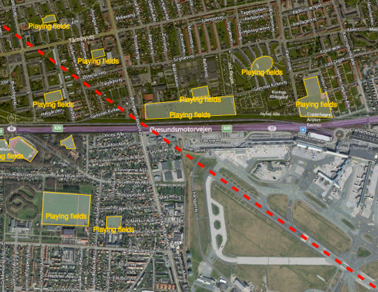
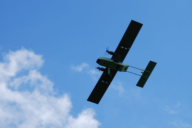
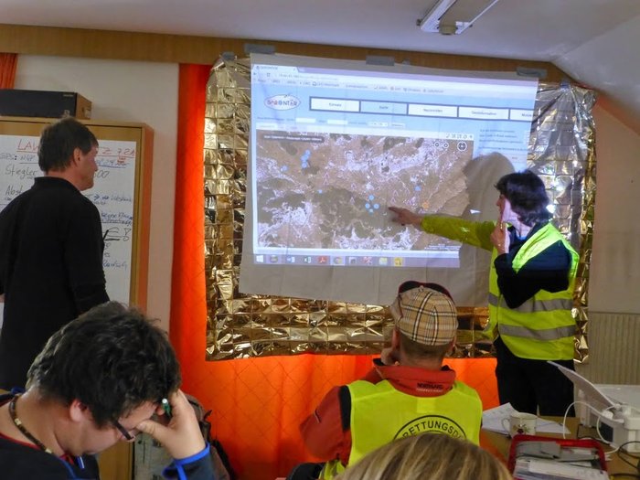
Reducing the risk of bird strikes using satellite images and Ascend’s Normalised Difference Water index software (NDWI)


BROWSE PROJECTS
Based on user needs and industry skills, the evolution of customized solutions and the establishment of innovative services is accomplished through project activities. Focusing on various thematic areas, relevant information on the project activities is provided below.
DAPPO
Status date: 09 March 2021
An AI & EO-based service that improves management of tuber supply to potato processing industry and potato storage facilities.
HGR
Status date: 30 March 2021
The project designed a hybrid GNSS receiver (HGR). The HGR provides innovative time and position certification services for smart transportation applications. HGR has the ability to detect spoofing and meaconing attacks, therefore validating the authenticity of the location-related data. The HGR combines GALILEO OSNMA service, ADS-B data from aircrafts and Network timing information
airUTM
Status date: 30 March 2021
airUTM is an Unmanned Traffic Management system that allows for equitable use of airspace for both manned and unmanned aircraft in Africa. We enable large numbers of drones to safely and securely conduct operations in compliance with aviation regulations.
Ag|knowledge 4.0
Status date: 26 March 2021
Ag|knowledge 4.0 improves the agricultural risk management for the stakeholders of the agri-supply chain in emerging economies. The services provided exploit various EO-technologies from remote sensing, weather satellites to GNNS to close a big information gap on operational crop monitoring in support of smallholders. The focus of the pilot-demonstration service is on India.
ASTROCAST
Status date: 25 March 2021
Astrocast is developing an advanced Nanosatellite network for the Internet of things (IoT).
FreeBreath
Status date: 24 March 2021
FreeBreath is a technical and economic feasibility study of a service improving the real-time understanding of air quality status and forecast in areas not covered by terrestrial sensors thanks to satellite EO, GNSS data and predictive analysis.
HoloCap pilotage application
Status date: 19 March 2021
A remote pilotage telepresence project, utilizing 3D game engine, volumetric video and Augmented Reality to bring maritime pilots virtually onboard a ship`s bridge from a remote location.
HRIDE
Status date: 19 March 2021
HRIDE has demonstrated the use of ionospheric products collected by Spire’s LEO satellites. These satellites measure the total electron content by monitoring signals from GNSS. Spire has developed an ionospheric data assimilation model and a space weather API that permits users to extract data. The project has demonstrated the use of the ionospheric model to provide corrections for positioning algorithms.

Orbital Witness
Status date: 11 March 2021
This project is working to provide archives of high-resolution satellite imagery alongside complementary property and legal datasets to allow real estate lawyers to conduct legal due diligence on property assets in a faster and more pain-free fashion.
SAIUDMA
Status date: 11 March 2021
A new ground-to-space air quality (AQ) analytics platform for city and traffic planning departments with the purpose of positioning data insights at the heart of managing resilient urban environments. Our analytics products form the decision making basis for investing in initiatives that help reduce harmful pollution and push for the design of new infrastructure sensitive to local residential communities and vulnerable population cohorts whilst allowing for sustainable economic development.
ESA FGC
Status date: 10 March 2021
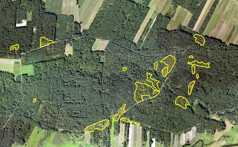
We applied space imagery to automate the identification of football fields with artificial turf material to an extent and frequency not possible with land-based tools. Pooling information enables the generation of information about football fields. Other information may be added for a tailored value proposition to field owners, field manufacturers and for field maintenance.
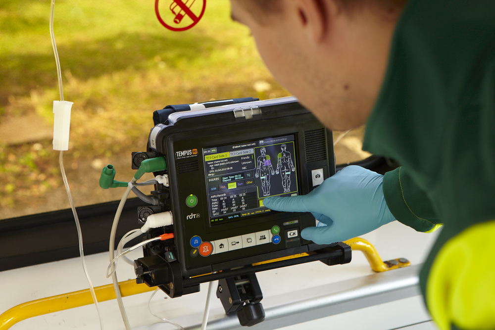
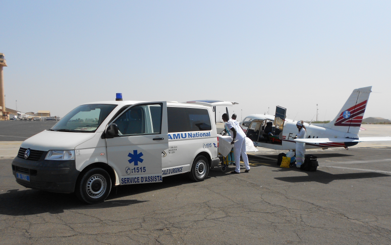
SatCare
Status date: 04 March 2021
SatCare aimed to demonstrate two service concepts of remote diagnostics using a broadband managed communication system to include satcom. SatCare allows for video rich data to transmit scans to an hospital from a vehicle on the scene of the emergency and en-route to the hospital. Enabling a robust clinical decision support system for prehospital patients has an impact on the health outcomes for patients and can improve the productivity and efficiency of the ambulance service. Through the addition of Satcom we can broaden the coverage of this service to include areas where terrestrial broadband communication (LTE) is unavailable or over-subscribed.
DeFROST for Hydropower
Status date: 01 March 2021
Based on satellite data, DeFROST delivers the ultimate snow monitoring solution for Energy (hydropower) industry. With DeFROST, such actors can improve current water inflow seasonal forecast by ingesting snow data, as well as, diagnosing early snow melt events for hydropower energy generation optimization
Liveland CCN
Status date: 25 February 2021
The scope of the Liveland CCN has been to further develop and refine the GMV NSL STICK service previously developed under the Liveland Demonstration project in order to improve its commercial viability.
This included the overhaul of the STICK architecture to function in stand-alone, the improvement of the service accessibility to the clients and the enhancement of the STICK firmware functionalities making the service further appealing.
CubeHAPS
Status date: 25 February 2021
A constellation of mini HAPS that provides a low-latency and low-cost telecommunication service over areas not covered by terrestrial infrastructures.
Foresight Marine
Status date: 23 February 2021
Foresight Marine digitises the process of machinery inspection; our edge sensors generate certifiable & actionable data accessible to anyone, anytime, anywhere – from the ship mechanic to the board room decision makers.
HumaNav-Next
Status date: 17 February 2021
HumaNav Next demo project addresses the Aid & Development community’s urgent need to increase the security of humanitarian missions. It will develop a fully integrated and reliable vehicle on-board solution, providing:
• Geo-location, fleet monitoring, management and security
• Telecommunications: voice, messaging and data
The solution will provide seamless world-wide coverage and full service regardless of the lack of any local infrastructure, by using Iridium satcom and GNSS location. It will be adapted to humanitarian vehicles deployed in field missions in underdeveloped regions and conflict areas. All services will be available while driving.
HeraSpace IUU
Status date: 17 February 2021
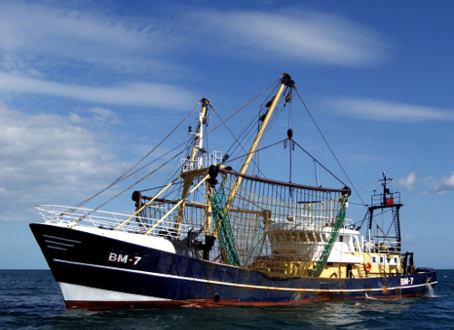
HeraSpace IUU helps the identification of illegal unreported and unregulated fishing supporting EU legislation and environmental protection.
VisionV
Status date: 09 February 2021
VisionV integrates a combination of data provided by the end-user (spatial and non-spatial) and data derived from space-borne assets (VHR optical, elevation, structural health) to create new AR/VR visualisation capabilities in the context of:
- Situational awareness for Critical National Infrastructure (CNI) asset management
- Search & Rescue
Seco
Status date: 08 February 2021
SECO is a novel system that integrates three EO services and five EO technologies with the sole purpose to prevent and detect water leaks. The services are delivered directly to customers systems via an API and/or a web platform. SECO integrates satellite optical and radar datasets delivering a short to long-term intelligent alert system for water leaks prevention and detection.
Aquax
Status date: 03 February 2021
AQUAX is an integrated system of robots, satellites and artificial intelligence, intended for monitoring and identifying anomalous discharges within lakes, rivers and reservoirs.
Collie AI
Status date: 02 February 2021
Route optimization software is abundantly present in logistics. However, none of the available solutions has a global scope of application, they are limited to a single transport mode: ship, train, truck, or airplane. Though extremely useful, there is an essential missing piece of information: the concatenation between transport modes.