ESA title

Portfolio

PROJECT SHOWCASES

22 November 2017

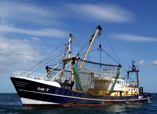
Reducing the risk of bird strikes using satellite images and Ascend’s Normalised Difference Water index software (NDWI)

16 August 2017

British start-up Rezatec has developed a landscape monitoring service based on Earth Observation data

06 June 2017

A new forestry monitoring service, which is currently being used by three regional forestry departments in Poland, combines space and terrestrial data with a web-based interface.

09 May 2017

With the support of ESA, Belgian SME Ovinto has developed a service that offers satellite-based monitoring of rail cars and intermodal tank containers.

20 March 2017

A new satellite-enabled information management system for commercial fishermen, developed the support of ESA, is currently being used by some seventy Irish fishing vessels.

14 February 2017

Managing seasonal navigational hazards, such as winter ice, on Romania's section of the Danube river is the goal of an ongoing ARTES IAP Demonstration Project.

06 December 2016

With the support of ESA's ARTES Applications programme, 21Net has built a system that seemlessly integrates satcoms to improve the user experience of WiFi on high-speed trains.

11 November 2016

The GeoSHM structural health monitoring system, developed with the support of ESA, is now being further deployed in Scotland and China.

03 November 2016

The Basilicata Region in southern Italy has announced the allocation of a nearly one million euros to support an ongoing ARTES Applications project, ONE Class! Open network for Education.

28 July 2016

An integrated rescue management tool being developed with the support of ESA is improving the speed and accuracy of search and rescue missions in the mountains of the Czech Republic.

30 June 2016

With the support of ESA, HydroLogic (NL) is developing an application called the HydroNET Flood and Rain Report generator to map rainfall and flooding quickly and easily. It has been successfully deployed in flood-prone Australia, and other countries are taking interest in the system.

01 April 2016

An enterprising Dutch startup is developing a viable business using Sentinel-1 SAR imagery to monitor oil and gas pipelines from space.

25 January 2016

Thanks to a new portal video encoder device developed with the support of ESA, high definition video can now be cost-effectively streamed from mobile satellite terminals. This breakthrough facilitates the transmission of broadcast-quality video content from regions with limited terrestrial infrastructure.  


15 November 2015

With the support of ESA through the ARTES IAP programme, Vista GmbH has developed a successful business supplying precision agriculture services to farmers. At this year's Agritechnica trade fair in Hannover, the Munich-based company was awarded a gold medal for innovation in recognition of its achievements.

15 September 2015

A recent ARTES IAP demonstration project shows how satellites give the deployment of RPAS a huge boost. The project leader, an enterprising British SME, is capitalising on this experience to develop a viable business in remote surveying services.

24 March 2015

Long-term monitoring using historical Earth Observation data and short-term GNSS positioning is a potent combination for studying the health and well-being of complex structures such as bridges.

24 February 2015

Demonstration and pilot implementation of a satellite-based operations control system for managing teams in alpine rescue missions.

26 January 2015

How satellite services give landowners an easier and cheaper way of calculating the potential economic value of conserving or restoring environmentally important peatlands.

07 November 2014

In an activity supported by ESA, a software package called VECMAP was developed that uses Satellite Navigation and Earth Observation data to populate an online database, allowing researchers to map high-risk areas. 

10 September 2014

With the support of ESA, Irish company Treemetrics has developed an innovative system that uses space and ground assets to map forests and monitor tree-harvesting machinery.

26 August 2014

Thanks to European telecoms satellites, affordable broadband Internet access via satellite is becoming reality. 

23 May 2014

Two recent ARTES-funded feasibility studies looked into ways of understanding and mitigating the risks associated with unstable terrain.

06 May 2014

The incorporation of satellite communication services in railway signalling systems is now one step closer.

11 March 2014

A robust portable device for monitoring vital signs and providing communications for medics developed with the support of ESA offers a lifeline even in the remotest areas on Earth via satcoms.

14 February 2014

ASSIST allows project managers to analyse the positive and negative impacts of their Telemedicine services way before they go live.

12 February 2014

European Defence Agency (EDA) and European Space Agency (ESA), have agreed to pursue their cooperation in the domain of Remotely Piloted Aircrafts.

12 February 2014

The Dutch company Robin Radar has recently taken the FlySafe technology down a new and unexpected path.

BROWSE PROJECTS

Based on user needs and industry skills, the evolution of customized solutions and the establishment of innovative services is accomplished through project activities. Focusing on various thematic areas, relevant information on the project activities is provided below.

Thematic Areas
Space Assets
Filter By Prime Contractor Country
Filter By Subcontractors' Country

MEDICO AMICO

Status date: 13 April 2022

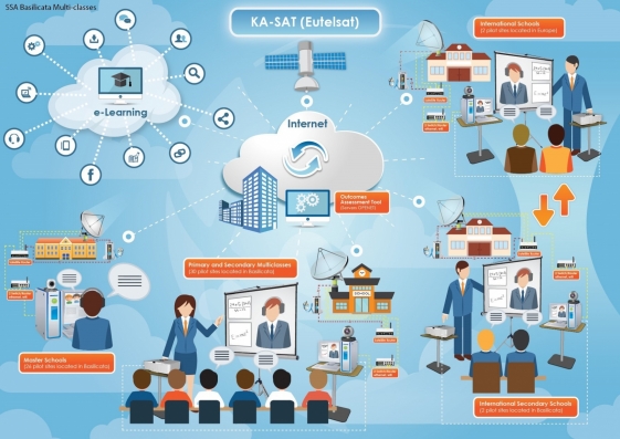
MEDICOAMICO is a new App allowing medical staff, wherever they are, to monitor their patients at home, to make teleconsultations and to deliver telerehabilitation sessions.

The patient simply needs to download MEDICAL AMICO on his/her smartphone, tablet or PC.

Rehabilitation sessions can be carried out both in real time interactively with the Therapist, or independently by the Patient, but always monitored at any time by the Therapist.
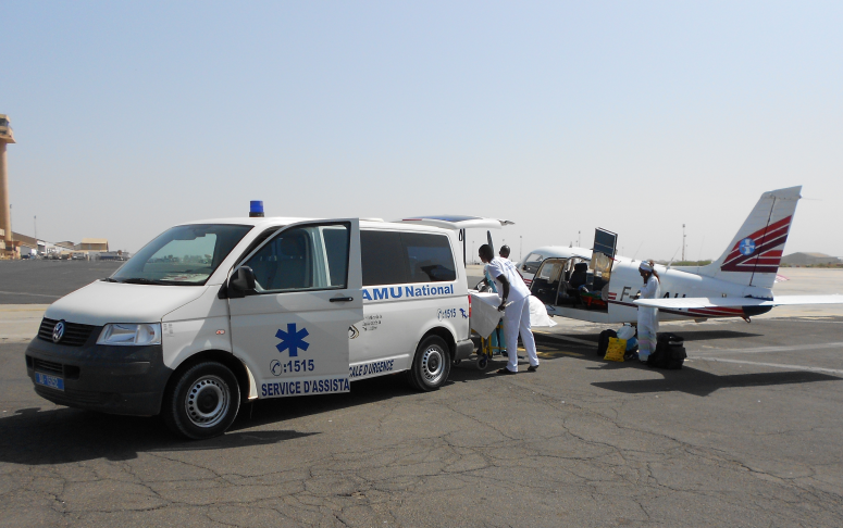
REACT2

Status date: 13 April 2022

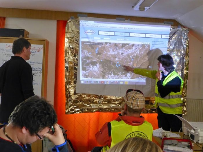
React 2 provides satellite and emergency communications to deliver national and regional health bodies, to hospitals and first responders on the ground, a truly innovative pandemic response system. A fully integrated software suite which supports pandemic responses as well as major emergencies. React 2 provides a ‘Virtual Command and Control’ system for emergency management and a ‘Back-office’ system for Case Report Form and Contact Tracing Forms analytics.

LudoTrek

Status date: 13 April 2022

LudoTrek is a GNSS-based learning game platform with an easy-to-use interface for creating customisable routes which can designed for educational and entertainment purposes.

TREVAR

Status date: 21 March 2022

TREVAR is a platform designed for the realisation of tactical training in team games. The solution is based on GNSS satellite positioning technology and Virtual and Augmented Reality (VR/AR) aspects. The recipients of the system are coaches and players. The main functionality of the system is based on ability to visualise selected tactics and conventional training.

AstroLEO

Status date: 13 April 2022

Awareness of the Earth's vulnerability and the digitization of education are important issues for current and future generations of students. AstroLEO serves these areas in an Augmented Reality (AR) based mobile learning application by presenting curriculum-compliant content against the backdrop of Earth observation. 

Space studies

Status date: 12 April 2022

Our project develops four workshops with high interactivity between participants and instructor and among participants, in order to provide the participants an experience as similar as possible to the on-site workshop. The workshops offer training in handling of astronomical databases within the virtual observatory scheme; of Earth observations for disaster management and environmental studies; and Life science and “OMICS” technics.

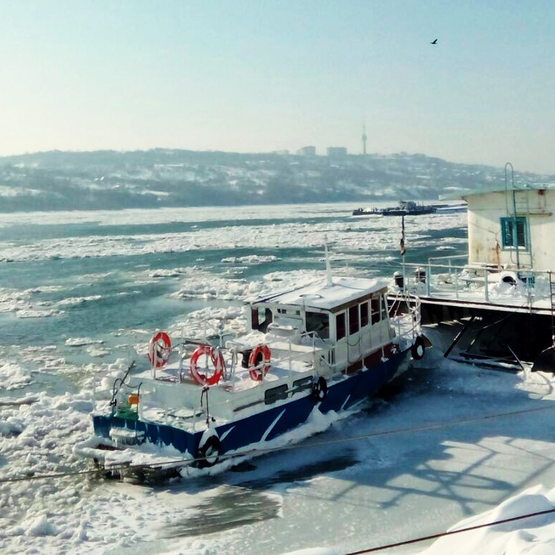
Unmanned maritime data acquisition and intelligence for decommissioning

Status date: 24 March 2022

The project consortium led by Sulmara are developing an unmanned subsea data acquisition and delivery system for decommissioning of offshore energy assets. The service is based on use of an uncrewed surface vehicle (USV), combined with a remote operated towed vehicle (ROTV) to acquire subsea survey data required by offshore energy operators. The main services offered are pipeline, area, and asset integrity surveys, including environmental surveys.

EBX4EDU

Status date: 24 March 2022

For individuals and educational institutions, Earth Blox makes access to satellite data easy by removing the barriers to access and understanding. Earth Blox quickly empowers students to go from sensing to sense-making, whether they are in a lab or at home.

EMLM

Status date: 22 March 2022

EMLM investigated the technical feasibility and commercial viability of Earth observation satellites to detect, monitor and model the movement of large accumulations of floating marine plastic litter as it travels from the source, along rivers and estuaries, and into the Oceans.

PlastEcoTrack

Status date: 21 March 2022

This project assesses the technical and commercial feasibility of space-related services to support the reduction of marine litter. A multi-technology approach is studied to detect and track marine litter in the coastal area. An integrated economic channel from the collect to the revalorization is evaluated, including the tracking solution and involving local fishing communities to boost efficiency.

MEO-Certif

Status date: 17 March 2022

MEO-Certif is a web mapping tool dedicated to organic farming players. Thanks to a panel of cartographic indicators, professionals can use the service during their decision-making process.