
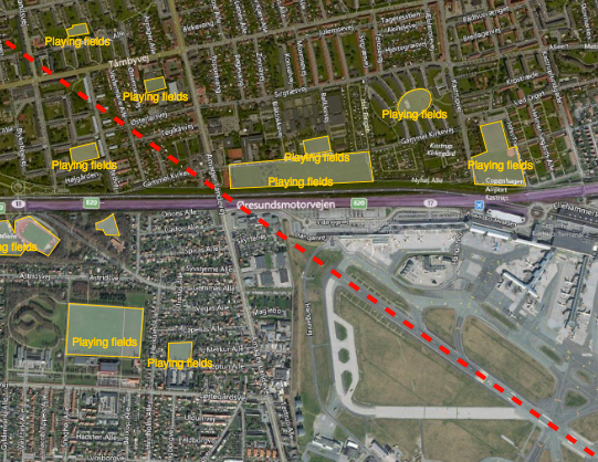
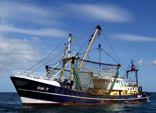
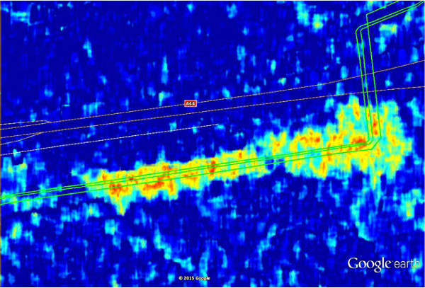
Reducing the risk of bird strikes using satellite images and Ascend’s Normalised Difference Water index software (NDWI)


BROWSE PROJECTS
Based on user needs and industry skills, the evolution of customized solutions and the establishment of innovative services is accomplished through project activities. Focusing on various thematic areas, relevant information on the project activities is provided below.
SAGRESSMART
Status date: 01 September 2022
Powered by artificial intelligence and earth observation, SAGRESSMART provides solutions to improve efficiencies and success in seafloor mineral exploration and investment. As a way to increase knowledge, reduce risk and uncertainty, and assess mineral potential, SAGRESSMART is design to simplify and reduce the time spent compiling, managing and interpreting data and concentrate efforts on the evaluation and raking of high-value targets.
SEED
Status date: 24 August 2020
An advanced AI enabled satellite-based data powered software solution for renewable energy production forecasting including solar and wind energy
SPACEWHALE II
Status date: 11 December 2020
SPACEWHALE is an innovative, semi-automated approach based on deep-learning techniques to detect large whales (~ 10 – 30 m) from VHR satellite images. It forms the bridge between space asset providers and stakeholders in need of population assessments of large whales and enables surveying areas out of reach for traditional methods such as ship and aerial surveys.

YouShip
Status date: 16 August 2022
YouShip is an on demand delivery platform that connects any business with local couriers or autonomous delivery robots to provide the best delivery experience at the best price. The platform in real-time matches the couriers according to the packages type, delivery windows, and locations. Its AI-powered algorithms find and notify the right courier to the right location at the right schedule time.
DRAMA (AMMO CCN#2)
Status date: 11 August 2022
DRAMA enables airports to address the drone challenge in a systematic, fact-based manner. All decisions concerning the management of drones and procurement of detection solutions are driven by risk assessment and ongoing risk monitoring. DRAMA provides airports with an easily adaptable solution that enables mitigation strategies and drone sensor selection.
First RESPonse
Status date: 11 August 2022
First RESPonse aims to help health professionals (ambulance dispatchers, first responders, hospitals) to deal with pandemic outbreak via acceleration of the entire pre-medical resource chain by up-to 20%, increase the first responders’ safety and improvement of situation awareness for public.

IE4Education
Status date: 11 August 2022
Creation, production and installation of exhibitions based on satellite images to promote space applications or to highlight a territory or a specific topic.

SATET
Status date: 11 August 2022
The SATET project will assess how the space asset data can be used to forecast revenues, and costs and quantify operational risks associated with the planning, operation and management of wave and wind energy platforms.
B-SURE
Status date: 11 August 2022
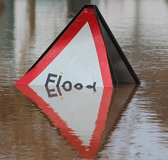
B-SURE can significantly reduce disaster management response time
The main B-SURE service is rapid collection and bandwidth-efficient secure communication of operationally relevant field information. The baseline field platform is a smartphone, while remote information managers access data and interact with the field users via Web browsers online on secure servers. The field users cover professionals, civil population and small UAV operators. A novel element is the specific focus on and support for remote disaster management support.

GeoInsure
Status date: 02 August 2022
GeoInsure is an operational solution based on Global Navigation Satellite System and Earth Observation, specially designed for the (re)insurance industry. GeoInsure provides two main geospatial gateways: (1) it enables the seamless integration of multiple geospatial data sources, providing a comprehensive environmental context and (2), through GeoInsure service activation, insurers can benefit from extensive Earth Observation data based pre / post-event analysis.
DIBAS
Status date: 02 August 2022
DDK Positioning Ltd. (DDK) provide GNSS hardware and Precise Point Positioning (PPP) services that improve GNSS positions from 10m to an accuracy of <5cm. DDK delivers its positioning service exclusively via the Iridium satellite communications constellation using Iridium’s 66 military grade LEO satellites to the maritime and agricultural sectors globally, from pole-to-pole.
BePI
Status date: 15 July 2022
BePI is a health and security service born to help public and private entities to address COVID-19 emergency. The synergic use of UAVs and UGVs (aerial and ground robots) assisted by AI, makes it possible to contactless measure people’s body temperature, blood oxygen saturation and heart rate and to detect specific alerts (presence of people’s gatherings and use of protective face mask). The service provides geo-referenced and aggregated data for each covered area.
EO4CS
Status date: 15 July 2022
After decades of interventions in the cocoa sector and implementation of voluntary sustainability standards, the environmental impacts of cocoa production are still present. Supposedly sustainably produced cocoa is mislabelled and not produced according to sustainability standards. The EO4CS project aims at preventing food fraud of cacao by supporting the certification process for labels of sustainability with objective satellite-based earth observation information.

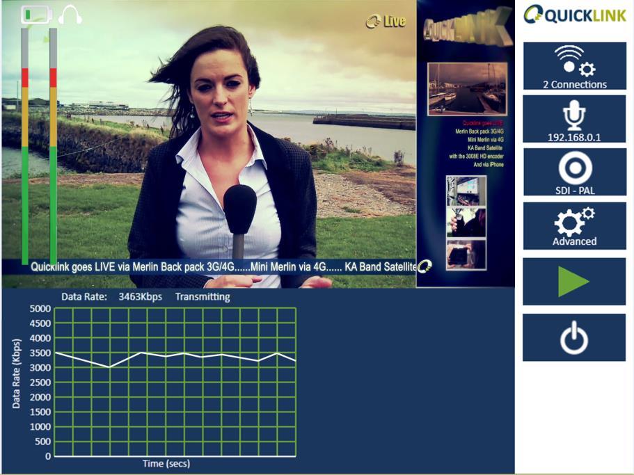
AIBROINFRA
Status date: 13 July 2022
Quicklink proposes to develop Artificial Intelligence (AI) that will both optimise the quality of remote video contribution and dramatically reduce costs for the production customer. The solution will be tested on the OneWeb network to enable high quality news interviews to be transmitted to and from remote locations.

Virtual Post-It
Status date: 13 July 2022
The Virtual Post-Its project seeks to develop a solution that allows construction foremen and technical building inspectors to create location-anchored, interpersonal digital rework messages or “virtual post-its” during the review of construction work. These digital rework messages or “virtual post-its” are thus linked to the location of rework in real 3D space using alphanumeric content and semantic signs based on a set of rework typology.

LeA: Learning Achievements
Status date: 13 July 2022
LeA Project boosts the acquisition, development and consolidation of skills and knowledge, both technical and scientific, with particular reference to Space, using tools and methods that combine education and entertainment.
Meandair
Status date: 27 May 2019
Every day, pilots have to take difficult decisions about their flight routes avoiding adverse weather and safeguarding fuel-efficiency of their flights. Meandair helps to quickly determine the safest and most fuel-efficient routes for general aviation flights with respect to the ever-changing weather.
SmartSatCare
Status date: 13 July 2022
SmartSatCare’s goal was to promote the use of TV-based remote assistance services for medical monitoring with specific relevance during the COVID-19 pandemic. It aimed at integrating the whole system with satellite technologies, and test it on a real territory. The goal was to enhance the teleassistance in different geographical areas, including those rather remote.