
Reducing the risk of bird strikes using satellite images and Ascend’s Normalised Difference Water index software (NDWI)


BROWSE PROJECTS
Based on user needs and industry skills, the evolution of customized solutions and the establishment of innovative services is accomplished through project activities. Focusing on various thematic areas, relevant information on the project activities is provided below.

Space-to-Tree S-2-3
Status date: 26 December 2023
S-2-3 a multi-scale/parametric system aimed at monitoring the health status of trees within parks of historical-cultural or naturalistic interest. Objectives: defend the beauty of the tree, archaeological and monumental heritage; monitor the environment; manage risks to people or property. The data is enjoyed through webGIS platform with dual functionality: cataloguing trees; Monitoring the dynamics of trees with respect to wind.
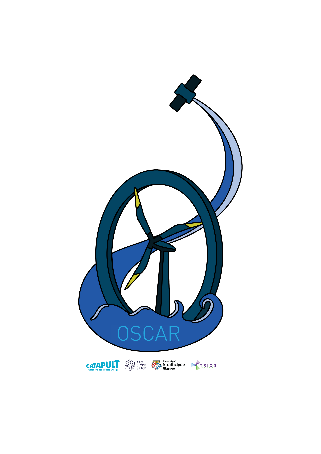
OSCAR
Status date: 26 December 2023
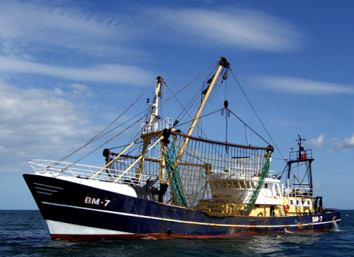
Space-data surveillance service for effective vessel management, enabling greater efficiencies in the planning of construction and the maintenance of offshore wind farms.
It will not appear on the project web page itself but is used in project lists e.g.
AlertSat Portal
Status date: 26 December 2023
The AlertSat satellite constellation is to deliver Alerts directly to its users, through AlertSat Portal - when critical information has been detected and there is still time to act upon it.

Maritime port container activity zones
Status date: 26 December 2023
This geo fencing data base provides the shipping industry with container door opening event qualification, operational deficiencies tracking, container mishandling events locations and CO2 shipment emission data tracking.

OPT4SOL.AI
Status date: 26 December 2023
A smarter way to identify the location for your next solar project. OPT4SOL uses satellite images, GIS, and AI to support site selection for new utility scale PV projects. All the data in one place. The system considers every aspect, from exclusion zones and regulatory limits to distances from power lines and areas of high cunsomption supported by AI powered analysis and scoring of potential locations.

ABSeaD
Status date: 26 December 2023
ABSeaD focuses on environmental conservation. It utilizes advanced machine learning models to analyse Earth Observation data for the strategic management of Posidonia Oceanica seagrass beds, crucial for carbon sequestration.

5SEnSES
Status date: 19 December 2023
The project entails developing a software platform for real-time measurement and quantitative monitoring of gas and/or oil extraction sites. This integrates data from seismic, satellite (SAR), GPS, IoT networks and correlating the Earth's surface movements, seismic activity and pore pressure through an AI engine. The results can be employed for industrial monitoring and predictive simulations.

SGAM
Status date: 19 December 2023
SGAM is designed for hazard and risk assessment, focusing on the interaction between infrastructures and natural environment. It combines Earth Observation data, ground-based monitoring data, geohazard databases, and AI algorithms to identify critical issues and cost-effective maintenance investments. It features techniques such as A-DInSAR and PhotomonitoringTM for precise monitoring of surface changes, allowing for historical analysis and change detection.

WHIS
Status date: 14 December 2023
The Water Health Indicator Service (WHIS) provides a continuous data stream of environmental health indicators for inland water bodies. This service is an API with monitoring and reporting capabilities that allows you to track a set of specialised and highly descriptive Water Health Indicators.

uSmart Revenue
Status date: 14 December 2023
The uSmart REVENUE project uses Artificial Intelligence and Machine Learning to process satellite imagery and link this with Non-Domestic Rates registers to determine whether building usage might have changed. This enables fraud detection and identification of potentially missing revenues to local authorities.
WaSat
Status date: 12 December 2023
The Norwegian company Ocean Oasis is developing a wave powered desalination technology to increase access to safe and affordable water in water scarce coastal regions. The capacity to efficiently evaluate the wave resource in specific locations allows for production forecasting and pricing. Earth Observation data has been used to improve the accuracy of the analysis tool.
Soil health space-based evaluation
Status date: 12 December 2023
The Soil health space-based evaluation project leverages SatEO to generate time series capturing historical land use and farming practices on plots. These time series are then correlated to soil measurements in order to explain the impact of farming practices on the health of cultivated soils and identify improvement levers.
Blue Belt
Status date: 01 November 2012
Embedded into the SAT-AIS context, this IAP Demonstration Project aims to support the EMSA Blue Belt project. Providing space-based AIS data, it seeks to complement the terrestrial AIS data and provide an added-value source of information for Customs Authorities interested in maritime situational awarenees for vessels and geographical focus areas.
AGRO-BIOMES
Status date: 11 December 2023
The AGRO-BIOMES Kickstart activity aims at understanding the biodiversity market level readiness in four major agricultural markets segments, proposing a few architectures scenario based on the <geosys/> platform capabilities, testing biodiversity-related analytics with ground truth and Copernicus data and finally evaluating economical, technical, and scientific risks and mitigations plan to be considered prior to a go-to-market decision.