Objectives of the service
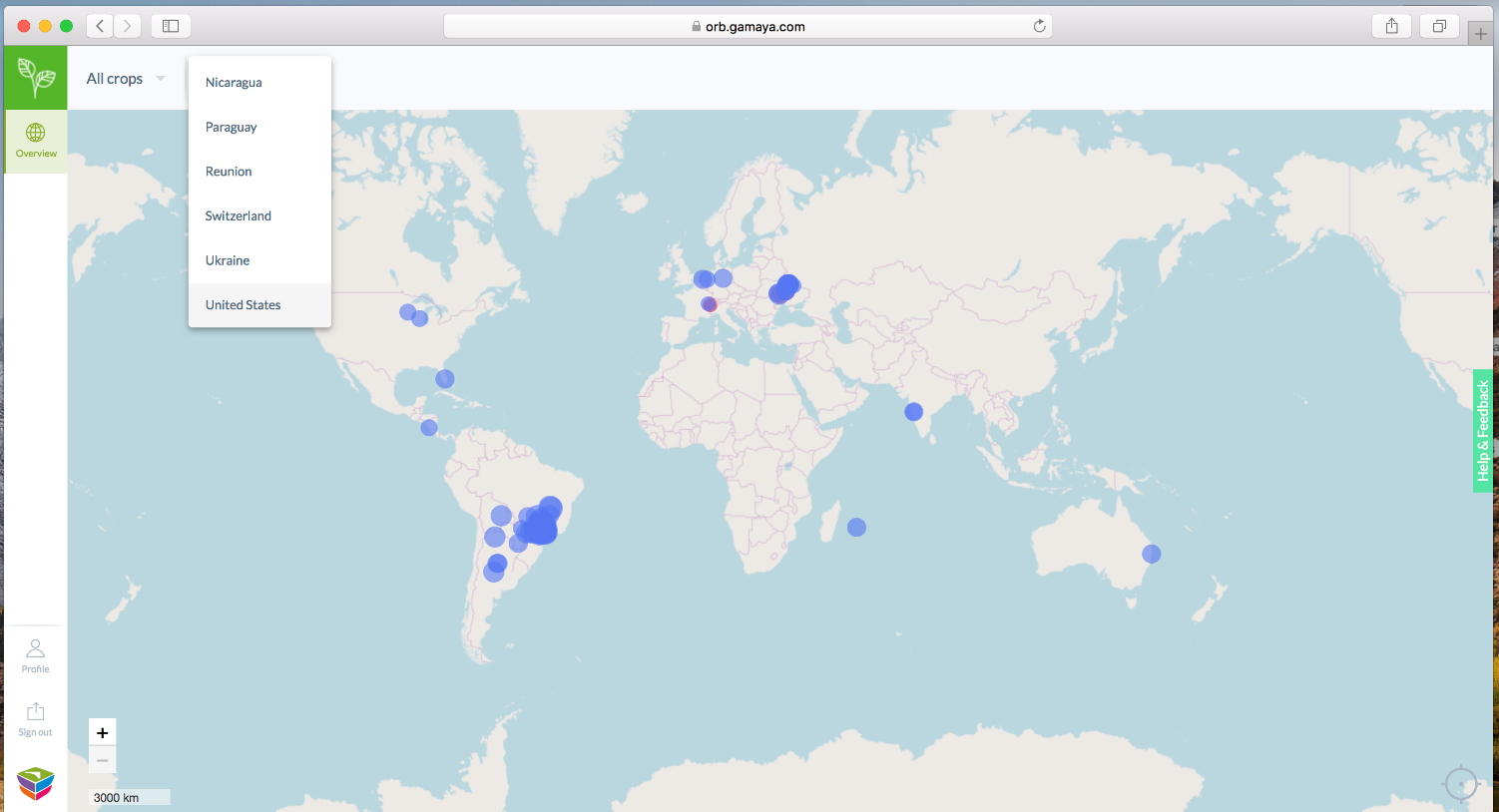 Image credit: GAMAYA, ORB web platform
SOLAR3 was designed to provide farmers, agronomists, and other agricultural experts with actionable intelligence they can use to decide on the amounts and locations of agrochemical doses for precision agriculture as well as to make other operational and strategic decisions. Therefore, development of field/vegetation analytic maps for various crops during their growing cycles using hyperspectral imaging, satellite imagery, machine learning, and solar powered unmanned aerial vehicles (UAVs) was proposed as an approach.
The objective of SOLAR3 was to develop, demonstrate and bring to the market a new system capable of delivering at large scale diagnostics of crop issues such as diseases, environmental stresses, fertilization level, and facilitate farmers decisions in their in-the-field applications. The idea was that analytic maps should highlight the situation on a field/crop at required place and in needed time.
It was planned, that the system itself will rely on a novel hyperspectral imaging (HSI) technology and decision support information (DSI) system developed by Gamaya and the SenseSoar2 long endurance, solar powered UAS developed at ETH Zurich. The Ukraine, one of the world’s top10 producers and exporters of grain, was chosen as a country for demonstration/testing of the novel UAS-HSI system within this project, and for development of commercial opportunities for Gamaya products.
Users and their needs
SOLAR3’s targeted users are large industrial growers in Eastern Europe including Ukraine. Expansion to other countries and additional crops will follow.
Ukrainian and other farmers need to know where in their field they should focus the application of expensive agro-inputs to achieve the highest, or more economically reasonable yields possible year after year.
Improper use of chemical inputs is also linked to various ecological issues, including continuous lessening of arable fields and turning them into deserts. Farmers in Ukraine are facing this problem as well, and they lose their land year-by-year. Therefore, an assistance of farmers in their decisions has also ecological impact towards sustainable agriculture, sustainable world.
Groups of users:
- FARMERS AND AGRI PRODUCERS: Timely control of diseases and weeds; Reduction in fertiliser and chemical usage with better outcome
- AGRONOMY SERVICE PROVIDERS: Advanced services for their customers including advice on timely action for pests and diseases control and overall agricultural practices; Serve many customers efficiently
Service/ system concept
The SOLAR3 decision support information system (DSI) requires remote sensing data to assist farmers with their management and planning. The SOLAR3 product combines power of SenseSoar2, data acquisition platform: a long endurance unmanned aerial vehicle equipped with a lightweight and data-efficient hyper spectral camera, with a web-based ORB system.
Processing of data and computation of reflectance and reflectance-derived spectral vegetation indices are fully automatic. Because HSI camera provides narrow bands data, it gives access for analysis that is not possible in multispectral or broad-band satellite imagery.
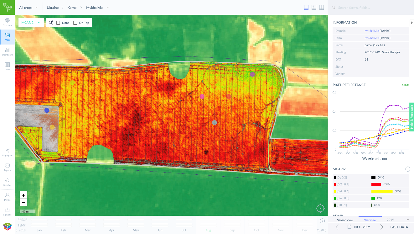
The analytics maps are supplied to customers via a cloud-and-web-based user interface (pictured below). Therefore, the SOLAR3 decision support system is an end-to-end solution for improved airborne monitoring and diagnostics of large-scale agricultural areas.
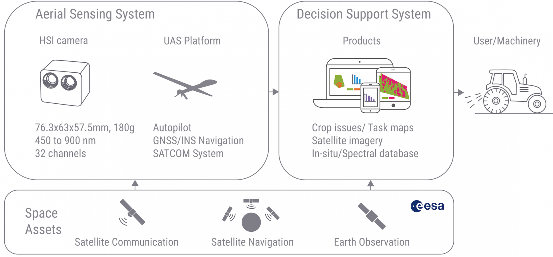
Image credit: GAMAYA
Space Added Value
The use of space assets is necessary to fulfil the large-scale airborne hyperspectral agricultural monitoring task proposed within this project in an end-to-end manner, i.e. without assuming extensive pre-existing infrastructure on the ground. The following space technologies are used:
- Satellite Communication Capability
Satellite communication (SatCom) systems provide reliable infrastructure-independent global communication coverage. SatComs enable SOLAR³ to provide safe and easy-to-use agricultural mapping services that cover large-scale agricultural land areas. In SOLAR³ we develop and integrate a SatCom framework for use on lightweight small-scale Unmanned Aerial Systems such as the SOLAR³ aerial sensing system.
- Global Navigation Satellite System (GPS/GALILEO)
To provide stable and reliable aircraft position, attitude and velocity estimates, the aerial sensing platform implements state estimation that uses inertial measurement data which is corrected using GNSS position and velocity information. Support for the European GALILEO constellation is included.
- Complementary use of satellite-based observations
SOLAR³ includes the development of a multi-scale methodology that takes full advantage of the continuously expanding fleet of space-borne remote sensing instruments, i.e. when advantageous, airborne and space-borne sensing methods can be used in a complementary way for situation analysis in the Decisions Support Information system.
Current Status
Collaboration between Autonomous Systems Lab from ETHZ and GAMAYA SA led to development of novel UAV platform equipped with cutting-edge HSI camera for long-ranges flights for remote sensing application. SenseSoar2 system has been tested and then successfully operated in Ukraine during 2018-2019 years. Flights were performed by internal national drone operator.
Engineering of the UAS and its integration with HSI camera was effectively accomplished. Data sets of HSI flights were routinely processed in an automated manner for fields up to 260 Ha. The deployment of Gamaya's user-friendly web platform, ORB system, was also implemented which enabled simple access of all data through the Web and mobile applications.
Processing of data and computation of reflectance and reflectance-derived spectral vegetation indices, developed during SOLAR3 project, is fully automatic. Because HSI camera provides narrow bands data, it gives access for analysis that is not possible in multispectral or broad-band satellite imagery. Complementarity of Sentinel2 accessible information and HSI data was demonstrated, and fusion of both sources of information is recommended for many applications.
Prime Contractor(s)