
Objectives of the service
Meteo-marine conditions and events strongly influence maritime commercial and leisure activities, as well as the health status of the environment.
Many recent events provide a clear picture of the dramatic impact in terms of safety of people and safeguard of the marine environment that a missing or wrong interpretation of meteo-marine conditions can cause.
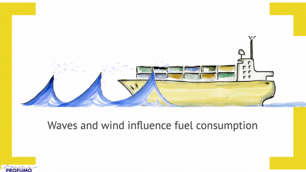
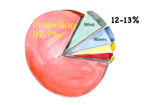
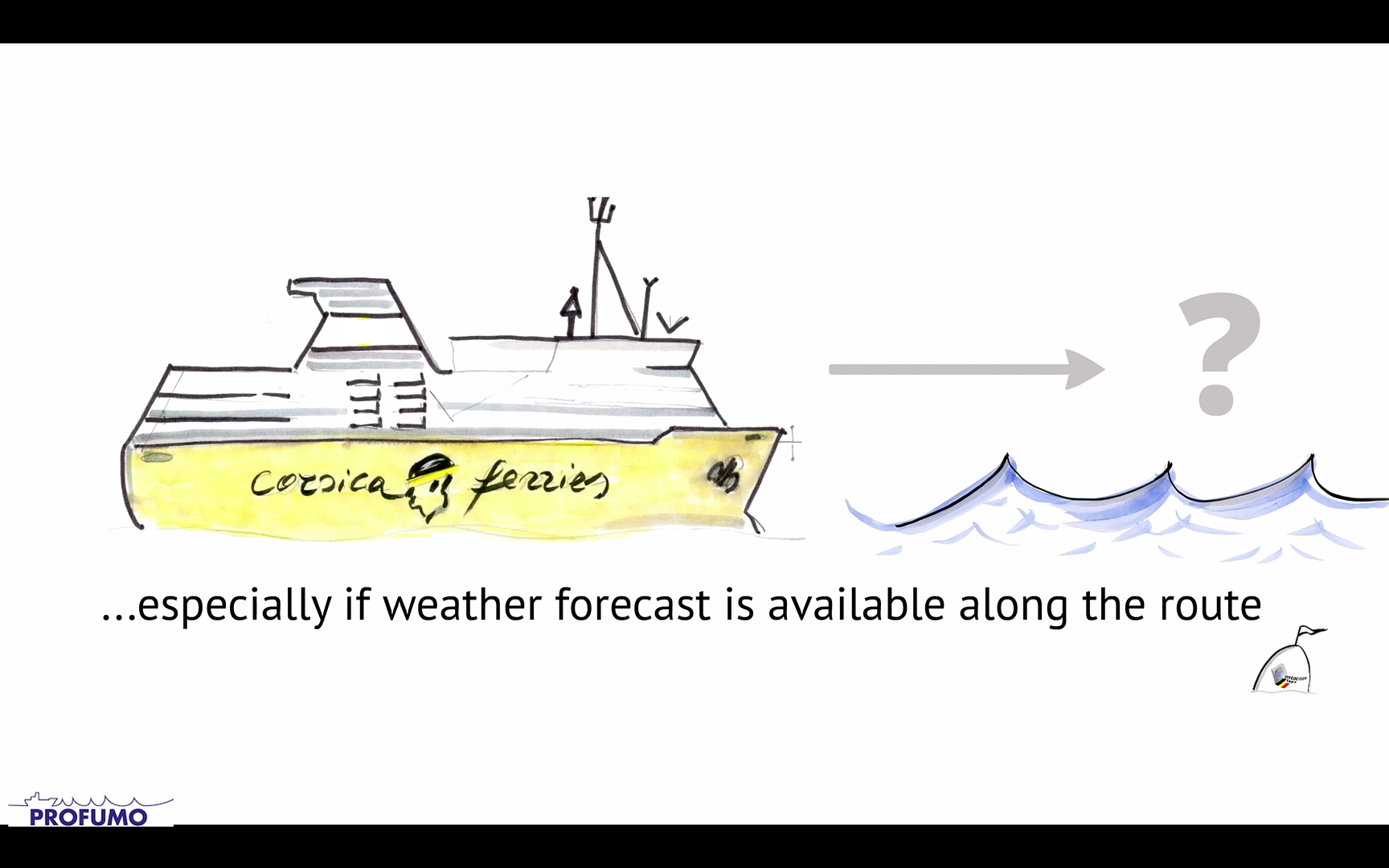
Meteo-marine conditions are important not only for the safety of navigation but also for the economics of commercial activities that are exercised on the sea. A study carried out by Corsica Ferries company, shows that, the impact of meteo-marine factors (wind, waves, currents) can be quantified as around 14% of the overall energy (i.e. fuel) consumption.
The reduction, through the provision of specific commercial weather routing services, of the impact of meteomarine conditions on navigation safety, in terms of prevention of sea accidents (with associated costs) and on fuel consumption (with associated environmental benefits) constitutes the contest of Profumo services.
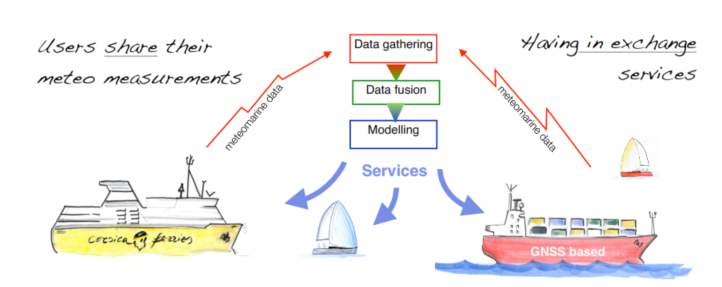
Cooperative data gathering
Profumo proposes a collaborative model: end-users cooperate to the Profumo services providing their own geo- referenced Meteo-marine measures gathered from common on-board sensors.
(Pre-installed meteo and GNSS stations).
Why do we need meteorological measurements?
More data means more reliability!
Weather models can produce good nowcasts and forecasts only if “fed” with a good and large amount of actual measured data. On seas meteorological stations are extremely sparse: Profumo uses vessels as moving meteorological stations, which continuously provide this precious information.
Innovative data processing
The meteorological data from vessels are not-certified, unusable as-is in the models. Therefore, a specific data processing technique merges and extracts proper information as input for the high resolution weather models.
Users and their needs
The objective of Profumo is constituted by the provision of weather routing services to the commercial and recreational maritime community.
Profumo services are aimed – broadly – at two objectives:
- Improved safety of navigation and
- Fuel consumption/pollution reduction.
Although the first objective is of outmost importance and constitutes per se a business opportunity, it is clearly the second objective that it is more perceived by the end user community as a strong value added in economic terms. Fuel and pollution reduction, in turn, is a valuable asset for the professional user community and – partially – for the small fleets or individual commercial boats community, while nominally this is not an asset for the seasonal user category.
Professional users constitute the key community for the service provision and the core of the cooperative schema for the meteorological data collection.
The Profumo evolution is the provision of Dynamic Navigation for yachting.
These services are driven by the needs of recreational navigation. They provide weather-related assistance to yachts based on actual weather conditions and precise short term forecasting.
The outcome is the improvement of navigation safety and comfort in cruising and in coastal and offshore regattas.
Profumo services will address commercial and recreational vessels in Mediterranean Sea at first instance, but the aim is to propose Profumo services, as second step, to the European side of the Atlantic, the North Sea and the Baltic.
Service/ system concept
A novel concept on weather routing
Profumo combines innovative components.
Collaborative data from private ships and boats is a precious source of information for the meteo-marine monitoring and is profitable for the middle/short weather routing. The advanced data processing and fusion “merges and cleans” measurements extracting proper information for the assimilation into the high resolution nowcasting and forecasting models.
Profumo’s innovative routing algorithm uses these detailed observations and predictions for calculating the optimal route.
On the basis of the different environmental conditions this algorithm is capable of predicting the fuel consumption suggesting the optimal route. It takes in account voyage constrains such as speed, time-windows, and in perspectives, comfort and loading conditions.
Space Added Value
Profumo services involve the use of three space assets, which are fundamental for the success of the services: Satellite navigation, Satellite communications, Earth Observation.
Satellite navigation constitutes the obvious prerequisite for the provision of weather routing services, (which are intrinsically location based). Satellite communication is the transmission mean for the delivery of services and the transmission of meteo data in sea areas not covered by other transmission channels for sending the geo-referenced meteo-measurements from the cooperative users to the service centre.
In addition an innovative meteo sensor based on the processing of GNSS signals for the estimation of atmospheric profile parameters (Meteo GNSS) in the frame of Profumo project is experimented.
Earth Observation data from meteo satellites are intrinsically used within the standard meteo services which represent the starting point for the targeted services.
Current Status
The idea to use ships as distributed meteo sensors for retrieving meteorological geo-referenced data have been successfully experimented in the context of COSMEMOS R&D project.
COSMEMOS objectives were mainly focused on the scientific exploitation of cooperative schema.
Profumo objectives were to demonstrate the technical, scientific, economic viability of Profumo services.
The proof of concept developed in the frame of the project fully verified the technical feasibility of the main services.
The study of propagation of meteo forecast errors in fuel estimation demonstrated the potential of the service provision.