Objectives of the service
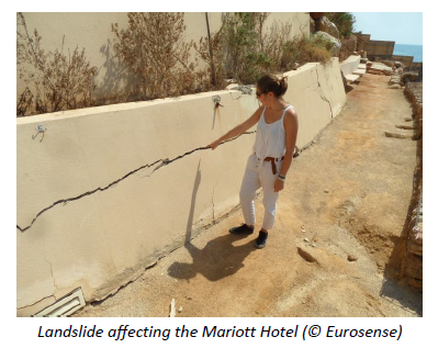
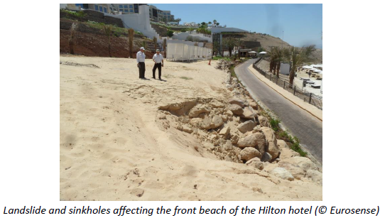
Karst landscapes formed from the dissolution of carbonate rocks. They crop out over 25% of the Earth with unique landscapes that are frequently labelled UNESCO World Heritage Site. Karst systems represent significant groundwater reservoirs. They are increasingly exploited due to the growth in the tourism, industrial, and agricultural activities. The aquifers level drop is the triggering factor of subsidence, sinkholes and landslides. “Karst” is becoming a synonym of failure for engineers and land planners, due to the large number of geotechnical issues these areas are causing.
The importance of applied geomorphology in the construction of large resorts has been amply confirmed by the fact that most of the accidents had geological reasons in the background. A major cause is related to inadequate knowledge of the geotechnical conditions, and on the absence of a monitoring system capable of apprehending ground collapses, subsidence, and landslides.
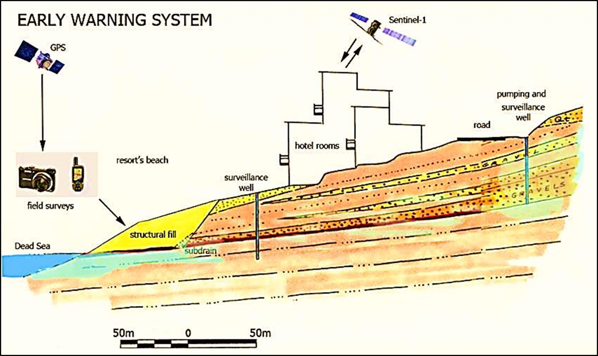
KATOUM proposes a solution that will consist in the coupling of hydro-climatic elements that we will be obtained by satellites and observation stations with the constituents of the karst systems. This will be done via a coupled hydraulic-mechanical model which will be then able to simulate the observed ground movements and to predict their future movements.
Users and their needs
- Fund providers are coming from diverse perspectives and want a rapid return on their investments. They have profits in mind and are determined to achieve their goals. Environmental constraints are secondary issues for most of them.
- Architects and planners have generally established their offices outside the project area. Their knowledge of the environmental setting of any particular project is generally poor, or at best based on a limited dataset centred over the parcels they have to valorise.
- Companies qualified to construct infrastructures are a mixture of local and international enterprises. In general, local workers are more informed about the environmental issues in their areas of work because staff and engineers spend months at a time in the field. However, their objectives consist of the realization of the project, not of planning or questioning it.
- Safety engineers are fully aware of the environmental degradation, although they lack a synoptic view and a sound understanding of the underlying mechanism. Their methods and approaches to solving these problems are hardly sustainable.
Bulgaria, Croatia, and Jordan
Service/ system concept
- KATOUM will deliver three types of products/services:
- Water table maps with gradients where ground failures are likely to occur;
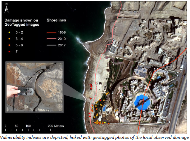
- Vulnerability maps at the cadastral parcel level and at regional scale;
- An “early” warning system able to point out areas susceptible of collapse several weeks before the geotechnical issue will occur.
- KATOUM is a flexible toolbox dedicated to the fusion of various sources and types of information. The system is made of three major components:
- Image processing of radar and optical images: advanced techniques are used to extract ground deformations at cm scales; Image classifications are used to focus on LU LC and the health status of the vegetation;
- A dedicated geographical information system is used to cross-check information from satellite images with in-situ datasets. Dedicated workflows are used to publish water table depths and gradients as well as vulnerability maps.
- The advantages for the users consist in:
- the integration of the environmental constraints into the projects design for the future projects;
- the integration of valuable information in the design of remediation works for the ongoing projects;
- the integration of the environmental constraints into the daily decision making process owing to a tailored “early” warning system.
Space Added Value
KATOUM will use the following space assets:
- Sentinel-1: radar images are one of the major space assets which is used in this project. The revisit time of 6 days in the Mediterranean region fits with the theme. Time series radar images are used to compute ground deformation in and around the region were the tourism project is taking place (or will take place).
- Sentinel-2/3: optical and infrared images bring high resolution ground information and low resolution water data however with a large amount of valuable frequencies. This range of frequency is ideal for detection of underwater springs next to the shoreline.
- GNSS: to pass from relative to absolute measurements with radar interferometry techniques, it is mandatory to collect ground evidence from an independent reference system (Galileo, GPS, etc.).
Information derived from spaceborne sensors is mandatory input for the setting up of added-value products such as vulnerability maps. It complements the expert knowledge about karst environments.
Currently, there is no competitor on the market able to provide services both in image processing, GIS and geotechnical analysis, and inputs for remediation work. This chain of competencies is unique as illustrated by the early warning method based on image processing - field observations.
Current Status
The Feasibility Study has been concluded in November 2017. The technical feasibility has been proved. The study user in Jordan has help to substantiate the need and applicability of this services. The progress towards a demonstration activity is on hold until potential customers are engaged in the next phase. The Final Report is available for download.
Prime Contractor(s)