Objectives of the service
SEMAFORS will investigate, establish and demonstrate through sea trials a concept to improve ship fuel efficiency by providing the means to better planning, avoiding of adverse weather and by making better use of ocean currents.
SEMAFORS will integrate actual measured vessel performance, forecasted weather and accurate tidal and ocean current data obtained from space and terrestrial systems to optimise the voyage to reduce fuel costs, improve safety and reduce emissions.
The primary objective of SEMAFORS is to demonstrate that the SEMAFORS concept can be delivered meeting the needs of the shipping industry at an affordable price. Additionally, SEMAFORS aims to show that ocean sea currents can be forecast accurately enough to allow their use in routing and that data from shipping can be used in evaluating and improving ocean current forecasts.
SEMAFORS has set itself a number of business oriented goals which shall be verified during the demonstration phase:
- Achieve up to a 1% fuel use reduction by making better use of global sea currents;
- Get a 2% reduction in fuel consumption by applying improved weather routing capabilities;
- Get a fuel cost saving of 2% by simply better planning that computes the ETA (Estimated Time of Arrival) of the vessel at its destination port based on its current progress, planned route, and expected weather along that route, which can use to fine-tune its RTA (Required Time of Arrival) of the route and arrival time at the destination port;
- Provide a routing service based on vessel performance characteristics for specific weather and loading conditions targeting efficiency and safety;
- Provide a service that delivers key performance indicators and efficiency reports tuned to the needs of Ship Energy Efficiency Management Plans (SEEMP) that users can tailor to their specific needs to quantify the net effect of measures taken.
Users and their needs
- Vessel Owners / Operators
- Vessel Captains
- Charterers
- Port Authorities
Service/ system concept
SEMAFORS will be implemented on a server-based architecture with a split installation. The onshore and on-board communication and operational mode differ to take into account communication constraints on-board, where the available bandwidth and the requirement to manage and limit communication costs inhibit continuous broadband connection to a shore based server.
Users will interact with the services by means of a Web interface.
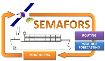
SEMAFORS will provide the following services:
- Monitoring
Collection of vessel performance data to evaluate the vessel performance over time to identify possible fuel and operational efficiency improvements. - Forecasting
Provision of weather forecasts along the planned route to help the vessel crew to avoid adverse weather conditions to maintain safety for crew, vessel and cargo.
- Routing
Provision of a route advice regarding the optimum route to sail for a set of given user constraints, like mandatory waypoints, ETA at waypoint, loading condition, safety limits, and operational limits.
Space Added Value
- GMES (Global Monitoring for Environment and Security) Marine, Meteorological and ESA satellite data will be used to create weather forecasts
- Satellite communication will be used for the exchange of data between vessel and shore
- GNSS (Global Navigation Satellite System) information will be used to track the sailed route of vessels and to collocate MetOcean information with vessel performance data
Current Status
The project kicked off April 3rd, 2012. At this moment a set of User Needs have been established and preparation for roll-out of the Monitoring Service is almost complete. Based on previous feasibility work the system requirements have been defined. Preliminary talks have taken place with a restricted user and stakeholder group, and the User Focal Groups are being established to consolidate and confirm the user requirements and system capabilities. This will be followed by development of the services.
Operation and verification of SEMAFORS will be performed using sea trials. They are planned to take place for a period of 9-12 months with a selected group of users. Users participate in two phases:
- Phase 1 where monitoring is performed to establish the actual ship performance and
- Phase 2 to use SEMAFORS and monitor the results of using SEMAFORS.
The global distribution of the participating vessels and limited time slots for installation preferably requires a remote roll-out, which is an interesting challenge. The roll-out is part of the incremental deployment.
In parallel to the trials, the business plan will be further developed and additional user needs and requirements will be identified on the basis of feedback from trials.